Huber Heights, Ohio

Last updated

Huber Heights, Ohio
Huber Heights City Hall 51217487905.jpg
Huber Heights City Hall
Flag of Huber Heights, Ohio.png
The Seal of Huber Heights, Ohio.jpg
Nickname(s): 
Brick City, Huber, The Heights
Motto: 
"Come Grow With Us!"
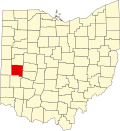
Montgomery County Ohio incorporated and unincorporated areas Huber Heights highlighted.svg
Location in Montgomery County and the state of Ohio.
Coordinates: 39°51′35″N84°07′39″W / 39.85972°N 84.12750°W / 39.85972; -84.12750
Country United States
State Ohio
Counties Montgomery, Miami
IncorporatedJanuary 23, 1981
Government
   Mayor Jeff Gore (R)[ citation needed ]
   City manager Richard S. Dzik[ citation needed ]
Area
[1]
  Total22.37 sq mi (57.94 km2)
  Land22.20 sq mi (57.50 km2)
  Water0.095 sq mi (0.44 km2)
Elevation
[2]
991 ft (302 m)
Population
 (2020)
  Total43,439
  Density1,956.62/sq mi (755.45/km2)
Time zone UTC-5 (Eastern (EST))
  Summer (DST) UTC-4 (EDT)
ZIP code
45424
Area code(s) 937, 326
FIPS code 39-36610 [3]
GNIS feature ID1086669 [2]
Website www.hhoh.org

Huber Heights is a city in Montgomery and Miami Counties in the U.S. state of Ohio. It is a suburb of Dayton. The population was 43,439 at the 2020 census. [4] This was a 14% increase since the 2010 census, making it the largest growth in Montgomery County in the last decade. [5]

Contents

History

Ausenbaugh-McElhenny House Ausenbaugh-McElhenny House.jpg
Ausenbaugh–McElhenny House

Hubert Heights' origins trace back to the now-defunct Wayne Township, which was settled in the early to mid-1800s. Wayne Township was incorporated as the City of Huber Heights on January 23, 1981. The city is named for Charles Huber, the developer who constructed a number of the houses that later constituted the city. Suburban development began in the area in 1956. [6] Huber Heights continued to grow by annexing parcels in Miami County.

Geography

Most of Huber Heights is in Montgomery County, while the city has more recently annexed land in Miami County. One small parcel of the city was located in Greene County, but it was detached from the city in 2013. [7]

According to the United States Census Bureau, the city has a total area of 22.37 square miles (57.94 km2), of which about 61 acres (25 ha) are covered by water. [8]

Demographics

Historical population
CensusPop.Note
1970 18,943
1980 34,64282.9%
1990 38,69611.7%
2000 38,212−1.3%
2010 38,101−0.3%
2020 43,43914.0%
Population 1970-2000. [9]

2010 census

As of the census [10] of 2010, 38,101 people, 14,720 households, and 10,552 families resided in the city. The population density was 1,710.9 inhabitants per square mile (660.6/km2). The 15,875 housing units had an average density of 712.8 per square mile (275.2/km2). The racial makeup of the city was 79.6% White, 13.0% African American, 0.3% Native American, 2.5% Asian, 0.1% Pacific Islander, 1.0% from other races, and 3.5% from two or more races. Hispanic or Latino residents of any race were 3.1% of the population.

Of the 14,720 households, 35.8% had children under 18 living with them, 51.5% were married couples living together, 14.9% had a female householder with no husband present, 5.3% had a male householder with no wife present, and 28.3% were not families. About 22.8% of all households were made up of individuals, and 8.1% had someone living alone who was 65 or older. The average household size was 2.58, and the average family size was 3.01.

The median age in the city was 37.4 years; The age distribution was 25.4% under 18; 8.2% from 18 to 24, 26.3% from 25 to 44, 27.2% from 45 to 64; and 12.9% were 65 or older. The gender makeup of the city was 48.3% male and 51.7% female.

2000 census

As of the census [3] of 2000, 38,212 people, 14,392 households, and 10,779 families were residing in the city. The population density was 1,817.2/sq mi (701.6/km2). The 14,938 housing units had an average density of 710.4/sq mi (274.3/km2). The racial makeup of the city was 84.88% White, 9.78% African American, 0.28% Native American, 2.18% Asian, 0.64% from other races, and 2.25% from two or more races. Hispanic or Latino residents of any race were 1.66% of the population.

Of the 14,392 households, 36.9% had children under 18 living with them, 58.7% were married couples living together, 12.0% had a female householder with no husband present, and 25.1% were nont amilies. About 20.5% of all households were made up of individuals, and 5.9% had someone living alone who was 65 or older. The average household size was 2.64, and the average family size was 3.05.

In the city, the age distribution was 27.4% under 18, 8.6% from 18 to 24, 31.1% from 25 to 44, 23.7% from 45 to 64, and 9.3% who were 65 or older. The median age was 34 years. For every 100 females, there were 95.0 males. For every 100 females 18 and over, there were 91.8 males.

The median income for a household in the city was $49,073, and for a family was $53,579. Males had a median income of $40,099 versus $28,723 for females. The per capita income for the city was $20,951. About 4.2% of families and 5.9% of the population were below the poverty line, including 6.6% of those under age 18 and 5.6% of those age 65 or over.

Economy

Huber Heights' location near the intersection of I-70 and I-75 has long made it an attractive hub for the trucking industry. With two exits on I-70, many popular chain restaurants exist near the exits. Also, various strip malls are in Huber Heights. Marian Shopping Center, located near the intersection of Brandt Pike and Fishburg Road, is slated for redevelopment, which the city purchased for $2.8 million. [11]

The city chamber of commerce notes these large businesses as operating within the city: ABF Freight System, Inc. Apache Technologies, Dayton Freight, NDC Technologies, AIDA/DTC, Bowser Morner, Coca-Cola, Enginetics, Fukuvi USA, Hughes-Peters, Metokote, and Trimble Navigation. [12]

In January 2013, Magnetar Capital bought 1,900 properties in Huber Heights from the family of the original developer. It rents these homes as part of its overall investment strategy. About one in every 11 homes in the city is owned by the firm. [13]

Top employers

According to the city's 2017 Comprehensive Annual Financial Report, [14] the top employers in the city are:

#Employer# of Employees
1 Huber Heights City School District 935
2 Walmart 566
3CBS Personnel Services537
4 Trimble 530
5 ABF Freight System 510
6 Meijer 503
7 McDonald's 444
8 FedEx Freight 415
9 Kroger 378
10AM PM Employment LLC344

Education

Wayne High School Wayne High School 51212089889.jpg
Wayne High School

Two public school districts serve Huber Heights. Residents living in the Montgomery County portion of Huber Heights are served by the Huber Heights City School District, which includes five elementary schools, one middle schools, and Wayne High School. Those residents living in the Miami County portion of Huber Heights are served by the Bethel Local Schools District.

Huber Heights has a new public library, a branch of the Dayton Metro Library. [15]

Transportation

Public transit in the city is provided by the Greater Dayton Regional Transit Authority.

Notable people

Sister cities

Huber Heights has two sister cities , as designated by Sister Cities International :

See also

Related Research Articles

<span class="mw-page-title-main">Montgomery County, Ohio</span> County in Ohio, United States

Montgomery County is in the southwestern part of the U.S. state of Ohio. At the 2020 census, the population was 537,309, making it the fifth-most populous county in Ohio. The county seat is Dayton. The county was named in honor of Richard Montgomery, an American Revolutionary War general, who was killed in 1775 while attempting to capture Quebec City, Canada. Montgomery County is part of the Dayton, Ohio, Metropolitan Statistical Area.

<span class="mw-page-title-main">Miami County, Ohio</span> County in Ohio, United States

Miami County is a county located in the U.S. state of Ohio. As of the 2020 census, the population was 108,774. Its county seat is Troy. The county is named in honor of the Miami people. Miami County is part of the Dayton, OH Metropolitan Statistical Area.

<span class="mw-page-title-main">Forest, Mississippi</span> City in Mississippi, United States

Forest is a city and the county seat of Scott County, Mississippi, United States. The population was 5,684 at the 2010 census and the population is a minority-majority.

<span class="mw-page-title-main">Park Layne, Ohio</span> Census-designated place in Ohio, United States

Park Layne is a census-designated place (CDP) in Bethel Township, Clark County, Ohio, United States. The population of the CDP was 4,248 at the 2020 census. It is part of the Springfield, Ohio Metropolitan Statistical Area. Park Layne became a CDP in the 1980 United States Census.

<span class="mw-page-title-main">Cleveland Heights, Ohio</span> City in Ohio, United States

Cleveland Heights is a city in Cuyahoga County, Ohio, United States. The population was 45,312 at the 2020 census. One of Cleveland's historic streetcar suburbs, it was founded as a village in 1903 and a city in 1921.

<span class="mw-page-title-main">Garfield Heights, Ohio</span> City in Ohio, United States

Garfield Heights is a city in Cuyahoga County, Ohio, United States. The population was 29,781 at the time of the 2020 census. A suburb of Cleveland, it is a part of the Cleveland metropolitan area.

<span class="mw-page-title-main">Tipp City, Ohio</span> City in Ohio, United States

Tipp City is a city in southern Miami County, Ohio, United States, just outside Dayton. The population was 10,274 at the 2020 census. Originally known as Tippecanoe, and then Tippecanoe City, it was renamed to Tipp City in 1938 because another town in Ohio was likewise named Tippecanoe. The city lies in the Miami Valley and sits along Interstate 75 near the Interstate 70 interchange. Tipp City is part of the Dayton metropolitan area.

<span class="mw-page-title-main">Troy, Ohio</span> City and county seat of Miami County, Ohio

Troy is a city in and the county seat of Miami County, Ohio, United States, along the Great Miami River. The population was 26,305 at the 2020 census, making it Miami County's largest city and Ohio's 55th-largest. About 19 miles (31 km) north of Dayton, Troy is part of the Dayton metropolitan area.

<span class="mw-page-title-main">Centerville, Ohio</span> City in Ohio, United States

Centerville is a city in Montgomery County, Ohio, United States. A core suburb of Metro Dayton, its population was 24,240 as of the 2020 census.

<span class="mw-page-title-main">Clayton, Ohio</span> City in Ohio, United States

Clayton is a city in Montgomery County, Ohio, United States. The population was 13,310 at the 2020 census. A suburb of Dayton, it is part of the Dayton metropolitan area.

<span class="mw-page-title-main">Farmersville, Ohio</span> Village in Ohio, United States

Farmersville is a village in Jackson Township, Montgomery County, Ohio, United States. The population was 975 at the 2020 census. It is part of the Dayton Metropolitan Statistical Area.

<span class="mw-page-title-main">Moraine, Ohio</span> City in Ohio, United States

Moraine is a city in Montgomery County, Ohio, United States. Situated on the banks of the Great Miami River, Moraine is an inner suburb of Dayton, Ohio and a part of the Dayton metropolitan area. The population was 6,393 at the 2020 census.

<span class="mw-page-title-main">Northridge, Montgomery County, Ohio</span> Unincorporated community and Census-designated place in Ohio, United States

Northridge is an unincorporated community in Harrison Township in Montgomery County, Ohio, United States. It was delineated as a census-designated place (CDP) for the 2000 census, at which time its population was 8,487. It is located directly north of the city of Dayton and is part of the Dayton Metropolitan Statistical Area.

<span class="mw-page-title-main">Riverside, Ohio</span> City in Ohio, United States

Riverside is a city in Montgomery County, Ohio, United States. The population was 24,474 at the 2020 census. A suburb of Dayton, it is part of the Dayton metropolitan area.

<span class="mw-page-title-main">Trotwood, Ohio</span> City in Ohio, United States

Trotwood is a city in Montgomery County, Ohio, United States. The population was 23,070 at the 2020 census. A suburb of Dayton, it is part of the Dayton metropolitan area. The city is served by the Trotwood-Madison City School District.

<span class="mw-page-title-main">Vandalia, Ohio</span> City in Ohio, United States

Vandalia is a city in Montgomery County, Ohio, United States, and a suburb of Dayton. Its population was 15,209 during the 2020 census. In addition to being the city closest to Dayton International Airport, Vandalia lies at the crossroads of I-75 and I-70.

<span class="mw-page-title-main">West Carrollton, Ohio</span> City in Ohio, United States

West Carrollton is a city in Montgomery County, Ohio, United States. A suburb of Dayton, its population was 13,129 at the 2020 census. It is part of the Dayton Metropolitan Statistical Area. The Great Miami River runs through the town and forms most of its northern border.

<span class="mw-page-title-main">Macedonia, Ohio</span> City in Ohio, United States

Macedonia is a city in northern Summit County, Ohio, United States. The population was 12,168 at the 2020 census. It is a suburb of the Akron metropolitan area.

<span class="mw-page-title-main">Kettering, Ohio</span> City in Ohio, United States

Kettering is a city in Montgomery County, Ohio, United States. It is an inner suburb of Dayton. As of the 2020 census, the city had a population of 57,862, making it the most populous suburb in the Dayton metropolitan area.

<span class="mw-page-title-main">Springboro, Ohio</span> City in Ohio, United States

Springboro is a city in the U.S. state of Ohio. Regarded as the most affluent suburb of Cincinnati and Dayton, it is located mostly in Warren County in Clearcreek and Franklin Townships; with a small portion in Miami Township in Montgomery County. The city is part of the Miami Valley. As of the 2020 census, the city had a population of 19,062.

References

  1. "ArcGIS REST Services Directory". United States Census Bureau. Retrieved September 20, 2022.
  2. 1 2 U.S. Geological Survey Geographic Names Information System: Huber Heights, Ohio
  3. 1 2 "U.S. Census website". United States Census Bureau . Retrieved January 31, 2008.
  4. "U.S. Census website" . Retrieved March 20, 2010.
  5. "2020 Census: Here are the biggest population gains, losses locally".
  6. "City History". City of Huber Heights. Archived from the original on March 18, 2013. Retrieved March 19, 2013.
  7. "City Council meeting minutes" (PDF). City of Huber Heights. September 23, 2013. Retrieved March 13, 2019. WHEREAS, the subject property is the only property within the City of Huber Heights that is also located in Greene County; and WHEREAS, the City of Huber Heights consents to the Detachment.
  8. "US Gazetteer files 2010". United States Census Bureau. Archived from the original on January 25, 2012. Retrieved January 6, 2013.
  9. "Census Of Population And Housing". U.S. Census Bureau. Retrieved March 23, 2010.
  10. "U.S. Census website". United States Census Bureau . Retrieved January 6, 2013.
  11. "City makes shopping center buy in revitalization efforts". www.bizjournals.com. May 4, 2020. Retrieved May 16, 2020.
  12. "Huber Heights Chamber of Commerce". Archived from the original on July 11, 2012. Retrieved May 31, 2012.
  13. Perlberg, Heather; Gittelsohn, John (October 21, 2013). "Magnetar Goes Long Ohio Town While Shorting Its Tax Base". Bloomberg News . Retrieved October 22, 2013.
  14. "City of Huber Heights CAFR".
  15. "Locations". Dayton Metro Library. Retrieved March 1, 2018.