Phoneton, Ohio

Last updated
Location of Phoneton, Ohio OHMap-doton-Phoneton.png
Location of Phoneton, Ohio

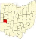
Phoneton (also known as Phonetown) is an unincorporated community in southwestern Bethel Township, Miami County, Ohio, United States, [1] that is located at the junction of the National Road (U.S. Route 40) and Old Troy Pike {State Rotue 202) in southwestern Bethel Township, Miami County, Ohio, United States. It is part of the Dayton Metropolitan Statistical Area.

Contents

History

Phoneton was originally called Phonetown, and under the latter name had its start in 1893 as a company town of the American Telephone and Telegraph Company. [2] A post office called Phoneton was established in 1898, and remained in operation until 1981. [3]

See also

Flag of Ohio.svg   Ohioportal

Related Research Articles

Miami County, Ohio County in Ohio, United States

Miami County is a county located in the U.S. state of Ohio. As of the 2020 census, the population was 108,774. Its county seat is Troy. The county is named in honor of the Miami people.

Tipp City, Ohio City in Ohio, United States

Tipp City is a city in Miami County, Ohio, United States just outside Dayton. The population was 9,689 at the 2010 census. Formerly known as Tippecanoe, and then Tippecanoe City, this town was renamed to Tipp City in 1938 because another town in Ohio was likewise named Tippecanoe. The city lies in the Miami Valley and sits along Interstate 75 near the Interstate 70 interchange.

Kings Mills, Ohio

Kings Mills is a census-designated place in the southwestern corner of Deerfield Township, Warren County, Ohio, United States, on the western shore of the Little Miami River. Located along I-71 twenty miles northeast of Cincinnati, it is less than a mile east of Mason, two miles southwest of South Lebanon, two and one-half miles north of Fosters, and two miles west of Hopkinsville.

Hammel and Millgrove, Ohio

Hammel and Millgrove are extinct towns in western Warren County, Ohio, United States. They are located along the Little Miami River, about 2 miles (3 km) south of Fort Ancient and 1 mile north of Roachester at the Strout Road crossing of the river. Hammel lies on the eastern shore of the river, in southwestern Washington Township, and Millgrove lies on the western shore of the river, in northeastern Salem Township.

Fairfield Township, Butler County, Ohio Township in Ohio, United States

Fairfield Township, one of thirteen townships in Butler County, Ohio, United States, is located in the south central portion of the county. It had a population of 21,373 at the 2010 census, up from 15,571 in 2000, but down sharply from 49,353 in 1990 because of the withdrawal of the city of Fairfield in 1994 and annexations from Fairfield and Hamilton. Before annexations by the cities of Hamilton and Fairfield, it had an area of about 50 square miles (130 km2).

Warren County Canal

The Warren County Canal was a branch of the Miami and Erie Canal in southwestern Ohio about 20 miles (32 km) in length that connected the Warren County seat of Lebanon to the main canal at Middletown in the mid-19th century. Lebanon was at the crossroads of two major roads, the highway from Cincinnati to Columbus and the road from Chillicothe to the College Township (Oxford), but Lebanon businessmen and civic leaders wanted better transportation facilities and successfully lobbied for their own canal, part of the canal fever of the first third of the 19th century. The Warren County Canal was never successful, operating less than a decade before the state abandoned it.

Shandon, Ohio Unincorporated community in Ohio, United States

Shandon is an unincorporated community in southwestern Morgan Township, Butler County, Ohio, United States. It is located on Paddy's Run, a tributary of the Great Miami River, about four miles west of Ross at the intersection of State Routes 126 and 748 in section 25 of R1ET3N of the Congress Lands. It was originally called Glendower as the town was settled by immigrants from Wales. It was later called New London and this survives in the names of Alert-New London and Hamilton-New London Roads. The town is in the Ross Local School District.

Maud, Ohio

Mauds is an unincorporated community in central West Chester Township, Butler County, Ohio, United States, located on Cincinnati–Dayton Road. Originally called Shoemaker, it was renamed for Richard Maud, the town's first postmaster and was formerly a stop on the Dayton Short Line, which became part of the Big Four Railroad. An important road in West Chester and Liberty Townships is Mauds Hughes Road.

Bethel Township, Miami County, Ohio Township in Ohio, United States

Bethel Township is one of the twelve townships of Miami County, Ohio, United States. The 2010 census found 4,843 people in the township.

Bethel Township, Clark County, Ohio Township in Ohio, United States

Bethel Township is one of the ten townships of Clark County, Ohio, United States. The 2010 census reported 18,523 people living in the township, 12,440 of whom were in the unincorporated portions of the township.

Pike Township, Clark County, Ohio Township in Ohio, United States

Pike Township is one of the ten townships of Clark County, Ohio, United States. The 2010 census reported 3,730 people living in the township, 3,246 of whom lived in the unincorporated portions of the township.

Mathers Mill, Ohio

Mathers Mill, alternately called Mathers Mills or Mather's Mills, is an unincorporated community in Warren County, Ohio, United States. It is approximately 5 miles east of Lebanon, and 2 miles south of Oregonia in eastern Turtlecreek Township. The area is served by the Oregonia post office, and Lebanon phone exchange and school district. Wilmington Road crosses the Little Miami River and intersects Corwin Road in this area. The bridge is known as the Mathers Mill bridge and the steep hill up out of the valley is sometimes referred to as Mathers Mill Hill.

Brandt, Ohio

Brandt is an unincorporated community in southern Bethel Township, Miami County, Ohio, United States. Brandt is part of the Dayton Metropolitan Statistical Area. The Bethel Township Administration Facility is located in Brandt.

West Charleston, Ohio

West Charleston is an unincorporated community in western Bethel Township, Miami County, Ohio, United States.

Conover, Ohio

Conover is an unincorporated community in eastern Brown Township, Miami County, Ohio, United States. It has a post office with the ZIP code 45317.

Excello, Ohio

Excello is an unincorporated community in central Lemon Township, Butler County, Ohio, United States, on the south side of Middletown. It comprises roughly the area south of Oxford State Road and State Route 73, west of State Route 4, and east of the Great Miami River. The Excello Lock was a canal lock on the Miami and Erie Canal. Remnants of the lock remain as public property owned by the MCD. Also in Excello was former Harding-Jones Paper Company plant, which is now closed but is on the National Register of Historic Places.

Mack, Ohio Census-designated place in Ohio, United States

Mack is a census-designated place (CDP) in Green and Miami townships, Hamilton County, Ohio, United States. The population was 11,585 at the 2010 census. At prior censuses, the community was listed as two separate CDPs, Mack North and Mack South.

Wolf Creek (Great Miami River tributary)

Wolf Creek is a 19.8-mile-long (31.9 km) tributary of the Great Miami River in southwestern Ohio in the United States. It rises in western Montgomery County, northwest of Brookville, and flows generally southeast, passing through the center of Trotwood and joining the Great Miami in downtown Dayton.

Miami Heights, Ohio Census-designated place in Ohio, United States

Miami Heights is a census-designated place (CDP) in Miami Township, Hamilton County, Ohio, United States. The population was 4,731 at the 2010 census.

Taylor Creek, Ohio Census-designated place in Ohio, United States

Taylor Creek is a census-designated place (CDP) in Colerain Township, Hamilton County, Ohio, United States. The population was 3,062 at the 2010 census.

References

  1. U.S. Geological Survey Geographic Names Information System: Phoneton
  2. Raitz, Karl B.; Thompson, George F. (1996). A Guide to the National Road. JHU Press. p. 205. ISBN   978-0-8018-5156-8.
  3. "Miami County". Jim Forte Postal History. Retrieved 9 January 2016.

Commons-logo.svg Media related to Phoneton, Ohio at Wikimedia Commons


Coordinates: 39°53′49″N84°08′07″W / 39.89694°N 84.13528°W / 39.89694; -84.13528