Garland, Ohio

Last updated

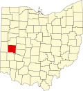
Garland is an unincorporated community in Miami County, in the U.S. state of Ohio. [1]

History

A post office called Garland was established in 1891, and remained in operation until 1905. [2] In 1906, Garland had about 50 inhabitants. [3]

Related Research Articles

<span class="mw-page-title-main">Stillwater River (Ohio)</span> River in Ohio, United States

The Stillwater River is a 69.3-mile-long (111.5 km) tributary of the Great Miami River in western Ohio in the United States. Via the Great Miami and Ohio rivers, it is part of the Mississippi River watershed.

<span class="mw-page-title-main">Chautauqua, Ohio</span> Unincorporated community in Ohio, U.S.

Chautauqua , also Chautaugua or Chatauqua, is an unincorporated community in Montgomery and Warren counties in the U.S. state of Ohio. Chautauqua is located at 39°35′28″N84°17′47″W. It lies on the west bank of the Great Miami River at the county boundary. It was established in 1901 with 310 acres (1.3 km2). The members of the Miami Valley Chautauqua Association lived in common in the town, occupying about two hundred homes.

<span class="mw-page-title-main">Phoneton, Ohio</span> Unincorporated community in Miami County, Ohio, United States

Phoneton is an unincorporated community in southwestern Bethel Township, Miami County, Ohio, United States, that is located at the junction of the National Road and Old Troy Pike in southwestern Bethel Township, Miami County, Ohio, United States. It is part of the Dayton Metropolitan Statistical Area.

<span class="mw-page-title-main">Miamiville, Ohio</span> Unincorporated community in Ohio, United States

Miamiville is an unincorporated community and census-designated place (CDP) in western Miami Township, Clermont County, Ohio, United States, along the Little Miami River and the Loveland Bike Trail. It had a population of 205 at the 2020 census. It has a post office with the ZIP code 45147.

Galloway is an unincorporated community in the U.S. state of Michigan. It is located at 43°19′54″N84°22′10″W on the boundary between Lakefield Township in Saginaw County and Lafayette Township in Gratiot County.

<span class="mw-page-title-main">Mack, Ohio</span> Census-designated place in Ohio, United States

Mack is a census-designated place (CDP) in Green and Miami townships, Hamilton County, Ohio, United States. The population was 11,088 at the 2020 census. At prior censuses, the community was listed as two separate CDPs, Mack North and Mack South.

<span class="mw-page-title-main">New Baltimore, Ohio</span> Census-designated place in Ohio, United States

New Baltimore is a census-designated place (CDP) in Crosby Township, Hamilton County, Ohio. The population was 1,596 in the 2020 census.

Plainville is a census-designated place (CDP) in Hamilton County, Ohio, United States. The population was 120 at the 2020 census.

<span class="mw-page-title-main">Wolf Creek (Great Miami River tributary)</span>

Wolf Creek is a 19.8-mile-long (31.9 km) tributary of the Great Miami River in southwestern Ohio in the United States. It rises in western Montgomery County, northwest of Brookville, and flows generally southeast, passing through the center of Trotwood and joining the Great Miami in downtown Dayton.

<span class="mw-page-title-main">Elizabethtown, Ohio</span> Census-designated place in Ohio, United States

Elizabethtown is a census-designated place (CDP) in Whitewater Township, Hamilton County, Ohio, United States. The population was 323 at the 2020 census.

<span class="mw-page-title-main">Miami Heights, Ohio</span> Census-designated place in Ohio, United States

Miami Heights is a census-designated place (CDP) in Miami Township, Hamilton County, Ohio, United States. The population was 4,731 at the 2010 census.

<span class="mw-page-title-main">Shawnee, Hamilton County, Ohio</span> Census-designated place in Ohio, United States

Shawnee is a census-designated place (CDP) in Miami Township, Hamilton County, Ohio, United States, 21 miles (34 km) west of downtown Cincinnati. The population of Shawnee was 747 at the 2020 census.

<span class="mw-page-title-main">Taylor Creek, Ohio</span> Census-designated place in Ohio, United States

Taylor Creek is a census-designated place (CDP) in Colerain Township, Hamilton County, Ohio, United States. The population was 4,056 at the 2020 census.

Armstrongs Mills is an unincorporated community in Washington Township, Belmont County, in the U.S. state of Ohio.

Frederick is an unincorporated community in Miami County, in the U.S. state of Ohio.

Ginghamsburg is an unincorporated community in Miami County, in the U.S. state of Ohio.

Grayson is an unincorporated community in Miami County, in the U.S. state of Ohio.

Kessler is an unincorporated community in Miami County, in the U.S. state of Ohio.

Branch Hill is an unincorporated community in Miami Township, Clermont County, Ohio, United States, on the banks of the Little Miami River near Loveland. The Little Miami Scenic Trail passes through Branch Hill.

Tadmor is an extinct town in Montgomery County, in the U.S. state of Ohio. Its location, 39°53′45″N84°9′55″W, is now within the Vandalia city limits.

References

  1. U.S. Geological Survey Geographic Names Information System: Garland, Ohio
  2. "Miami County". Jim Forte Postal History. Archived from the original on September 9, 2005. Retrieved January 9, 2016.
  3. Raza, Moonis (January 1, 1990). Geographical Dictionary Of The World In The Early 20th Century With Pronouncing Gazetteer (in 2 Vos.). Concept Publishing Company. p. 700. ISBN   978-81-7268-011-4.

39°56′05″N84°22′10″W / 39.93472°N 84.36944°W / 39.93472; -84.36944