West Milton, Ohio

Last updated

West Milton, Ohio
McKinley School in West Milton.jpg
The former McKinley School is listed on the National Register of Historic Places
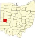
OHMap-doton-West Milton.png
Location of West Milton, Ohio
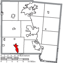
Map of Miami County Ohio Highlighting West Milton Village.png
Location of West Milton in Miami County
Coordinates: 39°57′32″N84°19′33″W / 39.95889°N 84.32583°W / 39.95889; -84.32583
CountryUnited States
State Ohio
County Miami
Township Union
Government
  MayorScott Hurst
Area
[1]
  Total
3.49 sq mi (9.04 km2)
  Land3.39 sq mi (8.78 km2)
  Water0.10 sq mi (0.26 km2)
Elevation
[2]
899 ft (274 m)
Population
 (2020)
  Total
4,697
  Density1,385.14/sq mi (534.86/km2)
Time zone UTC-5 (Eastern (EST))
  Summer (DST) UTC-4 (EDT)
ZIP code
45383
Area code(s) 937/326
FIPS code 39-83902
GNIS feature ID2400140 [2]
Website www.westmiltonohio.gov

West Milton is a village in Miami County, Ohio, United States. The population was 4,697 at the 2020 census. It is part of the Dayton Metropolitan Statistical Area.

Contents

History

The first settlement at West Milton was made in 1807. [3] West Milton was named for John Milton, an English poet. [3] A post office called Milton was established in 1824, and the name was changed to West Milton in 1829. [4] The village was incorporated around 1834. [3]

Government

West Milton uses the council-manager government system. In this system, the mayor is the ceremonial head, elected by the public every four years. The council chooses a City Manager, who holds administrative authority over the city government. Council members are selected on a nonpartisan, at-large ballot. [5]

Current Members of Council

Geography

According to the United States Census Bureau, the village has a total area of 3.34 square miles (8.65 km2), of which 3.24 square miles (8.39 km2) is land and 0.10 square miles (0.26 km2) is water. [7]

Demographics

Historical population
CensusPop.Note
1850 398
1860 390−2.0%
1870 45516.7%
1880 68851.2%
1890 79615.7%
1900 90413.6%
1910 1,20733.5%
1920 1,2564.1%
1930 1,38810.5%
1940 1,4393.7%
1950 2,10146.0%
1960 2,97241.5%
1970 3,69624.4%
1980 4,11911.4%
1990 4,3485.6%
2000 4,6456.8%
2010 4,630−0.3%
2020 4,6971.4%
U.S. Decennial Census [8]

2010 census

As of the census [9] of 2010, there were 4,630 people, 1,973 households, and 1,298 families living in the village. The population density was 1,429.0 inhabitants per square mile (551.7/km2). There were 2,102 housing units at an average density of 648.8 units per square mile (250.5 units/km2). The racial makeup of the village was 97.4% White, 0.5% African American, 0.1% Native American, 0.3% Asian, 0.2% from other races, and 1.5% from two or more races. Hispanic or Latino of any race were 0.8% of the population.

There were 1,973 households, of which 32.2% had children under the age of 18 living with them, 46.2% were married couples living together, 14.4% had a female householder with no husband present, 5.1% had a male householder with no wife present, and 34.2% were non-families. 30.2% of all households were made up of individuals, and 13.1% had someone living alone who was 65 years of age or older. The average household size was 2.35 and the average family size was 2.89.

The median age in the village was 39.3 years. 25.2% of residents were under the age of 18; 7.8% were between the ages of 18 and 24; 24.6% were from 25 to 44; 25.8% were from 45 to 64; and 16.5% were 65 years of age or older. The gender makeup of the village was 47.5% male and 52.5% female.

2000 census

As of the census [10] of 2000, there were 4,645 people, 1,875 households, and 1,314 families living in the village. The population density was 1,923.9 inhabitants per square mile (742.8/km2). There were 1,982 housing units at an average density of 820.9 units per square mile (317.0 units/km2). The racial makeup of the village was 98.58% White, 0.28% African American, 0.17% Native American, 0.26% Asian, 0.17% from other races, and 0.54% from two or more races. Hispanic or Latino of any race were 0.65% of the population.

There were 1,875 households, out of which 35.7% had children under the age of 18 living with them, 52.5% were married couples living together, 13.2% had a female householder with no husband present, and 29.9% were non-families. 26.7% of all households were made up of individuals, and 12.3% had someone living alone who was 65 years of age or older. The average household size was 2.48 and the average family size was 2.97.

In the village, the population was spread out, with 28.0% under the age of 18, 8.0% from 18 to 24, 29.6% from 25 to 44, 21.3% from 45 to 64, and 13.2% who were 65 years of age or older. The median age was 36 years. For every 100 females there were 92.4 males. For every 100 females age 18 and over, there were 86.8 males.

The median income for a household in the village was $41,905, and the median income for a family was $45,847. Males had a median income of $33,774 versus $25,199 for females. The per capita income for the village was $19,402. About 4.7% of families and 6.7% of the population were below the poverty line, including 10.4% of those under age 18 and 7.4% of those age 65 or over.

Education

The school district is Milton-Union Exempted Village School District. [11]

Schools include:

Notable people

WMPA-TV

West Milton operates WMPA-TV, an all-volunteer, non-profit Public-access television cable TV station. Founded in the late 1970s, this access station has served the villages of West Milton, Laura, Ludlow Falls, Potsdam and Union Township. It has offered a variety of programming over the years including several sporting events, school functions, church services, and the broadcasting of the West Milton Council Meetings. [15]

Related Research Articles

<span class="mw-page-title-main">Miami County, Ohio</span> County in Ohio, United States

Miami County is a county located in the U.S. state of Ohio. As of the 2020 census, the population was 108,774. Its county seat is Troy. The county is named in honor of the Miami people. Miami County is part of the Dayton, OH Metropolitan Statistical Area.

<span class="mw-page-title-main">Summitville, Indiana</span> Town in Indiana, United States

Summitville is a town in Van Buren Township, Madison County, Indiana, United States. It is part of the Indianapolis–Carmel–Anderson metropolitan statistical area. The population was 989 at the 2020 census.

<span class="mw-page-title-main">West College Corner, Indiana</span> Town in Indiana, United States

West College Corner is a town in Union Township, Union County, Indiana, United States. The population was 545 at the 2020 census. The town is bordered on the east by the state line with Ohio, directly bordering the village of College Corner, Ohio. The town's public school, part of the Union County–College Corner Joint School District, is bisected by the state line and is operated jointly with Ohio authorities.

<span class="mw-page-title-main">West Union, Iowa</span> City in Iowa, United States

West Union is a city in Fayette County, Iowa, United States. The population was 2,490 at the time of the 2020 census. It is the county seat of Fayette County.

Woodstock is a town in Oxford County, Maine, United States. Woodstock is included in the Lewiston-Auburn, Maine metropolitan New England city and town area. The population was 1,352 at the 2020 census. The village of Bryant Pond, on State Route 26 in the northern part of Woodstock, is the town's urban center and largest settlement.

<span class="mw-page-title-main">Lake Ann, Michigan</span> Village in Michigan, United States

Lake Ann is a village in northeastern Benzie County in the U.S. state of Michigan. Part of Almira Township, Lake Ann is situated 10 miles (16 km) west of Traverse City, and largely dependent upon that city. The population of Lake Ann was 273 at the 2020 census.

<span class="mw-page-title-main">West Union, Ohio</span> Village in Ohio, United States

West Union is a village in Adams County, Ohio, United States, about 55 miles (89 km) southeast of Cincinnati. The population was 3,004 at the 2020 census. It is the county seat of Adams County. West Union is served by West Union High School, the Adams County/Ohio Valley School District, and the West Union Public Library, a branch of the Adams County Public Library.

<span class="mw-page-title-main">Chesapeake, Ohio</span> Village in Ohio, United States

Chesapeake is a village in Lawrence County, Ohio, United States. The population was 765 as of the 2020 census. It lies across the Ohio River from Huntington, West Virginia, at the mouth of Symmes Creek.

<span class="mw-page-title-main">Craig Beach, Ohio</span> Village in Ohio, United States

Craig Beach is a village in northwestern Mahoning County, Ohio, United States. Located along the shores of Lake Milton, the population was 1,076 at the 2020 census. It is part of the Youngstown–Warren metropolitan area.

<span class="mw-page-title-main">Covington, Ohio</span> Village in Ohio, United States

Covington is a village in Miami County, Ohio, United States. The population was 2,548 at the 2020 census. It is part of the Dayton Metropolitan Statistical Area. The village was incorporated as Covington in 1835 on the site of the 1793 Fort Rowdy.

<span class="mw-page-title-main">Laura, Ohio</span> Village in Ohio, United States

Laura is a village in Miami County, Ohio, United States. The population was 398 at the 2020 census. It is part of the Dayton Metropolitan Statistical Area.

<span class="mw-page-title-main">Ludlow Falls, Ohio</span> Village in Ohio, United States

Ludlow Falls is a village in Miami County, Ohio, United States. The population was 175 at the 2020 census. It is part of the Dayton Metropolitan Statistical Area. Ludlow Falls is named after surveyor Israel Ludlow.

<span class="mw-page-title-main">Potsdam, Ohio</span> Village in Ohio, United States

Potsdam is a village in Miami County, Ohio, United States. The population was 225 at the 2020 census. It is part of the Dayton Metropolitan Statistical Area.

<span class="mw-page-title-main">Malta, Ohio</span> Village in Ohio, United States

Malta is a village in Morgan County, Ohio, United States. The population was 559 at the 2020 census.

<span class="mw-page-title-main">Magnetic Springs, Ohio</span> Village in Ohio, United States

Magnetic Springs is a village in Leesburg Township, Union County, Ohio, United States. The population was 267 at the 2020 census. The village has a post office with the ZIP Code of 43036.

<span class="mw-page-title-main">Windsor Heights, West Virginia</span> Village in West Virginia, United States

Windsor Heights is a village in Brooke County, West Virginia, United States. It is part of the Wheeling, West Virginia Metropolitan Statistical Area. The population was 423 at the 2010 census. Grace Davis was the mayor as of June 2017.

<span class="mw-page-title-main">Milton, West Virginia</span> Town in West Virginia, United States

Milton is a town in Cabell County, West Virginia, United States. The population was 2,831 at the 2020 census. It is part of the Huntington–Ashland metropolitan area.

<span class="mw-page-title-main">Twin Lakes, Wisconsin</span> Village in Wisconsin, United States

Twin Lakes is a village in Kenosha County, Wisconsin, United States, along the Illinois-Wisconsin border east of U.S. Highway 12, incorporated in 1937. With nearly 1000 acres of surface water, the twin lakes of Mary and Elizabeth have drawn vacationers to numerous resorts as well as ice harvesters in the days of icebox refrigeration. Today, many houses there are used for recreation, and the lakes remain a popular destination. Twin Lakes is home to about 6,041 permanent residents and a third more occasional ones.

<span class="mw-page-title-main">Union, Ohio</span> City in Ohio, United States

Union is a city in Montgomery and Miami Counties in the U.S. state of Ohio. The population was 6,859 at the time of the 2020 census. It is part of the Dayton Metropolitan Statistical Area.

<span class="mw-page-title-main">Milton, Washington</span> City in Washington, United States

Milton is a city in King and Pierce counties in the U.S. state of Washington. The population was 8,697 at the time of the 2020 census. Milton borders the larger but newer town of Edgewood.

References

  1. "ArcGIS REST Services Directory". United States Census Bureau. Retrieved September 20, 2022.
  2. 1 2 U.S. Geological Survey Geographic Names Information System: West Milton, Ohio
  3. 1 2 3 Harbaugh, T. C. (1909). Centennial history. Troy, Piqua and Miami county, Ohio. Chicago: Richmond-Arnold Publishing Co. p. 93.
  4. "Miami County". Jim Forte Postal History. Retrieved January 9, 2016.
  5. {{cite web | title= West Milton Charter |url=chrome-extension://efaidnbmnnnibpcajpcglclefindmkaj/https://storage.googleapis.com/proudcity/westmiltonoh/uploads/2022/11/Charter.amended11.3.15.pdf
  6. {{cite web | title= Members of Council |url=https://www.westmiltonohio.gov/village-council-members/
  7. "US Gazetteer files 2010". United States Census Bureau. Archived from the original on February 20, 2011. Retrieved January 6, 2013.
  8. "Census of Population and Housing". Census.gov. Retrieved June 4, 2015.
  9. "U.S. Census website". United States Census Bureau . Retrieved January 6, 2013.
  10. "U.S. Census website". United States Census Bureau . Retrieved January 31, 2008.
  11. "2020 CENSUS - SCHOOL DISTRICT REFERENCE MAP: Miami County, OH" (PDF). U.S. Census Bureau . Retrieved October 31, 2024. - Text list
  12. "Roster | Washington Football Team - WashingtonFootball.com". www.washingtonfootball.com. Retrieved December 31, 2021.
  13. "Bob Schul". USA Track & Field, Inc.
  14. "Pioneer for Peace: The Story of Ted Studebaker". Church of the Brethren Network.
  15. "WMPA". westmiltonohio.gov. Retrieved March 12, 2018.