Brandt, Ohio

Last updated

Brandt, Ohio
Bethel Township Miami County Ohio Administration Facility 2015.jpg
Bethel Township administration buildings and fire station, Brandt, Ohio
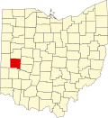
OHMap-doton-Brandt.png
Location of Brandt, Ohio
Coordinates: 39°54′10″N84°05′27″W / 39.90278°N 84.09083°W / 39.90278; -84.09083
Country United States
State Ohio
County Miami
Elevation
[1]
991 ft (302 m)
Population
 (2020) [2]
  Total282
Time zone UTC-5 (Eastern (EST))
  Summer (DST) UTC-4 (EDT)
GNIS feature ID2812835 [1]

Brandt is an unincorporated community and census-designated place in southern Bethel Township, Miami County, Ohio, United States. Brandt is part of the Dayton Metropolitan Statistical Area. The population was 282 at the 2020 census. The Bethel Township Administration Facility is located in Brandt.

History

Brandt School in 2015 Brandt School.jpg
Brandt School in 2015

It was formed on the National Road (today U.S. Route 40) as a stop for travelers on the road and for road toll-takers. It was laid out in 1839 by the Voorhis brothers. [3] A toll gate was located at the east end of Brandt where US 40 and State Route 201 intersect today. Toll-takers were appointed by the governor and earned $30 a month. [4]

Brandt School, constructed 1890, still stands on Third Street in the village.[ citation needed ]

Related Research Articles

<span class="mw-page-title-main">Miami County, Ohio</span> County in Ohio, United States

Miami County is a county located in the U.S. state of Ohio. As of the 2020 census, the population was 108,774. Its county seat is Troy. The county is named in honor of the Miami people.

<span class="mw-page-title-main">Clermont County, Ohio</span> County in Ohio, United States

Clermont County, popularly called Clermont, is a county in the U.S. state of Ohio. As of the 2020 census, the population was 208,601. Ordinanced in 1800 as part of the Virginia Military District, Clermont is Ohio's eighth oldest county, the furthest county west in Appalachian Ohio, and the eleventh oldest county of the former Northwest Territory. Clermont County is part of the Cincinnati, OH-KY-IN Metropolitan Statistical Area. The county is named from the French "clear hills or mountain." Its county seat is Batavia, while its largest city is Milford.

<span class="mw-page-title-main">Tipp City, Ohio</span> City in Ohio, United States

Tipp City is a city in southern Miami County, Ohio, United States, just outside Dayton. The population was 10,274 at the 2020 census. Originally known as Tippecanoe, and then Tippecanoe City, it was renamed to Tipp City in 1938 because another town in Ohio was likewise named Tippecanoe. The city lies in the Miami Valley and sits along Interstate 75 near the Interstate 70 interchange. Tipp City is part of the Dayton metropolitan area.

<span class="mw-page-title-main">East Liberty, Ohio</span> Census-designated place in Ohio, United States

East Liberty is an unincorporated community and census-designated place (CDP) located in Perry Township, Logan County, Ohio, United States. As of the 2020 census, it had a population of 371. It is located just off U.S. Route 33, 10 miles (16 km) east of Bellefontaine and 46 miles (74 km) northwest of Columbus. It has a post office with the ZIP code 43319.

<span class="mw-page-title-main">Hamilton Township, Warren County, Ohio</span> Township in Ohio, United States

Hamilton Township is one of the eleven townships of Warren County, Ohio, United States. It is located in the south central portion of the county. The population was 30,587 at the 2020 census.

<span class="mw-page-title-main">Lemon Township, Butler County, Ohio</span> Township in Ohio, United States

Lemon Township is one of thirteen townships in Butler County, Ohio, United States. Located in the northeastern part of the county, it includes most of the city of Monroe. It had a population of 16,885 at the 2020 census. It is the only Lemon Township statewide.

<span class="mw-page-title-main">Liberty Township, Butler County, Ohio</span> Township in Ohio, United States

Liberty Township is a suburb of Cincinnati located in Butler County, Ohio. It is one of thirteen townships in Butler County, Ohio, United States. The population was 43,999 at the 2020 census. It is located on the east-central part of the county, just south of the city of Monroe.

<span class="mw-page-title-main">Richland Township, Logan County, Ohio</span> Township in Ohio, United States

Richland Township is one of the seventeen townships of Logan County, Ohio, United States. As of the 2020 census, the population was 2,645.

<span class="mw-page-title-main">Miami Township, Logan County, Ohio</span> Township in Ohio, United States

Miami Township is one of the seventeen townships of Logan County, Ohio, United States. As of the 2020 census, the population was 2,110.

<span class="mw-page-title-main">Bethel Township, Miami County, Ohio</span> Township in Ohio, United States

Bethel Township is one of the twelve townships of Miami County, Ohio, United States. The 2020 census found 4,758 people in the township.

<span class="mw-page-title-main">Bethel Township, Clark County, Ohio</span> Township in Ohio, United States

Bethel Township is one of the ten townships of Clark County, Ohio, United States. The 2020 census reported 18,050 people living in the township.

<span class="mw-page-title-main">Mad River Township, Clark County, Ohio</span> Township in Ohio, United States

Mad River Township is one of the ten townships of Clark County, Ohio, United States. The 2020 census reported 10,984 people living in the township.

<span class="mw-page-title-main">Elizabeth Township, Miami County, Ohio</span> Township in Ohio, United States

Elizabeth Township is one of the twelve townships of Miami County, Ohio, United States. The 2020 census found 1,686 people in the township.

<span class="mw-page-title-main">Monroe Township, Miami County, Ohio</span> Township in Ohio, United States

Monroe Township is one of the twelve townships of Miami County, Ohio, United States. The 2020 census found 16,114 people in the township.

<span class="mw-page-title-main">Staunton Township, Miami County, Ohio</span> Township in Ohio, United States

Staunton Township is one of the twelve townships of Miami County, Ohio, United States. The 2020 census found 2,439 people in the township.

<span class="mw-page-title-main">Pike Township, Clark County, Ohio</span> Township in Ohio, United States

Pike Township is one of the ten townships of Clark County, Ohio, United States. The 2020 census reported 3,733 people living in the township.

<span class="mw-page-title-main">Bethel Township, Monroe County, Ohio</span> Township in Ohio, United States

Bethel Township is one of the eighteen townships of Monroe County, Ohio, United States. As of the 2020 census, the population was 271.

<span class="mw-page-title-main">Phoneton, Ohio</span> Unincorporated community in Miami County, Ohio, United States

Phoneton is an unincorporated community in southwestern Bethel Township, Miami County, Ohio, United States, that is located at the junction of the National Road and Old Troy Pike in southwestern Bethel Township, Miami County, Ohio, United States. It is part of the Dayton Metropolitan Statistical Area.

<span class="mw-page-title-main">Dayton metropolitan area</span> Metropolitan area in Ohio, United States

The Greater Dayton or Miami Valley, or more formally the Dayton–Kettering–Beavercreek, OH Metropolitan Statistical Area, as defined by the United States Census Bureau, is an area consisting of three counties in the Miami Valley region of Ohio and is anchored by the city of Dayton. As of 2020, it is the fourth largest metropolitan area in Ohio and the 73rd largest metropolitan area by population in the United States with a population of 814,049.

<span class="mw-page-title-main">Ohio State Route 201</span> State highway in western Ohio, US

State Route 201 (SR 201) is a 21.69-mile (34.91 km) long north–south state highway in the western portion of the U.S. state of Ohio. The southern terminus of SR 201 is at an interchange with the SR 4 freeway in Dayton. Its northern terminus is at a T-intersection with SR 55 approximately 3.25 miles (5.23 km) east of Casstown.

References

  1. 1 2 U.S. Geological Survey Geographic Names Information System: Brandt, Ohio
  2. "Brandt CPD, Ohio - Census Bureau Profile". United States Census Bureau. Retrieved July 27, 2023.
  3. The History of Miami County, Ohio: Containing a History of the County; Its Cities, Towns, Etc. Windmill Publications. 1880. p. 418.
  4. [Leonard U. Hill, A History Of Miami County, Ohio, 1807 - 1953, Miami County Sesquicentennial Committee, Columbus, Ohio, 1953, p 138]