Laura, Ohio

Last updated

Laura, Ohio
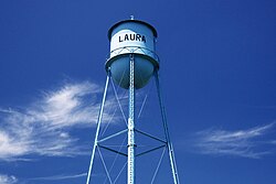
Laura-water-tower-oh.jpg
Water tower in Laura
OHMap-doton-Laura.png
Location of Laura, Ohio
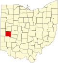
Map of Miami County Ohio Highlighting Laura Village.png
Location of Laura in Miami County
Coordinates: 39°59′50″N84°24′29″W / 39.99722°N 84.40806°W / 39.99722; -84.40806
Country United States
State Ohio
County Miami
Township Union
Area
[1]
  Total0.27 sq mi (0.69 km2)
  Land0.27 sq mi (0.69 km2)
  Water0.00 sq mi (0.00 km2)
Elevation
[2]
994 ft (303 m)
Population
 (2020)
  Total398
  Density1,485.07/sq mi (574.17/km2)
Time zone UTC-5 (Eastern (EST))
  Summer (DST) UTC-4 (EDT)
ZIP code
45337
Area code(s) 937, 326
FIPS code 39-42028 [3]
GNIS feature ID2398398 [2]

Laura is a village in Miami County, Ohio, United States. The population was 398 at the 2020 census. It is part of the Dayton Metropolitan Statistical Area.

Contents

History

Laura was laid out around 1840. [4] A post office called Laura has been in operation since 1850. [5] The village was named after Laura, the first postmaster's daughter. [6] Laura was incorporated as a village in 1892. [6]

Geography

According to the United States Census Bureau, the village has a total area of 0.27 square miles (0.70 km2), all land. [7]

Demographics

Historical population
CensusPop.Note
1900 378
1910 302−20.1%
1920 243−19.5%
1930 27111.5%
1940 31717.0%
1950 38019.9%
1960 52638.4%
1970 464−11.8%
1980 5018.0%
1990 483−3.6%
2000 4870.8%
2010 474−2.7%
2020 398−16.0%
U.S. Decennial Census [8]

2010 census

As of the census [9] of 2010, there were 474 people, 174 households, and 120 families living in the village. The population density was 1,755.6 inhabitants per square mile (677.8/km2). There were 185 housing units at an average density of 685.2 per square mile (264.6/km2). The racial makeup of the village was 96.6% White, 1.7% African American, 0.4% Native American, 0.2% Asian, 0.6% from other races, and 0.4% from two or more races. Hispanic or Latino of any race were 1.5% of the population.

There were 174 households, of which 30.5% had children under the age of 18 living with them, 54.6% were married couples living together, 8.6% had a female householder with no husband present, 5.7% had a male householder with no wife present, and 31.0% were non-families. 19.0% of all households were made up of individuals, and 8% had someone living alone who was 65 years of age or older. The average household size was 2.72 and the average family size was 3.19.

The median age in the village was 38 years. 23.4% of residents were under the age of 18; 10.8% were between the ages of 18 and 24; 24% were from 25 to 44; 28.9% were from 45 to 64; and 12.9% were 65 years of age or older. The gender makeup of the village was 49.8% male and 50.2% female.

2000 census

As of the census [3] of 2000, there were 487 people, 175 households, and 131 families living in the village. The population density was 1,714.6 inhabitants per square mile (662.0/km2). There were 182 housing units at an average density of 640.8 per square mile (247.4/km2). The racial makeup of the village was 97.54% White, 0.21% Native American, 0.21% Asian, 0.41% from other races, and 1.64% from two or more races. Hispanic or Latino of any race were 2.26% of the population.

There were 175 households, out of which 41.1% had children under the age of 18 living with them, 60.0% were married couples living together, 8.6% had a female householder with no husband present, and 25.1% were non-families. 17.1% of all households were made up of individuals, and 6.9% had someone living alone who was 65 years of age or older. The average household size was 2.78 and the average family size was 3.18.

In the village, the population was spread out, with 29.2% under the age of 18, 7.8% from 18 to 24, 29.8% from 25 to 44, 24.2% from 45 to 64, and 9.0% who were 65 years of age or older. The median age was 35 years. For every 100 females there were 110.8 males. For every 100 females age 18 and over, there were 101.8 males.

The median income for a household in the village was $45,833, and the median income for a family was $46,250. Males had a median income of $33,542 versus $23,906 for females. The per capita income for the village was $17,912. About 2.7% of families and 2.8% of the population were below the poverty line, including 3.0% of those under age 18 and none of those age 65 or over.
Related Research Articles

<span class="mw-page-title-main">Miami County, Ohio</span> County in Ohio, United States

Miami County is a county located in the U.S. state of Ohio. As of the 2020 census, the population was 108,774. Its county seat is Troy. The county is named in honor of the Miami people.

<span class="mw-page-title-main">Hamersville, Ohio</span> Village in Ohio, United States

Hamersville is a village in Clark Township, Brown County, Ohio, United States. The population was 485 at the 2020 census.

<span class="mw-page-title-main">Castine, Ohio</span> Village in Ohio, United States

Castine is a village in Darke County, Ohio, United States. The population was 110 at the 2020 census.

<span class="mw-page-title-main">Spring Valley, Ohio</span> Village in Ohio, United States

Spring Valley is a village in Greene County, Ohio, United States. The population was 415 at the 2020 census. It is part of the Dayton Metropolitan Statistical Area.

<span class="mw-page-title-main">Addyston, Ohio</span> Village in Ohio, United States

Addyston is a village in Miami Township, Hamilton County, Ohio, United States. Located along the Ohio River, it is a western suburb of the neighboring city of Cincinnati. The population was 927 at the 2020 census.

<span class="mw-page-title-main">Cleves, Ohio</span> City in Ohio, United States

Cleves is a village in Miami Township, Hamilton County, Ohio, United States. Located along the Ohio River, it is a western suburb of Cincinnati. The population was 3,414 at the 2020 census.

<span class="mw-page-title-main">Evendale, Ohio</span> Village in Ohio, United States

Evendale is a village in Hamilton County, Ohio, United States, within the Cincinnati metropolitan area. The population was 2,669 at the 2020 census.

<span class="mw-page-title-main">North Bend, Ohio</span> Village in Ohio, United States

North Bend is a village in Miami Township, Hamilton County, Ohio, United States, along the Ohio River. It is a part of the Greater Cincinnati area. The population was 835 at the 2020 census.

<span class="mw-page-title-main">St. Louisville, Ohio</span> Village in Ohio, United States

St. Louisville is a village in Licking County, Ohio, United States, along the North Fork of the Licking River. The population was 352 at the 2020 census.

<span class="mw-page-title-main">Casstown, Ohio</span> Village in Ohio, United States

Casstown is a village in Miami County, Ohio, United States. The population was 270 at the 2020 census. It is part of the Dayton Metropolitan Statistical Area.

<span class="mw-page-title-main">Covington, Ohio</span> Village in Ohio, United States

Covington is a village in Miami County, Ohio, United States. The population was 2,548 at the 2020 census. It is part of the Dayton Metropolitan Statistical Area. The village was incorporated as Covington in 1835 on the site of the 1793 Fort Rowdy.

<span class="mw-page-title-main">Ludlow Falls, Ohio</span> Village in Ohio, United States

Ludlow Falls is a village in Miami County, Ohio, United States. The population was 175 at the 2020 census. It is part of the Dayton Metropolitan Statistical Area. Ludlow Falls is named after surveyor Israel Ludlow.

<span class="mw-page-title-main">Pleasant Hill, Ohio</span> Village in Ohio, United States

Pleasant Hill is a village in Miami County, Ohio, United States. The population was 1,241 at the 2020 census. It is part of the Dayton Metropolitan Statistical Area.

<span class="mw-page-title-main">Potsdam, Ohio</span> Village in Ohio, United States

Potsdam is a village in Miami County, Ohio, United States. The population was 225 at the 2020 census. It is part of the Dayton Metropolitan Statistical Area.

<span class="mw-page-title-main">Corwin, Ohio</span> Village in Ohio, United States

Corwin is a village in Wayne Township, Warren County, Ohio, United States. The population was 484 at the 2020 census.

<span class="mw-page-title-main">Waynesville, Ohio</span> Village in Ohio, United States

Waynesville is a village in Wayne Township, Warren County, Ohio, United States. The population was 2,669 at the 2020 census. It is named for General "Mad" Anthony Wayne. The village, located at the crossroads of U.S. Route 42 and State Route 73, is known for its antique stores and its annual sauerkraut festival. Caesar Creek State Park is located 5 miles (8.0 km) east of the village.

<span class="mw-page-title-main">College Corner, Ohio</span> Village in Ohio, United States

College Corner is a village in Butler and Preble counties in the southwestern part of the U.S. state of Ohio, 5 miles (8 km) northwest of Oxford. The population was 387 at the 2020 census. The village lies on the state line with Indiana, where it borders the town of West College Corner. The public school, part of the Union County–College Corner Joint School District, is bisected by the state line and is operated jointly with Indiana authorities.

<span class="mw-page-title-main">Clifton, Ohio</span> Village in Ohio, United States

Clifton is a village in Clark and Greene counties in the U.S. state of Ohio and is home to the Clifton Mill, one of the largest water-powered grist mills still in existence. The population was 131 at the 2020 census.

<span class="mw-page-title-main">Bradford, Ohio</span> Village in Ohio, United States

Bradford is a village in Darke and Miami counties in the U.S. state of Ohio. The population was 1,796 at the 2020 census.

<span class="mw-page-title-main">West Milton, Ohio</span> Village in Ohio, United States

West Milton is a village in Miami County, Ohio, United States. The population was 4,697 at the 2020 census. It is part of the Dayton Metropolitan Statistical Area.

References

  1. "ArcGIS REST Services Directory". United States Census Bureau. Retrieved September 20, 2022.
  2. 1 2 U.S. Geological Survey Geographic Names Information System: Laura, Ohio
  3. 1 2 "U.S. Census website". United States Census Bureau . Retrieved January 31, 2008.
  4. The History of Miami County, Ohio: Containing a History of the County; Its Cities, Towns, Etc. Windmill Publications. 1880. p. 355.
  5. "Miami County". Jim Forte Postal History. Retrieved January 9, 2016.
  6. 1 2 Harbaugh, T. C. (1909). Centennial history. Troy, Piqua and Miami county, Ohio. Chicago: Richmond-Arnold Publishing Co. p. 93.
  7. "US Gazetteer files 2010". United States Census Bureau. Archived from the original on July 2, 2012. Retrieved January 6, 2013.
  8. "Census of Population and Housing". Census.gov. Retrieved June 4, 2015.
  9. "U.S. Census website". United States Census Bureau . Retrieved January 6, 2013.