National Register of Historic Places listings in Knox County, Ohio

Last updated

Location of Knox County in Ohio Map of Ohio highlighting Knox County.svg
Location of Knox County in Ohio

This is a list of the National Register of Historic Places listings in Knox County, Ohio.

Contents

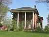
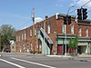
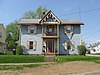
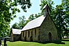
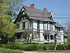
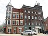
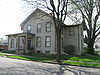
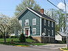
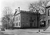
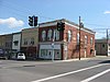
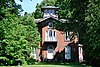
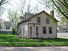
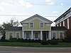
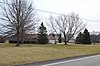
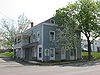
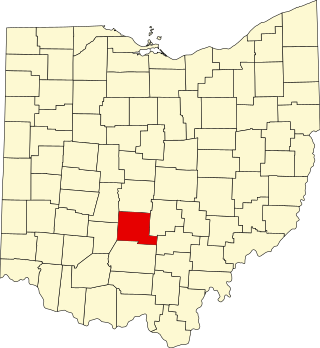
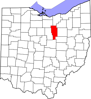
This is intended to be a complete list of the properties and districts on the National Register of Historic Places in Knox County, Ohio, United States. The locations of National Register properties and districts for which the latitude and longitude coordinates are included below, may be seen in a Google map. [1]

There are 45 properties and districts listed on the National Register in the county.


    This National Park Service list is complete through NPS recent listings posted December 15, 2023. [2]

Map all coordinates using: OpenStreetMap

Current listings

[3] Name on the Register [4] ImageDate listed [5] Location City or townDescription
1 Samuel Beers House
Samuel Beers House Samuel Beers House.jpg
Samuel Beers House
November 6, 1979
(#79003855)
W. Sandusky St.
40°28′49″N82°33′08″W / 40.480278°N 82.552222°W / 40.480278; -82.552222 (Samuel Beers House)
Fredericktown
2 Bell House
Bell House Bell House, Fredericktown.jpg
Bell House
November 6, 1979
(#79003856)
53-57 N. Main St.
40°28′55″N82°32′37″W / 40.481944°N 82.543611°W / 40.481944; -82.543611 (Bell House)
Fredericktown
3 Brick Commercial Block
Brick Commercial Block Brick Commercial Block, Fredericktown.jpg
Brick Commercial Block
November 6, 1979
(#79003857)
Main and College Sts.
40°28′57″N82°32′37″W / 40.4825°N 82.543611°W / 40.4825; -82.543611 (Brick Commercial Block)
Fredericktown
4 William Burch House
William Burch House William Burch House.jpg
William Burch House
November 6, 1979
(#79003858)
Edgehill Dr. and Mount Vernon Ave.
40°28′49″N82°32′26″W / 40.480139°N 82.540417°W / 40.480139; -82.540417 (William Burch House)
Fredericktown
5 Henry Cassell House
Henry Cassell House Henry Cassell House.jpg
Henry Cassell House
November 6, 1979
(#79003859)
23 High St.
40°29′03″N82°32′40″W / 40.484167°N 82.544444°W / 40.484167; -82.544444 (Henry Cassell House)
Fredericktown
6 Christ Church at the Quarry
Christ Church at the Quarry Christ Church at the Quarry.JPG
Christ Church at the Quarry
September 25, 1975
(#75001446)
East of Gambier at the junction of Quarry Chapel and Monroe Mills Rds.
40°23′16″N82°22′15″W / 40.387778°N 82.370833°W / 40.387778; -82.370833 (Christ Church at the Quarry)
College Township
7 Wilson S. Cummings House
Wilson S. Cummings House Wilson S. Cummings House.jpg
Wilson S. Cummings House
November 6, 1979
(#79003860)
Sandusky and Taylor Sts.
40°28′53″N82°32′52″W / 40.481389°N 82.547778°W / 40.481389; -82.547778 (Wilson S. Cummings House)
Fredericktown
8 Elias Delashment House
Elias Delashment House Elias Delashment House.jpg
Elias Delashment House
November 6, 1979
(#79003861)
2nd St. and Edgehill Dr.
40°28′53″N82°32′27″W / 40.481389°N 82.540833°W / 40.481389; -82.540833 (Elias Delashment House)
Fredericktown
9 Downtown Mount Vernon Historic District
Downtown Mount Vernon Historic District Buildings at High and Public Square, Mount Vernon.jpg
Downtown Mount Vernon Historic District
February 3, 2012
(#11001092)
S. Main, S. Mulberry, S. Gay, High, Vine, Gambier, and Howard Sts., Ohio Ave, and Phillips Dr.
40°23′30″N82°29′08″W / 40.391796°N 82.485609°W / 40.391796; -82.485609 (Downtown Mount Vernon Historic District)
Mount Vernon
10 Early Greek Revival Cottage
Early Greek Revival Cottage Early Greek Revival Cottage.jpg
Early Greek Revival Cottage
November 6, 1979
(#79003862)
2nd and Chestnut Sts.
40°28′55″N82°32′41″W / 40.481944°N 82.544722°W / 40.481944; -82.544722 (Early Greek Revival Cottage)
Fredericktown
11 Early Greek Revival House
Early Greek Revival House Early Greek Revival House, Fredericktown.jpg
Early Greek Revival House
November 6, 1979
(#79003863)
Main and 2nd Sts.
40°28′55″N82°32′35″W / 40.481944°N 82.543056°W / 40.481944; -82.543056 (Early Greek Revival House)
Fredericktown
12 East Gambier Street District
East Gambier Street District Home in East Gambier Historic District.JPG
East Gambier Street District
November 18, 1976
(#76001459)
100-519 E. Gambier St.
40°23′28″N82°28′48″W / 40.391111°N 82.48°W / 40.391111; -82.48 (East Gambier Street District)
Mount Vernon
13 East High Street Historic District
East High Street Historic District East High Street Historic District, Mount Vernon.jpg
East High Street Historic District
March 18, 1987
(#86003490)
Roughly bounded by E. Chestnut St., S. Catherine St., E. Vine St., and S. Gay St.
40°23′35″N82°28′51″W / 40.393056°N 82.480833°W / 40.393056; -82.480833 (East High Street Historic District)
Mount Vernon
14 Fredericktown Presbyterian Church
Fredericktown Presbyterian Church Fredericktown Presbyterian Church.jpg
Fredericktown Presbyterian Church
November 6, 1979
(#79003864)
Main St. and Public Sq.
40°28′50″N82°32′37″W / 40.480556°N 82.543611°W / 40.480556; -82.543611 (Fredericktown Presbyterian Church)
Fredericktown
15 Gambier Historic District
Gambier Historic District Gaskin Avenue in Gambier.jpg
Gambier Historic District
May 10, 2000
(#99001686)
Roughly bounded by State Route 229, Meadow Ln., Brooklyn St., and the northern village boundary
40°22′35″N82°23′43″W / 40.376389°N 82.395278°W / 40.376389; -82.395278 (Gambier Historic District)
Gambier
16 Gothic Revival House
Gothic Revival House Gothic Revival House, Fredericktown.jpg
Gothic Revival House
November 6, 1979
(#79003865)
High and N. Main Sts.
40°29′01″N82°32′38″W / 40.483611°N 82.543889°W / 40.483611; -82.543889 (Gothic Revival House)
Fredericktown
17 Greek Revival Commercial Building
Greek Revival Commercial Building Greek Revival Commercial Building, Fredericktown.jpg
Greek Revival Commercial Building
November 6, 1979
(#79003866)
67-69 N. Main St.
40°28′55″N82°32′37″W / 40.481944°N 82.543611°W / 40.481944; -82.543611 (Greek Revival Commercial Building)
Fredericktown
18 Hosack House
Hosack House Hosack House.jpg
Hosack House
November 6, 1979
(#79003867)
W. College St.
40°28′56″N82°32′38″W / 40.482222°N 82.543889°W / 40.482222; -82.543889 (Hosack House)
Fredericktown
19 Kenyon College
Kenyon College Old Kenyon crop.jpg
Kenyon College
December 6, 1975
(#75001447)
State Routes 229 and 308
40°22′29″N82°23′50″W / 40.374722°N 82.397222°W / 40.374722; -82.397222 (Kenyon College)
Gambier
20 Dr. King House
Dr. King House Dr. King House, Fredericktown.jpg
Dr. King House
November 6, 1979
(#79003868)
Main and 2nd Sts.
40°28′54″N82°32′37″W / 40.481667°N 82.543611°W / 40.481667; -82.543611 (Dr. King House)
Fredericktown
21 Knox County Courthouse
Knox County Courthouse Knox County, Ohio Courthouse (14516804607).jpg
Knox County Courthouse
June 4, 1973
(#73001484)
High St.
40°23′37″N82°28′57″W / 40.393611°N 82.4825°W / 40.393611; -82.4825 (Knox County Courthouse)
Mount Vernon
22 Knox County Infirmary
Knox County Infirmary Knox County Infirmary in September 2007.jpg
Knox County Infirmary
July 10, 1986
(#86001567)
7516 Johnstown Rd., southwest of Mount Vernon
40°20′52″N82°33′07″W / 40.347778°N 82.551944°W / 40.347778; -82.551944 (Knox County Infirmary)
Liberty Township Destroyed in a fire on June 26, 2015. [6]
23 Kokosing House
Kokosing House The Kokosing House.JPG
Kokosing House
February 19, 1985
(#85000450)
221 Kokosing Dr.
40°22′43″N82°24′12″W / 40.378611°N 82.403333°W / 40.378611; -82.403333 (Kokosing House)
Gambier
24 Richard and Ann Loveridge House
Richard and Ann Loveridge House Richard and Ann Loveridge House.jpg
Richard and Ann Loveridge House
April 1, 2009
(#09000171)
12526 Lower Green Valley Rd., northwest of Mount Vernon
40°25′11″N82°31′34″W / 40.419722°N 82.526111°W / 40.419722; -82.526111 (Richard and Ann Loveridge House)
Morris Township
25 James McFarland House
James McFarland House James McFarland House property.jpg
James McFarland House
March 9, 1990
(#90000384)
7864 Newark Rd., south of Mount Vernon
40°20′58″N82°28′18″W / 40.349306°N 82.471667°W / 40.349306; -82.471667 (James McFarland House)
Clinton Township
26 McKee-Pumphrey House
McKee-Pumphrey House McKee-Pumphrey House.jpg
McKee-Pumphrey House
July 28, 1995
(#95000938)
165 N. Market St.
40°16′19″N82°21′14″W / 40.272083°N 82.354027°W / 40.272083; -82.354027 (McKee-Pumphrey House)
Martinsburg
27 McLaughlin Mound
McLaughlin Mound 1914IllustrationCemeteryMoundMountVernonKnoxCountyOhioUS.png
McLaughlin Mound
December 11, 1972
(#72001025)
Address Restricted
Mount Vernon Also called Cemetery Mound
28 Mill Road Bowstring Bridge
Mill Road Bowstring Bridge Mill Road Bowstring Bridge.jpg
Mill Road Bowstring Bridge
December 5, 1979
(#79001869)
Ariel-Foundation Park [7]
40°23′16″N82°29′55″W / 40.387778°N 82.498611°W / 40.387778; -82.498611 (Mill Road Bowstring Bridge)
Mount Vernon Formerly located on Mill Road east of Bladensburg
29 Mount Liberty Tavern
Mount Liberty Tavern Mount Liberty Tavern.jpg
Mount Liberty Tavern
May 3, 1974
(#74001539)
U.S. Route 36 in Mount Liberty
40°20′46″N82°37′54″W / 40.346111°N 82.631667°W / 40.346111; -82.631667 (Mount Liberty Tavern)
Liberty Township
30 North Main-North Gay Streets Historic District
North Main-North Gay Streets Historic District Curtis-Devin House, Mount Vernon.jpg
North Main-North Gay Streets Historic District
March 9, 1990
(#90000383)
Roughly bounded by Curtis St., N. Gay St., Public Sq., and N. Main St.
40°23′50″N82°29′05″W / 40.397222°N 82.484722°W / 40.397222; -82.484722 (North Main-North Gay Streets Historic District)
Mount Vernon
31 Old Davis and Dague Grocery Store
Old Davis and Dague Grocery Store Old Davis and Dague Grocery Store.jpg
Old Davis and Dague Grocery Store
November 6, 1979
(#79003869)
Main and College Sts.
40°28′57″N82°32′35″W / 40.4825°N 82.543056°W / 40.4825; -82.543056 (Old Davis and Dague Grocery Store)
Fredericktown
32 Old Greek Revival Farmhouse
Old Greek Revival Farmhouse Site of the Old Greek Revival Farmhouse in Fredericktown.jpg
Old Greek Revival Farmhouse
November 6, 1979
(#79003870)
W. Sandusky St.
40°28′50″N82°32′59″W / 40.480556°N 82.549722°W / 40.480556; -82.549722 (Old Greek Revival Farmhouse)
Fredericktown Destroyed
33 Old Methodist Church
Old Methodist Church Old Fredericktown Methodist Church.jpg
Old Methodist Church
November 6, 1979
(#79003871)
Sandusky St. and Public Sq.
40°28′51″N82°32′34″W / 40.480833°N 82.542778°W / 40.480833; -82.542778 (Old Methodist Church)
Fredericktown
34 Old Telephone Building
Old Telephone Building Old Telephone Building, Fredericktown.jpg
Old Telephone Building
November 6, 1979
(#79003872)
College and Chestnut Sts.
40°28′57″N82°32′39″W / 40.4825°N 82.544167°W / 40.4825; -82.544167 (Old Telephone Building)
Fredericktown
35 Pennsylvania Depot
Pennsylvania Depot Pennsylvania Depot Mt Vernon Ohio.JPG
Pennsylvania Depot
November 3, 1972
(#09000100)
S. Main St.
40°23′19″N82°29′12″W / 40.388611°N 82.486667°W / 40.388611; -82.486667 (Pennsylvania Depot)
Mount Vernon
36 Raleigh Mound
Raleigh Mound Raleigh Mound at Fredericktown.jpg
Raleigh Mound
October 14, 1975
(#75001445)
Mound St. [8]
40°28′25″N82°32′35″W / 40.473611°N 82.543056°W / 40.473611; -82.543056 (Raleigh Mound)
Fredericktown Also known as the "Rowley Mound" [8]
37 James Reed House
James Reed House James Reed House, Fredericktown.jpg
James Reed House
November 6, 1979
(#79003873)
E. College St.
40°28′57″N82°32′30″W / 40.4825°N 82.541667°W / 40.4825; -82.541667 (James Reed House)
Fredericktown
38 Round Hill
Round Hill Round Hill Mount Vernon Ohio.JPG
Round Hill
December 12, 1976
(#76001460)
E. Pleasant and N. McKenzie Sts.
40°23′56″N82°28′48″W / 40.398889°N 82.48°W / 40.398889; -82.48 (Round Hill)
Mount Vernon
39 Second Hosack House
Second Hosack House Second Hosack House.jpg
Second Hosack House
November 6, 1979
(#79003874)
College and Chestnut Sts.
40°28′56″N82°32′39″W / 40.482222°N 82.544167°W / 40.482222; -82.544167 (Second Hosack House)
Fredericktown
40 Sprague-Deaver House
Sprague-Deaver House Sprague-Deaver House.jpg
Sprague-Deaver House
November 6, 1979
(#79003875)
Sandusky and Pleasant Sts.
40°28′51″N82°32′33″W / 40.480833°N 82.5425°W / 40.480833; -82.5425 (Sprague-Deaver House)
Fredericktown
41 Stackhouse Mound and Works
Stackhouse Mound and Works Stackhouse Mound.jpg
Stackhouse Mound and Works
June 18, 1973
(#73001483)
Off Montgomery Road east of Fredericktown [9]
40°28′51″N82°31′46″W / 40.480833°N 82.529444°W / 40.480833; -82.529444 (Stackhouse Mound and Works)
Morris Township Originally listed as "Braddock Mound and Works" [10]
42 Enoch Thompson House
Enoch Thompson House Enoch Thompson House site.jpg
Enoch Thompson House
November 25, 1980
(#80003107)
South of Mount Vernon on State Route 661
40°16′08″N82°30′59″W / 40.268889°N 82.516389°W / 40.268889; -82.516389 (Enoch Thompson House)
Miller Township
43 Tuttle House
Tuttle House Tuttle House, Fredericktown.jpg
Tuttle House
July 12, 1976
(#76001458)
33 E. College St.
40°28′57″N82°32′31″W / 40.4825°N 82.541944°W / 40.4825; -82.541944 (Tuttle House)
Fredericktown
44 Woodward Opera House
Woodward Opera House Woodward Opera House.JPG
Woodward Opera House
October 10, 1975
(#75001448)
Main and Vine Sts.
40°23′33″N82°29′10″W / 40.3925°N 82.486111°W / 40.3925; -82.486111 (Woodward Opera House)
Mount Vernon
45 Lyman Wright Building
Lyman Wright Building Lyman Wright Building, Fredericktown.jpg
Lyman Wright Building
November 6, 1979
(#79003876)
Main and 2nd Sts.
40°28′54″N82°32′35″W / 40.481667°N 82.543056°W / 40.481667; -82.543056 (Lyman Wright Building)
Fredericktown

See also

Related Research Articles

<span class="mw-page-title-main">National Register of Historic Places listings in Mobile County, Alabama</span>

This is a list of the National Register of Historic Places listings in Mobile County, Alabama.

<span class="mw-page-title-main">National Register of Historic Places listings in Cuyahoga County, Ohio</span>

This is a list of the National Register of Historic Places listings in Cuyahoga County, Ohio.

<span class="mw-page-title-main">National Register of Historic Places listings in Dauphin County, Pennsylvania</span>

This is a list of the National Register of Historic Places listings in Dauphin County, Pennsylvania.

<span class="mw-page-title-main">National Register of Historic Places listings in Alachua County, Florida</span>

This is a list of the National Register of Historic Places listings in Alachua County, Florida.

<span class="mw-page-title-main">National Register of Historic Places listings in Delaware County, Ohio</span>

This is a list of the National Register of Historic Places listings in Delaware County, Ohio.

<span class="mw-page-title-main">National Register of Historic Places listings in Fairfield County, Ohio</span>

This is a list of the National Register of Historic Places listings in Fairfield County, Ohio.

<span class="mw-page-title-main">National Register of Historic Places listings in Licking County, Ohio</span>

This is a list of the National Register of Historic Places listings in Licking County, Ohio.

<span class="mw-page-title-main">National Register of Historic Places listings in Greene County, Ohio</span>

This is a list of the National Register of Historic Places listings in Greene County, Ohio.

<span class="mw-page-title-main">National Register of Historic Places listings in Scioto County, Ohio</span>

This is a list of the National Register of Historic Places listings in Scioto County, Ohio.

<span class="mw-page-title-main">National Register of Historic Places listings in Pickaway County, Ohio</span>

This is a list of the National Register of Historic Places listings in Pickaway County, Ohio, USA.

<span class="mw-page-title-main">National Register of Historic Places listings in Jefferson County, Ohio</span>

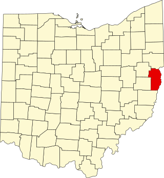
This is a list of the National Register of Historic Places listings in Jefferson County, Ohio.

<span class="mw-page-title-main">National Register of Historic Places listings in Ashland County, Ohio</span>

This is a list of the National Register of Historic Places listings in Ashland County, Ohio.

<span class="mw-page-title-main">National Register of Historic Places listings in Coshocton County, Ohio</span>

This is a list of the National Register of Historic Places listings in Coshocton County, Ohio.

<span class="mw-page-title-main">National Register of Historic Places listings in Converse County, Wyoming</span>

This is a list of the National Register of Historic Places listings in Converse County, Wyoming.

<span class="mw-page-title-main">National Register of Historic Places listings in Larimer County, Colorado</span> List of National Register of Historic Places in Larimer County, Colorado, United States

This is a list of the National Register of Historic Places listings in Larimer County, Colorado.

<span class="mw-page-title-main">National Register of Historic Places listings in Sandoval County, New Mexico</span>

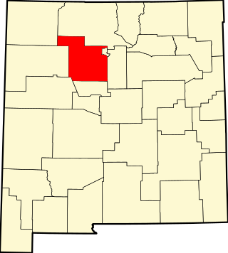
This is a list of the National Register of Historic Places listings in Sandoval County, New Mexico, United States.

<span class="mw-page-title-main">National Register of Historic Places listings in San Juan County, New Mexico</span>

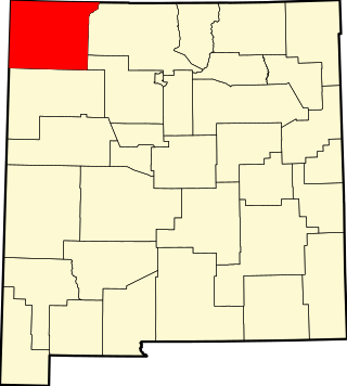
This is a list of the National Register of Historic Places listings in San Juan County, New Mexico.

<span class="mw-page-title-main">National Register of Historic Places listings in Knox County, Indiana</span>

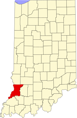
This is a list of the National Register of Historic Places listings in Knox County, Indiana.

<span class="mw-page-title-main">National Register of Historic Places listings in Pike County, Ohio</span>

This is a list of the National Register of Historic Places listings in Pike County, Ohio.

<span class="mw-page-title-main">National Register of Historic Places listings in Vernon Parish, Louisiana</span>

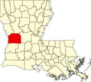
This is a list of the National Register of Historic Places listings in Vernon Parish, Louisiana.

References

  1. The latitude and longitude information provided in this table was derived originally from the National Register Information System, which has been found to be fairly accurate for about 99% of listings. Some locations in this table may have been corrected to current GPS standards.
  2. National Park Service, United States Department of the Interior, "National Register of Historic Places: Weekly List Actions", retrieved December 15, 2023.
  3. Numbers represent an alphabetical ordering by significant words. Various colorings, defined here, differentiate National Historic Landmarks and historic districts from other NRHP buildings, structures, sites or objects.
  4. "National Register Information System". National Register of Historic Places . National Park Service. April 24, 2008.
  5. The eight-digit number below each date is the number assigned to each location in the National Register Information System database, which can be viewed by clicking the number.
  6. Main, Fred (26 June 2015). "Eight departments responded to former Bible College blaze". Mount Vernon News. Mount Vernon, Ohio. Archived from the original on 27 June 2015. Retrieved 26 June 2015.
  7. Martin, Chuck (3 July 2014). "Ariel-Foundation Park bridge and pavilion open for business". Mount Vernon News. Mount Vernon, Ohio. Archived from the original on 29 June 2015. Retrieved 26 June 2015.
  8. 1 2 Location derived from its GNIS feature record; the NRIS lists the site as "Address Restricted".
  9. Location derived from the GNIS feature record for the Braddock Mound; the NRIS lists the site as "Address Restricted".
  10. Derived from its Federal Register notice; no other properties in Knox County were listed on that date