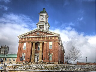
Danville, Ohio

Last updated

Danville, Ohio
Saint Luke Catholic Church (Danville, Ohio) - exterior.jpg
St. Luke's Catholic Church
Motto: 
"Gateway To Amish Country"
OHMap-doton-Danville.png
Location of Danville, Ohio
Map of Knox County Ohio Highlighting Danville Village.png
Location of Danville in Knox County
Coordinates: 40°26′50″N82°15′41″W / 40.44722°N 82.26139°W / 40.44722; -82.26139
Country United States
State Ohio
County Knox
Township Union
Area
[1]
  Total0.60 sq mi (1.54 km2)
  Land0.59 sq mi (1.53 km2)
  Water0.01 sq mi (0.01 km2)
Elevation
[2]
994 ft (303 m)
Population
 (2020)
  Total1,019
  Estimate 
(2023) [3]
996
  Density1,724.20/sq mi (666.24/km2)
Time zone UTC-5 (Eastern (EST))
  Summer (DST) UTC-4 (EDT)
ZIP code
43014
Area code 740
FIPS code 39-20114 [4]
GNIS feature ID2398682 [2]
Website Village website

Danville is a village in Knox County, Ohio, United States. The population was 1,019 at the 2020 census.

Contents

History

Modern Danville had its start in 1923 by the merging of two neighboring villages called Buckeye City and Rosstown (Rossville). [5] [6] The original Danville was laid out by George Sapp, Sr. and Robert Waddell in 1813 and was named for Daniel Sapp, a soldier in the War of 1812. [5]

Geography

According to the United States Census Bureau, the village has a total area of 0.56 square miles (1.45 km2), of which 0.55 square miles (1.42 km2) is land and 0.01 square miles (0.03 km2) is water. [7]

Buckeye City is a neighborhood of Danville. Buckeye City was laid out in 1880, [8] and was annexed by the village of Danville in 1923. [9]

Demographics

Historical population
CensusPop.Note
1830 234
1850 160
1870 134
1880 25489.6%
1890 29215.0%
1900 2982.1%
1910 37325.2%
1920 3832.7%
1930 76499.5%
1940 7903.4%
1950 8538.0%
1960 9268.6%
1970 1,02510.7%
1980 1,12710.0%
1990 1,001−11.2%
2000 1,10410.3%
2010 1,044−5.4%
2020 1,019−2.4%
2023 (est.)996 [3] −2.3%
U.S. Decennial Census [10]

2010 census

As of the census [11] of 2010, there were 1,044 people, 425 households, and 281 families living in the village. The population density was 1,898.2 inhabitants per square mile (732.9/km2). There were 474 housing units at an average density of 861.8 per square mile (332.7/km2). The racial makeup of the village was 97.9% White, 0.6% African American, 0.4% Native American, 0.1% Asian, 0.2% from other races, and 0.9% from two or more races. Hispanic or Latino of any race were 1.2% of the population.

There were 425 households, of which 36.5% had children under the age of 18 living with them, 43.5% were married couples living together, 16.0% had a female householder with no husband present, 6.6% had a male householder with no wife present, and 33.9% were non-families. 28.2% of all households were made up of individuals, and 10.1% had someone living alone who was 65 years of age or older. The average household size was 2.46 and the average family size was 2.98.

The median age in the village was 33.8 years. 28.3% of residents were under the age of 18; 8.4% were between the ages of 18 and 24; 26% were from 25 to 44; 24.4% were from 45 to 64; and 12.8% were 65 years of age or older. The gender makeup of the village was 49.2% male and 50.8% female.

2000 census

As of the census [4] of 2000, there were 1,104 people, 442 households, and 292 families living in the village. The population density was 2,055.1 inhabitants per square mile (793.5/km2). There were 479 housing units at an average density of 891.7 per square mile (344.3/km2). The racial makeup of the village was 98.10% White, 0.09% African American, 0.09% Native American, 0.18% Asian, and 1.54% from two or more races. Hispanic or Latino of any race were 0.36% of the population.

There were 442 households, out of which 32.4% had children under the age of 18 living with them, 50.0% were married couples living together, 12.4% had a female householder with no husband present, and 33.9% were non-families. 28.7% of all households were made up of individuals, and 13.3% had someone living alone who was 65 years of age or older. The average household size was 2.50 and the average family size was 3.09.

In the village, the population was spread out, with 28.1% under the age of 18, 10.6% from 18 to 24, 25.8% from 25 to 44, 19.9% from 45 to 64, and 15.6% who were 65 years of age or older. The median age was 33 years. For every 100 females there were 101.1 males. For every 100 females age 18 and over, there were 90.9 males.

The median income for a household in the village was $28,636, and the median income for a family was $31,375. Males had a median income of $30,208 versus $22,500 for females. The per capita income for the village was $14,595. About 15.0% of families and 15.2% of the population were below the poverty line, including 18.1% of those under age 18 and 13.5% of those age 65 or over.

Education

Danville Local School District operates Danville High School in the village. [12]

Danville has a public library, a branch of The Public Library of Mount Vernon & Knox County. [13]

Notable people

Related Research Articles

<span class="mw-page-title-main">Knox County, Ohio</span> County in Ohio, United States

Knox County is a county located in the U.S. state of Ohio. As of the 2020 census, the population was 62,721. Its county seat is Mount Vernon. The county is named for Henry Knox, an officer in the American Revolutionary War who was later the first Secretary of War. Knox County comprises the Mount Vernon, OH Micropolitan Statistical Area, which is also included in the Columbus-Marion-Zanesville, OH Combined Statistical Area.

<span class="mw-page-title-main">Belgium, Illinois</span> Village in Illinois, United States

Belgium is a village in Vermilion County, Illinois, United States. It is part of the Danville, Illinois Metropolitan Statistical Area. The population was 404 at the 2010 census.

<span class="mw-page-title-main">Danville, Kansas</span> City in Harper County, Kansas

Danville is a city in Harper County, Kansas, United States. As of the 2020 census, the population of the city was 29.

<span class="mw-page-title-main">Ashley, Ohio</span> Village in Ohio, United States

Ashley is a village in Delaware County, Ohio, United States. The population was 1,198 at the 2020 census.

<span class="mw-page-title-main">Fairfield Beach, Ohio</span> Census-designated place in Ohio, United States

Fairfield Beach is an unincorporated community and census-designated place (CDP) in Fairfield County, Ohio, United States. The population was 1,267 at the 2020 census.

<span class="mw-page-title-main">Old Washington, Ohio</span> Village in Ohio, United States

Old Washington is a village in Guernsey County, Ohio, United States. The population was 223 at the 2020 census.

<span class="mw-page-title-main">Addyston, Ohio</span> Village in Ohio, United States

Addyston is a village in Miami Township, Hamilton County, Ohio, United States. Located along the Ohio River, it is a western suburb of the neighboring city of Cincinnati. The population was 927 at the 2020 census.

<span class="mw-page-title-main">Dillonvale, Jefferson County, Ohio</span> Village in Ohio, United States

Dillonvale is a village in southern Jefferson County, Ohio, United States. The population was 589 at the 2020 census. It is part of the Weirton–Steubenville metropolitan area. Charles Eberle was the first mayor of Dillonvale and was the first Postmaster as well.

<span class="mw-page-title-main">Rayland, Ohio</span> Village in Ohio, United States

Rayland is a village in southern Jefferson County, Ohio, United States, along the Ohio River. The population was 389 at the 2020 census. It is part of the Weirton–Steubenville metropolitan area.

<span class="mw-page-title-main">Centerburg, Ohio</span> Village in Ohio, United States

Centerburg is a village in Knox County, Ohio, United States, along the North Fork of the Licking River. As of the 2020 census, the village population was 1,690. Centerburg is located near the geographical center of Ohio.

<span class="mw-page-title-main">Fredericktown, Ohio</span> Village in Ohio, United States

Fredericktown is a village in Knox County, Ohio, United States. The population was 2,648 at the 2020 census.

<span class="mw-page-title-main">Gambier, Ohio</span> Village in Ohio, United States

Gambier is a village in Knox County, Ohio, United States. The population was 2,213 at the 2020 census.

<span class="mw-page-title-main">Gann, Ohio</span> Village in Ohio, United States

Brinkhaven, once known as Mount Holly and Gann, is a village in Knox County, Ohio, United States. The population was 114 at the 2020 census.

<span class="mw-page-title-main">Harbor Hills, Ohio</span> Census-designated place in Ohio, United States

Harbor Hills is a census-designated place (CDP) in southern Licking County, Ohio, United States. The population was 1,565 at the 2020 census.

<span class="mw-page-title-main">Coldwater, Ohio</span> Village in Ohio, United States

Coldwater is a village in Mercer County, Ohio, United States. The population was 4,774 at the 2020 census.

<span class="mw-page-title-main">Newcomerstown, Ohio</span> Village in Ohio, United States

Newcomerstown is a village in Tuscarawas County, Ohio, United States, 85 miles (137 km) east-northeast of Columbus. The population was 3,702 at the 2020 census.

<span class="mw-page-title-main">Wilson, Ohio</span> Village in Ohio, United States

Wilson is a village in Belmont and Monroe counties in the U.S. state of Ohio. The population was 129 at the 2020 census. It is part of the Wheeling metropolitan area.

<span class="mw-page-title-main">Yorkville, Ohio</span> Village in Ohio, United States

Yorkville is a village in Belmont and Jefferson counties in the U.S. state of Ohio. The population was 968 at the 2020 census. Yorkville lies within two Metropolitan Statistical Areas; the Belmont County portion is part of the Wheeling metropolitan area, while the Jefferson County portion is part of the Weirton–Steubenville metropolitan area.
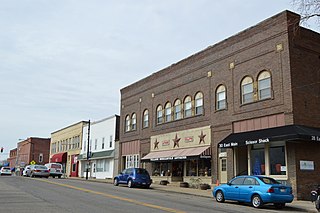
<span class="mw-page-title-main">Buckeye Lake, Ohio</span> Village in Ohio, United States

Buckeye Lake is a village in Fairfield and Licking counties in the U.S. state of Ohio. The population was 2,520 at the 2020 census. It is named for Buckeye Lake, a large lake along which the village is built.
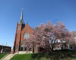
<span class="mw-page-title-main">Adena, Ohio</span> Village in Ohio, United States

Adena is a village in southwestern Jefferson and southeastern Harrison counties in the U.S. state of Ohio. The population was 664 at the 2020 census. It is part of the Weirton–Steubenville metropolitan area.

References

  1. "ArcGIS REST Services Directory". United States Census Bureau. Retrieved September 20, 2022.
  2. 1 2 U.S. Geological Survey Geographic Names Information System: Danville, Ohio
  3. 1 2 "Annual Estimates of the Resident Population for Incorporated Places in Ohio: April 1, 2020 to July 1, 2023". United States Census Bureau. Retrieved June 15, 2024.
  4. 1 2 "U.S. Census website". United States Census Bureau . Retrieved January 31, 2008.
  5. 1 2 "Village of Danville, Ohio". www.danvilleohio.org. Retrieved November 10, 2017.
  6. Overman, William Daniel (1958). Ohio Town Names. Akron, OH: Atlantic Press. p. 36.
  7. "US Gazetteer files 2010". United States Census Bureau. Archived from the original on July 2, 2012. Retrieved January 6, 2013.
  8. Graham, Albert Adams (1881). History of Knox County, Ohio: Its Past and Present, Containing a Condensed, Comprehensive History of Ohio. A. A. Graham & Company. p.  556.
  9. Population. U.S. Government Printing Office. 1931. p. 865.
  10. "Census of Population and Housing". Census.gov. Retrieved June 4, 2015.
  11. "U.S. Census website". United States Census Bureau . Retrieved January 6, 2013.
  12. "Homepage". Danville Local Schools. Retrieved February 26, 2018.
  13. "Branches". The Public Library of Mount Vernon & Knox County. Archived from the original on February 27, 2018. Retrieved February 26, 2018.