National Register of Historic Places listings in Ottawa County, Ohio

Last updated

Location of Ottawa County in Ohio Map of Ohio highlighting Ottawa County.svg
Location of Ottawa County in Ohio

This is a list of the National Register of Historic Places listings in Ottawa County, Ohio.

Contents

This is intended to be a complete list of the properties and districts on the National Register of Historic Places in Ottawa County, Ohio, United States. The locations of National Register properties and districts for which the latitude and longitude coordinates are included below, may be seen in an online map. [1]

There are 31 properties and districts listed on the National Register in the county, including 2 National Historic Landmarks.


    This National Park Service list is complete through NPS recent listings posted December 15, 2023. [2]

Map all coordinates using: OpenStreetMap

Current listings

[3] Name on the Register [4] ImageDate listed [5] Location City or townDescription
1 Charles Andres House November 6, 1995
(#95001196)
County Road 154 (Fox Rd.) on Middle Bass Island
41°41′08″N82°48′39″W / 41.6856°N 82.8108°W / 41.6856; -82.8108 (Charles Andres House)
Put-in-Bay Township
2 Carroll Township Hall
Carroll Township Hall Carroll Township Hall from southwest.jpg
Carroll Township Hall
March 9, 1990
(#90000385)
Toussaint E. Rd. and Behlman Rd., north of Oak Harbor
41°34′02″N83°07′31″W / 41.5672°N 83.1253°W / 41.5672; -83.1253 (Carroll Township Hall)
Carroll Township
3 Catawba Island Wine Company
Catawba Island Wine Company DanburyTwpOH Winery.jpg
Catawba Island Wine Company
May 5, 1983
(#83002019)
3845 Wine Celler Rd., east of Port Clinton
41°31′55″N82°51′31″W / 41.5319°N 82.8586°W / 41.5319; -82.8586 (Catawba Island Wine Company)
Catawba Island Township
4 Alexander Clemons House
Alexander Clemons House MarbleheadOH ClemonsHouse.jpg
Alexander Clemons House
September 17, 1987
(#87001628)
133 Clemons St.
41°32′33″N82°43′24″W / 41.5425°N 82.7233°W / 41.5425; -82.7233 (Alexander Clemons House)
Marblehead
5 Jay Cooke House
Jay Cooke House Cooke Castle 1.jpg
Jay Cooke House
November 13, 1966
(#66000620)
Gibraltar Island, Put-in-Bay, Lake Erie
41°39′29″N82°49′16″W / 41.6581°N 82.8211°W / 41.6581; -82.8211 (Jay Cooke House)
Put-in-Bay
6 East Point Manor June 15, 1990
(#87000804)
S. Shore Dr. on Middle Bass Island
41°41′40″N82°47′13″W / 41.6944°N 82.7869°W / 41.6944; -82.7869 (East Point Manor)
Put-in-Bay Township
7 First Congregational Church
First Congregational Church MarbleheadOH FirstCongChurch.jpg
First Congregational Church
September 22, 2000
(#00001161)
802 Prairie St.
41°32′32″N82°44′05″W / 41.5422°N 82.7347°W / 41.5422; -82.7347 (First Congregational Church)
Marblehead
8 Foster-Gram House
Foster-Gram House Foster-Graham House.jpg
Foster-Gram House
March 19, 1992
(#92000175)
Langrum Rd. on South Bass Island
41°38′43″N82°49′13″W / 41.6453°N 82.8203°W / 41.6453; -82.8203 (Foster-Gram House)
Put-in-Bay Township
9 Genoa Town Hall
Genoa Town Hall Genoa Town Hall in evening.jpg
Genoa Town Hall
June 7, 1976
(#76001504)
Main and 6th Sts.
41°31′05″N83°21′29″W / 41.5181°N 83.3581°W / 41.5181; -83.3581 (Genoa Town Hall)
Genoa
10 Gill-Luchsinger-Bahnsen House and Barn
Gill-Luchsinger-Bahnsen House and Barn Gill-Luchsinger-Bahnsen House.jpg
Gill-Luchsinger-Bahnsen House and Barn
July 16, 1992
(#92000888)
426 E. 4th St.
41°30′31″N82°56′04″W / 41.5086°N 82.9344°W / 41.5086; -82.9344 (Gill-Luchsinger-Bahnsen House and Barn)
Port Clinton
11 Golden Eagle Wine Cellars April 24, 1986
(#86000868)
Fox and Lonz Rds. on Middle Bass Island
41°40′36″N82°48′37″W / 41.6767°N 82.8103°W / 41.6767; -82.8103 (Golden Eagle Wine Cellars)
Put-in-Bay Township
12 Green Island Light
Green Island Light Green Island Light (Ottawa County, Ohio).jpg
Green Island Light
December 18, 1990
(#90001909)
Green Island in Lake Erie
41°38′44″N82°51′57″W / 41.6456°N 82.8658°W / 41.6456; -82.8658 (Green Island Light)
Put-in-Bay Township ARLHS USA 353
13 Inselruhe
Inselruhe Inselruhe front vertical.jpg
Inselruhe
December 12, 1976
(#76001506)
Northeast of Put-in-Bay at the junction of Bayview Ave. and Chapman Rd. on South Bass Island
41°39′26″N82°48′36″W / 41.6571°N 82.8100°W / 41.6571; -82.8100 (Inselruhe)
Put-in-Bay
14 Island House
Island House Island House 2.jpg
Island House
July 2, 2008
(#08000623)
102 Madison St.
41°30′48″N82°56′28″W / 41.5133°N 82.9411°W / 41.5133; -82.9411 (Island House)
Port Clinton
15 Johnson Island Civil War Prison and Fort Site
Johnson Island Civil War Prison and Fort Site Johnson's Island.JPG
Johnson Island Civil War Prison and Fort Site
March 27, 1975
(#75001514)
Eastern shore area of Johnson's Island
41°29′42″N82°43′53″W / 41.4951°N 82.7313°W / 41.4951; -82.7313 (Johnson Island Civil War Prison and Fort Site)
Danbury Township
16 Lakeside Historic District
Lakeside Historic District LakesideOH Houses.jpg
Lakeside Historic District
March 29, 1983
(#83002020)
Roughly bounded by Lake Erie, railroad tracks, and Poplar and Oak Aves., in Lakeside
41°32′32″N82°44′53″W / 41.5422°N 82.7481°W / 41.5422; -82.7481 (Lakeside Historic District)
Danbury Township Encompasses the entire gated community of Lakeside.
17 Main Street Historic District
Main Street Historic District Genoa Main Street, eastern side.jpg
Main Street Historic District
September 22, 1992
(#92001261)
Roughly bounded by 8th, Washington, 5th, and West Sts.
41°31′07″N83°21′30″W / 41.5186°N 83.3583°W / 41.5186; -83.3583 (Main Street Historic District)
Genoa
18 Marblehead Lighthouse
Marblehead Lighthouse Marblehead.jpg
Marblehead Lighthouse
December 17, 1969
(#69000148)
State Route 163
41°32′11″N82°42′42″W / 41.5364°N 82.7117°W / 41.5364; -82.7117 (Marblehead Lighthouse)
Marblehead
19 Middle Bass Club Historic District August 23, 1985
(#85001843)
Grape and Grove Aves. on Middle Bass Island
41°41′05″N82°49′30″W / 41.6847°N 82.825°W / 41.6847; -82.825 (Middle Bass Club Historic District)
Put-in-Bay Township
20 Betsy Mo-John Cabin
Betsy Mo-John Cabin DanburyTwpOH Cabin.jpg
Betsy Mo-John Cabin
May 6, 1976
(#76001505)
About 4 mi (6.4 km) east of Port Clinton off State Route 53
41°31′55″N82°51′29″W / 41.5319°N 82.8581°W / 41.5319; -82.8581 (Betsy Mo-John Cabin)
Catawba Island Township
21 North Bass School
North Bass School North Bass Island School.jpg
North Bass School
June 22, 2020
(#100005289)
515 Kenny Rd. (North Bass Island State Park)
41°42′59″N82°48′55″W / 41.7164°N 82.8154°W / 41.7164; -82.8154 (North Bass School)
Isle St. George, Put-in-Bay Township
22 Ohio State Route 51 Bridge over the Portage River
Ohio State Route 51 Bridge over the Portage River Portage River bridge at Elmore.jpg
Ohio State Route 51 Bridge over the Portage River
March 17, 1994
(#94000239)
State Route 51 over the Portage River
41°28′37″N83°17′44″W / 41.4769°N 83.2956°W / 41.4769; -83.2956 (Ohio State Route 51 Bridge over the Portage River)
Elmore and Harris Township
23 Old School Privy
Old School Privy Old School Privy.jpg
Old School Privy
July 31, 1975
(#75001515)
310 Main St.
41°30′54″N83°21′34″W / 41.5149°N 83.3594°W / 41.5149; -83.3594 (Old School Privy)
Genoa
24 Ottawa County Courthouse
Ottawa County Courthouse Ottawa County Courthouse 2.jpg
Ottawa County Courthouse
May 3, 1974
(#74001588)
W. 4th and Madison Sts.
41°30′35″N82°56′25″W / 41.5097°N 82.9403°W / 41.5097; -82.9403 (Ottawa County Courthouse)
Port Clinton
25 Perry's Victory and International Peace Memorial
Perry's Victory and International Peace Memorial Perrys monument.jpg
Perry's Victory and International Peace Memorial
October 15, 1966
(#66000118)
South Bass Island
41°39′15″N82°48′41″W / 41.6542°N 82.8114°W / 41.6542; -82.8114 (Perry's Victory and International Peace Memorial)
Put-in-Bay
26 Port Clinton City Hall
Port Clinton City Hall Port Clinton City Hall.jpg
Port Clinton City Hall
February 10, 2000
(#00000096)
Adams St.
41°30′44″N82°56′16″W / 41.5122°N 82.9378°W / 41.5122; -82.9378 (Port Clinton City Hall)
Port Clinton
27 St. Thomas Episcopal Church
St. Thomas Episcopal Church St. Thomas Episcopal Church.jpg
St. Thomas Episcopal Church
July 15, 1999
(#99000845)
214 E. 2nd St.
41°30′41″N82°56′20″W / 41.5114°N 82.9389°W / 41.5114; -82.9389 (St. Thomas Episcopal Church)
Port Clinton
28 South Bass Island Light
South Bass Island Light South bass island light.JPG
South Bass Island Light
April 5, 1990
(#90000473)
Langram Rd., on the southwestern point of South Bass Island
41°37′46″N82°50′30″W / 41.6294°N 82.8417°W / 41.6294; -82.8417 (South Bass Island Light)
Put-in-Bay Township
29 Union Chapel March 8, 2021
(#100006196)
5258 East Porter St.
41°34′58″N82°50′06″W / 41.5827°N 82.8351°W / 41.5827; -82.8351 (Union Chapel)
Catawba Island Township
30 War Of 1812 Battle Site
War Of 1812 Battle Site First battle of 1812 in Ohio.JPG
War Of 1812 Battle Site
February 23, 1972
(#72001038)
East Bay Shore Rd., 1 mi (1.6 km) west of its junction with Township Road 142
41°30′51″N82°44′43″W / 41.5142°N 82.7453°W / 41.5142; -82.7453 (War Of 1812 Battle Site)
Danbury Township
31 Benajah Wolcott House
Benajah Wolcott House DanburyTwpOH BenajahWolcottHouse.jpg
Benajah Wolcott House
March 14, 1991
(#91000251)
9999 E. Bay Shore Rd., southwest of Marblehead
41°30′52″N82°44′54″W / 41.5144°N 82.7483°W / 41.5144; -82.7483 (Benajah Wolcott House)
Danbury Township

See also

Related Research Articles

<span class="mw-page-title-main">National Register of Historic Places listings in Erie County, Ohio</span>

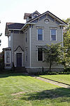
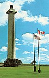
This is a list of the National Register of Historic Places listings in Erie County, Ohio.

<span class="mw-page-title-main">National Register of Historic Places listings in Lucas County, Ohio</span>

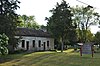
This is a list of the National Register of Historic Places listings in Lucas County, Ohio.

<span class="mw-page-title-main">National Register of Historic Places listings in Wood County, Ohio</span>

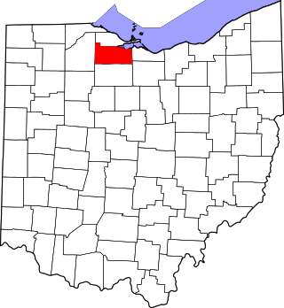
This is a list of the National Register of Historic Places listings in Wood County, Ohio.

<span class="mw-page-title-main">National Register of Historic Places listings in Miami County, Ohio</span>

This is a list of the National Register of Historic Places listings in Miami County, Ohio.

<span class="mw-page-title-main">National Register of Historic Places listings in Washington County, Ohio</span>

This is a list of the National Register of Historic Places listings in Washington County, Ohio.

<span class="mw-page-title-main">National Register of Historic Places listings in Allen County, Ohio</span>

This is a list of the National Register of Historic Places listings in Allen County, Ohio.

<span class="mw-page-title-main">National Register of Historic Places listings in Darke County, Ohio</span>

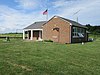
This is a list of the National Register of Historic Places listings in Darke County, Ohio.

<span class="mw-page-title-main">National Register of Historic Places listings in Guernsey County, Ohio</span>

This is a list of the National Register of Historic Places listings in Guernsey County, Ohio.

<span class="mw-page-title-main">National Register of Historic Places listings in Mercer County, Ohio</span>

This is a list of the National Register of Historic Places listings in Mercer County, Ohio.

<span class="mw-page-title-main">National Register of Historic Places listings in Ohio County, West Virginia</span>

This is a list of the National Register of Historic Places listings in Ohio County, West Virginia.

<span class="mw-page-title-main">National Register of Historic Places listings in Holmes County, Ohio</span>

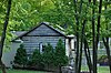
This is a list of the National Register of Historic Places listings in Holmes County, Ohio.

<span class="mw-page-title-main">National Register of Historic Places listings in Hancock County, Ohio</span>

This is a list of the National Register of Historic Places listings in Hancock County, Ohio.

<span class="mw-page-title-main">National Register of Historic Places listings in Jackson County, Ohio</span>

This is a list of the National Register of Historic Places listings in Jackson County, Ohio.

<span class="mw-page-title-main">National Register of Historic Places listings in Sandusky County, Ohio</span>

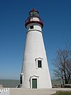
This is a list of the National Register of Historic Places listings in Sandusky County, Ohio.

<span class="mw-page-title-main">National Register of Historic Places listings in Putnam County, Ohio</span>

This is a list of the National Register of Historic Places listings in Putnam County, Ohio.

<span class="mw-page-title-main">National Register of Historic Places listings in Wyandot County, Ohio</span>

This is a list of the National Register of Historic Places listings in Wyandot County, Ohio.

<span class="mw-page-title-main">National Register of Historic Places listings in Noble County, Ohio</span>

This is a list of the National Register of Historic Places listings in Noble County, Ohio.

<span class="mw-page-title-main">National Register of Historic Places listings in Gallia County, Ohio</span>

This is a list of the National Register of Historic Places listings in Gallia County, Ohio.

<span class="mw-page-title-main">National Register of Historic Places listings in Harrison County, Ohio</span>

This is a list of the National Register of Historic Places listings in Harrison County, Ohio.

<span class="mw-page-title-main">National Register of Historic Places listings in Williams County, Ohio</span>

This is a list of the National Register of Historic Places listings in Williams County, Ohio.

References

  1. The latitude and longitude information provided in this table was derived originally from the National Register Information System, which has been found to be fairly accurate for about 99% of listings. Some locations in this table may have been corrected to current GPS standards.
  2. National Park Service, United States Department of the Interior, "National Register of Historic Places: Weekly List Actions", retrieved December 15, 2023.
  3. Numbers represent an alphabetical ordering by significant words. Various colorings, defined here, differentiate National Historic Landmarks and historic districts from other NRHP buildings, structures, sites or objects.
  4. "National Register Information System". National Register of Historic Places . National Park Service. April 24, 2008.
  5. The eight-digit number below each date is the number assigned to each location in the National Register Information System database, which can be viewed by clicking the number.