National Register of Historic Places listings in Highland County, Ohio

Last updated

Location of Highland County in Ohio Map of Ohio highlighting Highland County.svg
Location of Highland County in Ohio

This is a list of the National Register of Historic Places listings in Highland County, Ohio.

Contents

This is intended to be a complete list of the properties and districts on the National Register of Historic Places in Highland County, Ohio, United States. The locations of National Register properties and districts for which the latitude and longitude coordinates are included below, may be seen in an online map. [1]

There are 27 properties and districts listed on the National Register in the county. Another property was once listed but has been removed.


    This National Park Service list is complete through NPS recent listings posted March 1, 2024. [2]

Current listings

[3] Name on the Register [4] ImageDate listed [5] Location City or townDescription
1 Barretts Mill
Barretts Mill BarrettsMill.JPG
Barretts Mill
December 26, 1972
(#72001024)
County Road 1A and Rocky Fork Creek, southeast of Rainsboro; also on Factory Branch Creek
39°12′07″N83°23′14″W / 39.2019°N 83.3872°W / 39.2019; -83.3872 (Barretts Mill)
Paint Township Factory Branch Creek represents a boundary increase of July 24, 1979. This mill and covered bridge was destroyed by fire on October 14, 1980.
2 Bell Mansion
Bell Mansion CSBellMansion.JPG
Bell Mansion
November 25, 1980
(#80003099)
225 Oak St.
39°12′05″N83°37′17″W / 39.2013°N 83.6213°W / 39.2013; -83.6213 (Bell Mansion)
Hillsboro
3 Bell's First Home
Bell's First Home Bell's First Home from the southwest.jpg
Bell's First Home
November 25, 1980
(#80003096)
222 Beech St.
39°12′15″N83°36′53″W / 39.2042°N 83.6146°W / 39.2042; -83.6146 (Bell's First Home)
Hillsboro
4 Bell's Opera House
Bell's Opera House BellOperaHouse.JPG
Bell's Opera House
November 25, 1980
(#80003097)
109-119 S. High St.
39°12′06″N83°36′43″W / 39.20167°N 83.61194°W / 39.20167; -83.61194 (Bell's Opera House)
Hillsboro
5 C. S. Bell Foundry and Showroom
C. S. Bell Foundry and Showroom HillsboroOhio1.JPG
C. S. Bell Foundry and Showroom
November 25, 1980
(#80003098)
154-158 W. Main St.
39°12′10″N83°36′49″W / 39.2028°N 83.6137°W / 39.2028; -83.6137 (C. S. Bell Foundry and Showroom)
Hillsboro
6 East Main Street Historic District
East Main Street Historic District House in the East Main Street HD in Hillsboro.jpg
East Main Street Historic District
June 1, 1982
(#82003594)
E. Main and E. Walnut Sts.
39°12′04″N83°36′30″W / 39.2011°N 83.6083°W / 39.2011; -83.6083 (East Main Street Historic District)
Hillsboro
7 Eubanks-Tytus House
Eubanks-Tytus House EubanksTytusHouse.JPG
Eubanks-Tytus House
February 27, 1979
(#79001865)
Southeast of Hillsboro on State Route 41
39°08′55″N83°21′59″W / 39.1486°N 83.3664°W / 39.1486; -83.3664 (Eubanks-Tytus House)
Brushcreek Township
8 Fort Hill State Park
Fort Hill State Park HighlandCountyOhioFortHill.JPG
Fort Hill State Park
November 10, 1970
(#70000500)
Southeast of Hillsboro on State Route 41
39°06′38″N83°24′10″W / 39.1106°N 83.4028°W / 39.1106; -83.4028 (Fort Hill State Park)
Brushcreek Township
9 Greenfield Commercial Historic District January 7, 2021
(#100005996)
Roughly bounded by Jefferson, Washington, and Mirabeau Sts.
39°21′04″N83°22′58″W / 39.3511°N 83.3828°W / 39.3511; -83.3828 (Greenfield Commercial Historic District)
Greenfield
10 Highland County Courthouse
Highland County Courthouse Highland County Courthouse, Hillsboro.jpg
Highland County Courthouse
August 24, 1978
(#78002087)
Main and High Sts.
39°12′09″N83°36′44″W / 39.2025°N 83.6122°W / 39.2025; -83.6122 (Highland County Courthouse)
Hillsboro
11 Highland Pants factory
Highland Pants factory HEPCB.JPG
Highland Pants factory
January 24, 2002
(#01001524)
135 N. West St.
39°12′13″N83°36′50″W / 39.2036°N 83.6139°W / 39.2036; -83.6139 (Highland Pants factory)
Hillsboro
12 Hillsboro Historic Business District
Hillsboro Historic Business District Commercial Buildings -- Hillsboro, Ohio.jpg
Hillsboro Historic Business District
April 19, 1984
(#84003727)
Roughly bounded by Beech, Walnut, East, and West Sts.
39°12′08″N83°36′44″W / 39.2022°N 83.6122°W / 39.2022; -83.6122 (Hillsboro Historic Business District)
Hillsboro
13 Hirons-Brown House
Hirons-Brown House HironsBrownHouse.JPG
Hirons-Brown House
December 12, 1976
(#76001455)
Southwest of Buford on Buford-Bardwell Rd.
39°03′51″N83°51′50″W / 39.06417°N 83.86389°W / 39.06417; -83.86389 (Hirons-Brown House)
Clay Township
14 Robert D. Lilley House
Robert D. Lilley House RobertDLilleyHouse.JPG
Robert D. Lilley House
June 17, 1982
(#82003595)
7915 State Route 124
39°11′59″N83°35′43″W / 39.1997°N 83.5953°W / 39.1997; -83.5953 (Robert D. Lilley House)
Hillsboro
15 Samuel Lyle Log House
Samuel Lyle Log House Samuel Lyle Log House.JPG
Samuel Lyle Log House
July 28, 1995
(#95000939)
7190 Pondlick Rd., northwest of Seaman
39°02′21″N83°37′29″W / 39.0391°N 83.6248°W / 39.0391; -83.6248 (Samuel Lyle Log House)
Concord Township
16 Lynchburg Covered Bridge
Lynchburg Covered Bridge Lynchburg Covered Bridge.jpg
Lynchburg Covered Bridge
March 16, 1976
(#76001456)
East Fork of the Little Miami River
39°14′42″N83°47′40″W / 39.245°N 83.7944°W / 39.245; -83.7944 (Lynchburg Covered Bridge)
Lynchburg Extends into Clinton County
17 Morrow-Overman-Fairley House
Morrow-Overman-Fairley House Morrow-Overman-Fairley House, Hillsboro, Ohio.jpg
Morrow-Overman-Fairley House
May 31, 1984
(#84003729)
404 N. High St.
39°12′22″N83°36′37″W / 39.2061°N 83.6103°W / 39.2061; -83.6103 (Morrow-Overman-Fairley House)
Hillsboro
18 Mother Thompson House
Mother Thompson House HillsboroOhioMotherThompsonHouse.JPG
Mother Thompson House
June 1, 1982
(#82003596)
133 Willow St.
39°12′20″N83°36′33″W / 39.2056°N 83.6093°W / 39.2056; -83.6093 (Mother Thompson House)
Hillsboro Due to extreme disrepair, the Mother Thompson House was demolished on May 19, 2017. [6]
19 New Market Township Community House
New Market Township Community House NMTCH.JPG
New Market Township Community House
March 10, 2004
(#04000151)
4641 U.S. Route 62, southwest of Hillsboro
39°08′15″N83°40′06″W / 39.1375°N 83.6683°W / 39.1375; -83.6683 (New Market Township Community House)
New Market Township
20 Rocky Fork Park Group
Rocky Fork Park Group Cornfield at Rocky Fork State Park.jpg
Rocky Fork Park Group
June 18, 1973
(#73001478)
Southern side of Rocky Fork Lake east of Fisherman's Wharf [7]
39°10′36″N83°29′58″W / 39.1767°N 83.4994°W / 39.1767; -83.4994 (Rocky Fork Park Group)
Marshall Township Location is for the West Mound, one of three mounds in the group [8]
21 Rocky Fork Park Site
Rocky Fork Park Site Rocky Fork Park Site overview.jpg
Rocky Fork Park Site
June 18, 1973
(#73001479)
South of Rocky Fork and west of Fisherman Wharf Rd. [9]
39°10′19″N83°30′40″W / 39.1719°N 83.5111°W / 39.1719; -83.5111 (Rocky Fork Park Site)
Marshall Township A pair of circular enclosures on a hillside [10]
22 Saint Mary's Episcopal Church and Parish House
Saint Mary's Episcopal Church and Parish House St. Mary's Episcopal Church in Hillsboro.jpg
Saint Mary's Episcopal Church and Parish House
September 8, 1988
(#88001421)
232 N. High St.
39°12′16″N83°36′38″W / 39.2044°N 83.6106°W / 39.2044; -83.6106 (Saint Mary's Episcopal Church and Parish House)
Hillsboro
23 William Scott House
William Scott House William Scott House -- Hillsboro, Ohio.jpg
William Scott House
November 5, 1987
(#87001981)
338 W. Main St.
39°12′13″N83°37′04″W / 39.2036°N 83.6178°W / 39.2036; -83.6178 (William Scott House)
Hillsboro
24 Samuel Smith House and Tannery
Samuel Smith House and Tannery Samuel Smith House -- Greenfield, Ohio.jpg
Samuel Smith House and Tannery
July 5, 1978
(#78002086)
103 Jefferson St.
39°21′09″N83°22′45″W / 39.3525°N 83.3792°W / 39.3525; -83.3792 (Samuel Smith House and Tannery)
Greenfield
25 Travellers' Rest Inn
Travellers' Rest Inn Travelers' Rest -- Greenfield, Ohio.jpg
Travellers' Rest Inn
May 15, 1979
(#79001864)
Jefferson St. and McArthur Way
39°21′07″N83°22′43″W / 39.3519°N 83.3786°W / 39.3519; -83.3786 (Travellers' Rest Inn)
Greenfield
26 Trop Farm
Trop Farm TropFarm.JPG
Trop Farm
April 1, 1982
(#82003597)
6250 Mad River Rd., west of Hillsboro
39°10′53″N83°40′32″W / 39.1814°N 83.6756°W / 39.1814; -83.6756 (Trop Farm)
New Market Township
27 Workman Works
Workman Works Workman Works, comprehensive from north.jpg
Workman Works
October 26, 1971
(#71000641)
4206 Certier Rd. [11]
39°07′27″N83°48′52″W / 39.1242°N 83.8144°W / 39.1242; -83.8144 (Workman Works)
Salem Township Also known as Fort Salem.

Former listing

[3] Name on the RegisterImageDate listedDate removedLocationCity or townDescription
1 Plum Run Mound Unavailable
(#72001592)
1974Address Restricted
Rainsboro

See also

Related Research Articles

<span class="mw-page-title-main">National Register of Historic Places listings in Hamilton County, Ohio</span>

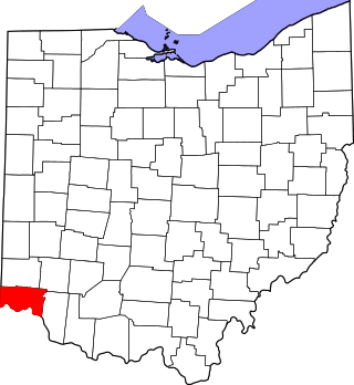
This is a list of the National Register of Historic Places listings in Hamilton County, Ohio.

<span class="mw-page-title-main">National Register of Historic Places listings in Montgomery County, Ohio</span>

This is a list of the National Register of Historic Places listings in Montgomery County, Ohio.

<span class="mw-page-title-main">National Register of Historic Places listings in Stark County, Ohio</span>

This is a list of the National Register of Historic Places listings in Stark County, Ohio.

<span class="mw-page-title-main">National Register of Historic Places listings in Delaware County, Ohio</span>

This is a list of the National Register of Historic Places listings in Delaware County, Ohio.

<span class="mw-page-title-main">National Register of Historic Places listings in Fairfield County, Ohio</span>

This is a list of the National Register of Historic Places listings in Fairfield County, Ohio.

<span class="mw-page-title-main">National Register of Historic Places listings in Clark County, Ohio</span>

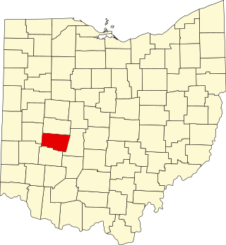
This is a list of the National Register of Historic Places listings in Clark County, Ohio.

<span class="mw-page-title-main">National Register of Historic Places listings in Ross County, Ohio</span>

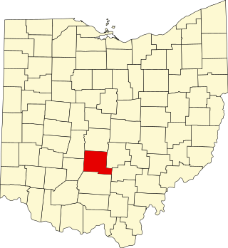
This is a list of the National Register of Historic Places listings in Ross County, Ohio.

<span class="mw-page-title-main">National Register of Historic Places listings in Scioto County, Ohio</span>

This is a list of the National Register of Historic Places listings in Scioto County, Ohio.

<span class="mw-page-title-main">National Register of Historic Places listings in Athens County, Ohio</span>

This is a list of the National Register of Historic Places listings in Athens County, Ohio.

<span class="mw-page-title-main">National Register of Historic Places listings in Clermont County, Ohio</span>

This is a list of the National Register of Historic Places listings in Clermont County, Ohio.

<span class="mw-page-title-main">National Register of Historic Places listings in Pickaway County, Ohio</span>

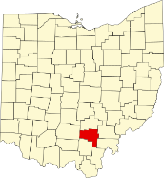
This is a list of the National Register of Historic Places listings in Pickaway County, Ohio, USA.

<span class="mw-page-title-main">National Register of Historic Places listings in Fayette County, Ohio</span>

This is a list of the National Register of Historic Places listings in Fayette County, Ohio.

<span class="mw-page-title-main">National Register of Historic Places listings in Geauga County, Ohio</span>

This is a list of the National Register of Historic Places listings in Geauga County, Ohio.

<span class="mw-page-title-main">National Register of Historic Places listings in Perry County, Ohio</span>

This is a list of the National Register of Historic Places listings in Perry County, Ohio.

<span class="mw-page-title-main">National Register of Historic Places listings in Hocking County, Ohio</span>

This is a list of the National Register of Historic Places listings in Hocking County, Ohio.

<span class="mw-page-title-main">National Register of Historic Places listings in Madison County, Ohio</span>

This is a list of the National Register of Historic Places listings in Madison County, Ohio.

<span class="mw-page-title-main">National Register of Historic Places listings in Vinton County, Ohio</span>

This is a list of the National Register of Historic Places listings in Vinton County, Ohio.

<span class="mw-page-title-main">National Register of Historic Places listings in Fulton County, Ohio</span>

This is a list of the National Register of Historic Places listings in Fulton County, Ohio.

<span class="mw-page-title-main">National Register of Historic Places listings in Pike County, Ohio</span>

This is a list of the National Register of Historic Places listings in Pike County, Ohio.

<span class="mw-page-title-main">National Register of Historic Places listings in Union County, Ohio</span>

This is a list of the National Register of Historic Places listings in Union County, Ohio.

References

  1. The latitude and longitude information provided in this table was derived originally from the National Register Information System, which has been found to be fairly accurate for about 99% of listings. Some locations in this table may have been corrected to current GPS standards.
  2. National Park Service, United States Department of the Interior, "National Register of Historic Places: Weekly List Actions", retrieved March 1, 2024.
  3. 1 2 Numbers represent an alphabetical ordering by significant words. Various colorings, defined here, differentiate National Historic Landmarks and historic districts from other NRHP buildings, structures, sites or objects.
  4. "National Register Information System". National Register of Historic Places . National Park Service. March 13, 2009.
  5. The eight-digit number below each date is the number assigned to each location in the National Register Information System database, which can be viewed by clicking the number.
  6. Gilliand, Jeff (May 12, 2017). "Mother Thompson House Coming Down". Civitas Media. Retrieved 3 August 2017.
  7. Case, D. Troy, and Christopher Carr. The Scioto Hopewell and Their Neighbors: Bioarchaeological Documentation and Cultural Understanding. New York: Springer, 2007, Appendix 7.1.
  8. Owen, Lorrie K., ed. Dictionary of Ohio Historic Places. Vol. 2. St. Clair Shores: Somerset, 1999, 770.
  9. Mills, William C. Archeological Atlas of Ohio. Columbus: Ohio State Archeological and Historical Society, 1914, page 36 and plate 36.
  10. Owen, Lorrie K., ed. Dictionary of Ohio Historic Places. Vol. 2. St. Clair Shores: Somerset, 1999, 770.
  11. Location derived from property owner's website Archived 2009-09-02 at the Wayback Machine ; the NRIS lists the site as "Address Restricted"