Leesburg, Ohio | |
---|---|
Nickname: The Friendly Village | |
Coordinates: 39°20′31″N83°33′07″W / 39.34194°N 83.55194°W | |
Country | United States |
State | Ohio |
County | Highland |
Government | |
• Mayor | Shawn Priest[ citation needed ] |
Area | |
• Total | 1.17 sq mi (3.03 km2) |
• Land | 1.17 sq mi (3.03 km2) |
• Water | 0.00 sq mi (0.00 km2) |
Elevation | 1,024 ft (312 m) |
Population (2020) | |
• Total | 1,273 |
• Density | 1,089.90/sq mi (420.72/km2) |
Time zone | UTC-5 (Eastern (EST)) |
• Summer (DST) | UTC-4 (EDT) |
ZIP code | 45135 |
Area code(s) | 937, 326 |
FIPS code | 39-42476 [3] |
GNIS feature ID | 2398411 [2] |
Website | leesburgohio |
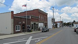
Leesburg is a village in Highland County, Ohio, United States. The population was 1,273 at the 2020 census.
Leesburg was laid out in 1802, and named after Leesburg, Virginia. [4]
According to the United States Census Bureau, the village has a total area of 1.17 square miles (3.03 km2), all land. [5]
Census | Pop. | Note | %± |
---|---|---|---|
1820 | 131 | — | |
1830 | 218 | 66.4% | |
1870 | 508 | — | |
1880 | 513 | 1.0% | |
1890 | 617 | 20.3% | |
1900 | 783 | 26.9% | |
1910 | 828 | 5.7% | |
1920 | 849 | 2.5% | |
1930 | 830 | −2.2% | |
1940 | 839 | 1.1% | |
1950 | 841 | 0.2% | |
1960 | 932 | 10.8% | |
1970 | 984 | 5.6% | |
1980 | 1,019 | 3.6% | |
1990 | 1,063 | 4.3% | |
2000 | 1,253 | 17.9% | |
2010 | 1,314 | 4.9% | |
2020 | 1,273 | −3.1% | |
U.S. Decennial Census [6] |
As of the census [7] of 2010, there were 1,314 people, 513 households, and 344 families living in the village. The population density was 1,123.1 inhabitants per square mile (433.6/km2). There were 579 housing units at an average density of 494.9 per square mile (191.1/km2). The racial makeup of the village was 97.6% White, 0.2% African American, 0.5% Native American, 0.1% Asian, and 1.6% from two or more races. Hispanic or Latino of any race were 0.7% of the population.
There were 513 households, of which 38.8% had children under the age of 18 living with them, 43.9% were married couples living together, 15.2% had a female householder with no husband present, 8.0% had a male householder with no wife present, and 32.9% were non-families. 26.3% of all households were made up of individuals, and 12.4% had someone living alone who was 65 years of age or older. The average household size was 2.56 and the average family size was 3.06.
The median age in the village was 33.8 years. 28.4% of residents were under the age of 18; 8.5% were between the ages of 18 and 24; 28.3% were from 25 to 44; 21.9% were from 45 to 64; and 12.9% were 65 years of age or older. The gender makeup of the village was 47.4% male and 52.6% female.
As of the census [3] of 2000, there were 1,253 people, 501 households, and 344 families living in the village. The population density was 1,560.0 inhabitants per square mile (602.3/km2). There were 538 housing units at an average density of 669.8 per square mile (258.6/km2). The racial makeup of the village was 98.48% White, 0.64% African American, 0.24% Native American, 0.08% Asian, 0.08% from other races, and 0.48% from two or more races. Hispanic or Latino of any race were 0.16% of the population.
There were 501 households, out of which 37.9% had children under the age of 18 living with them, 48.1% were married couples living together, 14.8% had a female householder with no husband present, and 31.3% were non-families. 26.3% of all households were made up of individuals, and 8.8% had someone living alone who was 65 years of age or older. The average household size was 2.50 and the average family size was 3.00.
In the village, the population was spread out, with 28.1% under the age of 18, 11.7% from 18 to 24, 30.0% from 25 to 44, 18.8% from 45 to 64, and 11.4% who were 65 years of age or older. The median age was 31 years. For every 100 females there were 97.3 males. For every 100 females age 18 and over, there were 91.3 males.
The median income for a household in the village was $34,653, and the median income for a family was $45,893. Males had a median income of $30,865 versus $22,112 for females. The per capita income for the village was $16,531. About 4.7% of families and 6.3% of the population were below the poverty line, including 4.7% of those under age 18 and 13.4% of those age 65 or over.
Fairfield Local Schools operates one elementary school, one middle school and high school, all combined. [8] Fairfield Local Schools opened in 1824. This coming year marks Fairfield’s bicentennial.
Leesburg has a public library, a branch of the Highland County District Library. [9]
Highland County is a county located in the U.S. state of Ohio. As of the 2020 census, the population was 43,317. Its county seat is Hillsboro. The county is named for the topography which is hilly and divides the watersheds of the Little Miami and Scioto Rivers.
Jacksonburg is a small village in Butler County, Ohio, United States. The population was 55 at the 2020 census.
Millville is a village in Butler County, Ohio, United States. The population was 634 at the 2020 census. Millville sits between Oxford, Ohio and Cincinnati, Ohio along U.S. Route 27.
Somerville is a census-designated place (CDP) and former village in Milford Township, Butler County, Ohio, United States. The population was 258 at the 2020 census.
Leesville is a village in southwestern Carroll County, Ohio, United States. The population was 127 at the 2020 census. It is part of the Canton–Massillon metropolitan area.
Amanda is a village in Fairfield County, Ohio, United States. The population was 637 at the 2020 census.
Baltimore is a village in Fairfield County, Ohio, United States. The population was 2,981 at the 2020 census.
Bremen is a village in Fairfield County, Ohio, United States. The population was 1,479 at the 2020 census.
Fairfield Beach is an unincorporated community and census-designated place (CDP) in Fairfield County, Ohio, United States. The population was 1,267 at the 2020 census.
Lithopolis is a village in Fairfield and Franklin counties in the U.S. state of Ohio. The population was 2,134 at the 2020 census.
Millersport is a village in Fairfield County, Ohio, United States. The population was 978 at the 2020 census. Millersport is most notable as the home of the Sweet Corn Festival, which is held in Millersport annually during the first week of September.
Pleasantville is a village in Fairfield County, Ohio, United States. The population was 934 at the 2020 census.
Stoutsville is a village in Fairfield County, Ohio, United States. The population was 579 at the 2020 census.
Sugar Grove is a village in Fairfield County, Ohio, United States. The population was 429 at the 2020 census.
Thurston is a village in Fairfield County, Ohio, United States. The population was 603 at the 2020 census.
West Rushville is a village in Fairfield County, Ohio, United States. The population was 166 at the 2020 census.
Highland is a village in Fairfield Township, Highland County, Ohio, United States. The population was 232 at the 2020 census.
North Fairfield is a village in Huron County, Ohio, United States. The population was 465 at the 2020 census.
Tarlton is a village in Fairfield and Pickaway counties in the U.S. state of Ohio. The population was 254 at the 2020 census.
Magnetic Springs is a village in Leesburg Township, Union County, Ohio, United States. The population was 267 at the 2020 census. The village has a post office with the ZIP Code of 43036.