National Register of Historic Places listings in Wayne County, Ohio

Last updated

Location of Wayne County in Ohio Map of Ohio highlighting Wayne County.svg
Location of Wayne County in Ohio

This is a list of the National Register of Historic Places listings in Wayne County, Ohio.

Contents

This is intended to be a complete list of the properties and districts on the National Register of Historic Places in Wayne County, Ohio, United States. The locations of National Register properties and districts for which the latitude and longitude coordinates are included below, may be seen in an online map. [1]

There are 21 properties and districts listed on the National Register in the county.


    This National Park Service list is complete through NPS recent listings posted December 8, 2023. [2]

Map all coordinates using: OpenStreetMap

Current listings

[3] Name on the Register [4] ImageDate listed [5] Location City or townDescription
1 James Akey Farm
James Akey Farm JAMES AKEY FARM, MT. EATON, WAYNE COUNTY, OHIO.jpg
James Akey Farm
December 22, 1978
(#78002212)
North of Brenneman Rd., southeast of Mt. Eaton [6]
40°40′40″N81°39′18″W / 40.6779°N 81.6551°W / 40.6779; -81.6551 (James Akey Farm)
Paint Township Also known as the Starks Wilderness Center Pioneer Farm [4]
2 Ault-Weygandt Farm
Ault-Weygandt Farm AULT-WEYGANDT FARM.jpg
Ault-Weygandt Farm
January 14, 2002
(#01001481)
15090 Back Massillon Rd., northeast of Orrville
40°52′37″N81°42′38″W / 40.8769°N 81.7106°W / 40.8769; -81.7106 (Ault-Weygandt Farm)
Baughman Township
3 Barnet-Hoover Log House
Barnet-Hoover Log House BARNET-HOOVER LOG HOUSE.jpg
Barnet-Hoover Log House
August 13, 1974
(#74001648)
Northwest of downtown Orrville
40°51′40″N81°47′20″W / 40.8611°N 81.7889°W / 40.8611; -81.7889 (Barnet-Hoover Log House)
Orrville
4 Gen. Reasin Beall House
Gen. Reasin Beall House Gen. Reasin Beall House.jpg
Gen. Reasin Beall House
June 7, 1976
(#76001548)
546 E. Bowman St.
40°48′20″N81°56′00″W / 40.8056°N 81.9333°W / 40.8056; -81.9333 (Gen. Reasin Beall House)
Wooster
5 College of Wooster
College of Wooster COWkaukehall.jpg
College of Wooster
February 25, 1980
(#80003246)
State Route 3
40°48′37″N81°56′07″W / 40.8103°N 81.9353°W / 40.8103; -81.9353 (College of Wooster)
Wooster
6 Deerlick Farm
Deerlick Farm DEERLICK FARM, WAYNE COUNTY, OHIO.jpg
Deerlick Farm
June 20, 1986
(#86001365)
7482 Britton Rd., east of West Salem
40°58′14″N82°04′06″W / 40.9706°N 82.0683°W / 40.9706; -82.0683 (Deerlick Farm)
Congress Township
7 Charles Gasche House
Charles Gasche House Gasche House - Wooster Ohio.jpg
Charles Gasche House
January 13, 1989
(#88003192)
340 Bever St.
40°48′07″N81°56′17″W / 40.8019°N 81.9381°W / 40.8019; -81.9381 (Charles Gasche House)
Wooster
8 Gertenslager Carriage and Wagon Company
Gertenslager Carriage and Wagon Company Gertenslager carriage works - Wooster, Ohio.jpg
Gertenslager Carriage and Wagon Company
February 13, 1986
(#86000240)
572 E. Liberty St.
40°47′57″N81°55′57″W / 40.7991°N 81.9325°W / 40.7991; -81.9325 (Gertenslager Carriage and Wagon Company)
Wooster
9 Green Township High School
Green Township High School GREEN TOWNSHIP HIGH SCHOOL, WAYNE COUNTY, OHIO.jpg
Green Township High School
September 4, 2013
(#13000684)
484 E. Main St.
40°52′01″N81°51′17″W / 40.8669°N 81.8547°W / 40.8669; -81.8547 (Green Township High School)
Smithville Demolished in 2014 [7]
10 Kister Mill
Kister Mill KISTER MILL.jpg
Kister Mill
July 10, 1974
(#74001647)
Junction of Township Roads 34 and 228 at Millbrook
40°43′35″N82°00′17″W / 40.7264°N 82.0047°W / 40.7264; -82.0047 (Kister Mill)
Clinton Township
11 Liggett-Freedlander House
Liggett-Freedlander House Liggett-Freedlander House in Wooster.jpg
Liggett-Freedlander House
July 22, 1994
(#94000770)
408 N. Bever St.
40°48′09″N81°56′17″W / 40.8025°N 81.9381°W / 40.8025; -81.9381 (Liggett-Freedlander House)
Wooster
12 John McSweeney House
John McSweeney House John McSweeney House.jpg
John McSweeney House
July 30, 1974
(#74001649)
531 N. Market St.
40°48′13″N81°56′28″W / 40.8036°N 81.9411°W / 40.8036; -81.9411 (John McSweeney House)
Wooster
13 Tawney Musser Farm March 4, 2021
(#100006182)
10495 Black Diamond Rd.
40°55′39″N81°41′05″W / 40.9276°N 81.6846°W / 40.9276; -81.6846 (Tawney Musser Farm)
Marshallville vicinity
14 Old Wayne County Jail
Old Wayne County Jail Old Wayne County Jail.jpg
Old Wayne County Jail
April 29, 1982
(#82003665)
W. North St.
40°47′58″N81°56′30″W / 40.7994°N 81.9417°W / 40.7994; -81.9417 (Old Wayne County Jail)
Wooster
15 Orrville Downtown Historic District
Orrville Downtown Historic District CentralOrrville.jpg
Orrville Downtown Historic District
June 15, 2011
(#11000370)
Market St. roughly between High & Main
40°50′26″N81°45′52″W / 40.8406°N 81.7644°W / 40.8406; -81.7644 (Orrville Downtown Historic District)
Orrville
16 Overholt House
Overholt House Overholt House at the College of Wooster.jpg
Overholt House
December 6, 1983
(#83004345)
1473 Beall Ave.
40°48′55″N81°56′02″W / 40.8154°N 81.9339°W / 40.8154; -81.9339 (Overholt House)
Wooster
17 Schantz Organ Company
Schantz Organ Company 7-25-22 Orrville - schantz (2).jpg
Schantz Organ Company
August 17, 2021
(#100006818)
626 South Walnut St.
40°50′05″N81°45′48″W / 40.8348°N 81.7633°W / 40.8348; -81.7633 (Schantz Organ Company)
Orrville
18 J.M. Smucker House September 2, 2022
(#100008048)
708 North Main St.
40°50′46″N81°45′50″W / 40.8461°N 81.7640°W / 40.8461; -81.7640 (J.M. Smucker House)
Orrville
19 Walnut Street School
Walnut Street School Wayne Center for the Arts.jpg
Walnut Street School
March 1, 1984
(#84003811)
237 S. Walnut St.
40°47′47″N81°56′29″W / 40.7964°N 81.9414°W / 40.7964; -81.9414 (Walnut Street School)
Wooster
20 Wayne County Courthouse District
Wayne County Courthouse District Wayne County courthouse (Wooster).jpg
Wayne County Courthouse District
July 26, 1973
(#73001551)
Liberty and Market Sts.
40°47′55″N81°56′26″W / 40.7986°N 81.9406°W / 40.7986; -81.9406 (Wayne County Courthouse District)
Wooster
21 Ezekiel B. Zimmerman Octagon House
Ezekiel B. Zimmerman Octagon House The Octagon House (3601790588).jpg
Ezekiel B. Zimmerman Octagon House
May 28, 1975
(#75001553)
Northwest of Marshallville on State Route 57
40°55′22″N81°45′47″W / 40.9228°N 81.7631°W / 40.9228; -81.7631 (Ezekiel B. Zimmerman Octagon House)
Chippewa Township

See also

Related Research Articles

<span class="mw-page-title-main">National Register of Historic Places listings in Erie County, Ohio</span>

This is a list of the National Register of Historic Places listings in Erie County, Ohio.

<span class="mw-page-title-main">National Register of Historic Places listings in Summit County, Ohio</span>

This is a list of the National Register of Historic Places listings in Summit County, Ohio.

<span class="mw-page-title-main">National Register of Historic Places listings in Delaware County, Ohio</span>

This is a list of the National Register of Historic Places listings in Delaware County, Ohio.

<span class="mw-page-title-main">National Register of Historic Places listings in Licking County, Ohio</span>

This is a list of the National Register of Historic Places listings in Licking County, Ohio.

<span class="mw-page-title-main">National Register of Historic Places listings in Ashtabula County, Ohio</span>

This is a list of the National Register of Historic Places listings in Ashtabula County, Ohio.

<span class="mw-page-title-main">National Register of Historic Places listings in Allen County, Ohio</span>

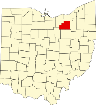
This is a list of the National Register of Historic Places listings in Allen County, Ohio.

<span class="mw-page-title-main">National Register of Historic Places listings in Scioto County, Ohio</span>

This is a list of the National Register of Historic Places listings in Scioto County, Ohio.

<span class="mw-page-title-main">National Register of Historic Places listings in Darke County, Ohio</span>

This is a list of the National Register of Historic Places listings in Darke County, Ohio.

<span class="mw-page-title-main">National Register of Historic Places listings in Jefferson County, Ohio</span>

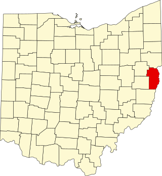
This is a list of the National Register of Historic Places listings in Jefferson County, Ohio.

<span class="mw-page-title-main">National Register of Historic Places listings in Medina County, Ohio</span>

This is a list of the National Register of Historic Places listings in Medina County, Ohio.

<span class="mw-page-title-main">National Register of Historic Places listings in Ashland County, Ohio</span>

This is a list of the National Register of Historic Places listings in Ashland County, Ohio.

<span class="mw-page-title-main">National Register of Historic Places listings in Wayne County, Pennsylvania</span>

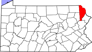
This is a list of the National Register of Historic Places listings in Wayne County, Pennsylvania.

<span class="mw-page-title-main">National Register of Historic Places listings in Clinton County, Ohio</span>

This is a list of the National Register of Historic Places listings in Clinton County, Ohio.

<span class="mw-page-title-main">National Register of Historic Places listings in Preble County, Ohio</span>

This is a list of the National Register of Historic Places listings in Preble County, Ohio.

<span class="mw-page-title-main">National Register of Historic Places listings in Lawrence County, Ohio</span>

This is a list of the National Register of Historic Places listings in Lawrence County, Ohio.

<span class="mw-page-title-main">National Register of Historic Places listings in Holmes County, Ohio</span>

This is a list of the National Register of Historic Places listings in Holmes County, Ohio.

<span class="mw-page-title-main">National Register of Historic Places listings in Marion County, Ohio</span>

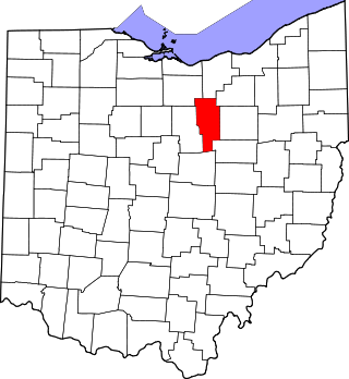
This is a list of the National Register of Historic Places listings in Marion County, Ohio.

<span class="mw-page-title-main">National Register of Historic Places listings in Randolph County, Indiana</span>

This is a list of the National Register of Historic Places listings in Randolph County, Indiana.

<span class="mw-page-title-main">National Register of Historic Places listings in Meigs County, Ohio</span>

This is a list of the National Register of Historic Places listings in Meigs County, Ohio.

<span class="mw-page-title-main">National Register of Historic Places listings in Pike County, Ohio</span>

This is a list of the National Register of Historic Places listings in Pike County, Ohio.

References

  1. The latitude and longitude information provided in this table was derived originally from the National Register Information System, which has been found to be fairly accurate for about 99% of listings. Some locations in this table may have been corrected to current GPS standards.
  2. National Park Service, United States Department of the Interior, "National Register of Historic Places: Weekly List Actions", retrieved December 8, 2023.
  3. Numbers represent an alphabetical ordering by significant words. Various colorings, defined here, differentiate National Historic Landmarks and historic districts from other NRHP buildings, structures, sites or objects.
  4. 1 2 "National Register Information System". National Register of Historic Places . National Park Service. April 24, 2008.
  5. The eight-digit number below each date is the number assigned to each location in the National Register Information System database, which can be viewed by clicking the number.
  6. Location derived from this Archived 2010-11-30 at the Wayback Machine map, showing this as the only Wilderness Center location near Mount Eaton. The NRIS lists the site as "Address Restricted".
  7. Doohan, Thomas (May 27, 2014). "Greene Middle School demolition moving forward". The Daily Record . Retrieved November 17, 2016.