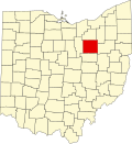
Jefferson is an unincorporated community in Wayne County, in the U.S. state of Ohio.
Jefferson was platted on June 30, 1829 by Stephen Williams and Alexander Hutchinson. It was surveyed by George Emery. The plat and certificate recorded July 2, 1829. [1] The community was named after Thomas Jefferson, third President of the United States. [2] An old variant name of Jefferson was Plain. [3]
Jefferson became popular as a business center because it was located four miles west of Wooster, the county seat. A coach line passed through Jefferson, which further helped the settlement. However, it was later vacated and Jefferson declined in popularity. [4] A post office called Plain was established in 1833, and remained in operation until 1907. [5]
Today, homes and businesses in Jefferson have Wooster addresses. A handful of companies operate here, or near the original settlement. These include B.W. Rogers Co, Kelly's Propane, Professional Textile Services, Central Farm & Garden Inc, and Airgas Store. Jefferson is located at the intersection of N Jefferson Rd and W Old Lincoln Way. [6]
Wayne County is a county in the U.S. state of Ohio. As of the 2020 census, the population was 116,894. Its county seat is Wooster. The county is named for General "Mad" Anthony Wayne. Wayne County comprises the Wooster, OH Micropolitan Statistical Area.
Chesterfield Charter Township is a charter township of Macomb County in the U.S. state of Michigan. As of the 2000 census, the township population was 37,405. The 2010 Census places the population at 43,381.
The Northwest Territory, also known as the Old Northwest and formally known as the Territory Northwest of the River Ohio, was formed from unorganized western territory of the United States after the American Revolutionary War. Established in 1787 by the Congress of the Confederation through the Northwest Ordinance, it was the nation's first post-colonial organized incorporated territory.
Brigadier-General Rufus Putnam was a colonial military officer during the French and Indian War, and a general in the Continental Army during the American Revolutionary War. As an organizer of the Ohio Company of Associates, he was instrumental in the initial settling of the Northwest Territory in present-day Ohio following the war.
David Wooster was an American general who served in the French and Indian War and in the American Revolutionary War. He died of wounds sustained during the Battle of Ridgefield, Connecticut. Several cities, schools, and public places were named after him thereafter. He has been called "a largely forgotten hero of the Revolution."
Funk is an unincorporated community in southwestern Plain Township, Wayne County, Ohio, United States. Because it is not tracked by the U.S. Census, a census population estimate is not available.
The 18th congressional district of Ohio is an obsolete congressional district last represented by Republican Bob Gibbs. The district voted for the majority party in the House of Representatives in every election since 1954.
Sugar Creek Township is one of the sixteen townships of Wayne County, Ohio, United States. The 2000 census found 6,502 people in the township, 4,897 of whom lived in the unincorporated portions of the township.
Richmond Dale is a census-designated place in central Jefferson Township, Ross County, Ohio, United States. It has a post office with the ZIP code 45673. It is located along U.S. Route 35 southeast of the county seat of Chillicothe.
Cyrus Spink was an American politician who served as a U.S. Representative from Ohio for three month in 1859 prior to his death in office.
East Union is an unincorporated community in Wayne County, in the U.S. state of Ohio.
George Rex was a Democratic politician in Wooster in the U.S. State of Ohio who was in the Ohio Senate and was an Ohio Supreme Court Judge 1874–1877.
Edward Avery was a lawyer from Wooster, Ohio, United States who was an Ohio State Senator and served on the Ohio Supreme Court from 1847 to 1851. He later helped found the College of Wooster and the Wooster Cemetery.
New Pittsburg is a census-designated place in Wayne County, in the U.S. state of Ohio.
Blachleyville is an unincorporated community in Wayne County, in the U.S. state of Ohio.
Johnsons Corners is an unincorporated community in Wayne County, in the U.S. state of Ohio.
Millbrook is an unincorporated community in Wayne County, in the U.S. state of Ohio.
Moreland is an unincorporated community in Wayne County, in the U.S. state of Ohio.
Reedsburg is an unincorporated community in Wayne County, in the U.S. state of Ohio.
Springville is an unincorporated community in Wayne County, in the U.S. state of Ohio.
Coordinates: 40°48′06″N82°01′23″W / 40.80167°N 82.02306°W