Easton, Ohio

Last updated

Easton is an unincorporated community in Wayne County, in the U.S. state of Ohio. [1]

Contents

History

Easton was originally called Slankerville, and under the latter name was laid out in 1843. [2] [3] A post office called Easton was established in 1850, and remained in operation until 1905. [4]

Geography and transport

Easton lies at an elevation of around 1,000 feet (300 m) above sea level. [5]

The town lays at the intersection and brief concurrence of Ohio State Routes 94 and 585, with Wayne County Road 5A serving as the main road within the densest part of Easton. Easton is 2.5 miles to the southwest of Doylestown, and 15 miles southwest of Akron. Easton further lies about 15 miles northeast of Wooster and about 37 miles south of downtown Cleveland. Wadsworth Municipal Airport is the nearest facility for general aviation, with Akron–Canton Airport and Cleveland Hopkins International Airport being the primary commercial air gateways for Easton. [6]

Related Research Articles

<span class="mw-page-title-main">U.S. Route 22</span> Highway in the United States

U.S. Route 22 (US 22) is a west–east route and is one of the original United States Numbered Highways of 1926, running from Cincinnati, Ohio, at US 27, US 42, US 127, and US 52 to Newark, New Jersey, at US 1/9 in the Newark Airport Interchange.

<span class="mw-page-title-main">Summit County, Ohio</span> County in Ohio, United States

Summit County is an urban county in the U.S. state of Ohio. As of the 2020 census, the population was 540,428, making it the fourth-most populous county in Ohio. Its county seat and largest city is Akron. The county was formed on March 3, 1840, from portions of Medina, Portage and Stark Counties. It was named Summit County because the highest elevation on the Ohio and Erie Canal is located in the county.

<span class="mw-page-title-main">Interstate 77</span> Interstate Highway from South Carolina to Ohio

Interstate 77 (I-77) is a north–south Interstate Highway in the Eastern United States. It traverses diverse terrain, from the mountainous state of West Virginia to the rolling farmlands of North Carolina and Ohio. It largely supplants the old US Route 21 (US 21) between Cleveland, Ohio, and Columbia, South Carolina, as an important north–south corridor through the middle Appalachian Mountains. The southern terminus of I-77 is in Cayce, South Carolina, in Lexington County at the junction with I-26. The northern terminus is in Cleveland at the junction with I-90. Other major cities that I-77 connects to include Columbia, South Carolina; Charlotte, North Carolina; Charleston, West Virginia; and Akron, Ohio. The East River Mountain Tunnel, connecting Virginia and West Virginia, is one of only two instances in the US where a mountain road tunnel crosses a state line. The other is the Cumberland Gap Tunnel, connecting Tennessee and Kentucky. I-77 is a snowbird route to the Southern US for those traveling from the Great Lakes region.

<span class="mw-page-title-main">Interstate 71</span> Interstate Highway in Ohio and Kentucky

Interstate 71 (I-71) is a north–south Interstate Highway in the Midwestern and Southeastern regions of the United States. Its southern terminus is at an interchange with I-64 and I-65 in Louisville, Kentucky, and its northern terminus at an interchange with I-90 in Cleveland, Ohio. I-71 runs concurrently with I-75 from a point about 20 miles (32 km) south of Cincinnati, Ohio, into Downtown Cincinnati. While most odd numbered Interstates run north–south, I-71 takes more of a northeast–southwest course, with some east–west sections, and is mainly a regional route serving Kentucky and Ohio. It links I-80 and I-90 to I-70, and ultimately links to I-40. Major metropolitan areas served by I-71 include Louisville, Cincinnati, Columbus, and Cleveland.

<span class="mw-page-title-main">Brecksville, Ohio</span> City in Ohio, United States

Brecksville is a city in southern Cuyahoga County, Ohio, United States. The city's population was 13,635 at the 2020 census. A suburb of Cleveland, it is part of the Cleveland metropolitan area.

<span class="mw-page-title-main">Medina, Ohio</span> City in Ohio (USA)

Medina is a city in and the county seat of Medina County, Ohio, United States. The population was 26,094 at the 2020 census. It lies about 33 miles (53 km) south of Cleveland and 23 miles (37 km) west of Akron within the Cleveland metropolitan area.

<span class="mw-page-title-main">Orrville, Ohio</span> City in Ohio, United States

Orrville is a city in Wayne County, Ohio, United States. It is about 9 miles east of Wooster and 20 miles southwest of Akron. The population was 8,452 at the 2020 census. It is part of the Wooster micropolitan area, and the city is best known as the headquarters of The J.M. Smucker Company, an American food and beverage company mostly known for its production of namesake jellies.

<span class="mw-page-title-main">Rittman, Ohio</span> City in Ohio, United States

Rittman is a city in Medina and Wayne counties in the U.S. state of Ohio. All but a small portion of the city is in Wayne County, within commuting distance of Akron, Canton and Cleveland. The population was 6,131 at the 2020 census.

<span class="mw-page-title-main">Cuyahoga Valley National Park</span> National park in Ohio, United States

Cuyahoga Valley National Park is an American national park that preserves and reclaims the rural landscape along the Cuyahoga River between Akron and Cleveland in Northeast Ohio.

<span class="mw-page-title-main">Akron–Canton Airport</span> Airport in Green, Ohio

Akron–Canton Airport is a commercial airport in the city of Green, in southern Summit County, Ohio. The airport is located about 14 miles (23 km) southeast of Akron and 10 miles (16 km) northwest of Canton. It is jointly operated by Summit County and Stark County. The airport is a "reliever" airport for Northeast Ohio and markets itself as "A better way to go", emphasizing the ease of travel in comparison to Cleveland Hopkins International Airport. Just under 90% of its traffic is general aviation. It is included in the Federal Aviation Administration (FAA) National Plan of Integrated Airport Systems for 2019–2023, in which it is categorized as a small-hub primary commercial service facility.

<span class="mw-page-title-main">Ohio and Erie Canal</span> 19th-century manmade water route between Akron and Cleveland, Ohio, USA

The Ohio and Erie Canal was a canal constructed during the 1820s and early 1830s in Ohio. It connected Akron with the Cuyahoga River near its outlet on Lake Erie in Cleveland, and a few years later, with the Ohio River near Portsmouth. It also had connections to other canal systems in Pennsylvania.

<span class="mw-page-title-main">Interstate 76 (Ohio–New Jersey)</span> Interstate from Ohio to New Jersey

Interstate 76 (I-76) is an east–west Interstate Highway in the Eastern United States. The highway runs approximately 435 miles (700 km) from an interchange with I-71 west of Akron, Ohio, east to I-295 in Bellmawr, New Jersey. This route is not contiguous with I-76 in Colorado and Nebraska.

<span class="mw-page-title-main">Ohio's 16th congressional district</span> U.S. House district for Ohio

The 16th congressional district of Ohio is an obsolete United States congressional district last represented by Representative Anthony Gonzalez (R). It was last located in the northeast of the state, covering Wayne County and with arms extending north into the suburbs of Cleveland, and east into Greater Akron and Stark County. The district was eliminated upon the swearing in of the 118th United States Congress on January 3, 2023, as the reapportionment after the 2020 census reduced the number of congressional districts in Ohio to fifteen.

<span class="mw-page-title-main">METRO Regional Transit Authority</span>

METRO Regional Transit Authority, also known as Akron Metropolitan Regional Transit Authority, is the public transit agency serving Summit County, Ohio and the city of Akron. It operates a number of local routes, and also operates one route into downtown Cleveland. Akron Metro transports passengers to/from school, work, grocery stores, malls and jobs all across Summit County. METRO RTA's fleet consists of about 200+ vehicles running on diesel, diesel-electric hybrid and as of 2022/2023, two fully electric Gillig vehicles, compressed natural gas fuels. In 2022, the system had a ridership of 3,673,700, or about 13,200 per weekday as of the second quarter of 2023.

<span class="mw-page-title-main">Etna, Licking County, Ohio</span> Census-designated place in Ohio, United States

Etna is an unincorporated community and census-designated place (CDP) in Licking County, Ohio, United States. As of the 2020 census it had a population of 1,209. It lies at an elevation of 1,069 feet (326 m) at the intersection of U.S. Route 40 and State Route 310. It was listed as a census-designated place in 2010.

<span class="mw-page-title-main">Akron metropolitan area</span> Metropolitan area in Ohio, United States

The Akron, OH Metropolitan Statistical Area, sometimes referred to as Greater Akron, is defined by the United States Office of Management and Budget as an area consisting of two counties, Summit and Portage, in Northeast Ohio and anchored by the city of Akron. As of the 2020 census, the MSA had a population of 702,219. The Akron MSA is also part of the larger Cleveland–Akron–Canton, OH Combined Statistical Area, which has a population of 3,633,962 people as of the 2020 census, the largest metropolitan area in Ohio.

<span class="mw-page-title-main">Doylestown, Ohio</span> Village in Ohio, United States

Doylestown is a village located atop the highest point in Wayne County, Ohio, United States. It is surrounded by Chippewa Township and located 13 miles (21 km) southwest of Akron. The village was founded in 1827 when William Doyle laid out a 40-lot town site at the crossing of two Native American trails on a hilltop.

<span class="mw-page-title-main">Burton City, Ohio</span> Unincorporated community
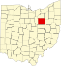
 in Ohio, United States

Burton City is an unincorporated community in Wayne County, in the U.S. state of Ohio.

References

  1. U.S. Geological Survey Geographic Names Information System: Easton, Ohio
  2. "Easton, Ohio". Wayne County, Ohio Online Resource Center. Retrieved June 27, 2023.
  3. History of Wayne County, Ohio. B.F. Bowen. 1910. p. 354.
  4. "Wayne County". Jim Forte Postal History. Archived from the original on March 5, 2016. Retrieved January 11, 2016.
  5. "Ohio topographic map, elevation, terrain". Topographic maps. Retrieved June 27, 2023.
  6. "Marshallville — Wayne County". maps.apple.com. Retrieved June 27, 2023.

40°57′7″N81°44′14″W / 40.95194°N 81.73722°W / 40.95194; -81.73722