Burton City, Ohio

Last updated

Burton City
Burton City, Ohio United Methodist Church.jpg
USA Ohio location map.svg
Red pog.svg
Burton City
Location of Burton City in Ohio
Coordinates: 40°50′41″N81°42′14″W / 40.84472°N 81.70389°W / 40.84472; -81.70389
CountryUnited States
State Ohio
County Wayne
Elevation
[1]
1,007 ft (307 m)
Time zone UTC-4 (EST)
  Summer (DST) EDT
GNIS feature ID1060912 [1]

Burton City is an unincorporated community in Wayne County, in the U.S. state of Ohio. [1]

Contents

History

Burton City was originally called Fairview, and under the latter name was laid out in 1850. [2] A post office called Baughman was established in 1852, the name was changed to Burton City in 1872, and the post office closed in 1918. [2] [3]

Geography

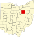
Burton City lies mainly on flat plains and is a little bit over halfway between the villages of Dalton and Marshallville. The town lies along the Newman Creek which eventually flows into the Tuscarawas River. The town is near Orrville, and is considered by some online mapping services and websites to be a suburb of the city. [4] [5] [6]

Demographics

As an unincorporated community, Burton City's population is not counted independently by the US census and is rounded into Orrville's, which also shares a ZIP code of 44667 with Burton City. [7]

Infrastructure and transport

Burton City has no maritime ports, though it is bisected east-west by freight railroad tracks presently owned and operated by Norfolk Southern. [8] Burton City is bisected north-south by Ohio State Route 94, the main road through, in and out of the unincorporated community as well as giving access to Interstate 76 fifteen miles to the north and U.S. Route 30 three miles to the south. Burton City relies on Akron–Canton Airport for commercial air travel (with some longer-distance routings opting for Cleveland Hopkins International Airport). [4]

Related Research Articles

<span class="mw-page-title-main">Columbus, Ohio</span> Capital and largest city of Ohio, United States

Columbus is the capital and most populous city of the U.S. state of Ohio. With a 2020 census population of 905,748, it is the 14th-most populous city in the U.S., the second-most populous city in the Midwest after Chicago, and the third-most populous U.S. state capital after Phoenix, Arizona and Austin, Texas. Columbus is the county seat of Franklin County; it also extends into Delaware and Fairfield counties. It is the core city of the Columbus metropolitan area, which encompasses ten counties in central Ohio. It had a population of 2,138,926 in 2020, making it the largest metropolitan area entirely in Ohio and 32nd-largest metro area in the U.S.

<span class="mw-page-title-main">Wayne County, Ohio</span> County in Ohio, United States

Wayne County is a county in the U.S. state of Ohio. As of the 2020 census, the population was 116,894. Its county seat is Wooster. The county is named for General "Mad" Anthony Wayne. Wayne County comprises the Wooster, OH Micropolitan Statistical Area.

<span class="mw-page-title-main">Cuyahoga County, Ohio</span> County in Ohio, United States

Cuyahoga County is a large urban county located in the northeastern part of the U.S. state of Ohio. The county seat and largest city is Cleveland. As of the 2020 census, its population was 1,264,817, making it the second-most populous county in the state.

<span class="mw-page-title-main">Wayne County, Michigan</span> County in Michigan, United States

Wayne County is the most populous county in the U.S. state of Michigan. As of 2020, the United States Census placed its population at 1,793,561, making it the 19th-most populous county in the United States. The county seat is Detroit. The county was founded in 1796 and organized in 1815. Wayne County is included in the Detroit-Warren-Dearborn, MI Metropolitan Statistical Area. It is one of several U.S. counties named after Revolutionary War-era general Anthony Wayne.

<span class="mw-page-title-main">Orrville, Ohio</span> City in Ohio, United States

Orrville is a city in Wayne County, Ohio, United States. It is about 9 miles east of Wooster and 20 miles southwest of Akron. The population was 8,452 at the 2020 census. It is part of the Wooster micropolitan area, and the city is best known as the headquarters of The J.M. Smucker Company, an American food and beverage company mostly known for its production of namesake jellies.

<span class="mw-page-title-main">Cato, Wisconsin</span> Town in Wisconsin, United States

Cato is a town in Manitowoc County, Wisconsin, United States. The population was 1,616 at the 2000 census. A Manitowoc County park is located in the town which is called "Cato Falls" for a waterfall on the Manitowoc River.

<span class="mw-page-title-main">Springboro, Ohio</span> City in Ohio, United States

Springboro is a city in the U.S. state of Ohio. A suburb of Cincinnati and Dayton, it is located mostly in Warren County in Clearcreek and Franklin Townships; with a small portion in Miami Township in Montgomery County. The city is part of the Miami Valley. As of the 2020 census, the city had a population of 19,062.

<span class="mw-page-title-main">Greater Cleveland</span> Metropolitan Statistical Area in Ohio, United States

The Cleveland metropolitan area, or Greater Cleveland as it is more commonly known, is the metropolitan area surrounding the city of Cleveland in Northeast Ohio, United States. According to the 2020 census results, the six-county Cleveland, OH Metropolitan Statistical Area (MSA) consists of Cuyahoga County, Ashtabula County, Geauga County, Lake County, Lorain County, and Medina County, and has a population of 2,185,825, making it the 33rd-most populous metropolitan area in the United States and the third largest metropolitan area in Ohio. The metro area is also part of the larger Cleveland–Akron–Canton Combined Statistical Area with a population of over 3.7 million people, the most populous statistical area in Ohio and the 17th most populous in the United States.

<span class="mw-page-title-main">Northeast Ohio</span> Place in Ohio, United States

The region Northeast Ohio, in the US state of Ohio, in its most expansive usage contains six metropolitan statistical areas: Cleveland–Elyria, Akron, Canton–Massillon, Youngstown–Warren, Mansfield, and Weirton–Steubenville along with eight micropolitan statistical areas. Most of the region is considered either part of the Cleveland–Akron–Canton, OH Combined Statistical Area and media market or the Youngstown–Warren, OH–PA Combined Statistical Area and media market. In all, the region is home to: 4,502,460 residents. It is also a part of the Great Lakes megalopolis, containing over 54 million people. Northeast Ohio also includes most of the area known historically as the Connecticut Western Reserve.

<span class="mw-page-title-main">Transportation in Pittsburgh</span> Transportation in Pittsburgh, Pennsylvania, United States

A large metropolitan area that is surrounded by rivers and hills, Pittsburgh has an infrastructure system that has been built out over the years to include roads, tunnels, bridges, railroads, inclines, bike paths, and stairways; however, the hills and rivers still form many barriers to transportation within the city.

<span class="mw-page-title-main">Sugar Creek Township, Wayne County, Ohio</span> Township in Ohio, United States

Sugar Creek Township is one of the sixteen townships of Wayne County, Ohio, United States. The 2020 census found 7,187 people in the township.

<span class="mw-page-title-main">Ohio State Route 57</span> State highway in northeastern Ohio, US

State Route 57 is a north–south state highway in northeast Ohio. SR 57 runs from US 30 near Orrville to US 6 in Lorain, a distance of 61.2 miles (98.5 km).

<span class="mw-page-title-main">Canaan Township, Athens County, Ohio</span> Township in Ohio, United States

Canaan Township is one of the fourteen townships of Athens County, Ohio, United States. The 2020 census found 1,586 people in the township.

<span class="mw-page-title-main">Painesville Township, Lake County, Ohio</span> Township in Ohio, United States

Painesville Township is one of the five townships of Lake County, Ohio, United States. The population was 20,453 at the 2020 census. It is a part of Greater Cleveland in the Northeast Ohio Region, and is included in the Cleveland-Akron-Canton, Ohio combined statistical area in the United States.

<span class="mw-page-title-main">Concord Township, Delaware County, Ohio</span> Township in Ohio, United States

Concord Township is one of the eighteen townships of Delaware County, Ohio, United States. The 2020 census found 11,207 people in the township.

<span class="mw-page-title-main">Vaughnsville, Ohio</span> CDP in Ohio, United States

Vaughnsville is an unincorporated community and census-designated place in southern Sugar Creek Township, Putnam County, Ohio, United States. It has a post office with the ZIP code 45893. It lies along State Route 115 at its intersection with State Routes 12 and 189. The population was 278 at the 2020 census.

<span class="mw-page-title-main">Geography of Columbus, Ohio</span> Topography, climate and cityscape in the city

The city of Columbus is located in central Ohio at the confluence of the Scioto and Olentangy rivers. The region is dominated by a humid continental climate, characterized by hot, muggy summers and cold, dry winters.

Easton is an unincorporated community in Wayne County, in the U.S. state of Ohio.

<span class="mw-page-title-main">Cincinnati metropolitan area</span> Metropolitan area in the United States

The Cincinnati metropolitan area is a metropolitan area with its core in Ohio and Kentucky. Its largest city is Cincinnati and includes surrounding counties in the U.S. states of Ohio, Kentucky, and Indiana.

<span class="mw-page-title-main">Transportation in Cleveland</span>

The transportation system of Cleveland is a network that includes several modes of transportation including sidewalks, roads, public transit, bicycle paths and regional and international airports.

References

  1. 1 2 3 U.S. Geological Survey Geographic Names Information System: Burton City, Ohio
  2. 1 2 History of Wayne County, Ohio. B.F. Bowen. 1910. p. 373.
  3. "Wayne County". Jim Forte Postal History. Retrieved January 11, 2016.
  4. 1 2 "Orrville — Wayne County". maps.apple.com. Retrieved August 2, 2023.
  5. "Burton City, Orrville, OH neighborhood | Nextdoor". nextdoor.com. Retrieved August 2, 2023.
  6. "Burton City Orrville, OH 44667, Neighborhood Profile - NeighborhoodScout". www.neighborhoodscout.com. Retrieved August 2, 2023.
  7. "Explore Census Data". data.census.gov. Retrieved August 2, 2023.
  8. "Freight Rail Map of Class I Carriers in North America - ACW Railway Company". www.acwr.com. Retrieved August 2, 2023.