Honeytown, Ohio

Last updated

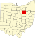
Honeytown is an unincorporated community in Wooster Township, Wayne County, in the U.S. state of Ohio. [1] Apple Creek flows past the town site. [2]

A post office called Honeytown was established in 1884, and closed in 1885. [3]

Related Research Articles

Wayne County, Ohio County in Ohio, United States

Wayne County is a county in the U.S. state of Ohio. As of the 2020 census, the population was 116,894. Its county seat is Wooster. The county is named for General "Mad" Anthony Wayne. Wayne County comprises the Wooster, OH Micropolitan Statistical Area.

Zolfo Springs, Florida Town in Florida, United States

Zolfo Springs is a town in Hardee County, Florida, United States. The population was 1,827 at the 2010 census, up from 1,641 at the 2000 census.

Perry Heights, Ohio CDP in Ohio, United States

Perry Heights is a census-designated place (CDP) in Stark County, Ohio, United States. The population was 8,900 at the 2000 census. It is part of the Canton-Massillon, OH Metropolitan Statistical Area. It was originally known as Genoa.

Rittman, Ohio City in Ohio, United States

Rittman is a city in Medina and Wayne counties in the U.S. state of Ohio. All but a small portion of the city is in Wayne County, within commuting distance of Akron, Canton and Cleveland. The population was 6,491 at the 2010 census.

Wayne College is a satellite campus of the University of Akron in Orrville, Ohio. It offers the first two years of general bachelor's degree coursework for students who plan to complete their degrees at the Akron campus or other colleges and universities. The college also offers two bachelor's programs including organizational supervision and social work. An MBA is also available at the campus through The University of Akron College of Business Administration.

Ohios 16th congressional district U.S. House district for Ohio

The 16th congressional district of Ohio is represented by Representative Anthony Gonzalez (R). It is located in the north east of the state, covering Wayne County and with arms extending north into the suburbs of Cleveland, and east into Greater Akron and Stark County. In the reapportionment after the 2020 census, Ohio lost a seat in the House, so this district will be eliminated when new congressional district borders take effect on January 3, 2023.

Dundee, Ohio

Dundee is a census-designated place in central Wayne Township, Tuscarawas County, Ohio, United States. It has a post office with the ZIP code 44624. It lies at the intersection of State Routes 93 and 516.

East Union is an unincorporated community in Wayne County, in the U.S. state of Ohio.

Easton is an unincorporated community in Wayne County, in the U.S. state of Ohio.

The Wooster Municipal Airport was a general aviation airport serving Wooster, Ohio, USA. It was built in the 1920s and was closed sometime between 1968 and 1972 and was replaced by Wayne County Airport 3 miles away on North Honeytown Road near Smithville, Ohio. The airport originally had sod runways but received a 3,100 foot paved runway in the 1950s. After closing, the runway was retained as a city street, now named Old Airport Road in Wooster.

Maysville is an unincorporated community in Coshocton County, in the U.S. state of Ohio.

Sewellsville is an unincorporated community in Belmont County, in the U.S. state of Ohio.

Chambersburg is an unincorporated community in Columbiana County, in the U.S. state of Ohio.

Moultrie is an unincorporated community in Columbiana County, in the U.S. state of Ohio.

Burton City, Ohio

Burton City is an unincorporated community in Wayne County, in the U.S. state of Ohio.

Golden Corners is an unincorporated community in Wayne County, in the U.S. state of Ohio.

Johnsons Corners is an unincorporated community in Wayne County, in the U.S. state of Ohio.

Maysville is an unincorporated community on the river side of the Ohio river ), in the U.S. state of Kentucky.

Moreland is an unincorporated community in Wayne County, in the U.S. state of Ohio.

West Lebanon is an unincorporated community in Wayne County, in the U.S. state of Ohio.

References

  1. U.S. Geological Survey Geographic Names Information System: Honeytown, Ohio
  2. The Preglacial Drainage of Ohio: Comprising the Results of Researches. Press of F.J. Heer. 1900. p.  53.
  3. "Wayne County". Jim Forte Postal History. Retrieved 11 January 2016.

Coordinates: 40°47′49″N81°52′47″W / 40.79694°N 81.87972°W / 40.79694; -81.87972