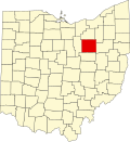
Blachleyville, Ohio

Last updated

Blachleyville is an unincorporated community in Wayne County, in the U.S. state of Ohio. [1]

History

Blachleyville was laid out on December 16, 1833, by Drs. William Boyd Blachley Sr and Jr, and named for Blachley Sr. It was surveyed by George Emery. The plat and certificate recorded March 1834. [2] Blachley was born in New Jersey, lived in Pennsylvania for most of his childhood, and came to Plain Township in 1816. [3] He was a physician who practiced medicine in the area for nineteen years and had nineteen children.

The first settlers of Plain Township settled near Blachleyville. The first were John Collier and wife Sarah Eylar. Others were William Meeks, Cyrus Baird, and George and David Lozier. Daniel Miller is credited with building the sawmill in 1815 and the first house in Blachleyville. John Cassiday was the first school teacher, and Elder French was the first minister (Baptist). [4]

A post office called Blackleysville was established in 1830, the name was changed to Blackleyville in 1884, and the post office closed in 1907. [5]

Related Research Articles

<span class="mw-page-title-main">Mason County, West Virginia</span> County in West Virginia, United States

Mason County is a county in the U.S. state of West Virginia. As of the 2020 census, the population was 25,453. Its county seat and largest city is Point Pleasant. The county was founded in 1804 and named for George Mason, delegate to the U.S. Constitutional Convention. Before the Civil War, the county was in the State of Virginia.

<span class="mw-page-title-main">Wayne County, Ohio</span> County in Ohio, United States

Wayne County is a county in the U.S. state of Ohio. As of the 2020 census, the population was 116,894. Its county seat is Wooster. The county is named for General "Mad" Anthony Wayne. Wayne County comprises the Wooster, OH Micropolitan Statistical Area.

<span class="mw-page-title-main">Fredericksburg, Ohio</span> Village in Ohio, United States

Fredericksburg is a village in Salt Creek Township, Wayne County, Ohio, United States. The population was 409 at the 2020 census.

<span class="mw-page-title-main">Ben Avon, Pennsylvania</span> Borough in Pennsylvania, United States

Ben Avon is a borough in Allegheny County, Pennsylvania, United States, along the Ohio River. The population was 1,918 at the 2020 census. It is part of the Pittsburgh metropolitan area.

<span class="mw-page-title-main">Northwest Territory</span> United States territory (1787–1803)

The Northwest Territory, also known as the Old Northwest and formally known as the Territory Northwest of the River Ohio, was formed from unorganized western territory of the United States after the American Revolution. Established in 1787 by the Congress of the Confederation through the Northwest Ordinance, it was the nation's first post-colonial organized incorporated territory.

<span class="mw-page-title-main">Firelands</span>

The Firelands, or Sufferers' Lands, tract was located at the western end of the Connecticut Western Reserve in what is now the U.S. state of Ohio. It was legislatively established in 1792, as the "Sufferers' Lands", and later became named "Fire Lands" because the resale of the land was intended as financial restitution for residents of the Connecticut towns of Danbury, Fairfield, Greenwich, Groton, New Haven, New London, Norwalk, and Ridgefield. Their homes had been burned in 1779 and 1781 by British forces during the American Revolutionary War. However, most of the settlement of the area did not occur until after the War of 1812. "Fire Lands" was later spelled as one word: "Firelands."

<span class="mw-page-title-main">Ohio's 18th congressional district</span> Defunct U.S. Congress electoral division

The 18th congressional district of Ohio is an obsolete congressional district last represented by Republican Bob Gibbs. The district voted for the majority party in the House of Representatives in every election since 1954.

<span class="mw-page-title-main">Harrison Township, Darke County, Ohio</span> Township in Ohio, United States

Harrison Township is one of the twenty townships of Darke County, Ohio, United States. The 2020 census found 2,164 people in the township.

<span class="mw-page-title-main">Cyrus Spink</span> American politician

Cyrus Spink was an American politician who served as a U.S. Representative from Ohio for three month in 1859 prior to his death in office.

East Union is an unincorporated community in Wayne County, in the U.S. state of Ohio.

<span class="mw-page-title-main">George Rex (politician)</span> American judge

George Rex was a Democratic politician in Wooster in the U.S. State of Ohio who was in the Ohio Senate and was an Ohio Supreme Court Judge 1874–1877.

<span class="mw-page-title-main">Edward Avery (judge)</span> American judge

Edward Avery was a lawyer from Wooster, Ohio, United States, who was an Ohio State Senator and served on the Ohio Supreme Court from 1847 to 1851. He later helped found the College of Wooster and the Wooster Cemetery.

West Bedford is an unincorporated community in Bedford Township, Coshocton County, Ohio, United States.

<span class="mw-page-title-main">West Carlisle, Ohio</span>

West Carlisle is an unincorporated community in Pike Township, Coshocton County, Ohio, United States.

Ankenytown is an unincorporated community in Knox County, in the U.S. state of Ohio.

Jefferson is an unincorporated community in Wayne County, in the U.S. state of Ohio.

Johnsons Corners is an unincorporated community in Wayne County, in the U.S. state of Ohio.

Moreland is an unincorporated community in Wayne County, in the U.S. state of Ohio.

Reedsburg is an unincorporated community in Wayne County, in the U.S. state of Ohio.

Springville is an unincorporated community in Wayne County, in the U.S. state of Ohio. It lies southwest of Wooster, Ohio and north of Shreve, Ohio

References

  1. U.S. Geological Survey Geographic Names Information System: Blachleyville, Ohio
  2. Douglass, Ben (1878). History of Wayne County, Ohio, from the days of the pioneers and first settlers to the present time. Indianapolis: Robert Douglass, publisher. pp.  647–.
  3. Douglass, Ben. History of Wayne County, Ohio, from the Days of the Pioneers and the First Settlers to Present Time. p. 643.
  4. Douglass, Ben. History of Wayne County, Ohio, from the Days of the Pioneers and the First Settlers to Present Time. pp. 642–643.
  5. "Wayne County". Jim Forte Postal History. Retrieved January 11, 2016.

40°45′52″N82°04′56″W / 40.76444°N 82.08222°W / 40.76444; -82.08222