Burbank, Ohio

Last updated

Burbank, Ohio
CentralBurbankOH.jpg
Central Burbank
OHMap-doton-Burbank.png
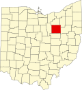
Location of Burbank, Ohio
Map of Wayne County Ohio Highlighting Burbank Village.png
Location of Burbank in Wayne County
Coordinates: 40°59′03″N81°59′56″W / 40.98417°N 81.99889°W / 40.98417; -81.99889
Country United States
State Ohio
County Wayne
Area
[1]
  Total0.36 sq mi (0.92 km2)
  Land0.36 sq mi (0.92 km2)
  Water0.00 sq mi (0.00 km2)
Elevation
[2]
991 ft (302 m)
Population
 (2020)
  Total296
  Density831.46/sq mi (321.24/km2)
Time zone UTC-5 (Eastern (EST))
  Summer (DST) UTC-4 (EDT)
ZIP code
44214
Area code 330
FIPS code 39-10254 [3]
GNIS feature ID2397495 [2]
Website villageofburbankohio.com

Burbank is a village in Wayne County, Ohio, United States, along Killbuck Creek. The population was 296 at the 2020 census.

Contents

Geography

According to the United States Census Bureau, the village has a total area of 0.35 square miles (0.91 km2), all of it land. [4]

Demographics

Historical population
CensusPop.Note
1870 258
1880 29313.6%
1890 33113.0%
1900 325−1.8%
1910 3518.0%
1920 300−14.5%
1930 299−0.3%
1940 34816.4%
1950 39312.9%
1960 324−17.6%
1970 3549.3%
1980 3653.1%
1990 289−20.8%
2000 279−3.5%
2010 207−25.8%
2020 29643.0%
U.S. Decennial Census [5]

2010 census

As of the census [6] of 2010, there were 207 people, 81 households, and 59 families living in the village. The population density was 591.4 inhabitants per square mile (228.3/km2). There were 102 housing units at an average density of 291.4 per square mile (112.5/km2). The racial makeup of the village was 97.6% White, 1.0% African American, 0.5% Native American, and 1.0% from two or more races. Hispanic or Latino of any race were 0.5% of the population.

There were 81 households, of which 34.6% had children under the age of 18 living with them, 49.4% were married couples living together, 16.0% had a female householder with no husband present, 7.4% had a male householder with no wife present, and 27.2% were non-families. 18.5% of all households were made up of individuals, and 8.6% had someone living alone who was 65 years of age or older. The average household size was 2.56 and the average family size was 2.76.

The median age in the village was 41.1 years. 23.7% of residents were under the age of 18; 9.2% were between the ages of 18 and 24; 24.6% were from 25 to 44; 27% were from 45 to 64; and 15.5% were 65 years of age or older. The gender makeup of the village was 51.7% male and 48.3% female.

2000 census

As of the census [3] of 2000, there were 279 people, 103 households, and 76 families living in the village. The population density was 842.3 inhabitants per square mile (325.2/km2). There were 107 housing units at an average density of 323.0 per square mile (124.7/km2). The racial makeup of the village was 98.92% White, 0.72% Asian, and 0.36% from two or more races. Hispanic or Latino of any race were 1.08% of the population.

There were 103 households, out of which 34.0% had children under the age of 18 living with them, 56.3% were married couples living together, 10.7% had a female householder with no husband present, and 26.2% were non-families. 17.5% of all households were made up of individuals, and 7.8% had someone living alone who was 65 years of age or older. The average household size was 2.71 and the average family size was 2.97.

In the village, the population was spread out, with 26.2% under the age of 18, 10.4% from 18 to 24, 31.9% from 25 to 44, 21.1% from 45 to 64, and 10.4% who were 65 years of age or older. The median age was 34 years. For every 100 females there were 111.4 males. For every 100 females age 18 and over, there were 110.2 males.

The median income for a household in the village was $39,375, and the median income for a family was $39,375. Males had a median income of $30,313 versus $23,393 for females. The per capita income for the village was $17,557. About 6.8% of families and 7.2% of the population were below the poverty line, including 5.1% of those under the age of eighteen and 12.5% of those 65 or over.

Related Research Articles

<span class="mw-page-title-main">Findlay, Illinois</span> Village in Illinois, United States

Findlay is a village in Shelby County, Illinois, United States. The population was 664 at the 2020 census.

<span class="mw-page-title-main">Little York, Illinois</span> Village in Illinois, United States

Little York is a village in Warren County, Illinois, United States. The population was 269 at the 2000 census. It is part of the Galesburg Micropolitan Statistical Area.

<span class="mw-page-title-main">Monroe, Maine</span> Town in the state of Maine, United States

Monroe is a town in Waldo County, Maine, United States named for President James Monroe. The population was 931 at the 2020 census.

<span class="mw-page-title-main">Geneva, Minnesota</span> City in Minnesota, United States

Geneva is a city in Freeborn County, Minnesota, United States. The population was 555 at the 2010 census.

<span class="mw-page-title-main">West Union, Minnesota</span> City in Minnesota, United States

West Union is a city in Todd County, Minnesota, United States. The population was 92 at the 2020 census.

<span class="mw-page-title-main">Union, Nebraska</span> Village in Nebraska, United States

Union is a village in southeast Cass County, Nebraska, United States. The population was 195 at the 2020 census.

<span class="mw-page-title-main">Silver Creek, Nebraska</span> Village in Nebraska, United States

Silver Creek is a village in Merrick County, Nebraska, United States. The population was 362 at the 2010 census. It is part of the Grand Island, Nebraska Micropolitan Statistical Area.

<span class="mw-page-title-main">Dawson, Nebraska</span> Village in Richardson County, Nebraska, United States

Dawson is a village in Richardson County, Nebraska, United States. The population was 148 at the 2020 census.

<span class="mw-page-title-main">Carleton, Nebraska</span> Village in Thayer County, Nebraska, United States

Carleton is a village in Thayer County, Nebraska, United States. The population was 94 at the 2020 census.

<span class="mw-page-title-main">Carroll, Nebraska</span> Village in Wayne County, Nebraska, United States

Carroll is a village in Wayne County, Nebraska, United States. The population was 193 at the 2020 census.

<span class="mw-page-title-main">Clarksville, Ohio</span> Village in Ohio, United States

Clarksville is a village in Clinton County, Ohio, United States. The population was 534 at the 2020 census. It is served by the Clinton Massie branch of the Wilmington Public Library of Clinton County.

<span class="mw-page-title-main">New Weston, Ohio</span> Village in Ohio, United States

New Weston is a village in Darke County, Ohio, United States. The population was 124 at the 2020 census.

<span class="mw-page-title-main">Baltimore, Ohio</span> Village in Ohio, United States

Baltimore is a village in Fairfield County, Ohio, United States. The population was 2,981 at the 2020 census.

<span class="mw-page-title-main">Holmesville, Ohio</span> Village in Ohio, United States

Holmesville is a village in Holmes County, Ohio, United States, along Killbuck Creek. The population was 371 at the 2020 census.

<span class="mw-page-title-main">Greenwich, Ohio</span> Village in Ohio, United States

Greenwich is a village in Huron County, Ohio, United States. The population was 1,409 at the 2020 census. It is served by a branch of the Willard Memorial Library.

<span class="mw-page-title-main">Hartford, Ohio</span> Village in Ohio, United States

Hartford is a village in the township of the same name in Licking County, Ohio, United States. The population was 404 at the 2020 census.

<span class="mw-page-title-main">Ludlow Falls, Ohio</span> Village in Ohio, United States

Ludlow Falls is a village in Miami County, Ohio, United States. The population was 175 at the 2020 census. It is part of the Dayton Metropolitan Statistical Area. Ludlow Falls is named after surveyor Israel Ludlow.

<span class="mw-page-title-main">Freeman, Wisconsin</span> Town in Wisconsin, United States

Freeman is a town in Crawford County, Wisconsin, United States. The population was 719 at the 2000 census. The villages of Ferryville and De Soto are located in the town. The unincorporated community of Reed is also located in the town.

<span class="mw-page-title-main">Centuria, Wisconsin</span> Village in Wisconsin, United States

Centuria is a village in Polk County, Wisconsin, United States. The population was 948 at the 2010 census.

<span class="mw-page-title-main">Trumbull, Nebraska</span> Village in Clay and Adams counties in Nebraska, United States

Trumbull is a village in Clay and Adams counties in Nebraska, United States. The population was 198 at the 2020 census. It is part of the Hastings, Nebraska Micropolitan Statistical Area.

References

  1. "ArcGIS REST Services Directory". United States Census Bureau. Retrieved September 20, 2022.
  2. 1 2 U.S. Geological Survey Geographic Names Information System: Burbank, Ohio
  3. 1 2 "U.S. Census website". United States Census Bureau . Retrieved January 31, 2008.
  4. "US Gazetteer files 2010". United States Census Bureau. Archived from the original on January 25, 2012. Retrieved January 6, 2013.
  5. "Census of Population and Housing". Census.gov. Retrieved June 4, 2015.
  6. "U.S. Census website". United States Census Bureau . Retrieved January 6, 2013.