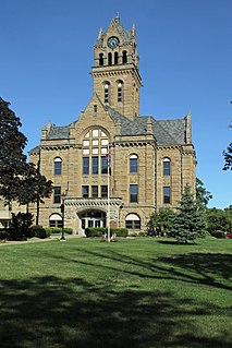
The Whitewater River is a 101-mile-long (163 km) southerly flowing right tributary of the Great Miami River in southeastern Indiana and southwestern Ohio in the United States. It is formed by the confluence of two forks, the West Fork and East Fork. The name is a misnomer, as there is no true white water on the river. However, there are many rapids due to the steep gradient present - the river falls an average of six feet per mile (1.1 m/km). The gradient rendered upstream navigation impossible, and in the mid-nineteenth century resulted in the construction of the Whitewater Canal paralleling the river from north of Connersville, Indiana, to the Ohio River.

The Elk River is a tributary of the Kanawha River, 172 miles (277 km) long, in central West Virginia in the United States. Via the Kanawha and Ohio rivers, it is part of the watershed of the Mississippi River.

The Hughes River is a tributary of the Little Kanawha River in western West Virginia in the United States. Via the Little Kanawha and Ohio Rivers, it is part of the watershed of the Mississippi River. As measured from the confluence of its north and south forks, the Hughes is 18 mi (29 km) long, and drains a rural area of the unglaciated portion of the Allegheny Plateau.
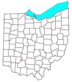
Lees Creek, also known as Centerville, is an unincorporated community in central Wayne Township, Clinton County, Ohio, United States. It lies at the intersection of State Route 729 with Cox Road, 6 miles south of Sabina and 12 miles (19 km) southeast of Wilmington, the county seat of Clinton County. It lies between the headwaters of the Middle Fork of Lees Creek, to the southeast, and the Anderson Fork of Caesar Creek. Although it is unincorporated, it had a post office, with the ZIP code of 45138. The Post Office closed in 2012 and the town, including East Clinton High School, now carries a Sabina mailing address.

The Mohican River is a principal tributary of the Walhonding River, about 40 miles (64 km) long, in north-central Ohio in the United States. Via the Walhonding, Muskingum and Ohio Rivers, it is part of the watershed of the Mississippi River, draining an area of 999 square miles (2,587 km²).
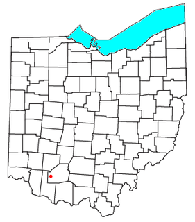
Pricetown is an unincorporated community in eastern Salem Township, Highland County, Ohio, United States. It was platted by Elijah, David and Jane Faris, along with Alexander Murphy on April 13, 1847 and named for Common Pleas Judge J.W. Price of Hillsboro. Its mail service is from Lynchburg. The community is on State Route 131 near the headwaters of the Oak Creek.
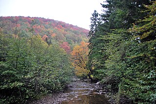
Laurel Fork is a 37.8-mile-long (60.8 km) river in eastern West Virginia, USA. It is a tributary of the Dry Fork; via the Dry Fork, the Black Fork, and the Cheat, Monongahela and Ohio rivers, it is part of the watershed of the Mississippi River, draining an area of 60 square miles (160 km2) in the Allegheny Mountains. With the Dry Fork, the Glady Fork, the Shavers Fork and the Blackwater River, it is considered to be one of the five principal headwaters tributaries of the Cheat River.

Piney Fork is an unincorporated community in central Smithfield Township, Jefferson County, Ohio, United States. The stream of Piney Fork flows southeast past the community; it meets Short Creek in far western Warren Township, and Short Creek in turn meets the Ohio River at Rayland.

Wheeling Creek is a tributary of the Ohio River, 25 miles (40 km) long, in the Northern Panhandle of West Virginia in the United States, with a watershed extending into southwestern Pennsylvania. Via the Ohio River, it is part of the watershed of the Mississippi River, draining an area of approximately 300 square miles (780 km2) on the unglaciated portion of the Allegheny Plateau. It flows into the Ohio River in downtown Wheeling, just downstream of Ohio's Wheeling Creek on the opposite bank. A variant name is Big Wheeling Creek.
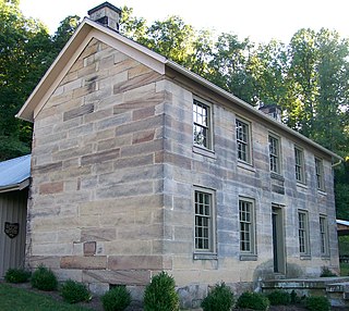
Salt Fork State Park is a public recreation area located six miles (9.7 km) north of Lore City in Guernsey County, Ohio. It is the largest state park in Ohio, encompassing 17,229 acres (6,972 ha) of land and 2,952 acres (1,195 ha) of water. The grounds include the Kennedy Stone House, which is listed on the National Register of Historic Places. The park is managed by the Ohio Department of Natural Resources Division of Parks and Watercraft.

Morgantown is a small, unincorporated community crossroads village in central Benton Township, Pike County, Ohio, United States. Located at the junction of Morgans Fork and Auerville Roads, it once possessed a school and a store. Today, the community consists of a few houses and the Morgantown Church of Christ in Christian Union.

Marshall is an unincorporated community in central Marshall Township, Highland County, Ohio, United States. It lies at the intersection of State Routes 124 and 506. Rocky Fork Lake, the site of Rocky Fork State Park, is located 2 miles (3 km) to the north. It lies 7 miles (11 km) east-southeast of the city of Hillsboro, the county seat of Highland County. An early variant name was West Liberty.

Harriettsville is an unincorporated community in western Elk Township, Noble County, Ohio, United States. It lies along State Route 145 at its intersection with County Road 46. The East Fork of Duck Creek, a subsidiary of the Ohio River that meets the river near Marietta, runs along State Route 145 past the community. It lies 8 miles (13 km) northeast of Lower Salem by road, and 13 miles (21 km) directly southeast of Caldwell, the county seat of Noble County.
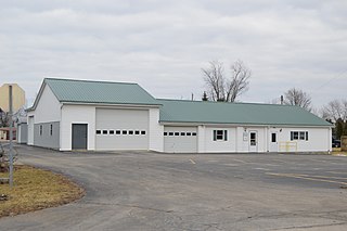
Plumwood is a census-designated place in central Monroe Township, Madison County, Ohio, United States. It lies at the intersection of State Route 38 with Arthur Bradley Road, 8½ miles north of the city of London, the county seat of Madison County. The Spring Fork of the Little Darby Creek flows past the community.
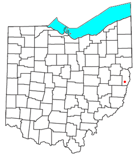
Greentown is an unincorporated community in eastern Smithfield Township, Jefferson County, Ohio, United States. It lies approximately 2 miles (3.2 km) south of Smithfield, on a small road. Part of the Dry Fork of Short Creek, a stream that meets the Ohio River at Rayland, flows past the community. It is located 11 3⁄4 miles (18.9 km) southwest of Steubenville, the county seat of Jefferson County. The community is part of the Weirton–Steubenville, WV-OH Metropolitan Statistical Area.

Mule Town is an unincorporated community in southwestern Madison Township, Scioto County, Ohio, United States. Located at the intersection of State Route 335, Lucasville-Minford Road and Bennett Road, it lies just north of the unincorporated community of Minford, 7 miles east of the census-designated place of Lucasville, and 14 miles (23 km) northeast of the city of Portsmouth, the county seat of Scioto County. Sweet Run, a tributary of the Rocky Fork of the Little Scioto River, flows past the community. Five businesses lie within Mule Town; Mule Town Mini-Mart, Foster and Fankell Garage, Bennet's Collision and Repair, Shumway Tires and the Minford Retirement Center.

Clarktown is an unincorporated community and census-designated place in southeastern Jefferson Township, Scioto County, Ohio, United States. As of the 2010 census it had a population of 958.

Roxabel is an unincorporated community in central Concord Township, Ross County, Ohio, United States. It lies at the intersection of Davis Hill and Jamison Roads, little more than 1 mile south of the village of Frankfort. Two parts of the North Fork of Paint Creek, a subsidiary of the Ohio River through the Scioto River, pass near Roxabel. It is located slightly more than 3 miles north of State Route 28, midway between the cities of Chillicothe — the county seat of Ross County — and Greenfield.

Birmingham is an unincorporated community in southeastern Monroe Township, Guernsey County, Ohio, United States. It lies at the intersection of Beal, Birmingham, and Peoli Roads, 3 3⁄4 miles (6.0 km) south of Peoli, 7 miles east-northeast of Kimbolton, and 13 miles (21 km) northeast of central Cambridge, the county seat of Guernsey County. Nearby streams flow southward into Salt Fork Lake, which is included in Salt Fork State Park.

The Miami and Erie Canal Deep Cut is a well-preserved long section of the Miami and Erie Canal near Spencerville in western Ohio. The 6,600-foot (2,000 m) segment represents one of the major construction efforts of the canal; in order to avoid using locks to go over a ridge, the canal was dug deeply into it, far more than the 5-foot (1.5 m) depth of the canal itself. Workers dug the canal bed up to 52 feet (16 m) into the blue clay ridge that separated the St. Marys and Auglaize River watersheds. It is a United States National Historic Landmark. The cut is owned by the state and managed by MetroParks as Deep Cut Historical Park, with multi-use trails and a picnic area.


