Richland, Ohio

Last updated

Richland is a former town in Vinton County, in the U.S. state of Ohio. The GNIS classifies it as a populated place.

Vinton County, Ohio county in Ohio, United States

Vinton County is a county located in the U.S. state of Ohio. As of the 2010 census, the population was 13,435, making it the least populous county in the state. Its county seat is McArthur. The county is named for Samuel Finley Vinton, US Representative from Ohio.

U.S. state constituent political entity sharing sovereignty as the United States of America

In the United States, a state is a constituent political entity, of which there are currently 50. Bound together in a political union, each state holds governmental jurisdiction over a separate and defined geographic territory and shares its sovereignty with the federal government. Due to this shared sovereignty, Americans are citizens both of the federal republic and of the state in which they reside. State citizenship and residency are flexible, and no government approval is required to move between states, except for persons restricted by certain types of court orders. Four states use the term commonwealth rather than state in their full official names.

Ohio State of the United States of America

Ohio is a Midwestern state in the Great Lakes region of the United States. Of the fifty states, it is the 34th largest by area, the seventh most populous, and the tenth most densely populated. The state's capital and largest city is Columbus.

History

An old variant name of Richland was Richland Furnace. [1] Richland Furnace was a blast furnace completed in 1854. [2] A post office called Richland was established in 1872, and remained in operation until 1914. [3]

Blast furnace type of metallurgical furnace used for smelting to produce industrial metals

A blast furnace is a type of metallurgical furnace used for smelting to produce industrial metals, generally pig iron, but also others such as lead or copper. Blast refers to the combustion air being "forced" or supplied above atmospheric pressure.

Related Research Articles

Ray, Ohio Human settlement in United States of America

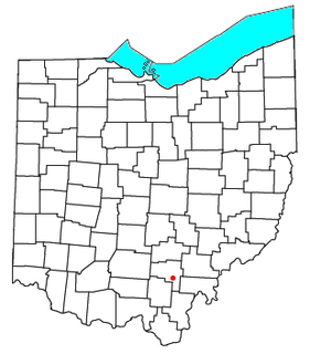
Ray is an unincorporated community in southeastern Harrison Township, Vinton County, Ohio, United States. Although it is unincorporated, it has a post office, with the ZIP code of 45672. It is located along State Route 327 in western Vinton County.

Zaleski State Forest is the second-largest state forest in the U.S. state of Ohio, located primarily in Vinton County, with areas in Athens County as well. The 28,000 acre (110 km²) forest surrounds Lake Hope State Park in Vinton County, and extensively borders the Waterloo Wildlife Research Station in Athens County. It is also located close to the Wayne National Forest. In addition, the older and much smaller Waterloo State Forest in Athens County is administered as part of the Zaleski. The forest is named after the Vinton County village of Zaleski, where the forest headquarters are located, and is centered on State Route 278.

Oreton, Ohio Ghost town in Ohio, United States

Oreton is a ghost town in eastern Vinton Township, Vinton County, Ohio, United States, located along State Route 160. Oreton was a small mining community. Today, all that remains are the crumbled ruins of the iron furnace, a few concrete foundations, and the brick safe of Dave Ebert's company store.

Richland Furnace State Forest is a state forest in Jackson and Vinton counties in the U.S. state of Ohio.

The Vinton Furnace State Experimental Forest and Raccoon Ecological Management Area (REMA) is a state forest in Vinton County, Ohio, United States. It comprises 15,849 acres, the largest remaining intact block of forest in Ohio still available for permanent protection. Since 2000, data collected at the forest has been cited in nearly 200 academic articles.

Hue is an unincorporated community in Swan Township, Vinton County, Ohio, in the United States.

Orland is an unincorporated community in Swan Township, Vinton County, Ohio, in the United States.

Siverly is an unincorporated community in Swan Township, Vinton County, Ohio, in the United States.

Stella is an unincorporated community in Jackson Township, Vinton County, Ohio, in the United States.

Allensville, Ohio human settlement in United States of America

Allensville is an unincorporated community in Richland Township, Vinton County, Ohio, in the United States.

Hope is an unincorporated community in Vinton County, in the U.S. state of Ohio.

Dundas is an unincorporated community in Vinton County, in the U.S. state of Ohio.

Eagle Mills is an unincorporated community in Vinton County, in the U.S. state of Ohio.

Jimtown is an unincorporated community in Vinton County, in the U.S. state of Ohio.

Knox is a former town in Vinton County, in the U.S. state of Ohio. The GNIS classifies it as a populated place.

Minerton is a former town in Vinton County, in the U.S. state of Ohio. The GNIS classifies it as a populated place.

Radcliff is an unincorporated community in Vinton County, in the U.S. state of Ohio.

Ratcliffburg is an unincorporated community in Vinton County, in the U.S. state of Ohio.

Vales Mills is an unincorporated community in Vinton County, in the U.S. state of Ohio.

References

  1. U.S. Geological Survey Geographic Names Information System: Richland, Ohio
  2. Vinton County, Ohio History and Families. Turner Publishing Company. 1 January 1996. p. 32. ISBN   978-1-56311-295-9.
  3. "Vinton County". Jim Forte Postal History. Retrieved 9 December 2015.

Coordinates: 39°11′13″N82°35′51″W / 39.18694°N 82.59750°W / 39.18694; -82.59750

Geographic coordinate system Coordinate system

A geographic coordinate system is a coordinate system that enables every location on Earth to be specified by a set of numbers, letters or symbols. The coordinates are often chosen such that one of the numbers represents a vertical position and two or three of the numbers represent a horizontal position; alternatively, a geographic position may be expressed in a combined three-dimensional Cartesian vector. A common choice of coordinates is latitude, longitude and elevation. To specify a location on a plane requires a map projection.