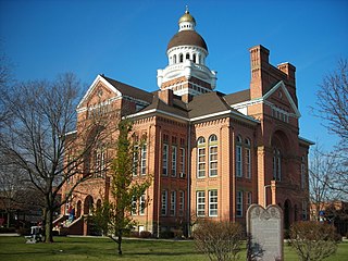
Paulding County is a county located in the U.S. state of Ohio. As of the 2020 census, the population was about 18,806. Its county seat is Paulding. The county was created in 1820 and later organized in 1839. It is named for John Paulding, one of the captors of Major John André in the American Revolutionary War.
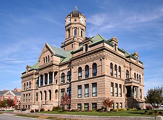
Auglaize County is a county in Northwestern Ohio, United States of America. As of the 2020 census, the population was 46,442. Its county seat and largest city is Wapakoneta.

Wapakoneta is a city in and the county seat of Auglaize County, Ohio, United States. Located along the Auglaize River, the city is about 56 miles (90 km) north of Dayton and 83 miles (134 km) south of Toledo. The population was 9,957 at the 2020 census. It is the principal city of the Wapakoneta micropolitan area, which is included in the Lima–Van Wert–Celina combined statistical area.

The Maumee River is a river running in the United States Midwest from northeastern Indiana into northwestern Ohio and Lake Erie. It is formed at the confluence of the St. Joseph and St. Marys rivers, where Fort Wayne, Indiana has developed, and meanders northeastwardly for 137 miles (220 km) through an agricultural region of glacial moraines before flowing into the Maumee Bay of Lake Erie. The city of Toledo is located at the mouth of the Maumee. The Maumee was designated an Ohio State Scenic River on July 18, 1974. The Maumee watershed is Ohio's breadbasket; it is two-thirds farmland, mostly corn and soybeans. It is the largest watershed of any of the rivers feeding the Great Lakes, and supplies five percent of Lake Erie's water.

The Great Black Swamp was a glacially fed wetland in northwest Ohio and northeast Indiana, United States, that existed from the end of the Wisconsin glaciation until the late 19th century. Comprising extensive swamps and marshes, with some higher, drier ground interspersed, it occupied what was formerly the southwestern part of proglacial Lake Maumee, a Holocene precursor to Lake Erie. The area was about 25 miles (40 km) wide and 100 miles (160 km) long, covering an estimated 1,500 square miles (4,000 km2). Gradually drained and settled in the second half of the 19th century, it is now highly productive farmland. However, this development has been detrimental to the ecosystem as a result of agricultural runoff. This runoff, in turn, has contributed to frequent toxic algal blooms in Lake Erie.

The Ottawa River is a tributary of the Auglaize River, approximately 50 miles (80 km) long, in northwestern Ohio in the United States. The river is named for the Ottawa tribe of Native Americans who inhabited the area in the 18th century. It shares its name with another river in northwestern Ohio, the Ottawa River in Toledo, as well as the Ottawa River in Ontario & Quebec, Canada.
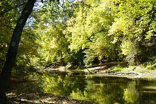
The Blanchard River is a 103-mile-long (166 km) tributary of the Auglaize River in northwestern Ohio in the United States. It drains a primarily rural farming area in the watershed of Lake Erie. Much of the length of the river can be navigated by canoe.

The Little Auglaize River is a 47.0-mile-long (75.6 km) tributary of the Auglaize River in northwest Ohio in the United States. It drains a primarily rural farming area in the watershed of Lake Erie.

Flatrock Creek is a 57.2-mile-long (92.1 km) tributary of the Auglaize River in northeastern Indiana and northwestern Ohio in the United States. It drains a primarily rural farming area in the watershed of Lake Erie.
The Tiffin River is a 54.9-mile-long (88.4 km) tributary of the Maumee River in northwestern Ohio in the United States. Headwater tributaries of the river rise in southeastern Michigan. The river drains a primarily rural farming region in the watershed of Lake Erie. Early French traders called the river Crique Féve, translated as Bean Creek, due to the natural growth of bean plants along the shores.

The St. Marys River is a 99-mile-long (159 km) tributary of the Maumee River in northwestern Ohio and northeastern Indiana in the United States. Prior to development, it was part of the Great Black Swamp. Today, it drains a primarily rural farming region in the watershed of Lake Erie.

The Ottawa River, also known as Ottawa Creek, is a short river, approximately 20 miles (32 km) long, in northwest Ohio and southeast Michigan in the United States. It drains an area on the Ohio-Michigan border along the eastern and northern fringes of the city of Toledo, goes through Ottawa Hills, and empties directly into Lake Erie. It is one of two rivers in northwestern Ohio that share the same name, along with the Ottawa River that is a tributary of the Auglaize River. The upper 4 miles (6 km) of the river in Michigan north of Sylvania, Ohio is called North Tenmile Creek on federal maps, while another branch rising in Fulton County, Ohio, is called Tenmile Creek.

The Mad River is a stream located in the west central part of the U.S. state of Ohio. It flows 66 miles (106 km) from Logan County to downtown Dayton, where it meets the Great Miami River. The stream flows southwest from its source near Campbell Hill through West Liberty, along U.S. Route 68 west of Urbana, past Springfield, then along Ohio State Route 4 into Dayton. The stream's confluence with the Great Miami River is in Deeds Park.

The Sandusky River is a tributary to Lake Erie in north-central Ohio in the United States. It is about 133 miles (214 km) long and flows into Lake Erie at the southwest side of Sandusky Bay.

Junction is an unincorporated community in western Auglaize Township, Paulding County, Ohio, United States. It lies along the concurrent State Routes 111 and 637. The Auglaize River flows along the eastern edge of the community. It is located midway between the village of Paulding, the county seat of Paulding County, and the city of Defiance, the county seat of Defiance County.
Grandglaize Creek is a creek and tributary to the Osage River that forms the Grand Glaize Arm of the Lake of the Ozarks in Missouri. The creek flows for 10 miles (16 km) before reaching the Lake of the Ozarks, and the Grand Glaize Arm extends another 15 miles (24 km) before reaching the Osage River within the lake.

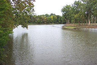
Lake Erie Basin consists of Lake Erie and surrounding watersheds, which are typically named after the river, creek, or stream that provides drainage into the lake. The watersheds are located in the states of Indiana, Michigan, New York, Ohio, and Pennsylvania in the United States, and in the province of Ontario in Canada. The basin is part of the Great Lakes Basin and Saint Lawrence River Watershed, which feeds into the Atlantic Ocean. 80% of the lake's water flows in from the Detroit River, with only 9% coming from all of the remaining watersheds combined. A littoral zone serves as the interface between land and lake, being that portion of the basin where the lake is less than 15 feet (4.6 m) in depth.
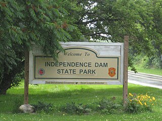
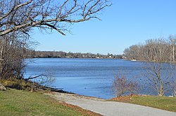
Independence Dam State Park is a 591-acre (239 ha) public recreation area located on the banks of the Maumee River three miles east of Defiance in Defiance County, Ohio, United States. The state park features ruins of the Miami and Erie Canal. Recreational features include boating, fishing, hiking, picnicking, and primitive camping.

Indian Land Grants were land tracts granted to various Indians by Treaty or by United States Congressional action in the Nineteenth century in northwestern Ohio.

The Fort Wayne Moraine is considered contemporary to the last stages of the Valparaiso Moraine. Centered on Fort Wayne, Indiana, the northern leg of the moraine is mostly overlaid by the younger Wabash Moraine angling northeastward through Williams County, Ohio. It only becomes identifiable in Lenawee County, Michigan south and northeast of Adrian before ending in the intermingling of moraines around Ann Arbor. The south and eastern leg of the moraine follows the northern bank of the St. Marys River into the State of Ohio. At the north bend of the St. Marys River, the moraine arcs northeastward through Lima, continuing in a northward arc to reach north of U.S. 30 in Hancock County to pass through Upper Sandusky, again bending to the north to end 15 miles (24 km) to 20 miles (32 km) to the northeast.

