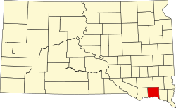
| Counties of South Dakota | |
|---|---|
 | |
| Location | State of South Dakota |
| Number | 66 |
| Populations | 874 (Jones) – 208,639 (Minnehaha) |
| Areas | 412 square miles (1,070 km2) (Clay) – 3,471 square miles (8,990 km2) (Meade) |
| Government | |
| Subdivisions |
|
There are 66 counties in the U.S. state of South Dakota with FIPS codes.
Contents
- Table of counties
- Former names
- Former counties
- Population density map
- See also
- References
- Further reading
Todd County and Oglala Lakota County are the only counties in South Dakota which do not have their own county seats. Hot Springs in Fall River County serves as the administrative center for Oglala Lakota County. Winner in Tripp County serves as the administrative center for Todd County. [1] These are two of six counties in South Dakota which are entirely within an Indian reservation. (The other four counties are Bennett, Corson, Dewey, and Ziebach.)
South Dakota's postal abbreviation is SD and its FIPS state code is 46.