Haakon County, South Dakota

Last updated

Haakon County
HaakonCountyCourthouseSD.jpg
Haakon County Courthouse in Philip
Map of South Dakota highlighting Haakon County.svg
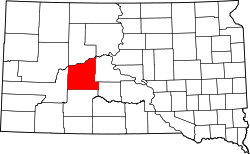
Location within the U.S. state of South Dakota
South Dakota in United States.svg
South Dakota's location within the U.S.
Coordinates: 44°18′N101°32′W / 44.3°N 101.53°W / 44.3; -101.53
CountryFlag of the United States.svg United States
StateFlag of South Dakota.svg  South Dakota
Founded1914 (created)
1915 (organized)
Named for Haakon VII of Norway
Seat Philip
Largest cityPhilip
Area
  Total1,827 sq mi (4,730 km2)
  Land1,811 sq mi (4,690 km2)
  Water16 sq mi (40 km2)  0.9%
Population
 (2020)
  Total1,872
  Estimate 
(2023)
1,851 Decrease2.svg
  Density1.0/sq mi (0.40/km2)
Time zone UTC−7 (Mountain)
  Summer (DST) UTC−6 (MDT)
Congressional district At-large
Website haakon.southdakotadirectors.com

Haakon County[ pronunciation? ] is a county in the U.S. state of South Dakota. As of the 2020 census, the population was 1,872. [1] Its county seat is Philip. [2]

Contents

History

The county was created in 1914 and organized in 1915, [3] and was formed from the original counties of Nowlin and most of Sterling, which had previously been absorbed by Stanley County. It is named for Haakon VII, who became king of Norway in 1905. It is the only county in South Dakota named for a non-American person and is one of only nine counties in South Dakota named for persons who did not live in South Dakota. [4] Most of South Dakota's counties are named for early South Dakota officials or legislators, or for physical features (Fall River and Lake), or are derived from Native American words (Minnehaha and Yankton), or from counties in other states (Jones and Walworth), with one (Aurora) named for a Roman goddess, one for an animal (Buffalo), and one (Union) for a concept.

Geography

The terrain of Haakon County consists of semi-arid rolling hills, carved with gullies and drainages, partially devoted to agriculture. The Cheyenne River, a tributary of the Missouri River, flows northeastward along the county's north boundary line, and the Bad River flows east-northeastward through the lower part of the county, both heading for their discharge points into the Missouri. [5] The terrain slopes to the northeast, and its highest point is near the midpoint of its western boundary line, at 2,802 ft (854 m) ASL. [6]

Haakon County has a total area of 1,827 square miles (4,730 km2), of which 1,811 square miles (4,690 km2) is land and 16 square miles (41 km2) (0.9%) is water. [7]

The eastern portion of South Dakota's counties (48 of 66) observe Central Time; the western counties (18 of 66) observe Mountain Time. Haakon County is the easternmost of the SD counties to observe Mountain Time. [8]

Major highways

Adjacent counties

Protected areas

Lakes

Source: [5]

Demographics

Historical population
CensusPop.Note
1920 4,596
1930 4,6791.8%
1940 3,515−24.9%
1950 3,167−9.9%
1960 3,3034.3%
1970 2,802−15.2%
1980 2,794−0.3%
1990 2,624−6.1%
2000 2,196−16.3%
2010 1,937−11.8%
2020 1,872−3.4%
2023 (est.)1,851 [9] −1.1%
U.S. Decennial Census [10]
1790-1960 [11] 1900-1990 [12]
1990-2000 [13] 2010-2020 [1]

2020 census

As of the 2020 census, there were 1,872 people, 773 households, and 510 families residing in the county. [14] The population density was 1.0 inhabitant per square mile (0.39/km2). There were 931 housing units.

2010 census

As of the 2010 census, there were 1,937 people, 850 households, and 540 families in the county. The population density was 1.1 inhabitants per square mile (0.42/km2). There were 1,013 housing units at an average density of 0.6 per square mile (0.23/km2). The racial makeup of the county was 94.7% white, 1.9% American Indian, 0.4% Asian, 0.2% black or African American, 0.1% Pacific islander, 0.2% from other races, and 2.6% from two or more races. Those of Hispanic or Latino origin made up 0.9% of the population. In terms of ancestry, 45.4% were German, 19.4% were Irish, 17.6% were Norwegian, 8.6% were English, 6.2% were Czech, 5.1% were Dutch, and 1.2% were American.

Of the 850 households, 23.8% had children under the age of 18 living with them, 56.6% were married couples living together, 4.2% had a female householder with no husband present, 36.5% were non-families, and 33.2% of all households were made up of individuals. The average household size was 2.24 and the average family size was 2.86. The median age was 48.8 years.

The median income for a household in the county was $46,281 and the median income for a family was $60,000. Males had a median income of $37,679 versus $22,277 for females. The per capita income for the county was $25,877. About 13.2% of families and 12.5% of the population were below the poverty line, including 14.9% of those under age 18 and 13.7% of those age 65 or over.

Housing cost

In 2007, the average price (in US dollars) for housing was: [15]

Communities

Towns

Unincorporated communities

Source: [5]

Unorganized territories

Politics

The Haakon County voters are reliably Republican. In no national election since 1936 has the county selected the Democratic Party candidate.

United States presidential election results for Haakon County, South Dakota [16]
Year Republican Democratic Third party
No.%No.%No.%
2020 1,02690.24%1059.23%60.53%
2016 93689.66%777.38%312.97%
2012 94086.08%13812.64%141.28%
2008 93981.44%18716.22%272.34%
2004 1,00781.21%21917.66%141.13%
2000 93883.08%16414.53%272.39%
1996 88768.81%28422.03%1189.15%
1992 86065.25%20915.86%24918.89%
1988 95870.91%37928.05%141.04%
1984 1,16882.84%23716.81%50.35%
1980 1,16279.32%25517.41%483.28%
1976 81261.89%47736.36%231.75%
1972 1,02173.14%36626.22%90.64%
1968 75960.96%37730.28%1098.76%
1964 79554.56%66245.44%00.00%
1960 98062.22%59537.78%00.00%
1956 93661.18%59438.82%00.00%
1952 1,17674.81%39625.19%00.00%
1948 75357.92%51939.92%282.15%
1944 63862.61%38137.39%00.00%
1940 1,12961.49%70738.51%00.00%
1936 93347.70%94848.47%753.83%
1932 79735.68%1,24555.73%1928.59%
1928 1,25564.33%66333.98%331.69%
1924 79749.87%31919.96%48230.16%
1920 71349.65%39327.37%33022.98%
1916 39941.05%47548.87%9810.08%

See also

Related Research Articles

<span class="mw-page-title-main">Ziebach County, South Dakota</span> County in South Dakota, United States

Ziebach County is a county in the U.S. state of South Dakota. As of the 2020 census, the population was 2,413. Its county seat is Dupree. It is the last county in the United States alphabetically.

<span class="mw-page-title-main">Walworth County, South Dakota</span> County in South Dakota, United States

Walworth County is a county in the U.S. state of South Dakota. As of the 2020 census, the population was 5,315. Its county seat is Selby. The county was created in 1873 and organized in 1883. It is named for Walworth County, Wisconsin.

<span class="mw-page-title-main">Todd County, South Dakota</span> County in South Dakota, United States

Todd County is a county in the U.S. state of South Dakota. As of the 2020 census, the population was 9,319. Todd County does not have its own county seat. Instead, Winner in neighboring Tripp County serves as its administrative center. Its largest city is Mission. The county was created in 1909, although it remains unorganized. The county was named for John Blair Smith Todd, a delegate from Dakota Territory to the United States House of Representatives and a Civil War general.

<span class="mw-page-title-main">Stanley County, South Dakota</span> County in South Dakota, United States

Stanley County is a county in the U.S. state of South Dakota. As of the 2020 census, the population was 2,980. Its county seat is Fort Pierre. The county was created in 1873, and was organized in 1890. It is named for David S. Stanley, a commander at Fort Sully from 1866 to 1874, which was located nearby.

<span class="mw-page-title-main">Potter County, South Dakota</span> County in South Dakota, United States

Potter County is a county in the U.S. state of South Dakota. As of the 2020 census, the population was 2,472. Its county seat is Gettysburg. The county was created in 1873 and organized in 1883.

<span class="mw-page-title-main">Pennington County, South Dakota</span> County in South Dakota, United States

Pennington County is a county in the U.S. state of South Dakota. As of the 2020 census, the population was 109,222, making it the second most populous county in South Dakota. Its county seat is Rapid City. The county was created in 1875, and was organized in 1877. It is named for John L. Pennington, fifth Governor of Dakota Territory, who held office in 1875 when the county was formed.

<span class="mw-page-title-main">Mellette County, South Dakota</span> County in South Dakota, United States

Mellette County is a county in the U.S. state of South Dakota. As of the 2020 census, the population was 1,918. Its county seat is White River. The county was created in 1909, and was organized in 1911. It was named for Arthur C. Mellette, the last Governor of the Dakota Territory and the first Governor of the state of South Dakota.

<span class="mw-page-title-main">Meade County, South Dakota</span> County in South Dakota, United States

Meade County is a county in the U.S. state of South Dakota. As of the 2020 census, the population was 29,852, making it the 6th most populous county in South Dakota. Its county seat is Sturgis. The county was created in 1889 and named for Fort Meade, which was garrisoned as a United States military post in the area in 1878 and itself named for General George Meade.

<span class="mw-page-title-main">Lawrence County, South Dakota</span> County in South Dakota, United States

Lawrence County is a county in the U.S. state of South Dakota. As of the 2020 census, the population was 25,768, making it the 8th most populous county in South Dakota. Its county seat is Deadwood.

<span class="mw-page-title-main">Jones County, South Dakota</span> County in South Dakota, United States

Jones County is a county in the U.S. state of South Dakota. As of the 2020 census, the population was 917, making it the least populous county in South Dakota. Its county seat is Murdo. Created in 1916 and organized in 1917, it is the most recently established county in South Dakota. It was named after Granville Whittington Jones, an Arkansas-born clergyman/lawyer, who moved to Chamberlain, SD and became a noted Chautauqua speaker.

<span class="mw-page-title-main">Jackson County, South Dakota</span> County in South Dakota, United States

Jackson County is a county in the U.S. state of South Dakota. As of the 2020 census, the population was 2,806. Its county seat is Kadoka. The county was created in 1883, and was organized in 1915. Washabaugh County was merged into Jackson County in 1983.

<span class="mw-page-title-main">Hand County, South Dakota</span> County in South Dakota, United States

Hand County is a county in the U.S. state of South Dakota. As of the 2020 census, the population was 3,145. Its county seat is Miller.

<span class="mw-page-title-main">Hamlin County, South Dakota</span> County in South Dakota, United States

Hamlin County is a county in the U.S. state of South Dakota. As of the 2020 census, the population was 6,164. Its county seat is Hayti. The county was created in 1873 and organized in 1878. It was named for Hannibal Hamlin, Lincoln's first vice-president.

<span class="mw-page-title-main">Dewey County, South Dakota</span> County in South Dakota, United States

Dewey County is a county in the U.S. state of South Dakota. As of the 2020 census, the population was 5,239. Its county seat is Timber Lake. The county was created in 1883 and organized in 1910. It was named for William P. Dewey, Territorial surveyor-general from 1873 to 1877.

<span class="mw-page-title-main">Custer County, South Dakota</span> County in South Dakota, United States

Custer County is a county in the U.S. state of South Dakota. As of the 2020 census, the population was 8,318. Its county seat is Custer. The county was created in 1875, and was organized in 1877.

<span class="mw-page-title-main">Corson County, South Dakota</span> County in South Dakota, United States

Corson County is a county in the U.S. state of South Dakota. As of the 2020 census, the population was 3,902. Its county seat is McIntosh. The county was named for Dighton Corson, a native of Maine, who came to the Black Hills in 1876, and in 1877 began practicing law at Deadwood.

<span class="mw-page-title-main">Campbell County, South Dakota</span> County in South Dakota, United States

Campbell County is a county in the U.S. state of South Dakota. As of the 2020 census, the population was 1,377, making it the fourth-least populous county in South Dakota. Its county seat is Mound City. The county was created in 1873 and organized in 1884. It was named for Norman B. Campbell, a Dakota Territory legislator in 1873 and son of General Charles T. Campbell.

<span class="mw-page-title-main">Buffalo County, South Dakota</span> County in South Dakota, United States

Buffalo County is a county in the U.S. state of South Dakota. As of the 2020 census, the population was 1,948. Its county seat is Gann Valley which, at 10 people, is the least populous county seat in the United States. The county was created in 1864, and was organized in 1871 as part of the Dakota Territory.

<span class="mw-page-title-main">Sioux County, North Dakota</span> County in North Dakota, United States

Sioux County is a county located along the southern border of the U.S. state of North Dakota. As of the 2020 census, the population was 3,898. Its eastern border is the Missouri River and its county seat is Fort Yates.

<span class="mw-page-title-main">Grant County, North Dakota</span> County in North Dakota, United States

Grant County is a county in the U.S. state of North Dakota. As of the 2020 census, the population was 2,301. Its county seat is Carson.

References

  1. 1 2 "State & County QuickFacts". United States Census Bureau. Retrieved March 21, 2024.
  2. "Find a County". National Association of Counties. Retrieved June 7, 2011.
  3. "Dakota Territory, South Dakota, and North Dakota: Individual County Chronologies". Dakota Territory Atlas of Historical County Boundaries. The Newberry Library. 2006. Archived from the original on April 2, 2018. Retrieved March 29, 2015.
  4. Clay, Custer, Douglas, Grant, Hamlin, Lincoln, McPherson, and Meade are the other eight.
  5. 1 2 3 Haakon County SD Google Maps (accessed February 3, 2019)
  6. ""Find an Altitude" Google Maps (accessed February 3, 2019)". Archived from the original on May 21, 2019. Retrieved February 3, 2019.
  7. "2010 Census Gazetteer Files". United States Census Bureau. August 22, 2012. Retrieved March 26, 2015.
  8. Map of Time Zone Line through South Dakota (accessed January 30, 2019)
  9. "County Population Totals and Components of Change: 2020-2023" . Retrieved March 17, 2024.
  10. "U.S. Decennial Census". United States Census Bureau. Retrieved March 26, 2015.
  11. "Historical Census Browser". University of Virginia Library. Retrieved March 26, 2015.
  12. Forstall, Richard L., ed. (March 27, 1995). "Population of Counties by Decennial Census: 1900 to 1990". United States Census Bureau. Retrieved March 26, 2015.
  13. "Census 2000 PHC-T-4. Ranking Tables for Counties: 1990 and 2000" (PDF). United States Census Bureau. April 2, 2001. Archived (PDF) from the original on October 9, 2022. Retrieved March 26, 2015.
  14. "US Census Bureau, Table P16: Household Type". United States Census Bureau. Retrieved March 21, 2024.
  15. "Haakon County, South Dakota detailed profile - houses, real estate, cost of living, wages, work, agriculture, ancestries, and more". www.city-data.com. Retrieved April 15, 2018.
  16. Leip, David. "Atlas of US Presidential Elections". uselectionatlas.org. Retrieved April 15, 2018.

44°18′N101°32′W / 44.30°N 101.53°W / 44.30; -101.53