Platte, South Dakota

Last updated

Platte, South Dakota
Platte, South Dakota- W side Main between 4 and 5 2.JPG
Main Street in Platte, February 2016
Charles Mix County South Dakota Incorporated and Unincorporated areas Platte Highlighted.svg
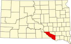
Location in Charles Mix County and the state of South Dakota
Coordinates: 43°23′13″N98°50′36″W / 43.38694°N 98.84333°W / 43.38694; -98.84333
CountryUnited States
State South Dakota
County Charles Mix
Incorporated1907 [1]
Government
  MayorKen VanZee
Area
[2]
  Total1.05 sq mi (2.73 km2)
  Land1.05 sq mi (2.73 km2)
  Water0.00 sq mi (0.00 km2)
Elevation
[3]
1,601 ft (488 m)
Population
 (2020) [4]
  Total1,296
  Density1,230.77/sq mi (475.39/km2)
Time zone UTC−6 (Central (CST))
  Summer (DST) UTC−5 (CDT)
ZIP code
57369
Area code 605
FIPS code 46-50260
GNIS feature ID1267535 [3]
Website http://www.plattesd.org/

Platte is a city in Charles Mix County, South Dakota, United States. The population was 1,311 at the 2022 census. [5] The community is named after the Platte Creek, a tributary of the Missouri River reservoir Lake Francis Case. Platte is located 15 miles east of Lake Francis Case on the Missouri River.

Contents

History

Lewis and Clark were told to watch for ‘burning bluffs’ in the area. [6] Settlement began in the early 1880s. [6] A fur trader named Bernard Pratte once lived at the mouth of what was then known as the ‘Fish Creek’. [6] Pratte's last name was mistakenly transcribed as Platte on an early map of the creek and the spelling error stuck. [7] The town that would become Platte was named after the creek. [7]

For 12 years, Charles Mix County was the only county in the state of South Dakota without a railroad. [8] Platte originated in the summer of 1900 after it was selected as the terminus for a Chicago, Milwaukee, and St. Paul railroad branch line from Yankton. [8] The railroad arrived in October and buildings were moved from the nearby settlements of Castalia, Old Platte, and Edgerton. [8] The Platte Enterprise newspaper was founded in 1900 and is still published today. [7]

The Great Depression and drought of the 1930s led to unemployment and out-migration in the area. [8] A dam was constructed on the Platte Creek during this time. [7] The area became a place for picnics and recreation. [7] In 1956, the Fort Randall Dam was completed creating Lake Francis Case. [8] In 1966, the Platte-Winner Bridge was completed over the lake giving travelers a new route to and from the Black Hills. [8]

Geography

According to the United States Census Bureau, the city has a total area of 1.02 square miles (2.64 km2), all land. [9]

The community is situated at the junction of Routes 44 and 45.

Climate

This climatic region is typified by large seasonal temperature differences, with warm to hot (and often humid) summers and cold (sometimes severely cold) winters. According to the Köppen Climate Classification system, Platte has a humid continental climate, abbreviated "Dfa" on climate maps. [10]

Climate data for Platte, South Dakota
MonthJanFebMarAprMayJunJulAugSepOctNovDecYear
Mean daily maximum °C (°F)−1
(31)
2
(35)
8
(46)
16
(60)
22
(72)
27
(81)
32
(89)
31
(87)
26
(78)
18
(65)
8
(47)
1
(34)
16
(60)
Mean daily minimum °C (°F)−13
(8)
−11
(12)
−6
(22)
2
(35)
7
(45)
13
(56)
16
(61)
15
(59)
9
(49)
3
(37)
−4
(24)
−11
(13)
2
(35)
Average precipitation mm (inches)13
(0.5)
15
(0.6)
33
(1.3)
64
(2.5)
84
(3.3)
97
(3.8)
69
(2.7)
64
(2.5)
48
(1.9)
38
(1.5)
20
(0.8)
13
(0.5)
550
(21.8)
Source: Weatherbase [11]

Demographics

Historical population
CensusPop.Note
1910 1,115
1920 1,24211.4%
1930 1,207−2.8%
1940 1,017−15.7%
1950 1,0695.1%
1960 1,1679.2%
1970 1,35115.8%
1980 1,334−1.3%
1990 1,311−1.7%
2000 1,3674.3%
2010 1,230−10.0%
2020 1,2965.4%
U.S. Decennial Census [12]
2018 Estimate [13] [4]

2010 census

As of the census [14] of 2010, there were 1,230 people, 548 households, and 337 families living in the city. The population density was 1,205.9 inhabitants per square mile (465.6/km2). There were 625 housing units at an average density of 612.7 units per square mile (236.6 units/km2). The racial makeup of the city was 98.5% White, 0.6% Native American, and 0.9% from two or more races. Hispanic or Latino of any race were 0.1% of the population.

There were 548 households, of which 23.0% had children under the age of 18 living with them, 56.6% were married couples living together, 3.5% had a female householder with no husband present, 1.5% had a male householder with no wife present, and 38.5% were non-families. 35.9% of all households were made up of individuals, and 19.5% had someone living alone who was 65 years of age or older. The average household size was 2.16 and the average family size was 2.80.

The median age in the city was 48.6 years. 20.4% of residents were under the age of 18; 6.3% were between the ages of 18 and 24; 19% were from 25 to 44; 25.9% were from 45 to 64; and 28.4% were 65 years of age or older. The gender makeup of the city was 48.4% male and 51.6% female.

2000 census

As of the census of 2000, there were 1,367 people, 587 households, and 363 families living in the city. The population density was 1,364.4 inhabitants per square mile (526.8/km2). There were 637 housing units at an average density of 635.8 units per square mile (245.5 units/km2). The racial makeup of the city was 99.20% White, 0.29% Native American, 0.15% Asian, 0.07% from other races, and 0.29% from two or more races. Hispanic or Latino of any race were 0.66% of the population.

There were 587 households, out of which 26.6% had children under the age of 18 living with them, 56.6% were married couples living together, 3.6% had a female householder with no husband present, and 38.0% were non-families. 37.5% of all households were made up of individuals, and 23.3% had someone living alone who was 65 years of age or older. The average household size was 2.22 and the average family size was 2.95.

In the city, the population was spread out, with 24.2% under the age of 18, 4.8% from 18 to 24, 21.1% from 25 to 44, 20.0% from 45 to 64, and 29.8% who were 65 years of age or older. The median age was 45 years. For every 100 females, there were 89.6 males. For every 100 females age 18 and over, there were 84.3 males.

As of 2000 the median income for a household in the city was $30,369, and the median income for a family was $38,750. Males had a median income of $27,283 versus $19,464 for females. The per capita income for the city was $15,962. About 3.0% of families and 5.4% of the population were below the poverty line, including 3.8% of those under age 18 and 12.0% of those age 65 or over.

See also

Related Research Articles

<span class="mw-page-title-main">Niobrara County, Wyoming</span> County in the United States

Niobrara County is a county in the U.S. state of Wyoming. As of the 2020 United States Census, the population was 2,467, making it the least populous county in Wyoming. Its county seat is Lusk. Its eastern boundary abuts the west lines of the states of Nebraska and South Dakota.

<span class="mw-page-title-main">Dakota, Minnesota</span> City in Minnesota, United States

Dakota is a city in Winona County, Minnesota, United States. The population was 295 at the 2020 census.

<span class="mw-page-title-main">Edgerton, Missouri</span> City in Missouri, United States

Edgerton is a city in northeastern Platte County, Missouri and is part of the Kansas City metropolitan area within the United States. The population was 601 at the 2020 census.

<span class="mw-page-title-main">Tracy, Missouri</span> City in Missouri, United States

Tracy is a city in Platte County, Missouri within the United States, located along the Platte River. The population was 269 at the 2020 census. The city is part of the Kansas City metropolitan area.

<span class="mw-page-title-main">Silver Creek, Nebraska</span> Village in Nebraska, United States

Silver Creek is a village in Merrick County, Nebraska, United States. The population was 320 at the 2020 census. It is part of the Grand Island metropolitan area.

<span class="mw-page-title-main">Tarnov, Nebraska</span> Village in Platte County, Nebraska, United States

Tarnov is a village in Platte County, Nebraska, United States. The population was 46 at the 2010 census.

<span class="mw-page-title-main">Lincoln, North Dakota</span> City in North Dakota, United States

Lincoln is a city in Burleigh County, North Dakota, United States. It is a suburb of adjacent Bismarck, and also a core city of the Bismarck-Mandan Metropolitan Statistical Area. The population was 4,257 at the 2020 census, making it the 15th most populous city in North Dakota. Lincoln was founded in 1977 and incorporated as a city on July 12, 1977.

<span class="mw-page-title-main">Clear Lake, South Dakota</span> City in South Dakota, United States

Clear Lake is a city in and the county seat of Deuel County, South Dakota, United States. The population was 1,218 at the 2020 census.

<span class="mw-page-title-main">Gregory, South Dakota</span> City in South Dakota, United States

Gregory is a city in western Gregory County, South Dakota, United States. The population was 1,221 at the 2020 census.

<span class="mw-page-title-main">Madison, South Dakota</span> City in South Dakota, United States

Madison is a city in Lake County, South Dakota, United States. The population was 6,191 at the 2020 census. It is the county seat of Lake County and is home to Dakota State University.

<span class="mw-page-title-main">Whitewood, South Dakota</span> City in South Dakota, United States

Whitewood is a city in Lawrence County, South Dakota, United States. The population was 879 at the 2020 census.

<span class="mw-page-title-main">Lennox, South Dakota</span> City in South Dakota, United States

Lennox is a city in Lincoln County, South Dakota, United States, located 20 miles (32 km) southwest of Sioux Falls. The population was 2,423 at the 2020 census.

<span class="mw-page-title-main">Leola, South Dakota</span> City in South Dakota, United States

Leola is a small city in and the county seat of McPherson County, South Dakota, United States. It was founded on May 1, 1884, and named for Leola Haynes, daughter of one of the town's founders. The population was 434 as of the 2020 census.

<span class="mw-page-title-main">Crooks, South Dakota</span> City in South Dakota, United States

Crooks is a city in Minnehaha County, South Dakota, United States and is a suburb of Sioux Falls. The population was 1,362 at the 2020 census. Crooks was named New Hope until 1904. The town's present name honors W. A. Crooks, a local politician.

<span class="mw-page-title-main">Valley Springs, South Dakota</span> City in South Dakota, United States

Valley Springs is a city in Minnehaha County, South Dakota, United States. The population was 885 at the 2020 census.

<span class="mw-page-title-main">Colome, South Dakota</span> City in South Dakota, United States

Colome is a city in Tripp County, South Dakota, United States. The population was 331 as of the 2020 census.

<span class="mw-page-title-main">Hamill, South Dakota</span> CDP in South Dakota, United States

Hamill is a rural hamlet in Tripp County, South Dakota, United States. The population was 14 at the 2020 census. There is a post office at Hamill, also two churches and a community hall; otherwise, no businesses or services.

<span class="mw-page-title-main">Lowry, South Dakota</span> Town in South Dakota, United States

Lowry is a town in Walworth County, South Dakota, United States. The population was 10 at the 2020 census. The town is home to Lowry Pilgrim Community Church, Swan Creek Harness Shop, J & C Repair, Karst Service and a fire station. Lowry also has an abandoned school, and a post office, which closed to service in the early 1970s.

<span class="mw-page-title-main">Dearborn, Missouri</span> City in Missouri, United States

Dearborn is a city in Buchanan and Platte counties in the U.S. state of Missouri and is part of the Kansas City metropolitan area. The population was 482 at the 2020 census.

<span class="mw-page-title-main">Newman Grove, Nebraska</span> City in Platte County, Nebraska, United States

Newman Grove is a city in Madison and Platte counties in Nebraska, United States. The population was 667 at the 2020 census.

References

  1. "SD Towns" (PDF). South Dakota State Historical Society . Retrieved February 15, 2010.
  2. "ArcGIS REST Services Directory". United States Census Bureau. Retrieved October 15, 2022.
  3. 1 2 U.S. Geological Survey Geographic Names Information System: Platte, South Dakota
  4. 1 2 "Census Population API". United States Census Bureau. Retrieved October 15, 2022.
  5. "U.S. Census Bureau: Platte city, South Dakota". www.census.gov. United States Census Bureau. Retrieved February 5, 2022.
  6. 1 2 3 "Platte Creek Recreation Area". South Dakota Game, Fish, and Parks. Retrieved March 6, 2013.
  7. 1 2 3 4 5 "Platte Info". King's Inn. Retrieved March 6, 2013.
  8. 1 2 3 4 5 6 "History of Platte" . Retrieved March 6, 2013.
  9. "US Gazetteer files 2010". United States Census Bureau. Archived from the original on July 2, 2012. Retrieved June 21, 2012.
  10. Climate Summary for Platte, South Dakota
  11. "Weatherbase.com". Weatherbase. 2013. Retrieved on October 13, 2013.
  12. United States Census Bureau. "Census of Population and Housing" . Retrieved March 22, 2014.
  13. "Population and Housing Unit Estimates" . Retrieved February 9, 2020.
  14. "U.S. Census website". United States Census Bureau . Retrieved June 21, 2012.