Geddes, South Dakota

Last updated

Geddes
City
Geddes, South Dakota, Main Street, W side, S of 3rd Street 1.JPG
Main Street in Geddes, February 2016
Charles Mix County South Dakota Incorporated and Unincorporated areas Geddes Highlighted.svg
Location in Charles Mix County and the state of South Dakota
Coordinates: 43°15′15″N98°41′51″W / 43.25417°N 98.69750°W / 43.25417; -98.69750
CountryUnited States
State South Dakota
County Charles Mix
Incorporated1900 [1]
Government
  MayorBrady Koopal[ citation needed ]
Area
[2]
  Total0.73 sq mi (1.89 km2)
  Land0.73 sq mi (1.89 km2)
  Water0.00 sq mi (0.00 km2)
Elevation
[3]
1,601 ft (488 m)
Population
 (2020) [4]
  Total156
  Density214.29/sq mi (82.68/km2)
Time zone UTC-6 (Central (CST))
  Summer (DST) UTC-5 (CDT)
ZIP code
57342
Area code 605
FIPS code 46-23980 [5]
GNIS feature ID1267403 [3]

Geddes is a city in central Charles Mix County, South Dakota, United States. The population was 156 at the 2020 census. [6]

Contents

Geddes was laid out in 1900. [7]

Geography

According to the United States Census Bureau, the city has a total area of 0.61 square miles (1.58 km2), all land. [8]

Geddes Historic District

Geddes Historic District
Geddes, South Dakota, building NW corner 3rd and Main from SE 1.JPG
3rd & Main
USA South Dakota location map.svg
Red pog.svg
Usa edcp location map.svg
Red pog.svg
LocationOff SD 50, Geddes, South Dakota
Coordinates 43°15′15″N98°41′43″W / 43.254167°N 98.695278°W / 43.254167; -98.695278
Area100 acres (40 ha)
Built1901
Architectural styleLate Victorian
NRHP reference No. 73001737 [9]
Added to NRHPMay 8, 1973

The Geddes Historic District is a 100 acres (40 ha) historic district which was listed on the National Register of Historic Places in 1973. [9]

Struve Block Geddes, South Dakota, Struve Block from SE 1.JPG
Struve Block

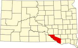
It includes the majority of the historic small town of Geddes, which "stopped growing, for the most part, by 1920," due to factors including the railroad not coming through, and its failure to win the county seat of Charles Mix County. Geddes had tried to wrest the county seat from Wheeler in 1900, 1904, and 1908, [10] and the seat eventually went to Lake Andes, South Dakota (about 15 miles (24 km) away), where Charles Mix County Courthouse was built in 1918. [10]

The oldest building in the district is the Papineau Trading Post, built in 1857 of squared plains cottonwood logs; it is actually probably the oldest building in the entire state of South Dakota. In the 1860;s it was a store, tavern, bawdy house, and county seat of Charles Mix County. It was moved from a few miles away to an open lot in what is now the southern edge of the historic district. [11]

The other contributing buildings were mostly built during 1900-1920. These include:

school (which was replaced in 1925). [11] Numerous private houses, "basically the same as when they were built", are included in the district. [11]

Demographics

Historical population
CensusPop.Note
1910 701
1920 695−0.9%
1930 680−2.2%
1940 581−14.6%
1950 502−13.6%
1960 380−24.3%
1970 308−18.9%
1980 303−1.6%
1990 280−7.6%
2000 252−10.0%
2010 208−17.5%
2020 156−25.0%
U.S. Decennial Census [12] [4]

2010 census

As of the census [13] of 2010, there were 208 people, 110 households, and 57 families residing in the city. The population density was 341.0 inhabitants per square mile (131.7/km2). There were 155 housing units at an average density of 254.1 per square mile (98.1/km2). The racial makeup of the city was 96.2% White, 0.5% Native American, 0.5% Asian, 0.5% from other races, and 2.4% from two or more races. Hispanic or Latino of any race were 1.0% of the population.

There were 110 households, of which 18.2% had children under the age of 18 living with them, 45.5% were married couples living together, 3.6% had a female householder with no husband present, 2.7% had a male householder with no wife present, and 48.2% were non-families. 45.5% of all households were made up of individuals, and 22.7% had someone living alone who was 65 years of age or older. The average household size was 1.89 and the average family size was 2.65.

The median age in the city was 50.6 years. 16.3% of residents were under the age of 18; 4.8% were between the ages of 18 and 24; 22% were from 25 to 44; 30.3% were from 45 to 64; and 26.4% were 65 years of age or older. The gender makeup of the city was 55.8% male and 44.2% female.

2000 census

At the 2000 census, [5] there were 252 people, 122 households and 61 families residing in the city. The population density was 420.4 inhabitants per square mile (162.3/km2). There were 160 housing units at an average density of 266.9 per square mile (103.1/km2). The racial makeup of the city was 98.02% White, 0.79% Native American, 0.40% Asian, 0.79% from other races. Hispanic or Latino of any race were 0.79% of the population.

There were 122 households, of which 22.1% had children under the age of 18 living with them, 41.0% were married couples living together, 4.9% had a female householder with no husband present, and 50.0% were non-families. 49.2% of all households were made up of individuals, and 34.4% had someone living alone who was 65 years of age or older. The average household size was 2.07 and the average family size was 2.98.

19.8% of the population were under the age of 18, 11.9% from 18 to 24, 20.6% from 25 to 44, 15.1% from 45 to 64, and 32.5% who were 65 years of age or older. The median age was 44 years. For every 100 females, there were 90.9 males. For every 100 females age 18 and over, there were 100.0 males.

The median household income was $21,250, and the median family income was $36,250. Males had a median income of $20,938 versus $20,000 for females. The per capita income for the city was $12,520. About 15.5% of families and 13.6% of the population were below the poverty line, including 7.3% of those under the age of eighteen and 23.6% of those 65 or over.

Building on Main Street in Geddes, February 2016 Geddes, South Dakota, building NW corner 3rd and Main from NE 1.JPG
Building on Main Street in Geddes, February 2016

Notable people

See also

Related Research Articles

<span class="mw-page-title-main">Charles Mix County, South Dakota</span> County in South Dakota, United States

Charles Mix County is a county in the U.S. state of South Dakota. As of the 2020 United States Census, the population was 9,373. Its county seat is Lake Andes. The county was created in 1862 and organized in 1879. It was named for Charles Eli Mix, an official of the Bureau of Indian Affairs influential in signing a peace treaty with the local Lakota Indian tribes. The easternmost approximately 60% of the county comprises the Yankton Indian Reservation.

<span class="mw-page-title-main">Dakota City, Iowa</span> City in Iowa, United States

Dakota City is a city in and the county seat of Humboldt County, Iowa, United States. The population was 759 at the time of the 2020 census. Dakota City shares its western border with the much larger city of Humboldt. It is the least populous county seat in Iowa.

<span class="mw-page-title-main">Randolph, Minnesota</span> City in Minnesota, United States

Randolph is a city in Dakota County, Minnesota, United States. The population was 436 at the 2010 census.

<span class="mw-page-title-main">Hettinger, North Dakota</span> City in North Dakota, United States

Hettinger is a city in, and the county seat of, Adams County, North Dakota, United States. The population was 1,074 at the 2020 census.

<span class="mw-page-title-main">Tyndall, South Dakota</span> City in South Dakota, United States

Tyndall is a city in and the county seat of Bon Homme County, South Dakota, United States. The population was 1,057 at the 2020 census.

<span class="mw-page-title-main">Chamberlain, South Dakota</span> City in South Dakota, United States

Chamberlain is a city in Brule County, South Dakota, United States. It is located on the east bank of the Missouri River, at the dammed section of the Lake Francis Case, close to where it is crossed by Interstate 90.

<span class="mw-page-title-main">Lake Andes, South Dakota</span> City in South Dakota, United States

Lake Andes is a city in, and the county seat of, Charles Mix County, South Dakota, United States. The population was 710 at the 2020 census.

<span class="mw-page-title-main">Platte, South Dakota</span> City in South Dakota, United States

Platte is a city in Charles Mix County, South Dakota, United States. The population was 1,311 at the 2022 census. The community is named after the Platte Creek, a tributary of the Missouri River reservoir Lake Francis Case. Platte is located 15 miles east of Lake Francis Case on the Missouri River.

<span class="mw-page-title-main">Wagner, South Dakota</span> City in South Dakota, United States

Wagner is a city in Charles Mix County, South Dakota, United States. The population was 1,490 at the 2020 census. The city is served by Wagner Municipal Airport as well as YST Transit buses.

<span class="mw-page-title-main">Clear Lake, South Dakota</span> City in South Dakota, United States

Clear Lake is a city in and the county seat of Deuel County, South Dakota, United States. The population was 1,218 at the 2020 census.

<span class="mw-page-title-main">Gregory, South Dakota</span> City in South Dakota, United States

Gregory is a city in western Gregory County, South Dakota, United States. The population was 1,221 at the 2020 census.

<span class="mw-page-title-main">Freeman, South Dakota</span> City in South Dakota, United States

Freeman is a city in Hutchinson County, South Dakota, United States. The population was 1,329 at the 2020 census.

<span class="mw-page-title-main">Madison, South Dakota</span> City in South Dakota, United States

Madison is a city in Lake County, South Dakota, United States. The population was 6,191 at the 2020 census. It is the county seat of Lake County and is home to Dakota State University. Mike Dorris is the Mayor

<span class="mw-page-title-main">Lake City, South Dakota</span> Town in South Dakota, United States

Lake City is a town in Marshall County, South Dakota, United States. The population was 45 at the 2020 census. Fort Sisseton Historic State Park, whose fort is listed on the National Register of Historic Places, is located nearby.

<span class="mw-page-title-main">Leola, South Dakota</span> City in South Dakota, United States

Leola is a small city in, and the county seat of, McPherson County, South Dakota, United States. It was founded on May 1, 1884, and named for Leola Haynes, daughter of one of the town's founders. The population was 434 as of the 2020 census.

<span class="mw-page-title-main">Baltic, South Dakota</span> City in South Dakota, United States

Baltic is a city on the Big Sioux River in northern Minnehaha County, South Dakota, United States. The population was 1,246 at the 2020 census.

<span class="mw-page-title-main">Hartford, South Dakota</span> City in South Dakota, United States

Hartford is a suburban American city in Minnehaha County, South Dakota, a few miles northwest of Sioux Falls. Its population was 3,354 at the 2020 census.

<span class="mw-page-title-main">Mission, South Dakota</span> City in South Dakota, United States

Mission is a city on the Rosebud Indian Reservation in northern Todd County, South Dakota, United States. The population was 1,156 at the 2020 census.

<span class="mw-page-title-main">Parker, South Dakota</span> City in South Dakota, U.S.

Parker is a city in Turner County, South Dakota, United States. The population was 1,194 at the 2020 census. It is the county seat of Turner County. Parker is bordered on its eastern side by South Dakota State Highway 19. Its northern side is bordered by South Dakota State Highway 44. Parker is located approximately 8 miles (13 km) northwest of Chancellor, 42 miles (68 km) east of Parkston and 41 miles (66 km) south of Madison.

<span class="mw-page-title-main">Irene, South Dakota</span> City in South Dakota, United States

Irene is a city in Clay, Turner, and Yankton counties in South Dakota, United States. The population was 422 at the 2020 census. The portion of Irene that is located in Turner County is a part of the Sioux Falls, South Dakota metropolitan area, the portion located in Yankton County is part of the Yankton Micropolitan Statistical Area, and the portion located in Clay County is part of both the Vermillion Micropolitan Statistical Area and the Sioux City-Vermillion Combined Statistical Area. Irene is also host to the Irene Rodeo, held every summer.

References

  1. "SD Towns" (PDF). South Dakota State Historical Society. Archived from the original (PDF) on February 10, 2010. Retrieved February 12, 2010.
  2. "ArcGIS REST Services Directory". United States Census Bureau. Retrieved October 15, 2022.
  3. 1 2 U.S. Geological Survey Geographic Names Information System: Geddes, South Dakota
  4. 1 2 "Census Population API". United States Census Bureau. Retrieved October 15, 2022.
  5. 1 2 "U.S. Census website". United States Census Bureau . Retrieved January 31, 2008.
  6. "U.S. Census Bureau: Geddes city, South Dakota". www.census.gov. United States Census Bureau. Retrieved February 5, 2022.
  7. Federal Writers' Project (1940). South Dakota place-names, v.1-3. University of South Dakota. p. 38. Archived from the original on March 15, 2016.
  8. "US Gazetteer files 2010". United States Census Bureau. Archived from the original on January 12, 2012. Retrieved June 21, 2012.
  9. 1 2 "National Register Information System". National Register of Historic Places . National Park Service. November 2, 2013.
  10. 1 2 Mark Hufstetler; Lon Johnson (September 1, 1992). "National Register of Historic Places Registration: Charles Mix County Courthouse". National Park Service . Retrieved August 1, 2022. With 14 photos.
  11. 1 2 3 4 5 6 7 J. Michael Peterson (March 26, 1973). "National Register of Historic Places Inventory/Nomination: Geddes Historic District". National Park Service . Retrieved August 1, 2022. With aerial photo from 1955 and others from c.1972
  12. "Census of Population and Housing". Census.gov. Retrieved June 4, 2015.
  13. "U.S. Census website". United States Census Bureau . Retrieved June 21, 2012.
  14. Barone, Michael; Ujifusa, Grant (1987). The Almanac of American Politics 1988. National Journal. p. 703.

Commons-logo.svg Media related to Geddes, South Dakota at Wikimedia Commons