Marty, South Dakota

Last updated

Marty, South Dakota
CDP
Charles Mix County South Dakota Incorporated and Unincorporated areas Marty Highlighted.svg
Location in Charles Mix County and the state of South Dakota
Coordinates: 42°59′47″N98°25′49″W / 42.99639°N 98.43028°W / 42.99639; -98.43028
CountryUnited States
State South Dakota
County Charles Mix
Area
[1]
  Total3.22 sq mi (8.35 km2)
  Land3.22 sq mi (8.35 km2)
  Water0.00 sq mi (0.00 km2)
Elevation
[2]
1,447 ft (441 m)
Population
 (2020) [3]
  Total677
  Density209.99/sq mi (81.09/km2)
Time zone UTC-6 (Central (CST))
  Summer (DST) UTC-5 (CDT)
ZIP code
57361
Area code 605
FIPS code 46-41180 [4]
GNIS feature ID2393121 [2]

Marty is a census-designated place (CDP) in southern Charles Mix County, South Dakota, United States. The population was 677 at the 2020 census. [5]

Contents

The community has the name of Bishop Martin Marty, the Bishop of Sioux Falls, SD. [6] The community is referred to as Ṡinasapa in Dakota language of the native Yankton Sioux Tribe. [7]

YST Transit buses connect the community to Wagner, Lake Andes and Ravinia.

Geography

Marty Indian School, February 2016 Marty Indian School, S portion, from SE 1.JPG
Marty Indian School, February 2016

Marty is located within Yankton Sioux Tribe's reservation. [8]

According to the United States Census Bureau, the CDP has a total area of 3.2 square miles (8.3 km2), all land.

Demographics

Historical population
CensusPop.Note
2020 677
U.S. Decennial Census [9]

As of the census [4] of 2000, there were 421 people, 96 households, and 79 families residing in the CDP. The population density was 129.7 inhabitants per square mile (50.1/km2). There were 106 housing units at an average density of 32.7 per square mile (12.6/km2). The racial makeup of the CDP was 4.51% White, 0.24% African American, 90.26% Native American, 1.66% from other races, and 3.33% from two or more races. Hispanic or Latino of any race were 8.08% of the population.

There were 96 households, out of which 58.3% had children under the age of 18 living with them, 21.9% were married couples living together, 43.8% had a female householder with no husband present, and 16.7% were non-families. 16.7% of all households were made up of individuals, and 4.2% had someone living alone who was 65 years of age or older. The average household size was 4.33 and the average family size was 4.55.

In the CDP, the population was spread out, with 46.6% under the age of 18, 13.3% from 18 to 24, 23.0% from 25 to 44, 11.6% from 45 to 64, and 5.5% who were 65 years of age or older. The median age was 20 years. For every 100 females, there were 102.4 males. For every 100 females age 18 and over, there were 99.1 males.

The median income for a household in the CDP was $18,750, and the median income for a family was $23,750. Males had a median income of $16,964 versus $26,250 for females. The per capita income for the CDP was $5,917. About 43.1% of families and 40.9% of the population were below the poverty line, including 44.2% of those under age 18 and 25.0% of those age 65 or over.

Education

Marty Indian School, a tribal boarding K-12 school affiliated with the Bureau of Indian Education (BIE), is in Marty.

The local school district is Tripp-Delmont School District 33-5. [10]

See also

Related Research Articles

<span class="mw-page-title-main">Cannon Ball, North Dakota</span> CDP in Standing Rock Indian Reservation, United States

Cannon Ball is a census-designated place (CDP) on the Standing Rock Indian Reservation and in Sioux County, North Dakota, United States. It is located in the northeastern part of Sioux County, having developed at the confluence of the Cannonball River and Lake Oahe of the Missouri River. The population was 875 at the 2010 census.

<span class="mw-page-title-main">Allen, South Dakota</span> CDP in South Dakota, United States

Allen is a census-designated place on the Pine Ridge Indian Reservation in Bennett County, South Dakota, United States, that was named for the Allen Township, which it encompasses. As of the 2020 census, the CDP had a population of 460. It is one of two places which are closest to the North American continental pole of inaccessibility.

<span class="mw-page-title-main">Springfield, South Dakota</span> City in South Dakota, United States

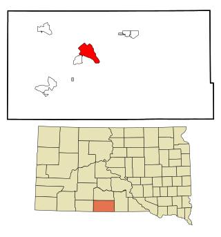
Springfield is a city in Bon Homme County, South Dakota, United States. The population was 1,914 at the 2020 census. As of 2012, about 1,200 of the residents were inmates at Mike Durfee State Prison.

<span class="mw-page-title-main">Fort Thompson, South Dakota</span> CDP in South Dakota, United States

Fort Thompson is a census-designated place (CDP) in Buffalo County, South Dakota, United States. The population was 1,282 at the 2010 census, making it the largest settlement on the Crow Creek Reservation.

<span class="mw-page-title-main">Lake Andes, South Dakota</span> City in South Dakota, United States

Lake Andes is a city in, and the county seat of, Charles Mix County, South Dakota, United States. The population was 710 at the 2020 census.

<span class="mw-page-title-main">La Plant, South Dakota</span> Census-designated place in South Dakota, United States

La Plant is a census-designated place (CDP) in Dewey County, South Dakota, United States. The population was 167 at the 2020 census. It is within the Cheyenne River Indian Reservation.

<span class="mw-page-title-main">Lower Brule, South Dakota</span> Census-designated place in South Dakota, United States

Lower Brule is a census-designated place (CDP) in Lyman County, South Dakota, United States. The population was 703 at the 2020 census. The community is located within the Lower Brule Indian Reservation, from which it takes its name.

<span class="mw-page-title-main">Flandreau, South Dakota</span> City in South Dakota, United States

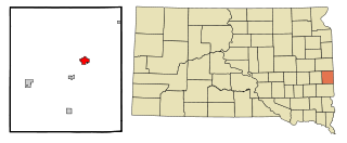
FlandreauFLAN-droo is a city in and county seat of Moody County, South Dakota, United States. The population was 2,372 at the 2020 census. It was named in honor of Charles Eugene Flandrau, a judge in the territory and state of Minnesota. He is credited with saving the community of New Ulm, Minnesota, from destruction during conflict with the Sioux tribe in 1862.

<span class="mw-page-title-main">Sisseton, South Dakota</span> City in South Dakota, United States

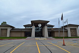
Sisseton is a city in Roberts County, South Dakota, United States. The population was 2,479 at the 2020 census. It is the county seat of Roberts County. Sisseton is the home to a number of tourist attractions, including the Nicollet Tower, and is near the "Song to the Great Spirit" building on the Sisseton Wahpeton College campus. The city is named for the Sisseton division of the Native American Sioux. It also serves as an important part of the Lake Traverse Indian Reservation.

<span class="mw-page-title-main">Oglala, South Dakota</span> CDP in South Dakota, United States

Oglala is a census-designated place (CDP) in West Oglala Lakota Unorganized Territory equivalent, Oglala Lakota County, South Dakota, United States. The population was 1,282 at the 2020 census. Its location is in the northwest of the Pine Ridge Indian Reservation.

<span class="mw-page-title-main">Pine Ridge, South Dakota</span> CDP in South Dakota, United States

Pine Ridge is a census-designated place (CDP) and the most populous community in Oglala Lakota County, South Dakota, United States. The population was 3,138 at the 2020 census. It is the tribal headquarters of the Oglala Sioux Tribe on the Pine Ridge Indian Reservation.

<span class="mw-page-title-main">Porcupine, South Dakota</span> CDP in South Dakota, United States

Porcupine is a census-designated place (CDP) in Oglala Lakota County, South Dakota, United States. The population was 925 at the 2020 census.

<span class="mw-page-title-main">Wounded Knee, South Dakota</span> CDP in South Dakota, United States

Wounded Knee is a census-designated place (CDP) on the Pine Ridge Indian Reservation in Oglala Lakota County, South Dakota, United States. The population was 364 at the 2020 census.

<span class="mw-page-title-main">Mission, South Dakota</span> City in South Dakota, United States

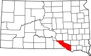
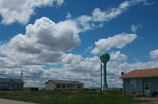
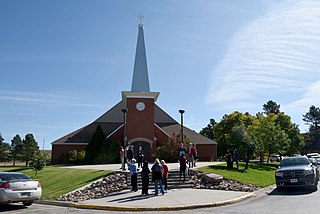
Mission is a city on the Rosebud Indian Reservation in northern Todd County, South Dakota, United States. The population was 1,156 at the 2020 census.

<span class="mw-page-title-main">Rosebud, South Dakota</span> CDP in South Dakota, United States

Rosebud also Sicanġu is a census-designated place (CDP) in Todd County, South Dakota, United States. The population was 1,455 at the 2020 census.

<span class="mw-page-title-main">Elk Point, South Dakota</span> City in South Dakota, United States

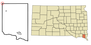
Elk Point is a city in and county seat of Union County, South Dakota, United States. The population was 2,149 as of the 2020 census.

<span class="mw-page-title-main">North Sioux City, South Dakota</span> City in South Dakota, United States

North Sioux City is a city in Union County, South Dakota, United States. The population was 3,042 at the 2020 census. It is part of the Sioux City, IA-NE-SD Metropolitan Statistical Area.

<span class="mw-page-title-main">Yankton, South Dakota</span> City in South Dakota, United States

Yankton is a city in and the county seat of Yankton County, South Dakota, United States.

<span class="mw-page-title-main">Irene, South Dakota</span> City in South Dakota, United States

Irene is a city in Clay, Turner, and Yankton counties in South Dakota, United States. The population was 422 at the 2020 census. The portion of Irene that is located in Turner County is a part of the Sioux Falls, South Dakota metropolitan area, the portion located in Yankton County is part of the Yankton Micropolitan Statistical Area, and the portion located in Clay County is part of both the Vermillion Micropolitan Statistical Area and the Sioux City-Vermillion Combined Statistical Area. Irene is also host to the Irene Rodeo, held every summer.

<span class="mw-page-title-main">Eagle Butte, South Dakota</span> City in South Dakota, United States

Eagle Butte is a city in Dewey and Ziebach counties in South Dakota, United States. The population was 1,258 at the 2020 census.

References

  1. "ArcGIS REST Services Directory". United States Census Bureau. Retrieved October 15, 2022.
  2. 1 2 U.S. Geological Survey Geographic Names Information System: Marty, South Dakota
  3. "Census Population API". United States Census Bureau. Retrieved October 15, 2022.
  4. 1 2 "U.S. Census website". United States Census Bureau . Retrieved January 31, 2008.
  5. "U.S. Census Bureau: Marty CDP, South Dakota". www.census.gov. United States Census Bureau. Retrieved February 5, 2022.
  6. Federal Writers' Project (1940). South Dakota place-names, v.1-3. University of South Dakota. p. 50.
  7. SISSETON-WAHPETON OYATE DAKOTAH LANGUAGE INSTITUTE, Dakota online dictionary - beta, "Marty" Link
  8. US Census, 2020 CENSUS - TRIBAL TRACT MAP (INDEX): Yankton Reservation Link
  9. "Census of Population and Housing". Census.gov. Retrieved June 4, 2016.
  10. "2020 CENSUS - SCHOOL DISTRICT REFERENCE MAP: Charles Mix County, SD" (PDF). U.S. Census Bureau . Retrieved August 6, 2021.

Commons-logo.svg Media related to Marty, South Dakota at Wikimedia Commons