List of census-designated places in South Dakota

Last updated

Map of the United States with South Dakota highlighted South Dakota in United States.svg
Map of the United States with South Dakota highlighted

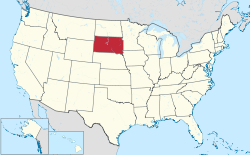
Census-designated places (CDPs) are unincorporated communities lacking elected municipal officers and boundaries with legal status. [1] South Dakota has 79 census designated places.

Census-designated places

RankCDPPopulationCounty
1 Rapid Valley 8,260 Pennington
2 Pine Ridge 3,308 Oglala Lakota
3 Black Hawk 2,892 Meade
4 Dakota Dunes 2,540 Union
5 Colonial Pine Hills 2,493 Pennington
6 North Spearfish 2,221 Lawrence
7 North Eagle Butte 1,954 Dewey
8 Rosebud 1,587 Todd
9 Oglala 1,290 Oglala Lakota
10 Fort Thompson 1,282 Buffalo
11 Porcupine 1,062 Oglala Lakota
12 Green Valley 928 Pennington
13 Kyle 846 Oglala Lakota
14 Antelope 826 Todd
15 Ashland Heights 754 Pennington
16 Wanblee 725 Jackson
17 Lake Madison 683 Lake
18 Johnson Siding 659 Pennington
19 Manderson-White Horse Creek 626 Oglala Lakota
20 Lower Brule 613 Lyman
21 Shindler 584 Lincoln
22 Parmelee 562 Todd
23 Meadow View Addition 538 Minnehaha
24 Goodwill 513 Roberts
25 Lake Poinsett 493 Hamlin
26 Blucksberg Mountain 462 Meade
27 Allen 420 Bennett
28 Marty 402 Charles Mix
29 Wounded Knee 382 Oglala Lakota
30 Anderson 371 Minnehaha
31 Bullhead 348 Corson
32 Little Eagle 319 Corson
33 Pine Lakes Addition 314 Minnehaha
34 Renner Corner 305 Minnehaha
35 White Horse 276 Todd
36 Okreek 269 Todd
37 Spring Creek 268 Todd
38 Chester 261 Lake
39 Soldier Creek 227 Todd
40 Two Strike 209 Todd
41 Long Hollow 192 Roberts
42 St. Onge 191 Lawrence
43 Agency Village 181 Roberts
44 Bath 172 Brown
45 La Plant 171 Dewey
46 Brant Lake 159 Lake
47 Norris 152 Mellette
48 Whitehorse 141 Dewey
49 Vale 136 Butte
50 Vivian 119 Lyman
51 Corn Creek 105 Mellette
52 Morningside 105 Beadle
53 Mansfield 93 Brown
Spink
54 Richland 89 Union
55 New Holland 76 Douglas
56 Forestburg 73 Sanborn
57 Kidder 57 Marshall
58 Harrison 52 Douglas
59 Winfred 52 Lake
60 Bath Corner 49 Brown
61 Kaylor 47 Hutchinson
62 Ferney 43 Brown
63 Fedora 37 Miner
64 Waverly 37 Codington
65 Okaton 36 Jones
66 Running Water 36 Bon Homme
67 Green Grass 35 Dewey
68 Loomis 34 Davison
69 Cow Creek 30 Sully
70 Prairie City 23 Perkins
71 Crocker 19 Clark
72 Gann Valley † 14 Buffalo
73 Ola 13 Brule
74 Aurora Center 12 Aurora
75 Hamill 11 Tripp
76 St. Charles 11 Gregory
77 Milltown 10 Hutchinson
78 Bijou Hills 6 Brule
79 Storla 6 Aurora

Related Research Articles

A census-designated place (CDP) is a concentration of population defined by the United States Census Bureau for statistical purposes only.

<span class="mw-page-title-main">Lynchburg metropolitan area</span> Metropolitan Statistical Area in Virginia, United States

The Lynchburg Metropolitan Statistical Area is a United States Metropolitan Statistical Area (MSA) in the state of Virginia, as defined by the Office of Management and Budget (OMB) as of June 2003. As of the 2000 census, the MSA had a population of 228,616. In 2009 this was estimated to have risen to 247,447; as of 2016, the Lynchburg MSA was estimated to have a population of 260,320, making it the fifth-largest metro area in the state.

<span class="mw-page-title-main">Roanoke metropolitan area</span> Metropolitan area in Virginia, United States

The Roanoke Metropolitan Statistical Area is a Metropolitan Statistical Area (MSA) in Virginia as defined by the United States Office of Management and Budget (OMB). The Roanoke MSA is sometimes referred to as the Roanoke Valley, even though the Roanoke MSA occupies a larger area than the Roanoke Valley. It is geographically similar to the area known as the Roanoke Region of Virginia, but while the latter includes Alleghany County, the former does not. As of the 2020 census, the MSA had a population of 315,251.

<span class="mw-page-title-main">Winchester, VA–WV MSA</span> Metropolitan area in the United States

Winchester, VA–WV MSA is a U.S. metropolitan statistical area (MSA) as defined by the United States Office of Management and Budget (OMB) as of June, 2003. This should not be confused with the City of Winchester, Virginia, the most populous community within this MSA. The population of the MSA as the 2015 U.S. Census Bureau estimates is 133,836.

<span class="mw-page-title-main">Fort Smith metropolitan area</span> Metropolitan area in the United States

The Fort Smith Metropolitan Statistical Area, as defined by the United States Census Bureau, is a five-county area including three Arkansas counties and two Oklahoma counties, and anchored by the city of Fort Smith, Arkansas. The total MSA population in 2000 was 273,170 people, estimated by the Bureau to have grown to 289,693 people by 2007.

<span class="mw-page-title-main">Baton Rouge metropolitan area</span> Metropolitan area in Louisiana, United States

The Baton Rouge metropolitan statistical area, as defined by the United States Office of Management and Budget, or simply the Baton Rouge metropolitan area or Greater Baton Rouge, is a sprawling metropolitan statistical area surrounding the city of Baton Rouge. Including the western edge of the Florida Parishes regions, it is known as "Plantation Country", the "Capital Region", and "The 225". At the 2010 U.S. census, the metropolitan area had a population of 802,484, up from 705,973 in 2000. At the 2020 census, its population increased to 870,569, up from 2020 estimates at 858,571.

The Charleston Metropolitan Statistical Area, as defined by the United States Census Bureau, is an area consisting of three counties in West Virginia, anchored by the city of Charleston. It is the largest metropolitan area entirely within the state of West Virginia. While the Huntington Metro Area is more populous, it spans three states, and the core county of the Charleston area, Kanawha County, is more populous than the West Virginia portion of the Huntington area.

The following is a set–index article, providing a list of lists, for the cities, towns and villages within the jurisdictional United States. It is divided, alphabetically, according to the state, territory, or district name in which they are located.

<span class="mw-page-title-main">Knoxville metropolitan area</span> Metropolitan area in Tennessee, United States

The Knoxville metropolitan area, commonly known as Greater Knoxville, is a metropolitan statistical area (MSA) centered on Knoxville, Tennessee, the third largest city in Tennessee and the largest city in East Tennessee. It is the third largest metropolitan area in Tennessee. In 2020, the Knoxville metro area had a population of 879,773, and a population of 903,300 including Grainger County. The Knoxville–Morristown–Sevierville Combined Statistical Area (CSA) had a population of 1,156,861 according to the census bureau in 2020.

The Parkersburg–Vienna metropolitan area, officially the Parkersburg–Vienna, WV Metropolitan Statistical Area as defined by the United States Census Bureau, is an area consisting of two counties in West Virginia, anchored by the cities of Parkersburg and Vienna. As of the 2020 census, the MSA had a population of 89,490. Prior to the 2020 census, the metro area included the city of Marietta, Ohio and Washington County, which has since been redefined as its own micropolitan area. They now form the Parkersburg–Marietta–Vienna, WV-OH Combined Statistical Area.

A designated place (DPL) is a type of community or settlement identified by Statistics Canada that does not meet the criteria used to define municipalities or population centres. DPLs are delineated every 5 years for the Canadian census as the statistical counterparts of incorporated places such as cities, towns, and villages.

The Salisbury, MD-DE Metropolitan Statistical Area is a United States Census Bureau-designated metropolitan area centered in and around Salisbury, Maryland, including four counties: Somerset, Wicomico, and Worcester in Maryland; and Sussex in Delaware.

<span class="mw-page-title-main">Wenatchee–East Wenatchee metropolitan area</span> Metropolitan statistical area in Washington, United States

The Wenatchee–East Wenatchee Metropolitan Statistical Area, as defined by the United States Census Bureau, is an area consisting of Chelan and Douglas Counties in Washington state, anchored by the cities of Wenatchee and East Wenatchee. According to the 2000 census the MSA had a population of 99,219. The 2010 census showed the MSA had a population increase of 11.76% to 110,884. As of 2015, the Wenatchee Metropolitan Statistical Area was the 331st largest MSA in the United States.

<span class="mw-page-title-main">Salem Metropolitan Statistical Area</span> Metropolitan statistical area in Oregon, US

The Salem Metropolitan Statistical Area (MSA), as defined by the United States Census Bureau, is a Metropolitan Statistical Area consisting of two counties in western Oregon, Marion and Polk. The principal city is Salem, the state capital, which has a population of 175,535. The Salem MSA had a population of 433,353 at the 2020 census. In 2010, there were 390,738 people living in the Salem MSA. In 2000, the MSA had a population of 347,214, and had a population of 278,024 according to the 1990 census.

Mohrsville is a census-designated place in Centre Township, Berks County, Pennsylvania, United States. It is located approximately three miles south of the borough of Shoemakersville, along the Schuylkill River. As of the 2010 census, the population was 383 residents.

References

  1. "Geographic Terms and Concepts– Place". United States Census Bureau. United States Department of Commerce. Retrieved February 24, 2014.