List of census-designated places in Delaware

Last updated

Map of the United States with Delaware highlighted Delaware in United States (zoom).svg
Map of the United States with Delaware highlighted

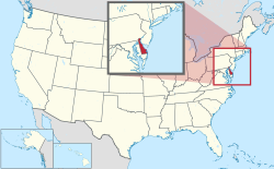
This is a list of census-designated places in Delaware. The United States Census Bureau defines census-designated places as unincorporated communities lacking elected municipal officers and boundaries with legal status. [1]

Contents

As of the 2020 census, Delaware has 22 census-designated places, [2] up from 19 in the 2010 census. [3]

Census-designated places

Name County Population
(2020) [4]
Area (2020) [2] Coordinates [2]
sq mikm2
Bear New Castle 23,0605.7815.0 39°37′45″N75°39′30″W / 39.62917°N 75.65833°W / 39.62917; -75.65833
Brookside New Castle 14,9743.8910.1 39°40′01″N75°43′37″W / 39.66694°N 75.72694°W / 39.66694; -75.72694
Claymont New Castle 9,8952.155.6 39°48′02″N75°27′35″W / 39.80056°N 75.45972°W / 39.80056; -75.45972
Dover Base Housing Kent 2,8100.71.8 39°07′42″N75°27′53″W / 39.12833°N 75.46472°W / 39.12833; -75.46472
Edgemoor New Castle 6,6352.185.6 39°45′00″N75°29′59″W / 39.75000°N 75.49972°W / 39.75000; -75.49972
Glasgow New Castle 15,2889.9325.7 39°36′17″N75°44′43″W / 39.60472°N 75.74528°W / 39.60472; -75.74528
Greenville New Castle 3,1042.817.3 39°46′44″N75°35′54″W / 39.77889°N 75.59833°W / 39.77889; -75.59833
Highland Acres Kent 3,4921.513.9 39°07′15″N75°31′19″W / 39.12083°N 75.52194°W / 39.12083; -75.52194
Hockessin New Castle 13,47810.0526.0 39°47′15″N75°41′48″W / 39.78750°N 75.69667°W / 39.78750; -75.69667
Kent Acres Kent 2,1440.932.4 39°07′54″N75°31′30″W / 39.13167°N 75.52500°W / 39.13167; -75.52500
Lincoln Sussex 8942.817.3 38°52′11″N75°25′23″W / 38.86972°N 75.42306°W / 38.86972; -75.42306
Long Neck Sussex 3,0173.138.1 38°37′12″N75°09′03″W / 38.62000°N 75.15083°W / 38.62000; -75.15083
North Star New Castle 8,0566.8017.6 39°45′40″N75°43′09″W / 39.76111°N 75.71917°W / 39.76111; -75.71917
Pike Creek New Castle 7,8082.697.0 39°43′51″N75°42′15″W / 39.73083°N 75.70417°W / 39.73083; -75.70417
Pike Creek Valley New Castle 11,6922.877.4 39°44′10″N75°41′54″W / 39.73611°N 75.69833°W / 39.73611; -75.69833
Port Penn New Castle 1620.51.3 39°31′00″N75°34′36″W / 39.51667°N 75.57667°W / 39.51667; -75.57667
Rising Sun-Lebanon Kent 4,1043.619.3 39°05′59″N75°30′18″W / 39.09972°N 75.50500°W / 39.09972; -75.50500
Riverview Kent 2,4583.699.6 39°01′35″N75°30′39″W / 39.02639°N 75.51083°W / 39.02639; -75.51083
Rodney Village Kent 1,4890.591.5 39°07′55″N75°31′57″W / 39.13194°N 75.53250°W / 39.13194; -75.53250
Saint Georges New Castle 1,9571.453.8 39°33′18″N75°39′01″W / 39.55500°N 75.65028°W / 39.55500; -75.65028
Wilmington Manor New Castle 8,1621.634.2 39°41′12″N75°35′04″W / 39.68667°N 75.58444°W / 39.68667; -75.58444
Woodside East Kent 2,5701.714.4 39°04′03″N75°32′15″W / 39.06750°N 75.53750°W / 39.06750; -75.53750

See also

References

  1. "Geographic Terms and Concepts– Place". United States Census Bureau . United States Department of Commerce.
  2. 1 2 3 "Places: Delaware". 2010 United States Census . United States Census Bureau . Retrieved January 17, 2022.
  3. "2010 Census Gazetteer Files". 2010 United States Census . United States Census Bureau . Retrieved January 15, 2022.
  4. "Explore Census Data". United States Census Bureau . Retrieved January 18, 2022.