Census-designated places in North Carolina
This is a list of census-designated places in the U.S. state of North Carolina .
Census-designated places (CDPs) are unincorporated communities lacking elected municipal officers and boundaries with legal status. [1] The term "census designated place" has been used as an official classification by the U.S. Census Bureau since 1980. [2] Prior to that, select unincorporated communities were surveyed in the U.S. Census. [2]
| CDP | County | Location of County | Population (2020) | Population (2010) | Population (2000) | Population (1990) [3] | Population (1980) | Notes |
|---|---|---|---|---|---|---|---|---|
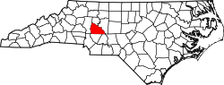
| Altamahaw-Ossipee | Alamance |  | x | x | 1,061 | 1,076 | Split prior to the 2010 census into Altamahaw CDP and the town of Ossipee | |
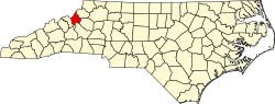
| Badin | Stanly |  | x | x | x | 1,481 | Incorporated prior to the 2000 census | |
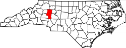
| Boger City | Lincoln |  | x | x | 554 | 1,373 | Annexed by Lincolnton; no longer listed as a CDP after the 2000 census | |
| Bonnie Doone | Cumberland |  | x | x | x | 3,893 | Annexed by Fayetteville; not listed as a CDP in the 2000 census | |
| Butner | Granville |  | x | x | 7,591 | 4,679 | Incorporated prior to the 2010 census | |
| Camp Lejeune Central | Onslow |  | x | x | x | 36,716 | Annexed by Jacksonville prior to the 2000 census | |
| Eastover | Cumberland | | x | x | 1,376 | 1,243 | Incorporated prior to the 2010 census | |
| Fort Bragg | Cumberland Hoke |  | x | x | 29,183 | 34,744 | Annexed by Fayetteville; not listed as a CDP in the 2010 census | |
| Hemby Bridge | Union |  | x | x | x | 2,876 | Incorporated prior to the 2000 census | |
| Lewisville | Forsyth | 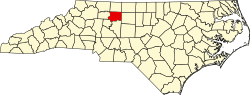 | x | x | x | 3,206 | Incorporated prior to the 2000 census | |
| Masonboro | New Hanover | 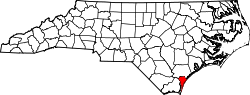 | x | x | 11,812 | 7,010 | Annexed by Wilmington after the 2000 census | |
| New Hope | Wake | 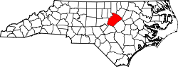 | x | x | x | 5,694 | Annexed by Raleigh prior to the 2000 census | |
| New River Station | Onslow | | x | x | x | 9,732 | Annexed by Jacksonville prior to the 2000 census | |
| North Hickory | Catawba |  | x | x | x | 4,299 | Annexed by Hickory prior to the 2000 census | |
| Parkwood | Durham |  | x | x | x | 4,123 | Annexed by Durham prior to the 2000 census | |
| Pleasant Garden | Guilford |  | x | x | x | 2,228 | Incorporated prior to the 2000 census | |
| Pope AFB | Cumberland | | x | x | 2,583 | 2,228 | Annexed by Fayetteville prior to the 2010 census | |
| Poplar Tent | Cabarrus |  | x | x | x | 3,872 | Annexed by Concord prior to the 2000 census | |
| Seagate | New Hanover | | x | x | 4,590 | 5,444 | Annexed by Wilmington after the 2000 census | |
| Sedge Garden | Forsyth | | x | x | x | 2,784 | Annexed by Winston-Salem prior to the 2000 census | |
| Sherrills Ford | Catawba | | x | x | 941 | 3,185 | Merged into the Lake Norman of Catawba CDP for the 2010 census | |
| Smith Creek | New Hanover | | x | x | x | 7,461 | Annexed by Wilmington prior to the 2000 census | |
| South Gastonia | Gaston |  | x | x | 5,433 | 5,487 | Annexed by Gastonia; last appeared in the 2000 census | |