
Sparks is a town in Cook County, Georgia, United States. The population was 2,052 at the 2010 census, and 2,043 in 2020.

Elizaville is a census-designated place and unincorporated community in Fleming County, Kentucky, United States. Its population was 181 as of the 2010 census. Elizaville is located at the junction of Kentucky Route 32 and Kentucky Route 170, 5 miles (8.0 km) west of Flemingsburg. Elizaville has a post office with ZIP code 41037.
Whitmer is a census-designated place (CDP) in Randolph County, West Virginia, United States. It is 7.5 miles (12.1 km) south-southwest of Harman and is situated on the Dry Fork Cheat River. Whitmer had a post office, which closed on May 21, 2011. As of the 2010 census, its population was 106.
Searles is an unincorporated community and census-designated place in Brown County, Minnesota, United States. Searles is located on Minnesota State Highway 15, 6 miles (9.7 km) south of New Ulm. Searles has a post office with ZIP code 56084. As of the 2010 census, its population was 171.
Lake George is an unincorporated community and census-designated place (CDP) in Lake George Township, Hubbard County, Minnesota, United States. As of the 2010 census, its population was 230.
Chauncey is a census-designated place (CDP) in Logan County, West Virginia, United States. Chauncey is located along West Virginia Route 44 and Island Creek, 5.5 miles (8.9 km) south of Logan. Chauncey had a post office, which opened on August 23, 1913, and closed on June 27, 2009. As of the 2010 census, its population is 283.
Salvisa is a census-designated place in Mercer County, Kentucky, United States. Its population was 420 as of the 2010 census. Salvisa is located at the junction of U.S. Route 127 and Kentucky Route 1987, 10.7 miles (17.2 km) north of Harrodsburg. Salvisa has a post office with ZIP code 40372, which opened on April 4, 1825.
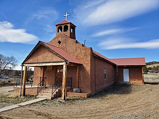
Coyote is a village in Rio Arriba County, New Mexico, United States. Its population was 128 as of the 2010 census. Coyote has a post office with ZIP code 87012, a store, a gas station and a school. New Mexico State Road 96 passes through the community. Coyote was settled in 1862. The village is part of a larger census-designated place which is named after it.
Cordova is a census-designated place in Rio Arriba County, New Mexico, United States.
Maury is an unincorporated community and census-designated place (CDP) in Greene County, North Carolina, United States. Its population was 1,685 as of the 2010 census. Maury has a post office with ZIP code 28554. North Carolina Highway 123 and North Carolina Highway 903 intersect in the community.
Caroleen is an unincorporated community and census-designated place (CDP) in southeastern Rutherford County, North Carolina, United States. Its population was 652 as of the 2010 census. Caroleen has a post office with ZIP code 28019. U.S. Route 221 Alternate passes through the community.
Cliffside is an unincorporated community and census-designated place (CDP) in southeastern Rutherford County, North Carolina, United States. Its population was 611 as of the 2010 census. Cliffside has a post office with ZIP code 28024. U.S. Route 221 Alternate and North Carolina Highway 120 pass through the community.
Bell Arthur is an unincorporated community and census-designated place (CDP) in Pitt County, North Carolina, United States. Its population was 466 as of the 2010 census. Bell Arthur has a post office with ZIP code 27811.

South Mills is an unincorporated community and census-designated place (CDP) in Camden County, North Carolina, United States. Its population was 454 as of the 2010 census. South Mills has a post office with ZIP code 27976, which opened on March 2, 1840. The community is located near U.S. Route 17, and U.S. Route 17 Business and North Carolina Highway 343, and future Interstate 87 pass through the community.

Costilla is a census-designated place in Taos County, New Mexico, United States. Its population was 205 as of the 2010 census. Costilla has a post office with ZIP code 87524. State roads 196 and 522 intersect in the community.
Los Ojos is a census-designated place (CDP) in Rio Arriba County, New Mexico, United States. Its population was 125 as of the 2010 census. Los Ojos has a post office with ZIP code 87551, which opened on February 7, 1877. The community is located near U.S. routes 64 and 84.
San Cristobal is a census-designated place in Taos County, New Mexico. Its population was 273 as of the 2010 census. San Cristobal has a post office with ZIP code 87564, which opened on February 16, 1932.
Lemitar is a census-designated place in Socorro County, New Mexico, United States. Its population was 330 as of the 2010 census. Lemitar has a post office with ZIP code 87823. Exit 156 on Interstate 25 serves the community.

Cedar Falls is an unincorporated community in Randolph County, North Carolina, United States. The community is located along the Deep River, 5.5 miles (8.9 km) northeast of Asheboro. Cedar Falls has a post office with ZIP code 27230, which opened on March 4, 1878.

Manson is an unincorporated community in Warren County, North Carolina, United States. The community is located on U.S. Route 1, 5 miles (8.0 km) west-southwest of Norlina. Manson has a post office with ZIP code 27553.

