Manns Harbor, North Carolina | |
|---|---|
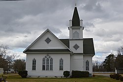 Methodist church | |
 Location in Dare County and the state of North Carolina. | |
| Coordinates: 35°53′09″N75°45′46″W / 35.88583°N 75.76278°W | |
| Country | United States |
| State | North Carolina |
| County | Dare County |
| Named after | Charles Mann [1] |
| Area | |
• Total | 4.01 sq mi (10.39 km2) |
| • Land | 3.99 sq mi (10.34 km2) |
| • Water | 0.02 sq mi (0.05 km2) |
| Elevation | 5 ft (2 m) |
| Population (2020) | |
• Total | 790 |
| • Density | 197.90/sq mi (76.40/km2) |
| Time zone | UTC-5 (Eastern (EST)) |
| • Summer (DST) | UTC-4 (EDT) |
| ZIP code | 27953 |
| Area code | 252 |
| GNIS feature ID | 989288 [3] |
| FIPS code | 37-40980 |
Manns Harbor is a census-designated place (CDP) in Dare County, North Carolina, United States. As of the 2010 census it had a population of 821. [4]
