Nags Head, North Carolina | |
|---|---|
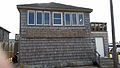
 Nags Head beachfront | |
 Flag  Seal | |
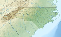
 Location in Dare County, North Carolina | |
 Nags Head  Nags Head | |
| Coordinates: 35°55′55″N75°36′54″W / 35.93194°N 75.61500°W | |
| Country | United States |
| State | North Carolina |
| County | Dare |
| Incorporated | 1923 and 1961 [1] |
| Named after | Tied lanterns around the necks of ponies [1] |
| Government | |
| • Mayor | Ben Cahoon [2] |
| Area | |
• Total | 6.68 sq mi (17.31 km2) |
| • Land | 6.62 sq mi (17.14 km2) |
| • Water | 0.066 sq mi (0.17 km2) |
| Elevation | 3.3 ft (1 m) |
| Population (2020) | |
• Total | 3,168 |
| • Density | 478.7/sq mi (184.84/km2) |
| Time zone | UTC−5 (Eastern (EST)) |
| • Summer (DST) | UTC−4 (EDT) |
| ZIP Code | 27959 |
| Area code | 252 |
| FIPS code | 37-45880 [4] |
| GNIS feature ID | 1021599 [5] |
| Website | nagsheadnc |
Nags Head is a town in Dare County, North Carolina, United States. It is a busy vacation spot because of its beaches and sand dunes of Jockey's Ridge. The population was 3,146 at the 2020 census. [6]


