Route description


The tour route is not a linear route, like most scenic routes, but a collection of several highways in the region. The following list are the component highways that make-up the tour route:
| Highway | Route | Sites of Interest |
|---|---|---|
| Williamston – VA state line | ||
| Washington – VA state line | ||
| Williamston – Whalebone Junction | ||
| Barco – Whalebone Junction | ||
| NC 561 – VA state line | ||
| Washington – Whalebone Junction | ||
| Halifax – VA state line | ||
| Pitt-Martin county line– Murfreesboro | ||
| NC 99 – VA state line | ||
| Barco – Sligo | ||
| US 64 – US 17 | ||
| US 264 – NC 99/NC 306 | ||
| Pantego – NC 32 | ||
| Sligo – VA state line | ||
| US 13 – US 258/NC 561 | ||
| US 301 – US 258 |
Sites
- Aurora Fossil Museum
- Bath, the oldest continuously inhabited town in North Carolina
- Belhaven Memorial Museum, currently housed in Belhaven City Hall, in the town of Belhaven
- Camden County Welcome Center, located on the Dismal Swamp Canal
- Chicamacomico Life-Saving Station located in Rodanthe
- Columbia
- Corolla, location of the Currituck Beach Light
- Edenton, former colonial capital of the Province of North Carolina
- Elizabeth City
- Frisco Native American Museum in Frisco, North Carolina
- Graveyard of the Atlantic Museum in Hatteras Village
- Halifax, location of the Fourth Provincial Congress, which authorized the Halifax Resolves
- Hertford
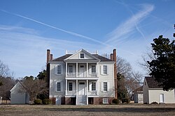
- Hope Plantation, a restored antebellum plantation house near Windsor
- Jackson
- Museum of the Albemarle
- North Carolina Aquariums with locations in Manteo, Fort Fisher, and Pine Knoll Shores
- Ocracoke
- Plymouth
- Roanoke Island Festival Park in Manteo
- Somerset Place, a restored antebellum plantation house near Creswell
- Tarboro
- Williamston
- Windsor