Carova Beach, North Carolina

Last updated

NCMap-doton-Carova.PNG

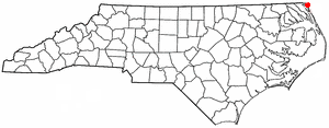
Carova Beach or Carova is an unincorporated community in Currituck County in the extreme northeastern corner of North Carolina, United States. The community, begun in the 1960s, is found on Currituck Banks, north of Bodie Island, and can be accessed only by boat or by four-wheel drive vehicle. There are no paved roads connecting Carova to the town of Corolla, North Carolina. The neighboring settlement of Sandbridge in Virginia Beach, Virginia, is not accessible by vehicle from Carova. In the 1960s, when development began in Carova, there were plans to construct a paved road from Sandbridge south to Carova through the Back Bay National Wildlife Refuge, but these never materialized. Today, there is a permanent fence from ocean to sound to keep vehicles from crossing and, more importantly, to keep the wild horses from migrating to the Virginia side of the border. To reach Carova, four-wheel drive vehicles must drive north along the beach from Corolla into the community, as access from Virginia is limited to pedestrians and bicyclists.

Contents

The community's name derives from the portmanteau of the first syllables of Carolina and Virginia, since the coastal community lies just south of the North Carolina-Virginia state line. Thus, it is the northernmost of the Outer Banks communities of North Carolina. Historically the Currituck Inlet which served as the boundary between Virginia and North Carolina existed where the community of Carova now stands. The inlet closed in 1730s.

Banker horses and other wildlife roam freely on the beaches of Carova. [1] There is an enforced law on the beach that states that no one is to get within 50 feet (15 m) of the horses. Carova only has approximately 50 year-round residents and commercialism is absent from this section of the Outer Banks; there are no restaurants, shops, or other attractions that often accompany beach communities. There are approximately 740 beach homes, many of which are weekly rentals, and otherwise only a fire/EMS station and a refuse station. Developers continue to build in the area.

Flooding is a continual problem [2] that worsens with each bad storm [3] in Carova Beach, where summer tourist traffic is heavy on roads that are little more than uneven sand paths through the dunes. Sandfiddler Road and Sandpiper Road, the two primary routes through the community, become nearly impassable after heavy rains, when large potholes fill with water.

During hurricanes and tropical storms the community can become inaccessible when the beach is awash due to storm surge.

Although some residents of Carova are opposed to a paved road being built to the community, the Currituck County Commission is in favor of constructing a paved road to Carova. They say a road is essential for the county to continue providing services like garbage collection, housing inspections, and emergency response. A road to connect Carova to the rest of Currituck County would have to cut through the 8,316 acre Currituck National Wildlife Refuge that stretches for 11 miles along the Currituck Banks between Corolla and Carova and any effort to build a road through the refuge would likely face stiff opposition from environmentalists. [4]

Climate

According to the Trewartha climate classification system, Carova Beach, North Carolina has a humid subtropical climate with hot and humid summers, cool winters and year-around precipitation (Cfak). Cfak climates are characterized by all months having an average mean temperature > 32.0 °F (> 0.0 °C), at least eight months with an average mean temperature ≥ 50.0 °F (≥ 10.0 °C), at least one month with an average mean temperature ≥ 71.6 °F (≥ 22.0 °C) and no significant precipitation difference between seasons. During the summer months in Carova Beach, a cooling afternoon sea breeze is present on most days, but episodes of extreme heat and humidity can occur with heat index values ≥ 100 °F (≥ 38 °C). Carova Beach is prone to hurricane strikes, particularly during the Atlantic hurricane season which extends from June 1 through November 30, sharply peaking from late August through September. During the winter months, episodes of cold and wind can occur with wind chill values < 10 °F (< -12 °C). The plant hardiness zone at Carova Beach is 8a with an average annual extreme minimum air temperature of 14.1 °F (-9.9 °C). [5] The average seasonal (Dec-Mar) snowfall total is < 2 inches (< 5 cm), and the average annual peak in nor'easter activity is in February.

Climate data for Carova Beach, NC (1981-2010 Averages)
MonthJanFebMarAprMayJunJulAugSepOctNovDecYear
Average high °F (°C)49.3
(9.6)
50.7
(10.4)
56.9
(13.8)
65.5
(18.6)
72.9
(22.7)
81.3
(27.4)
85.0
(29.4)
83.8
(28.8)
78.6
(25.9)
70.3
(21.3)
61.3
(16.3)
52.6
(11.4)
67.4
(19.7)
Daily mean °F (°C)42.0
(5.6)
43.7
(6.5)
49.4
(9.7)
58.0
(14.4)
66.0
(18.9)
74.8
(23.8)
79.1
(26.2)
78.0
(25.6)
73.0
(22.8)
63.5
(17.5)
54.1
(12.3)
45.6
(7.6)
60.7
(15.9)
Average low °F (°C)34.7
(1.5)
36.6
(2.6)
41.8
(5.4)
50.4
(10.2)
59.1
(15.1)
68.4
(20.2)
73.2
(22.9)
72.1
(22.3)
67.4
(19.7)
56.7
(13.7)
46.9
(8.3)
38.6
(3.7)
53.9
(12.2)
Average precipitation inches (mm)3.57
(91)
3.02
(77)
3.69
(94)
3.23
(82)
3.42
(87)
4.00
(102)
4.42
(112)
5.20
(132)
4.42
(112)
3.46
(88)
3.20
(81)
3.25
(83)
44.88
(1,140)
Average relative humidity (%)69.969.867.067.270.974.175.575.274.572.072.972.071.8
Average dew point °F (°C)32.9
(0.5)
34.5
(1.4)
38.9
(3.8)
47.2
(8.4)
56.3
(13.5)
66.0
(18.9)
70.7
(21.5)
69.5
(20.8)
64.4
(18.0)
54.3
(12.4)
45.6
(7.6)
37.1
(2.8)
51.5
(10.8)
Source: PRISM [6]


Climate data for Duck, NC Ocean Water Temperature (24 S Carova Beach)
MonthJanFebMarAprMayJunJulAugSepOctNovDecYear
Daily mean °F (°C)45
(7)
44
(7)
46
(8)
59
(15)
67
(19)
74
(23)
71
(22)
74
(23)
75
(24)
69
(21)
59
(15)
52
(11)
61
(16)
Source: NOAA [7]

Ecology

According to the A. W. Kuchler U.S. potential natural vegetation types, Carova Beach, North Carolina would have a dominant vegetation type of Northern Cordgrass (73) with a dominant vegetation form of Coastal Prairie (20). [8]

36°31′24″N75°51′33″W / 36.52333°N 75.85917°W / 36.52333; -75.85917

Related Research Articles

<span class="mw-page-title-main">Kitty Hawk, North Carolina</span> Town in North Carolina, United States

Kitty Hawk is a town in Dare County, North Carolina, on Bodie Island, part of what is known as the state's Outer Banks. The population was 3,708 at the 2020 census. It was established in the early 18th century as Chickahawk.

<span class="mw-page-title-main">Nags Head, North Carolina</span> Town in North Carolina, United States

Nags Head is a town in Dare County, North Carolina, United States. It is a busy vacation spot because of its beaches and sand dunes of Jockey's Ridge. The population was 3,146 at the 2020 census.

<span class="mw-page-title-main">Southern Shores, North Carolina</span> Town in North Carolina, United States

Southern Shores is a town in Dare County, North Carolina, United States. It is located on the Outer Banks and the population was 3,107 at the 2020 census.

<span class="mw-page-title-main">Cape Lookout National Seashore</span>

Cape Lookout National Seashore preserves a 56-mile (90-km) long section of the Southern Outer Banks, or Crystal Coast, of North Carolina, USA, running from Ocracoke Inlet on the northeast to Beaufort Inlet on the southwest. Three undeveloped barrier islands make up the seashore - North and South Core Banks and Shackleford Banks. The seashore includes two historic villages on Core Banks, Shackleford's wild horses, and the Cape Lookout Lighthouse, which has a black-and-white diamond pattern. A visitor center for the seashore is located on Harkers Island.

<span class="mw-page-title-main">Corolla, North Carolina</span> Unincorporated community in North Carolina, U.S.

Corolla is an unincorporated community located in Poplar Branch township, Currituck County, North Carolina, United States, along the northern Outer Banks. It has a permanent population of approximately 500 people; during the summer vacation season, the population surges into the thousands. Corolla is home to the Currituck Beach Lighthouse, one of the seven North Carolina coastal lighthouses.

<span class="mw-page-title-main">Waves, North Carolina</span> Census-designated place in North Carolina, United States

Waves is an unincorporated community and census-designated place (CDP) in Dare County, North Carolina, United States. It is on Hatteras Island, part of North Carolina's Outer Banks. As of the 2010 census it had a population of 134. Waves, along with Rodanthe and Salvo, are part of the settlement of Chicamacomico.

<span class="mw-page-title-main">Portsmouth, North Carolina</span> United States historic place

Portsmouth was a fishing and shipping village located on Portsmouth Island on the Outer Banks in North Carolina, United States. Portsmouth Island is a tidal island connected, under most conditions, to the northern end of the North Core Banks, across Ocracoke Inlet from the village of Ocracoke. The town lies in Carteret County, was established in 1753 by the North Carolina Colonial Assembly, and abandoned in 1971. Its remains are now part of the Cape Lookout National Seashore.

<span class="mw-page-title-main">Buxton, North Carolina</span> Census-designated place in North Carolina, United States of America

Buxton is an unincorporated community and census-designated place (CDP) on Hatteras Island near Cape Hatteras. It is located in Dare County in the U.S. state of North Carolina. As of the 2010 census, it had a population of 1,273. Located at the widest part of Hatteras Island, it is the largest community on Hatteras Island both in terms of area and population, and is home to the island's schools and other major public buildings and offices.

<span class="mw-page-title-main">Frisco, North Carolina</span> Census-designated place in North Carolina, United States of America

Frisco is a small unincorporated community and census-designated place (CDP) on the barrier island of Hatteras Island, between the villages of Buxton and Hatteras. It is located in Dare County, North Carolina, United States, and was previously named "Trent", or "Trent Woods", but received a new name with the coming of the post office in 1898. Most of the land is taken by houses available for rental during the summer months, and as such the community's population varies seasonally. As of the 2010 census, the permanent population of the community was 200. North Carolina Highway 12 serves as the primary road in Frisco and connects the community to others on the island.

<span class="mw-page-title-main">Cape Hatteras National Seashore</span>

Cape Hatteras National Seashore is a United States national seashore which preserves the portion of the Outer Banks of North Carolina from Bodie Island to Ocracoke Island, stretching over 70 miles (110 km), and is managed by the National Park Service. Included within this section of barrier islands along N.C. 12, but outside the national seashore boundaries, are Pea Island National Wildlife Refuge and several communities, such as Rodanthe, Buxton, and Ocracoke. Cape Hatteras is a combination of natural and cultural resources, and provides a wide variety of recreational opportunities.

<span class="mw-page-title-main">Cape Lookout (North Carolina)</span>

Cape Lookout is the southern point of the Core Banks, one of the natural barrier islands on the Atlantic coast of North Carolina. It delimits Onslow Bay to the west from Raleigh Bay to the east. Core Banks and Shackleford Banks have been designated as parts of the Cape Lookout National Seashore.

<span class="mw-page-title-main">Back Bay National Wildlife Refuge</span> Wildlife reserve in Virginia, US

Back Bay National Wildlife Refuge in southeastern Virginia is located in the independent city of Virginia Beach. Established in 1938 in an isolated portion of the former Princess Anne County, it is managed by the U.S. Fish & Wildlife Service. The administrative office is located on Sandbridge Road at Sigma between Lago Mar and Sandbridge Beach. The Visitor Contact Center is accessed via Sandpiper Road from the Sandbridge area of Virginia Beach, which is the southernmost area of development on the Atlantic Coast of Virginia.

<span class="mw-page-title-main">Outer Banks</span> Barrier islands in North Carolina, U.S.

The Outer Banks are a 200 mi (320 km) string of barrier islands and spits off the coast of North Carolina and southeastern Virginia, on the east coast of the United States. They line most of the North Carolina coastline, separating Currituck Sound, Albemarle Sound, and Pamlico Sound from the Atlantic Ocean. A major tourist destination, the Outer Banks are known for their wide expanse of open beachfront and the Cape Hatteras National Seashore. The seashore and surrounding ecosystem are important biodiversity zones, including beach grasses and shrubland that help maintain the form of the land.

<span class="mw-page-title-main">Sandbridge, Virginia Beach, Virginia</span> Neighborhood in the United States

Sandbridge, in the U.S. state of Virginia, is a coastal community of Virginia Beach, located along the coastline on the Currituck Banks Peninsula at the northern end of the Outer Banks. The Atlantic Ocean is to the east, the Back Bay of the Currituck Sound is to the west, and the Back Bay National Wildlife Refuge and False Cape State Park lie to the south. To the north, Sandbridge borders the U.S. Navy's Dam Neck facility. Located near the southern end of Sandbridge is Little Island Park, which is managed by the City of Virginia Beach. Sandbridge Beach runs approximately 4.5 miles from north to south along the oceanfront.

<span class="mw-page-title-main">Pea Island National Wildlife Refuge</span> National Wildlife Refuge in North Carolina, United States

Pea Island National Wildlife Refuge is a national wildlife refuge located on North Carolina's Pea Island, a coastal barrier island and part of a chain of islands known as the Outer Banks, adjacent to Cape Hatteras National Seashore. The sanctuary is located 10 miles (16 km) south of Nags Head, North Carolina on NC 12.

<span class="mw-page-title-main">Currituck Sound</span>

Currituck Sound is a lagoon located in northeastern part of North Carolina and extreme southeastern Virginia.

<span class="mw-page-title-main">Sigma, Virginia</span> Unincorporated community in Virginia, United States

Sigma is a small community near Sandbridge in the independent city of Virginia Beach, Virginia, United States. Sigma lies just south of Lago Mar on Ashville Bridge Creek along Sandbridge Road at its intersection with New Bridge Road.

Bodie Island is a long, narrow barrier peninsula that forms the northernmost portion of the Outer Banks. The land that is most commonly referred to as Bodie Island was at one time a true island, but in 1811 Roanoke Inlet, which had separated it from the Currituck Banks in the north, closed. As a result, the Currituck Banks and Bodie Island are now one contiguous peninsula, joined at the Nags Head area, where the inlet once flowed. Today, either name can be used to refer to peninsula as a whole, but both portions colloquially retain their historical names.

<span class="mw-page-title-main">Currituck National Wildlife Refuge</span> National Wildlife Refuge in North Carolina, United States

Currituck National Wildlife Refuge, located on the northern end of North Carolina's Outer Banks, was established in 1984 to preserve and protect the coastal barrier island ecosystem. Refuge lands are managed to provide wintering habitat for waterfowl and to protect endangered species such as piping plover, sea turtles, and seabeach amaranth.

<span class="mw-page-title-main">Core Banks, North Carolina</span> Barrier islands in North Carolina, US

The Core Banks are barrier islands in North Carolina, part of the Outer Banks and Cape Lookout National Seashore. Named after the Coree tribe, they extend from Ocracoke Inlet to Cape Lookout, and consist of two low-relief narrow islands, North Core Banks and South Core Banks, and, since September 2011, two smaller islands. New Drum Inlet, Old Drum Inlet and Ophelia Inlet now separate the islands. The Core Banks are now uninhabited. However, Portsmouth, at the north end of the North Core Banks, was once a substantial port, and Cape Lookout Village, about one and half miles south of the Cape Lookout Lighthouse, contains the historic Lookout Life-Saving Station, a U.S. Coast Guard Station, and several island homes.

References

  1. Observer, MARK PRICE The Charlotte. "Outer Banks wild horses thwart spread of destructive invasive plant — by eating it". Greensboro News and Record. Retrieved June 30, 2021.
  2. "UPDATED: N.C. 12 expected to remain closed until Tuesday on Hatteras Island - OBX Today". www.obxtoday.com. Retrieved June 30, 2021.
  3. Board, The Virginian-Pilot & Daily Press Editorial. "Editorial: $141 million in beach renourishment projects shows need for climate action". pilotonline.com. Retrieved June 30, 2021.
  4. "Living on Earth: No Roads Lead to Corova".
  5. "USDA Interactive Plant Hardiness Map". United States Department of Agriculture . Retrieved August 6, 2019.
  6. "PRISM Climate Group, Oregon State University" . Retrieved August 6, 2019.
  7. "Water Temperature Table of All Coastal Regions". Archived from the original on September 5, 2017. Retrieved August 6, 2019.
  8. "U.S. Potential Natural Vegetation, Original Kuchler Types, v2.0 (Spatially Adjusted to Correct Geometric Distortions)" . Retrieved August 6, 2019.