"},"elevation_ft":{"wt":"3"},"coordinates":{"wt":"{{coord|34|41|49|N|76|49|24|W|region:US_type:city|display=inline,title}}"},"postal_code_type":{"wt":"[[ZIP code]]"},"postal_code":{"wt":"28512"},"area_code":{"wt":"[[Area code 252|252]]"},"blank_name":{"wt":"[[Federal Information Processing Standard|FIPS code]]"},"blank_info":{"wt":"37-52000{{cite web|url=https://www.census.gov|publisher=[[United States Census Bureau]]|accessdate=January 31, 2008|title=U.S. Census website}}"},"blank1_name":{"wt":"[[Geographic Names Information System|GNIS]] feature ID"},"blank1_info":{"wt":"2407116{{GNIS|2407116}}"},"website":{"wt":"{{URL|www.townofpks.com}}"},"footnotes":{"wt":""},"pop_est_as_of":{"wt":""},"pop_est_footnotes":{"wt":""},"population_est":{"wt":""}},"i":0}}]}" id="mwBQ">Town in North Carolina, United States
Pine Knoll Shores, North Carolina | |
---|---|
The North Carolina Aquarium at Pine Knoll Shores | |
Location of Pine Knoll Shores, North Carolina | |
Coordinates: 34°41′49″N76°49′24″W / 34.69694°N 76.82333°W | |
Country | United States |
State | North Carolina |
County | Carteret |
Area | |
• Total | 6.92 sq mi (17.91 km2) |
• Land | 2.21 sq mi (5.72 km2) |
• Water | 4.71 sq mi (12.19 km2) |
Elevation | 3 ft (0.9 m) |
Population (2020) | |
• Total | 1,388 |
• Density | 628.34/sq mi (242.63/km2) |
Time zone | UTC-5 (Eastern (EST)) |
• Summer (DST) | UTC-4 (EDT) |
ZIP code | 28512 |
Area code | 252 |
FIPS code | 37-52000 [3] |
GNIS feature ID | 2407116 [2] |
Website | www |
Pine Knoll Shores is a coastal town in Carteret County, North Carolina, United States. The population was 1,388 at the 2020 census. [4] One of North Carolina's state aquariums is located here.
Pine Knoll Shores is located in southwestern Carteret County on Bogue Banks, a barrier island along the Atlantic Ocean. It is bordered to the west by the town of Indian Beach and to the east by the town of Atlantic Beach. To the north is Bogue Sound, and to the south is the Atlantic Ocean.
North Carolina Highway 58 passes through the town, traveling the length of Bogue Banks. To the east, NC 58 connects with a bridge to Morehead City on the mainland, and to the west, NC 58 crosses Bogue Sound from Emerald Isle to Cape Carteret on the mainland.
According to the United States Census Bureau, Pine Knoll Shores has a total area of 2.5 square miles (6.6 km2), of which 2.2 square miles (5.8 km2) is land and 0.31 square miles (0.8 km2), or 12.54%, is water. [4]
Census | Pop. | Note | %± |
---|---|---|---|
1980 | 646 | — | |
1990 | 1,360 | 110.5% | |
2000 | 1,524 | 12.1% | |
2010 | 1,339 | −12.1% | |
2020 | 1,388 | 3.7% | |
U.S. Decennial Census [5] |
Race | Number | Percentage |
---|---|---|
White (non-Hispanic) | 1,334 | 96.11% |
Black or African American (non-Hispanic) | 2 | 0.14% |
Native American | 2 | 0.14% |
Asian | 8 | 0.58% |
Other/Mixed | 26 | 1.87% |
Hispanic or Latino | 16 | 1.15% |
As of the 2020 United States census, there were 1,388 people, 663 households, and 453 families residing in the town.
As of the census [3] of 2008, there were 1,547 people, 776 households, and 557 families residing in the town. The population density was 668.9 inhabitants per square mile (258.3/km2). There were 2,049 housing units at an average density of 899.4 per square mile (347.3/km2). The racial makeup of the town was 99.15% White, 0.07% African American, 0.13% Native American, 0.13% Asian, 0.07% Pacific Islander, 0.07% from other races, and 0.39% from two or more races. Hispanic or Latino of any race were 1.05% of the population.
There were 776 households, out of which 7.9% had children under the age of 18 living with them, 68.8% were married couples living together, 2.2% had a female householder with no husband present, and 28.1% were non-families. 24.9% of all households were made up of individuals, and 14.6% had someone living alone who was 65 years of age or older. The average household size was 1.96 and the average family size was 2.27.
In the town, the population was spread out, with 7.5% under the age of 18, 2.2% from 18 to 24, 11.2% from 25 to 44, 36.4% from 45 to 64, and 42.7% who were 65 years of age or older. The median age was 62 years. For every 100 females, there were 90.7 males. For every 100 females age 18 and over, there were 91.8 males.
The median income for a household in the town was $53,800, and the median income for a family was $60,662. Males had a median income of $42,417 versus $27,321 for females. The per capita income for the town was $34,618. About 1.8% of families and 3.6% of the population were below the poverty line, including 4.2% of those under age 18 and 2.1% of those age 65 or over.
The North Carolina Aquarium at Pine Knoll Shores is located in Pine Knoll Shores.
Carteret County is a county located in the U.S. state of North Carolina. As of the 2020 census, the population was 67,686. Its county seat is Beaufort. The county was created in 1722 as Carteret Precinct and gained county status in 1739. It was named for Sir George Carteret, one of the 17th century English Lords Proprietor, or for his descendant and heir John Carteret, 2nd Earl Granville.
Lagunitas-Forest Knolls is a census-designated place, composed of two unincorporated areas in the western half of the San Geronimo Valley in Marin County, California. It is located to the west of San Geronimo and Woodacre. The population was 1,924 at the 2020 census.
Kiantone is a town in Chautauqua County, New York, United States. As of the 2020 census, the town had a population of 1,388. The town is immediately south of Jamestown and is at the south border of the county.
Spafford is a town in Onondaga County, New York, United States. As of the 2020 Census, the population was 1,588. The town was named after Horatio Gates Spafford, a writer and founder of the local library. Spafford is in the southwestern corner of Onondaga County and is southwest of Syracuse.
Elizabethtown is a town in Bladen County, North Carolina, United States. The population was 3,296 at the 2020 census. It is the county seat of Bladen County.
Carolina Shores is a town in Brunswick County, North Carolina, United States. The population was 3,048 at the 2010 census, up from 1,482 in 2000. It is part of the Wilmington, NC Metropolitan Statistical Area.
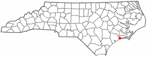
Atlantic Beach is a town in Carteret County, North Carolina, United States. It is one of the five communities located on Bogue Banks. The population was 1,364 at the 2020 census.
Beaufort is a town in and the county seat of Carteret County, North Carolina, United States. Established in 1713 and incorporated in 1723, Beaufort is the fourth oldest town in North Carolina . On February 1, 2012, Beaufort was ranked as "America's Coolest Small Town" by readers of Budget Travel Magazine.
Bogue is a town in Carteret County, North Carolina, United States. The population was 684 in 2010.
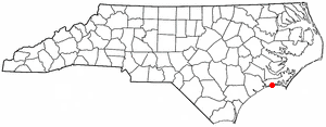
Cape Carteret is a town in Carteret County, on the southern coast of North Carolina, United States. It was incorporated in 1959 and had a population of 2,224 as of the 2020 census.
Cedar Point is a town in Carteret County, North Carolina, United States. The population was 1,297 in 2010.
Emerald Isle is a town in Carteret County, North Carolina, United States. It is part of the Crystal Coast and is located entirely on Bogue Banks. The population was 3,847 at the 2020 census, but as many as 50,000 tourists each week inhabit the area during the summer season, filling up vacant rental properties that do not count toward official census results.
Indian Beach is a town in Carteret County, North Carolina, United States. The population was 223 as of the 2020 census.
Morehead City is a port town in Carteret County, North Carolina, United States. The population was 8,661 at the 2010 census. Morehead City celebrated the 150th anniversary of its founding on May 5, 2007. It forms part of the Crystal Coast.
Newport is a town in Carteret County, North Carolina, United States. The population was 4,510 at the 2010 census.
Peletier is a town in Carteret County, North Carolina, United States. The population was 644 at the 2010 census.
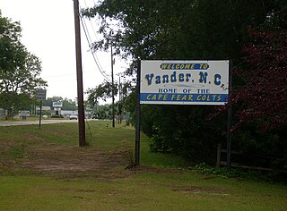
Vander is an unincorporated community and census-designated place (CDP) in Cumberland County, North Carolina, United States. The population was 1,388 at the 2020 census.
Westport is an unincorporated community and census-designated place (CDP) located in Lincoln County, North Carolina, United States. The population of the CDP was 4,026 at the 2010 census, up from 2,006 at the 2000 census. The community's name comes from its location on the west side of Lake Norman.
China Grove is a town in Rowan County, North Carolina, United States. The population was 4,434 at the 2020 census. The town is located just north of Landis and south of Salisbury. It was one of the first towns in the United States to have Rural Free Mail Delivery.
Red Bank is an unincorporated community and census-designated place (CDP) in Lexington County, South Carolina, United States. The population was 9,617 at the 2010 census, up from 8,811 at the 2000 census. It is part of the Columbia, South Carolina Metropolitan Statistical Area.