
Carteret County is located in the U.S. state of North Carolina. As of the 2020 census, the population was 67,686. Its county seat is Beaufort. The county was created in 1722 as Carteret Precinct and gained county status in 1739. It was named for Sir George Carteret, one of the 17th century English Lords Proprietor, or for his descendant and heir John Carteret, 2nd Earl Granville.
Cape Carteret is a town in Carteret County, on the southern coast of North Carolina, United States. It was incorporated in 1959 and had a population of 2,224 as of the 2020 census.

Harkers Island is a census-designated place (CDP) in Carteret County, North Carolina, United States. The population of Harkers Island was 1,207 at the 2010 census. Harkers Island is unincorporated and receives most public services, including law enforcement and public education, from Carteret County. A membership cooperative provides the island with electric and water services. Major industries on the island include fishing, boat building, tourism, and waterfowl decoy carving.

Pine Knoll Shores is a coastal town in Carteret County, North Carolina, United States. The population was 1,388 at the 2020 census. One of North Carolina's state aquariums is located here.

Westport is an unincorporated community and census-designated place (CDP) located in Lincoln County, North Carolina, United States. The population of the CDP was 4,026 at the 2010 census, up from 2,006 at the 2000 census. The community's name comes from its location on the west side of Lake Norman.

Gantt is a census-designated place (CDP) in Greenville County, South Carolina, United States. The population was 14,229 at the 2010 census. It is part of the Greenville–Mauldin–Easley Metropolitan Statistical Area and a suburb of the city of Greenville.
Parker is a census-designated place (CDP) in Greenville County, South Carolina, United States. The population was 11,431 at the 2010 census, up from 10,760 in 2000. It is part of the Greenville–Mauldin–Easley Metropolitan Statistical Area.
Wade Hampton is a census-designated place (CDP) in Greenville County, South Carolina, United States. The population was 20,622 at the 2010 census. It is named for American Civil War general and South Carolina governor Wade Hampton.

Joanna is an unincorporated community and census-designated place (CDP) in Laurens County, South Carolina, United States. The population was 1,539 at the 2010 census, down from 1,609 at the 2000 census. It is part of the Greenville–Mauldin–Easley Metropolitan Statistical Area.

Mountville is an unincorporated community and census-designated place (CDP) in Laurens County, South Carolina, United States. The population was 108 at the 2010 census, down from 130 at the 2000 census. It is part of the Greenville–Mauldin–Easley Metropolitan Statistical Area.
Seven Oaks is a census-designated place (CDP) in Lexington County, South Carolina, United States, 8 miles (13 km) northwest of downtown Columbia, the state capital. The population of the CDP was 15,144 at the 2010 census. It is part of the Columbia Metropolitan Statistical Area.
Advance is an unincorporated community and census-designated place (CDP) in Davie County, North Carolina, United States. It is seventy-five miles northeast of Charlotte. As of the 2010 census it had a population of 1,138. It is located along North Carolina Highway 801 just south of Bermuda Run. Advance is part of the Piedmont Triad region of North Carolina.
Atlantic is an unincorporated community and census-designated place in eastern Carteret County, North Carolina, United States. As of the 2010 census it had a population of 543. It is situated along Core Sound, located in what was known to early settlers of the area as Hunting Quarters. It is the location of US 70's eastern terminus and the ferry terminal for journeys to North Core Banks in the Cape Lookout National Seashore.
Gulf is an unincorporated community and census-designated place (CDP) in southwestern Chatham County, North Carolina, United States, southeast of the town of Goldston. As of the 2010 census, the Gulf CDP had a population of 144. The community is home to a general store and several historic homes. It received its name from its location at a wide bend in the Deep River.

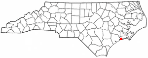
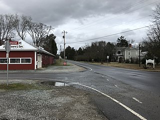
Broad Creek is an unincorporated area and census-designated place (CDP) in Carteret County, North Carolina, United States. As of the 2010 census it had a population of 2,334. It is part of the greater Newport area and currently shares the Newport zip code of 28570.

Engelhard is a census-designated place (CDP) and fishing community in Lake Landing Township on the mainland of Hyde County, North Carolina, United States. It has access to Pamlico Sound. As of the 2010 census it had a population of 445.
Edneyville is an unincorporated community and census-designated place (CDP) in Henderson County, North Carolina, United States. Its population was 2,367 as of the 2010 census.
Fruitland is an unincorporated community and census-designated place (CDP) in Henderson County, North Carolina, United States. Its population was 2,031 as of the 2010 census.
Gloucester is an unincorporated area and census-designated place (CDP) in Carteret County, North Carolina, United States. As of the 2010 census it had a population of 537.
Marshallberg is an unincorporated area and census-designated place (CDP) in Carteret County, North Carolina, United States. As of the 2010 census it had a population of 403. It lies on the mainland, directly across Core Sound from Harkers Island and Cape Lookout beyond that. Lying at the extreme southeast corner of a peninsula, it is isolated from other Carteret County communities and only a single road connects it to the rest of the state.

