
Carteret County is a county located in the U.S. state of North Carolina. As of the 2020 census, the population was 67,686. Its county seat is Beaufort. The county was created in 1722 as Carteret Precinct and gained county status in 1739. It was named for Sir George Carteret, one of the 17th century English Lords Proprietor, or for his descendant and heir John Carteret, 2nd Earl Granville.
Cedar is a city in Smith County, Kansas, United States. As of the 2020 census, the population of the city was 11.

Cedar Rapids is a village in Boone County, Nebraska, United States. The population was 382 at the 2010 census.

Polkton is a town in Anson County, North Carolina, United States. As of the 2020 census, the town population was 2,250, down from 3,375 in 2010.

Elizabethtown is a town in Bladen County, North Carolina, United States. The population was 3,296 at the 2020 census. It is the county seat of Bladen County.

Cedar Rock is a village in Caldwell County, North Carolina, United States. The population was 300 at the 2010 census.

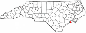
Atlantic Beach is a town in Carteret County, North Carolina, United States. It is one of the five communities located on Bogue Banks. The population was 1,364 at the 2020 census.

Beaufort is a town in and the county seat of Carteret County, North Carolina, United States. Established in 1713 and incorporated in 1723, Beaufort is the fourth oldest town in North Carolina . On February 1, 2012, Beaufort was ranked as "America's Coolest Small Town" by readers of Budget Travel Magazine.

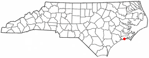
Bogue is a town in Carteret County, North Carolina, United States. The population was 684 in 2010.
Cape Carteret is a town in Carteret County, on the southern coast of North Carolina, United States. It was incorporated in 1959 and had a population of 2,224 as of the 2020 census.

Emerald Isle is a town in Carteret County, North Carolina, United States. It is part of the Crystal Coast and is located entirely on Bogue Banks. The population was 3,847 at the 2020 census, but as many as 50,000 tourists each week inhabit the area during the summer season, filling up vacant rental properties that do not count toward official census results.
Indian Beach is a town in Carteret County, North Carolina, United States. The population was 223 as of the 2020 census.

Newport is a town in Carteret County, North Carolina, United States. The population was 4,510 at the 2010 census.

Peletier is a town in Carteret County, North Carolina, United States. The population was 644 at the 2010 census.

Pine Knoll Shores is a coastal town in Carteret County, North Carolina, United States. The population was 1,388 at the 2020 census. One of North Carolina's state aquariums is located here.

Mars Hill is a town in Madison County, North Carolina, United States. The population was 1,869 at the 2010 census, and was estimated at 2,032 in 2018 by the U.S. Census. It is the home of Mars Hill University, the name of which was inspired by Acts 17:22. The town is located 15 miles (24 km) due north of Asheville. Interstate 26 passes one mile east of the town. It is part of the Asheville Metropolitan Statistical Area.

Carolina Beach is a beach town in New Hanover County, North Carolina, United States, situated about 12 miles (19 km) south of Wilmington International Airport in southeastern coastal North Carolina. As of the 2020 census, the city population was 6,564. It is part of the Wilmington metropolitan area. The community of Wilmington Beach was annexed by the town in 2000.

Winterville is a town in Pitt County, North Carolina, United States. The population was 10,591 as of the 2020 census. The town is a part of the Greenville Metropolitan Area.

Columbus is a town and the county seat of Polk County, North Carolina, United States. The population was 999 at the 2010 census.

Cedar Lake is a town in Barron County in the U.S. state of Wisconsin. The population was 1,076 at the 2020 census, up from 948 at the 2010 census. The unincorporated communities of Angus and Mikana are located in the town.


