Kings Grant, North Carolina

Last updated

Kings Grant, North Carolina
CDP
US117nNC132nRoadSigns (39245152335).jpg
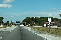
Northbound College Road (NC 132/US 117) passing through Kings Grant; a half mile (0.8 km) beyond lies the eastern terminus of Interstate 40
New Hanover County North Carolina incorporated and unincorporated areas Kings Grant highlighted.svg
Location in New Hanover County and the state of North Carolina.
Coordinates: 34°15′59″N77°51′57″W / 34.26639°N 77.86583°W / 34.26639; -77.86583
Country United States
State North Carolina
County New Hanover
Area
[1]
  Total4.56 sq mi (11.80 km2)
  Land4.54 sq mi (11.76 km2)
  Water0.02 sq mi (0.05 km2)
Elevation
[2]
23 ft (7 m)
Population
 (2020)
  Total8,466
  Density1,864.76/sq mi (720.04/km2)
Time zone UTC-5 (Eastern (EST))
  Summer (DST) UTC-4 (EDT)
ZIP code
28405 [3]
Area codes 910, 472
FIPS code 37-35870 [4]
GNIS feature ID2403177 [2]

Kings Grant is a census-designated place (CDP) in New Hanover County, North Carolina, United States. The population was 8,113 at the 2010 census, up from 7,738 in 2000. It is part of the Wilmington Metropolitan Statistical Area.

Contents

Geography

According to the United States Census Bureau, the CDP has a total area of 4.6 square miles (12 km2), all land.

Demographics

Historical population
CensusPop.Note
2020 8,466
U.S. Decennial Census [5]

2020 census

Kings Grant racial composition [6]
RaceNumberPercentage
White (non-Hispanic)5,75768.0%
Black or African American (non-Hispanic)96411.39%
Native American 340.4%
Asian 1912.26%
Pacific Islander 60.07%
Other/Mixed 3654.31%
Hispanic or Latino 1,14913.57%

As of the 2020 United States census, there were 8,466 people, 3,450 households, and 2,276 families residing in the CDP.

2000 census

As of the census [4] of 2000, there were 7,738 people, 3,011 households, and 2,185 families residing in the CDP. The population density was 1,669.9 inhabitants per square mile (644.8/km2). There were 3,152 housing units at an average density of 680.2 per square mile (262.6/km2). The racial makeup of the CDP was 84.34% White, 12.26% African American, 0.52% Native American, 0.94% Asian, 0.04% Pacific Islander, 0.80% from other races, and 1.10% from two or more races. Hispanic or Latino of any race were 1.73% of the population.

There were 3,011 households, out of which 32.8% had children under the age of 18 living with them, 58.5% were married couples living together, 10.5% had a female householder with no husband present, and 27.4% were non-families. 18.8% of all households were made up of individuals, and 4.3% had someone living alone who was 65 years of age or older. The average household size was 2.56 and the average family size was 2.92.

In the CDP, the population was spread out, with 23.6% under the age of 18, 9.2% from 18 to 24, 33.1% from 25 to 44, 25.1% from 45 to 64, and 9.0% who were 65 years of age or older. The median age was 36 years. For every 100 females, there were 99.4 males. For every 100 females age 18 and over, there were 95.7 males.

The median income for a household in the CDP was $46,643, and the median income for a family was $52,071. Males had a median income of $38,688 versus $26,160 for females. The per capita income for the CDP was $19,889. About 3.9% of families and 6.7% of the population were below the poverty line, including 7.4% of those under age 18 and 6.8% of those age 65 or over.

Related Research Articles

<span class="mw-page-title-main">East Orosi, California</span> Place in California, United States

East Orosi is a unincorporated community in Tulare County, California, United States. The population was 495 at the 2010 census, up from 426 in 2000. For statistical purposes, the United States Census Bureau has defined East Orosi as a census-designated place (CDP).

<span class="mw-page-title-main">South Bradenton, Florida</span> Census-designated place in Florida, United States

South Bradenton is an unincorporated community and census-designated place (CDP) in Manatee County, Florida, United States. The population was 26,858 at the 2020 census, up from 22,178 in 2010. It is part of the Bradenton–Sarasota–Venice Metropolitan Statistical Area.

<span class="mw-page-title-main">North Sarasota, Florida</span> Census-designated place in Florida, United States

North Sarasota is a census-designated place (CDP) in Sarasota County, Florida, United States. The population was 6,982 at the 2010 census. It is part of the Bradenton–Sarasota–Venice Metropolitan Statistical Area.

<span class="mw-page-title-main">Hanamaulu, Hawaii</span> Census-designated place in Hawaii, United States

Hanamāʻulu is a census-designated place (CDP) in Kauaʻi County, Hawaiʻi, United States. It is the ancient birthplace of Kawelo, a member of Kauai's ruling family. The population was 4,994 at the 2020 census, up from 3,272 at the 2000 census.

Rome is a census-designated place (CDP) in Medina Township, Peoria County, Illinois, United States. The population of the CDP was 1,738 at the 2010 census. Rome is part of the Peoria, Illinois Metropolitan Statistical Area.

<span class="mw-page-title-main">Fairland, Maryland</span> Census-designated place in Maryland, United States

Fairland is a census-designated place and an unincorporated area in Montgomery County, Maryland, United States. It had a population of 25,396 per the 2020 census.

<span class="mw-page-title-main">West Swanzey, New Hampshire</span> Census-designated place in New Hampshire, United States

West Swanzey is a census-designated place (CDP) in the town of Swanzey within Cheshire County, New Hampshire, United States. The population was 1,281 at the 2020 census. It is the largest village in the town of Swanzey.

<span class="mw-page-title-main">Greentree, New Jersey</span> Populated place in Camden County, New Jersey, US

Greentree is an unincorporated community and census-designated place (CDP) located within Cherry Hill Township, in Camden County, in the U.S. state of New Jersey. As of the 2010 United States Census, the CDP's population was 11,367.

<span class="mw-page-title-main">Springdale, New Jersey</span> Populated place in Camden County, New Jersey, US

Springdale is an unincorporated community and census-designated place (CDP) located within Cherry Hill Township, in Camden County, in the U.S. state of New Jersey. As of the 2010 United States Census, the section population was 14,518.

<span class="mw-page-title-main">Victory Lakes, New Jersey</span> Populated place in Gloucester County, New Jersey, US

Victory Lakes is an unincorporated community and census-designated place (CDP) located within Monroe Township, in Gloucester County, in the U.S. state of New Jersey. As of the 2010 United States Census, the CDP's population was 2,111.

<span class="mw-page-title-main">Crestwood Village, New Jersey</span> Populated place in Ocean County, New Jersey, US

Crestwood Village is an unincorporated community and census-designated place (CDP) located within Manchester Township, in Ocean County, in the U.S. state of New Jersey. As of the 2010 United States Census, the CDP's population was 7,907.

<span class="mw-page-title-main">Leisure Knoll, New Jersey</span> Populated place in Ocean County, New Jersey, US

Leisure Knoll is an unincorporated community and census-designated place (CDP) located within Manchester Township, in Ocean County, in the U.S. state of New Jersey. As of the 2010 United States Census, the CDP's population was 2,490.

<span class="mw-page-title-main">Tillson, New York</span> CDP in New York, United States

Tillson is a hamlet in Ulster County, New York, United States. The population was 1,516 at the 2020 census.

<span class="mw-page-title-main">Fox Run, Pennsylvania</span> Former census-designated place in Pennsylvania, United States

Fox Run is a neighborhood in Cranberry Township, Butler County, Pennsylvania, United States. It is among the Township's earliest housing developments, including 320 homes built on a 131-acre site in the late 1960s. It was formerly a census-designated place (CDP), but that designation was removed as of TIGER 2013 after Cranberry Township officials pointed out that users of Internet mapping websites had misinterpreted the CDP as the name of its parent municipality.

<span class="mw-page-title-main">Garden View, Pennsylvania</span> Census-designated place in Pennsylvania, United States

Garden View is a census-designated place (CDP) in Lycoming County, Pennsylvania, United States. The population was 2,503 at the 2010 census. It is part of the Williamsport Metropolitan Statistical Area.

<span class="mw-page-title-main">Cumberland Hill, Rhode Island</span> Census-designated place in Rhode Island, United States

Cumberland Hill is a census-designated place (CDP) in the town of Cumberland, in Providence County, Rhode Island, United States. The population was 7,934 at the 2010 census.

<span class="mw-page-title-main">La Puerta, Texas</span> CDP in Texas, United States

La Puerta is a census-designated place (CDP) in Starr County, Texas, United States. The population was 632 at the 2010 census down from 1,636 at the 2000 census.

<span class="mw-page-title-main">Lake Wissota, Wisconsin</span> CDP in Wisconsin, United States

Lake Wissota is a census-designated place (CDP) in the town of Lafayette in Chippewa County in the U.S. state of Wisconsin. The population was 2,738 at the 2010 census. The CDP, known locally as Lake Wissota Village, is located along the southern shores of Lake Wissota.

<span class="mw-page-title-main">Spencer (CDP), Massachusetts</span> CDP in Massachusetts, United States

Spencer is a census-designated place (CDP) in the town of Spencer in Worcester County, Massachusetts, United States. The population was 5,700 at the 2010 census.

<span class="mw-page-title-main">Clearbrook, New Jersey</span> Populated place in Middlesex County, New Jersey, US

Clearbrook is a gated community and census-designated place (CDP) located in Monroe Township, Middlesex County, in the U.S. state of New Jersey. It is in the western part of the township, bordered to the north by Encore at Monroe and to the east by Concordia and The Ponds. It is 3.5 miles (5.6 km) southwest of Jamesburg and 5 miles (8 km) northeast of Hightstown.

References

  1. "ArcGIS REST Services Directory". United States Census Bureau. Retrieved September 20, 2022.
  2. 1 2 U.S. Geological Survey Geographic Names Information System: Kings Grant, North Carolina
  3. "Kings Grant ZIP Code". zipdatamaps.com. 2023. Retrieved January 12, 2023.
  4. 1 2 "U.S. Census website". United States Census Bureau . Retrieved January 31, 2008.
  5. "Census of Population and Housing". Census.gov. Retrieved June 4, 2016.
  6. "Explore Census Data". data.census.gov. Retrieved December 24, 2021.