Marion County is a county located in the coastal plain of the U.S. state of South Carolina. As of the 2020 census, its population was 29,183. Its county seat is Marion. It is a majority-minority county.

Georgetown County is a county located in the U.S. state of South Carolina. As of the 2020 census, the population was 63,404. Its county seat is Georgetown. The county was founded in 1769. It is named for George III of the United Kingdom.

Pender County is a county located in the U.S. state of North Carolina. As of the 2020 census, the population was 60,203. Its county seat is Burgaw. Pender County is part of the Wilmington, NC Metropolitan Statistical Area.

Lenoir County is a county in the U.S. state of North Carolina. As of the 2020 census, its population was 55,122. Its county seat is Kinston, located on the Neuse River, across which the county has its territory.

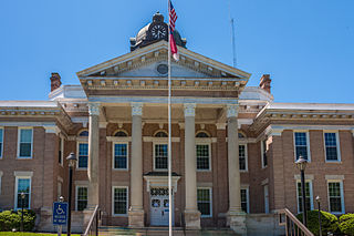
Halifax County is a county located in the U.S. state of North Carolina. As of the 2020 census, the population was 48,622. Its county seat is Halifax.

Long Neck is a census-designated place (CDP) in Sussex County, Delaware, United States. The population was 1,980 at the 2010 census. Long Neck was the only census-designated place in Sussex County until Lincoln was added in the 2020 United States census. It is part of the Salisbury, Maryland-Delaware Metropolitan Statistical Area.

Goulds is an unincorporated community and census-designated place (CDP) in Miami-Dade County, Florida, United States. The area was originally populated as the result of a stop on the Florida East Coast Railroad. The railroad depot was located near the current Southwest 224th Street. The community was named after its operator, Lyman Gould, who cut trees for railroad ties. As of the 2020 census, the population stood at 11,446, up from 10,103 in 2010.

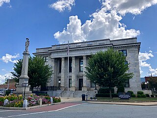
Graham is a city in Alamance County, North Carolina, United States. It is part of the Burlington, North Carolina Metropolitan Statistical Area. As of the 2020 census the population was 17,153. It is the county seat of Alamance County.

Wadesboro is a town and the county seat of Anson County, North Carolina, United States. The population was 5,049 at the 2020 census. The town was originally found in 1783 as New Town but changed by the North Carolina General Assembly to Wadesboro in 1787 to honor Colonel Thomas Wade, a native son, state legislator, and Revolutionary War commander of the Anson County Regiment.

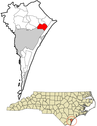
Kirkland, more commonly known as Porter's Neck, was a census-designated place (CDP) in New Hanover County, North Carolina, United States. Redesignated as Porters Neck CDP for the 2010 census, the population was 6,204. It is part of the Wilmington Metropolitan Statistical Area.

Ogden is a census-designated place (CDP) in New Hanover County, North Carolina, United States. It is both a suburb of the city of Wilmington and part of the Wilmington Metropolitan Statistical Area. The population was 6,766 at the 2010 census, up from 5,481 in 2000.

King is a city in Stokes and Forsyth counties, North Carolina, United States. The population was 7,096 at the 2020 census. King is part of the Piedmont Triad metropolitan area, located 15 miles northwest of Winston-Salem.
Advance is an unincorporated community and census-designated place (CDP) in Davie County, North Carolina, United States. It is seventy-five miles northeast of Charlotte. As of the 2010 census it had a population of 1,138. It is located along North Carolina Highway 801 just south of Bermuda Run. Advance is part of the Piedmont Triad region of North Carolina.

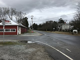
Gulf is an unincorporated community and census-designated place (CDP) in southwestern Chatham County, North Carolina, United States, southeast of the town of Goldston. As of the 2010 census, the Gulf CDP had a population of 144. The community is home to a general store and several historic homes. It received its name from its location at a wide bend in the Deep River.
Bunnlevel is an unincorporated community and census-designated place (CDP) along U.S. Highway 401 in Stewarts Creek Township, Harnett County, North Carolina, United States. The population was 552 at the 2010 census. It is a part of the Dunn Micropolitan Area, which is also a part of the greater Raleigh–Durham–Cary Combined Statistical Area (CSA) as defined by the United States Census Bureau.
Mamers is an unincorporated community and census-designated place (CDP) in Harnett County, North Carolina, United States. The population was 826 at the 2010 census. It is a part of the Dunn Micropolitan Area, which is also a part of the greater Raleigh–Durham–Cary Combined Statistical Area (CSA) as defined by the United States Census Bureau.
Blue Clay Farms is an unincorporated community and census-designated place in New Hanover County, North Carolina, United States. Its population was 33 as of the 2010 census.
Northchase is an unincorporated community and census-designated place in New Hanover County, North Carolina, United States. Its population was 3,747 as of the 2010 census. U.S. Route 117 passes through the community.
Cove Creek is an unincorporated community and census-designated place in Watauga County, North Carolina, United States. Its population was 1,171 as of the 2010 census.
Deercroft is an unincorporated community and census-designated place in Scotland County, North Carolina, United States. Its population was 411 as of the 2010 census. U.S. Routes 15 and 501 pass through the community.


