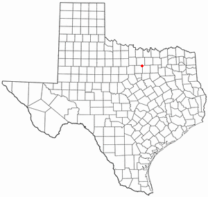
Briar is a census-designated place (CDP) in Parker, Tarrant and Wise counties in the U.S. state of Texas, near the west side of Eagle Mountain Lake.The population was 7,035 in 2020.
Caesars Head is an unincorporated community and census-designated place (CDP) on top of Caesars Head, a mountain in Greenville County, South Carolina, United States. It was first listed as a CDP in the 2020 census with a population of 84.
The Governors Village is a 450+ acre New Urbanism neighborhood and census-designated place (CDP) in Chatham County, North Carolina, United States, with an address of Chapel Hill. It was first listed as a CDP in the 2020 census with a population of 1,512.
Cypress Landing is a planned community and census-designated place (CDP) in Beaufort County, North Carolina, United States. It was first listed as a CDP in the 2020 census with a population of 1,257.
Brandywine Bay is a planned community and census-designated place (CDP) in Carteret County, North Carolina, United States. It was first listed as a CDP in the 2020 census with a population of 1,153.
Carolina Meadows is a planned community and census-designated place (CDP) in Chatham County, North Carolina, United States. It was first listed as a CDP in the 2020 census with a population of 727.
Governors Club is a golf course community and census-designated place (CDP) in Chatham County, North Carolina, United States. It was first listed as a CDP in the 2020 census with a population of 1,969.
Graingers is an unincorporated community and census-designated place (CDP) in Lenoir County, North Carolina, United States. It was first listed as a CDP in the 2020 census with a population of 229.
Long Creek is an unincorporated community and census-designated place (CDP) in Pender County, North Carolina, United States. It was first listed as a CDP in the 2020 census with a population of 277.
New Hope is an unincorporated area and census-designated place (CDP) in Wayne County, North Carolina, United States. It was first listed as a CDP in the 2020 census with a population of 1,588.
Danwood is an unincorporated community and census-designated place (CDP) in Florence County, South Carolina, United States. It was first listed as a CDP prior to the 2020 census with a population of 453.
Finklea is an unincorporated community and census-designated place (CDP) in Horry County, South Carolina, United States. As of the 2020 census it had a population of 291.
Unity is an unincorporated community and census-designated place (CDP) in Lancaster County, South Carolina, United States. It was first listed as a CDP prior to the 2020 census with a population of 325.
Manville is an unincorporated community and census-designated place (CDP) in Lee County, South Carolina, United States. It was first listed as a CDP prior to the 2020 census with a population of 471.
Edmund is an unincorporated community and census-designated place (CDP) in Lexington County, South Carolina, United States. It was first listed as a CDP in the 2020 census with a population of 969.
White Knoll is an unincorporated area and census-designated place (CDP) in Lexington County, South Carolina, United States. It was first listed as a CDP prior to the 2020 census with a population of 7,858.
South Union is an unincorporated community and census-designated place (CDP) in Oconee County, South Carolina, United States. It was first listed as a CDP prior to the 2020 census with a population of 341.
Arkwright is an unincorporated area and census-designated place (CDP) adjacent to the city of Spartanburg in Spartanburg County, South Carolina, United States. It was first listed as a CDP prior to the 2020 census with a population of 2,311.
The Cliffs Valley is a resort community and census-designated place (CDP) in Greenville County, South Carolina, United States. It was first listed as a CDP prior to the 2020 census with a population of 736.
Baxter Village is a planned community and census-designated place (CDP) in York County, South Carolina, United States. It was first listed as a CDP prior to the 2020 census which showed a population of 4,217.


