List of census-designated places in North Dakota

Last updated
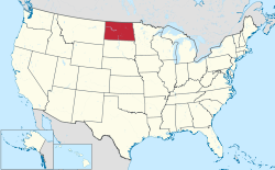
Map of the United States with North Dakota highlighted North Dakota in United States.svg
Map of the United States with North Dakota highlighted

Census-designated places (CDPs) are unincorporated communities lacking elected municipal officers and boundaries with legal status. [1] North Dakota has 44 census designated places.

Census-designated place

Population data based on 2010 census.

2018 RankCity2018 Estimate [2] 2010 Census [3] ChangeCounty
1 Minot Air Force Base 5,7895,521+4.85% Ward
2 Grand Forks Air Force Base 2,9222,367+23.45% Grand Forks
3 Belcourt 1,9332,078−6.98% Rolette
4 Fort Totten 1,3721,243+10.38% Benson
5 Shell Valley 1,3601,197+13.62% Rolette
6 Cannon Ball 931875+6.40% Sioux
7 Green Acres 702575+22.09% Rolette
8 Mandaree 595596−0.17% McKenzie
9 Four Bears Village 580517+12.19% McKenzie
10 East Dunseith 505500+1.00% Rolette
11 Ruthville 377191+97.38% Ward
12 White Shield 288336−14.29% McLean
13 Porcupine 255146+74.66% Sioux
14 Harmon 203145+40.00% Morton
15 Englevale 14440+260.00% Ransom
16 Logan 128194−34.02% Ward
17 Ypsilanti 92104−11.54% Stutsman
18 Brooktree Park 8580+6.25% Cass
19 Menoken 8070+14.29% Burleigh
20 Erie 7550+50.00% Cass
21 Driscoll 7082−14.63% Burleigh
22 Manning 6574−12.16% Dunn
23 Dahlen 4518+150.00% Nelson
24 East Fairview 4476−42.11% McKenzie
25 Foxholm 3975−48.00% Ward
26 Nash 3832+18.75% Walsh
27 Embden 3759−37.29% Cass
28 Caledonia 3639−7.69% Traill
29 Blanchard 3226+23.08% Traill
30 De Lamere 3230+6.67% Sargent
31 Denhoff 2620+30.00% Sheridan
32 Selz 2646−43.48% Pierce
33 Wheatland 2668−61.76% Cass
34 Orrin 2122−4.55% Pierce
35 Heil 2015+33.33% Grant
36 Barton 1920−5.00% Pierce
37 Auburn 1548−68.75% Walsh
38 Jessie 1125−56.00% Griggs
39 Larson 1012−16.67% Burke
40 Raleigh 1012−16.67% Grant
41 Spiritwood 718−61.11% Stutsman
42 Sutton 617−64.71% Griggs
43 McLeod 527−81.48% Ransom
44 Heimdal 427−85.19% Wells

Related Research Articles

Buffalo County, South Dakota U.S. county in South Dakota

Buffalo County is a county in the U.S. state of South Dakota. As of the 2010 census, the population was 1,912. Its county seat is Gann Valley which, at 14 people, is the least populous county seat in the United States. The county was created in 1864, and was organized in 1871 as part of the Dakota Territory.

Larson, North Dakota Census-designated place & Unincorporated community in North Dakota, United States

Larson is a former city and current census-designated place in Burke County, North Dakota, United States. The population was 12 at the 2010 census.

North Eagle Butte, South Dakota Census-designated place in South Dakota, United States

North Eagle Butte is a census-designated place (CDP) in Dewey County, South Dakota, United States, along the 45th parallel. The population was 1,954 at the 2010 census.

Blanchard, North Dakota Census-designated place in North Dakota, United States

Blanchard is a census-designated place in Blanchard Township, Traill County, North Dakota in the United States. The population was 26 at the 2010 census.

Union Center, South Dakota Census-designated place & unincorporated community in South Dakota, United States

Union Center is a small rural village in Meade County, South Dakota, United States. It is an unincorporated community, which was designated as part of the U.S. Census Bureau's Participant Statistical Areas Program on June 10, 2010. It was not counted separately during the 2000 Census, but is scheduled for inclusion in the 2010 Census. It has the post office which serves the area covered by ZIP code 57787, and three small businesses.

Dahlen, North Dakota Census-designated place & unincorporated community in North Dakota, United States

Dahlen is a census-designated place and an unincorporated community in Nelson County, North Dakota, United States. It was designated as part of the U.S. Census Bureau's Participant Statistical Areas Program on March 31, 2010. It was not counted separately during the 2000 Census, but was included in the 2010 Census, where a population of 18 was reported.

Caledonia, North Dakota Census-designated place & unincorporated community in North Dakota, United States

Caledonia is a census-designated place in Traill County, North Dakota in the United States. A former boomtown of the 1870s and the era of the Hudson's Bay Company steamship trade, the community has now all but virtually disappeared.

Manning, North Dakota Census-designated place in North Dakota, United States

Manning is a small town in, and the county seat of, Dunn County, North Dakota, United States. Manning was founded in 1908 to serve as the seat of Dunn County, itself organized that year. Its population was not reported in the 2000 Census, but was included in the 2010 Census, where a population of 74 was given. Its ZIP Code is 58642.

Nash, North Dakota Census-designated place & Unincorporated community in North Dakota, United States

Nash is a census-designated place and unincorporated community in Walsh County, North Dakota, United States. Its population was 32 as of the 2010 census. The unincorporated community is located in Farmington Township, northwest of Grafton, North Dakota.

Raleigh, North Dakota Census-designated place in North Dakota, United States

Raleigh is a census-designated place (CDP) in Grant County, North Dakota, United States. An unincorporated community, it was designated as part of the U.S. Census Bureau's Participant Statistical Areas Program on March 31, 2010. It was not counted separately during the 2000 Census, but was included in the 2010 Census, where a population of 12 was reported.

McLeod, North Dakota Census-designated place & Unincorporated community in North Dakota, United States

McLeod is a census designated place in eastern Ransom County, North Dakota, United States. An unincorporated community, it was designated as part of the U.S. Census Bureau's Participant Statistical Areas Program on March 31, 2010. It was not counted separately during the 2000 Census, but was included in the 2010 Census, where its population was reported to be 27.

Menoken, North Dakota Census-designated place in North Dakota, United States

Menoken is a census-designated place (CDP) in southwestern Burleigh County, North Dakota, United States. It was designated as part of the U.S. Census Bureau's Participant Statistical Areas Program on June 10, 2010. It was not counted separately during the 2000 Census, but was included in the 2010 Census, where a population of 70 was reported.

Driscoll, North Dakota Census-designated place in North Dakota, United States

Driscoll is a census-designated place in southeastern Burleigh County, North Dakota, United States. An unincorporated community, it was designated as part of the U.S. Census Bureau's Participant Statistical Areas Program on June 10, 2010. It was not counted separately during the 2000 Census, but was included in the 2010 Census, where a population of 82 was reported. In 2018, Driscoll was counted as a Census Designated Place, and had a population of 78.

Sutton, North Dakota Census-designated place in North Dakota, United States

Sutton is a census-designated place in western Griggs County, North Dakota, United States. An unincorporated community, it was designated as part of the U.S. Census Bureau's Participant Statistical Areas Program on March 31, 2010. It was not counted separately during the 2000 Census, but was included in the 2010 Census, where a population of 17 was reported.

Spiritwood, North Dakota Census-designated place & Unincorporated community in North Dakota, United States

Spiritwood is a census-designated place (CDP) in eastern Stutsman County, North Dakota, United States. An unincorporated community, it was designated as part of the U.S. Census Bureau's Participant Statistical Areas Program on March 31, 2010. It was not counted separately during the 2000 Census, but was included in the 2010 Census, where a population of 18 was reported.

Denhoff, North Dakota Census-designated place & unincorporated community in North Dakota, United States

Denhoff is an unincorporated community and census-designated place in central Sheridan County, North Dakota, United States. The community was designated as part of the U.S. Census Bureau's Participant Statistical Areas Program on March 31, 2010. It was not counted separately during the 2000 Census, but was included in the 2010 Census, where a population of 20 was reported.

Jessie, North Dakota Census-designated place in North Dakota, United States

Jessie is a census-designated place in northern Griggs County, North Dakota, United States. An unincorporated community, it was designated as part of the U.S. Census Bureau's Participant Statistical Areas Program on March 31, 2010. It was not counted separately during the 2000 Census, but was included in the 2010 Census, where a population of 25 was reported.

Porcupine, North Dakota Census-designated place & Unincorporated community in North Dakota, United States

Porcupine is a census-designated place in Sioux County, North Dakota, United States. It lies only a few minutes' drive from the city of Selfridge. The community includes the headquarters of the Selfridge/Porcupine district.

References

  1. "Geographic Terms and Concepts– Place". United States Census Bureau. United States Department of Commerce. Retrieved February 24, 2014.
  2. "North Dakota Cities by Population". Cubit. Retrieved October 6, 2019.
  3. "2010 Census Redistricting Data (Public Law 94-171) Summary File". American FactFinder2. U.S. Census Bureau, 2010 Census. Retrieved October 8, 2019.[ dead link ]