Sutton, North Dakota | |
|---|---|
 Grain elevator in Sutton | |
 Sutton  Sutton | |
| Coordinates: 47°24′7″N98°26′21″W / 47.40194°N 98.43917°W | |
| Country | United States |
| State | North Dakota |
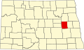
| County | Griggs |
| Area | |
• Total | 0.20 sq mi (0.53 km2) |
| • Land | 0.20 sq mi (0.53 km2) |
| • Water | 0 sq mi (0.00 km2) |
| Elevation | 1,470 ft (450 m) |
| Population (2020) | |
• Total | 17 |
| • Density | 83.0/sq mi (32.06/km2) |
| Time zone | UTC-6 (Central (CST)) |
| • Summer (DST) | UTC-5 (CDT) |
| ZIP codes | 58484 |
| Area code | 701 |
| FIPS code | 38-77260 [2] |
| GNIS feature ID | 2584358 [2] |
Sutton is a census-designated place in western Griggs County, North Dakota, United States. An unincorporated community, it was designated as part of the U.S. Census Bureau's Participant Statistical Areas Program on March 31, 2010. [3] It was not counted separately during the 2000 Census, [4] but was included in the 2010 Census, [5] where a population of 17 was reported. [6]
It lies west of the city of Cooperstown, the county seat of Griggs County. [3] It had a post office with the ZIP code 58484. [7]