Ball Hill Township, North Dakota | |
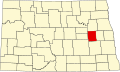
---|---|
Coordinates: 47°22′12″N98°10′44″W / 47.37000°N 98.17889°W | |
Country | United States |
State | North Dakota |
County | Griggs County |
Township | Ball Hill Township |
Area | |
• Total | 36.49 sq mi (94.5 km2) |
Elevation | 1,460 ft (445 m) |
Population (2010) | |
• Total | 55 |
• Density | 1.5/sq mi (0.6/km2) |
Time zone | UTC-6 (Central (CST)) |
• Summer (DST) | UTC-5 (CDT) |
Postal Code(s) [1] | 58448 & 58425 |
Area code | 701 |
GNIS feature ID | 1036633 |
Census Code | 04540 |
Census Class Code | T1 |
Website | Griggs County |
Census | Pop. | Note | %± |
---|---|---|---|
1890 | 183 | — | |
1900 | 244 | 33.3% | |
1910 | 266 | 9.0% | |
1920 | 276 | 3.8% | |
1930 | 260 | −5.8% | |
1940 | 204 | −21.5% | |
1950 | 194 | −4.9% | |
1960 | 150 | −22.7% | |
1970 | 113 | −24.7% | |
1980 | 119 | 5.3% | |
1990 | 109 | −8.4% | |
2000 | 82 | −24.8% | |
2010 | 55 | −32.9% | |
2018 (est.) | 51 | [2] | −7.3% |
Ball Hill Township [3] is a township in Griggs County, North Dakota, United States.
Its population during the 2010 census was 55. [4]
Ball Hill Township is located in Township 145 Range 59 west of the Fifth principal meridian. [5]
Range 61 | Range 60 | Range 59 | Range 58 | |
---|---|---|---|---|
Township 148 | Rosendal | Willow | Pilot Mound | Lenora |
Township 147 | Bryan | Addie | Tyrol | Romness |
Township 146 | Kingsley | Clearfield | Cooperstown | Washburn |
Township 145 | Mabel | Helena | Ball Hill | Sverdrup |
Township 144 | Dover | Bartley | Greenfield | Broadview |
North Dakota is a landlocked U.S. state in the Upper Midwest, named after the indigenous Dakota Sioux. It is bordered by the Canadian provinces of Saskatchewan and Manitoba to the north and by the U.S. states of Minnesota to the east, South Dakota to the south, and Montana to the west. North Dakota is part of the Great Plains region, characterized by broad prairies, steppe, temperate savanna, badlands, and farmland. North Dakota is the 19th-largest state by area, but with a population of just under 800,000, it is the fourth-least populous and fourth-most sparsely populated. The state capital is Bismarck while the most populous city is Fargo, which accounts for nearly a fifth of the state's population; both cities are among the fastest-growing in the U.S., although half of all residents live in rural areas.
South Dakota is a landlocked state in the North Central region of the United States. It is also part of the Great Plains. South Dakota is named after the Dakota Sioux tribe, which comprises a large portion of the population — with nine reservations currently in the state — and has historically dominated the territory. South Dakota is the 17th-largest by area, but the fifth-least populous, and the fifth-least densely populated of the 50 United States. Pierre is the state capital, and Sioux Falls, with a population of about 213,900, is South Dakota's most populous city. The state is bisected by the Missouri River, dividing South Dakota into two geographically and socially distinct halves, known to residents as "East River" and "West River". South Dakota is bordered by North Dakota to the north, Minnesota to the east, Iowa to the southeast, Nebraska to the south, Wyoming to the west, and Montana to the northwest.
Adams County is a county in the U.S. state of North Dakota. As of the 2020 census, the population was 2,200. The county seat is Hettinger. The county was created on April 17, 1907, and organized one week later. It was named for John Quincy Adams (1848–1919), a railroad official for the Milwaukee Road Railroad and distant relative of sixth U.S. President John Quincy Adams (1767–1848). In 1923, Adams County was the site of one of the deadliest tornadoes in North Dakota's recorded history. The "Adams County Twister' killed eight people and injured 20.
Bennett County is a county in the U.S. state of South Dakota. As of the 2020 census, the population was 3,381. Its county seat is Martin. Bennett County was removed from the Pine Ridge Reservation by an act of Congress in 1911, much of Bennett County however is still held in trust by the Reservation. To the east is the Rosebud Indian Reservation, where dwell the Sicangu Oyate, also known the Upper Brulé Sioux Nation and the Rosebud Sioux Tribe (RST), a branch of the Lakota people.
Slope County is a county in the U.S. state of North Dakota. As of the 2020 census, the population was 706, making it the least populous county in North Dakota and the 18th-least populous county in the United States. The county seat is Amidon.
Mountrail County is a county in the northwestern part of North Dakota, United States. As of the 2020 census, the population was 9,809. Its county seat is Stanley. The county was originally created in 1873, then removed in 1892, annexed by Ward County. It was re-created and organized in 1909. The county is home to the headquarters of the Three Affiliated Tribes of the Mandan, Hidatsa, and Arikara people, and a large part of the county belongs to the tribe's Fort Berthold reservation.
Griggs County is a county in the U.S. state of North Dakota. As of the 2020 census, the population was 2,306. Its county seat is Cooperstown.
Grant County is a county in the U.S. state of North Dakota. As of the 2020 census, the population was 2,301. Its county seat is Carson.
Foster County is a county in the U.S. state of North Dakota. As of the 2020 census, the population was 3,397. Its county seat is Carrington.
Dickey County is a county in the U.S. state of North Dakota. As of the 2020 census, the population was 4,999. Its county seat is Ellendale.
Cass County is a county in the U.S. state of North Dakota. As of the 2020 census, the population was 184,525. Cass County is the most populous county in North Dakota, accounting for nearly a quarter of the state's population. The county seat is Fargo, the state's most populous city. The county is named for George Washington Cass, president of the Northern Pacific Railway from 1872 to 1875. It is the only Cass County in the United States that is not named after Lewis Cass.
Benson County is a county in the U.S. state of North Dakota. As of the 2020 census, the population was 5,964. Its county seat is Minnewaukan. The county was created on March 9, 1883 by the Dakota Territory legislature, and was named for Bertil W. Benson, a Dakota Territory legislator at the time. The county government was organized on June 4, 1884, and its boundary lines were altered by two legislative actions in 1885.
Keya Paha County is a county in the U.S. state of Nebraska. As of the 2020 United States Census, the population was 769. Its county seat is Springview.
Yellow Medicine County is a county in the southwestern part of the U.S. state of Minnesota. Its eastern border is formed by the Minnesota River. As of the 2020 census, the population was 9,528. Its county seat is Granite Falls.
Nicollet County is a county in the U.S. state of Minnesota. As of the 2020 census, the population was 34,454. Its county seat is St. Peter.
Dakota County is the third-most populous county in the U.S. state of Minnesota, located in the east central portion of the state. As of the 2020 census, the population was 439,882. The population of Dakota County was estimated to be 447,440 in 2023. The county seat is Hastings. Dakota County is named for the Dakota Sioux tribal bands who inhabited the area. The name is recorded as "Dahkotah" in the United States Census records until 1851. Dakota County is included in the Minneapolis–St. Paul–Bloomington, MN–WI Metropolitan Statistical Area, the sixteenth largest metropolitan area in the United States with about 3.71 million residents. The largest city in Dakota County is the city of Lakeville, the ninth-largest city in Minnesota and fifth-largest Twin Cities suburb. The county is bordered by the Minnesota and Mississippi Rivers on the north, and the state of Wisconsin on the east.
Blue Earth County is a county in the state of Minnesota. As of the 2020 census, the population was 69,112. Its county seat is Mankato. The county is named for the Blue Earth River and for the deposits of blue-green clay once evident along the banks of the Blue Earth River. Blue Earth County is part of the Mankato-North Mankato metropolitan area.
Ada is a township in Dickey County, North Dakota, United States. Its population during the 2020 Census was 29, down from 60 in 2000. Its population in 1900 was 232.
Omemee is a ghost town in Bottineau County in the U.S. state of North Dakota. It was a railroad hub in the early 1910s, located at the junction of two major railroads, the Soo Line Railroad and the Great Northern Railway. Incorporated as a city in 1902, Omemee has been abandoned since 2003.
Petrel is a ghost town in Adams County, North Dakota, United States. It is located just across the border with South Dakota, between Lemmon, South Dakota, in Perkins County and Haynes. Petrel is a former railroad townsite and siding on the Milwaukee Road. The town was named for the long-winged pigeons seen in the area.