Sverdrup Township, North Dakota | |
|---|---|
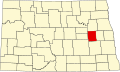
 Sverdrup Township, North Dakota Location within the state of North Dakota | |
| Coordinates: 47°22′11″N98°03′01″W / 47.36972°N 98.05028°W | |
| Country | United States |
| State | North Dakota |
| County | Griggs County |
| Township | Sverdrup Township |
| Area | |
• Total | 36.01 sq mi (93.3 km2) |
| Elevation | 1,339 ft (408 m) |
| Population (2010) | |
• Total | 92 |
| • Density | 2.6/sq mi (1/km2) |
| Time zone | UTC-6 (Central (CST)) |
| • Summer (DST) | UTC-5 (CDT) |
| Postal Code(s) [1] | 58425 |
| Area code | 701 |
| GNIS feature ID | 1036630 |
| Census Code | 77340 |
| Census Class Code | T1 |
| Website | Griggs County |
| Census | Pop. | Note | %± |
|---|---|---|---|
| 1890 | 274 | — | |
| 1900 | 331 | 20.8% | |
| 1910 | 327 | −1.2% | |
| 1920 | 327 | 0.0% | |
| 1930 | 315 | −3.7% | |
| 1940 | 240 | −23.8% | |
| 1950 | 202 | −15.8% | |
| 1960 | 155 | −23.3% | |
| 1970 | 139 | −10.3% | |
| 1980 | 112 | −19.4% | |
| 1990 | 109 | −2.7% | |
| 2000 | 90 | −17.4% | |
| 2010 | 92 | 2.2% | |
| 2018 (est.) | 84 | [2] | −8.7% |
Sverdrup Township [3] is a township in Griggs County, North Dakota, United States.