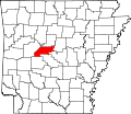
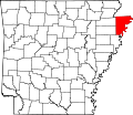
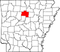
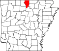
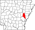
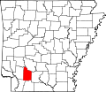
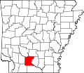
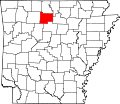
List of census-designated places in Arkansas

Last updated

This article lists census-designated places (CDPs) in the U.S. state of Arkansas. [1]

Contents

Census-Designated Places

CDPPopulation (2020)CountyLocation of countyNotes
Acorn 376 Polk
Map of Arkansas highlighting Polk County.svg
First appeared as a CDP in the 2020 census
Alix 100 Franklin
Map of Arkansas highlighting Franklin County.svg
First appeared as a CDP in the 2020 census
Alleene 97 Little River
Map of Arkansas highlighting Little River County.svg
First appeared as a CDP in the 2020 census
Alpine 134 Clark
Map of Arkansas highlighting Clark County.svg
First appeared as a CDP in the 2020 census
Aplin 100 Perry
Map of Arkansas highlighting Perry County.svg
First appeared as a CDP in the 2020 census
Appleton 399 Pope
Map of Arkansas highlighting Pope County.svg
First appeared as a CDP in the 2020 census
Armorel 320 Mississippi
Map of Arkansas highlighting Mississippi County.svg
First appeared as a CDP in the 2020 census
Avilla 1,325 Saline
Map of Arkansas highlighting Saline County.svg
Batavia 328 Boone
Map of Arkansas highlighting Boone County.svg
First appeared as a CDP in the 2020 census
Bee Branch 293 Van Buren
Map of Arkansas highlighting Van Buren County.svg
First appeared as a CDP in the 2020 census
Beirne 36 Clark
Map of Arkansas highlighting Clark County.svg
First appeared as a CDP in the 2020 census
Bethesda 199 Independence
Map of Arkansas highlighting Independence County.svg
First appeared as a CDP in the 2020 census
Bismarck 229 Hot Spring
Map of Arkansas highlighting Hot Spring County.svg
First appeared as a CDP in the 2020 census
Board Camp 87 Polk
Map of Arkansas highlighting Polk County.svg
First appeared as a CDP in the 2020 census
Boles 166 Scott
Map of Arkansas highlighting Scott County.svg
First appeared as a CDP in the 2020 census
Bowman 75 Craighead
Map of Arkansas highlighting Craighead County.svg
First appeared as a CDP in the 2020 census
Buffalo City 26 Baxter
Map of Arkansas highlighting Baxter County.svg
First appeared as a CDP in the 2020 census
Caddo Gap 39 Montgomery
Map of Arkansas highlighting Montgomery County.svg
First appeared as a CDP in the 2020 census
Canehill 74 Washington
Map of Arkansas highlighting Washington County.svg
First appeared as a CDP in the 2020 census
Center Point 179 Howard
Map of Arkansas highlighting Howard County.svg
First appeared as a CDP in the 2020 census
Center Ridge 290 Conway
Map of Arkansas highlighting Conway County.svg
Centerville 283 Yell
Map of Arkansas highlighting Yell County.svg
First appeared as a CDP in the 2020 census
Cherokee City 73 Benton
Map of Arkansas highlighting Benton County.svg
Cincinnati 306 Washington
Map of Arkansas highlighting Washington County.svg
First appeared as a CDP in the 2020 census
College Station 469 Pulaski
Map of Arkansas highlighting Pulaski County.svg
Collins 149 Drew
Map of Arkansas highlighting Drew County.svg
First appeared as a CDP in the 2020 census
Crystal Springs 129 Garland
Map of Arkansas highlighting Garland County.svg
First appeared as a CDP in the 2020 census
Deer 135 Newton
Map of Arkansas highlighting Newton County.svg
First appeared as a CDP in the 2020 census
Dennard 496 Van Buren
Map of Arkansas highlighting Van Buren County.svg
Desha 715 Independence
Map of Arkansas highlighting Independence County.svg
First appeared as a CDP in the 2020 census
Dora 121 Crawford
Map of Arkansas highlighting Crawford County.svg
First appeared as a CDP in the 2020 census
Drasco 144 Cleburne
Map of Arkansas highlighting Cleburne County.svg
First appeared as a CDP in the 2020 census
East End 7,137 Saline
Map of Arkansas highlighting Saline County.svg
Edgemont 56 Cleburne
Map of Arkansas highlighting Cleburne County.svg
First appeared as a CDP in the 2020 census
El Paso 267 White
Map of Arkansas highlighting White County.svg
First appeared as a CDP in the 2020 census
Evansville 102 Washington
Map of Arkansas highlighting Washington County.svg
First appeared as a CDP in the 2020 census
Fair Oaks 55 Cross
Map of Arkansas highlighting Cross County.svg
First appeared as a CDP in the 2020 census
Floral 109 Independence
Map of Arkansas highlighting Independence County.svg
First appeared as a CDP in the 2020 census
Floyd 377 White
Map of Arkansas highlighting White County.svg
First appeared as a CDP in the 2020 census
Fox 237 Stone
Map of Arkansas highlighting Stone County.svg
First appeared as a CDP in the 2020 census
Gamaliel 33 Baxter
Map of Arkansas highlighting Baxter County.svg
First appeared as a CDP in the 2020 census
Genoa 972 Miller
Map of Arkansas highlighting Miller County.svg
First appeared as a CDP in the 2020 census
Gibson 4,111 Pulaski
Map of Arkansas highlighting Pulaski County.svg
Goodwin 113 St. Francis
Map of Arkansas highlighting Saint Francis County.svg
First appeared as a CDP in the 2020 census
Gregory 43 Woodruff
Map of Arkansas highlighting Woodruff County.svg
First appeared as a CDP in the 2020 census
Hagarville 142 Johnson
Map of Arkansas highlighting Johnson County.svg
Halley 44 Desha
Map of Arkansas highlighting Desha County.svg
First appeared as a CDP in the 2020 census
Hattieville 132 Conway
Map of Arkansas highlighting Conway County.svg
First appeared as a CDP in the 2020 census
Henderson 309 Baxter
Map of Arkansas highlighting Baxter County.svg
First appeared as a CDP in the 2020 census
Hensley 137 Pulaski
Map of Arkansas highlighting Pulaski County.svg
Hot Springs Village 15,861 Garland and Saline Map of Arkansas highlighting Garland County.svg Map of Arkansas highlighting Saline County.svg
Indian Bay 15 Monroe
Map of Arkansas highlighting Monroe County.svg
First appeared as a CDP in the 2020 census
Ivan 135 Dallas
Map of Arkansas highlighting Dallas County.svg
First appeared as a CDP in the 2020 census
Jerome 24 Drew
Map of Arkansas highlighting Drew County.svg
First appeared as a CDP in 2022, previously a town [2]
Jerusalem 137 Conway
Map of Arkansas highlighting Conway County.svg
First appeared as a CDP in the 2020 census
Jones Mills 411 Hot Spring
Map of Arkansas highlighting Hot Spring County.svg
First appeared as a CDP in the 2020 census
Kingston 97 Madison
Map of Arkansas highlighting Madison County.svg
First appeared as a CDP in the 2020 census
Kirby 721 Pike
Map of Arkansas highlighting Pike County.svg
Lacey 139 Drew
Map of Arkansas highlighting Drew County.svg
First appeared as a CDP in the 2020 census
Lake Hamilton 2,084 Garland
Map of Arkansas highlighting Garland County.svg
Landmark 3,585 Pulaski
Map of Arkansas highlighting Pulaski County.svg
Lawson 260 Union
Map of Arkansas highlighting Union County.svg
First appeared as a CDP in the 2020 census
Lost Bridge Village 397 Benton
Map of Arkansas highlighting Benton County.svg
McAlmont 1,447 Pulaski
Map of Arkansas highlighting Pulaski County.svg
Magnet Cove 692 Hot Spring
Map of Arkansas highlighting Hot Spring County.svg
Maysville 117 Benton
Map of Arkansas highlighting Benton County.svg
Midway 1,036 Baxter
Map of Arkansas highlighting Baxter County.svg
Monroe 51 Monroe
Map of Arkansas highlighting Monroe County.svg
First appeared as a CDP in the 2020 census
Morrow 263 Washington
Map of Arkansas highlighting Washington County.svg
First appeared as a CDP in the 2020 census
Mount Holly 123 Union
Map of Arkansas highlighting Union County.svg
First appeared as a CDP in the 2020 census
Mount Judea 110 Newton
Map of Arkansas highlighting Newton County.svg
First appeared as a CDP in the 2020 census
Mount Olive 17 Izard
Map of Arkansas highlighting Izard County.svg
First appeared as a CDP in the 2020 census
Natural Steps 413 Pulaski
Map of Arkansas highlighting Pulaski County.svg
New Blaine 173 Logan
Map of Arkansas highlighting Logan County.svg
New Edinburg 134 Cleveland
Map of Arkansas highlighting Cleveland County.svg
Newhope 169 Pike
Map of Arkansas highlighting Pike County.svg
First appeared as a CDP in the 2020 census
North Crossett 2,756 Ashley
Map of Arkansas highlighting Ashley County.svg
Oak Grove 177 Pope
Map of Arkansas highlighting Pope County.svg
First appeared as a CDP in the 2020 census
Oakland 72 Marion
Map of Arkansas highlighting Marion County.svg
First appeared as a CDP in the 2020 census
Oark 43 Johnson
Map of Arkansas highlighting Johnson County.svg
First appeared as a CDP in the 2020 census
Oneida 13 Phillips
Map of Arkansas highlighting Phillips County.svg
First appeared as a CDP in the 2020 census
Ozark Acres 692 Sharp
Map of Arkansas highlighting Sharp County.svg
First appeared as a CDP in the 2020 census
Ozone 92 Johnson
Map of Arkansas highlighting Johnson County.svg
First appeared as a CDP in the 2020 census
Payneway 241 Poinsett
Map of Arkansas highlighting Poinsett County.svg
First appeared as a CDP in the 2020 census
Pearcy 306 Garland
Map of Arkansas highlighting Garland County.svg
First appeared as a CDP in the 2020 census
Pencil Bluff 72 Montgomery
Map of Arkansas highlighting Montgomery County.svg
First appeared as a CDP in the 2020 census
Piney 5,238 Garland
Map of Arkansas highlighting Garland County.svg
Pleasant Grove 235 Stone
Map of Arkansas highlighting Stone County.svg
First appeared as a CDP in the 2020 census
Ponca 30 Newton
Map of Arkansas highlighting Newton County.svg
First appeared as a CDP in the 2020 census
Poplar Grove 215 Phillips
Map of Arkansas highlighting Phillips County.svg
First appeared as a CDP in the 2020 census
Prairie Creek 2,217 Benton
Map of Arkansas highlighting Benton County.svg
Princeton 13 Dallas
Map of Arkansas highlighting Dallas County.svg
First appeared as a CDP in the 2020 census
Reader 40 Nevada and Ouachita Map of Arkansas highlighting Nevada County.svg Map of Arkansas highlighting Ouachita County.svg
Rivervale 46 Poinsett
Map of Arkansas highlighting Poinsett County.svg
First appeared as a CDP in the 2020 census
Rockwell 4,548 Garland
Map of Arkansas highlighting Garland County.svg
Roland 820 Pulaski
Map of Arkansas highlighting Pulaski County.svg
Rover 159 Yell
Map of Arkansas highlighting Yell County.svg
First appeared as a CDP in the 2020 census
Rye 123 Cleveland
Map of Arkansas highlighting Cleveland County.svg
Salado 472 Independence
Map of Arkansas highlighting Independence County.svg
First appeared as a CDP in the 2020 census
Salem 2,544 Saline
Map of Arkansas highlighting Saline County.svg
Saratoga 124 Hempstead and Howard Map of Arkansas highlighting Hempstead County.svg Map of Arkansas highlighting Howard County.svg First appeared as a CDP in the 2020 census
Sardis 833 Saline
Map of Arkansas highlighting Saline County.svg
First appeared as a CDP in the 2020 census
Scott 97 Pulaski and Lonoke Map of Arkansas highlighting Pulaski County.svg Map of Arkansas highlighting Lonoke County.svg
Springfield 223 Conway
Map of Arkansas highlighting Conway County.svg
First appeared as a CDP in the 2020 census
Staves 133 Cleveland
Map of Arkansas highlighting Cleveland County.svg
Sulphur Springs 1,032 Jefferson
Map of Arkansas highlighting Jefferson County.svg
Summers 166 Washington
Map of Arkansas highlighting Washington County.svg
First appeared as a CDP in the 2020 census
Sweet Home 712 Pulaski
Map of Arkansas highlighting Pulaski County.svg
Tucker 95 Jefferson
Map of Arkansas highlighting Jefferson County.svg
First appeared as a CDP in the 2020 census
Tumbling Shoals 902 Cleburne
Map of Arkansas highlighting Cleburne County.svg
Uniontown 112 Crawford
Map of Arkansas highlighting Crawford County.svg
First appeared as a CDP in the 2020 census
Urbana 177 Union
Map of Arkansas highlighting Union County.svg
First appeared as a CDP in the 2020 census
Vanndale 339 Cross
Map of Arkansas highlighting Cross County.svg
First appeared as a CDP in the 2020 census
Violet Hill 36 Izard
Map of Arkansas highlighting Izard County.svg
First appeared as a CDP in the 2020 census
Walcott 152 Greene
Map of Arkansas highlighting Greene County.svg
First appeared as a CDP in the 2020 census
Warm Springs 47 Randolph
Map of Arkansas highlighting Randolph County.svg
First appeared as a CDP in the 2020 census
Wayton 148 Newton
Map of Arkansas highlighting Newton County.svg
First appeared as a CDP in the 2020 census
Wesley 161 Madison
Map of Arkansas highlighting Madison County.svg
First appeared as a CDP in the 2020 census
West Crossett 1,144 Ashley
Map of Arkansas highlighting Ashley County.svg
Wilburn 132 Cleburne
Map of Arkansas highlighting Cleburne County.svg
First appeared as a CDP in the 2020 census
Witts Springs 33 Searcy
Map of Arkansas highlighting Searcy County.svg
First appeared as a CDP in the 2020 census
Woodlawn 174 Cleveland
Map of Arkansas highlighting Cleveland County.svg
Woodson 346 Pulaski
Map of Arkansas highlighting Pulaski County.svg
Yarborough Landing 457 Little River
Map of Arkansas highlighting Little River County.svg

Former Census-Designated Places

CDPPopulation (2020)CountyLocation of countyNotes
Holiday Island 2,533 Carroll
Map of Arkansas highlighting Carroll County.svg
Incorporated as a city in November 2020 [3]

See also

References

  1. "State of Arkansas Census Designated Places - Current/ACS22 - Data as of January 1, 2022". United States Census Bureau . January 1, 2022.
  2. "Petition and order revoking charter of the town of Jerome, Arkansas, 2021 October 14". Arkansas Digital Archives. October 14, 2021.
  3. Bowden, Bill (November 6, 2020). "Vote seals incorporation of Holiday Island as city". Arkansas Democrat Gazette .