West Crossett, Arkansas

Last updated

West Crossett, Arkansas
CDP
Ashley County Arkansas Incorporated and Unincorporated areas West Crossett Highlighted.svg
Location in Ashley County and the state of Arkansas
Coordinates: 33°8′18″N92°0′35″W / 33.13833°N 92.00972°W / 33.13833; -92.00972
Country United States
State Arkansas
County Ashley
Area
[1]
  Total11.90 sq mi (30.83 km2)
  Land11.89 sq mi (30.80 km2)
  Water0.01 sq mi (0.02 km2)
Elevation
151 ft (46 m)
Population
 (2020)
  Total1,144
  Density96.19/sq mi (37.14/km2)
Time zone UTC-6 (Central (CST))
  Summer (DST) UTC-5 (CDT)
ZIP code
71635
Area code 870
FIPS code 05-74270
GNIS feature ID0058849

West Crossett is a census-designated place (CDP) in Ashley County, Arkansas, United States. Per the 2020 census, the population was 1,144. [2]

Contents

Geography

West Crossett is located at 33°8′18″N92°0′35″W / 33.13833°N 92.00972°W / 33.13833; -92.00972 (33.138278, -92.009710). [3]

According to the United States Census Bureau, the CDP has a total area of 11.9 square miles (31 km2), of which 11.9 square miles (31 km2) is land and 0.01 square miles (0.026 km2) (.08%) is water.

Demographics

Historical population
CensusPop.Note
2010 1,256
2020 1,144−8.9%
U.S. Decennial Census [4]
2010 [5] 2020 [6]

2020 census

West Crossett CDP, Arkansas – Demographic Profile
(NH = Non-Hispanic)
Note: the US Census treats Hispanic/Latino as an ethnic category. This table excludes Latinos from the racial categories and assigns them to a separate category. Hispanics/Latinos may be of any race.
Race / EthnicityPop 2010 [5] Pop 2020 [6] % 2010% 2020
White alone (NH)79473063.22%63.81%
Black or African American alone (NH)41935933.36%31.38%
Native American or Alaska Native alone (NH)030.00%0.26%
Asian alone (NH)030.00%0.17%
Pacific Islander alone (NH)000.00%0.00%
Some Other Race alone (NH)090.00%0.79%
Mixed Race/Multi-Racial (NH)15241.19%2.10%
Hispanic or Latino (any race)28172.23%1.49%
Total1,2561,144100.00%100.00%

2000 Census

As of the census [7] of 2000, there were 1,664 people, 661 households, and 485 families residing in the CDP. The population density was 102.5 inhabitants per square mile (39.6/km2). There were 774 housing units at an average density of 47.7 per square mile (18.4/km2). The racial makeup of the CDP was 60.88% White, 36.72% Black or African American, 0.06% Native American, 0.06% Asian, 1.74% from other races, and 0.54% from two or more races. 3.06% of the population were Hispanic or Latino of any race.

There were 661 households, out of which 33.1% had children under the age of 18 living with them, 57.0% were married couples living together, 12.0% had a female householder with no husband present, and 26.5% were non-families. 22.8% of all households were made up of individuals, and 8.2% had someone living alone who was 65 years of age or older. The average household size was 2.52 and the average family size was 2.95.

In the CDP, the population was spread out, with 25.7% under the age of 18, 8.0% from 18 to 24, 27.3% from 25 to 44, 26.6% from 45 to 64, and 12.4% who were 65 years of age or older. The median age was 38 years. For every 100 females, there were 96.9 males. For every 100 females age 18 and over, there were 98.1 males.

The median income for a household in the CDP was $35,089, and the median income for a family was $37,763. Males had a median income of $34,500 versus $21,406 for females. The per capita income for the CDP was $15,759. About 9.5% of families and 11.7% of the population were below the poverty line, including 9.3% of those under age 18 and 12.0% of those age 65 or over.

Education

The community is in the Crossett School District, which operates Crossett High School. [8]

Related Research Articles

<span class="mw-page-title-main">Rock Creek, Alabama</span> CDP in Alabama, United States

Rock Creek is a census-designated place in Jefferson County, Alabama, United States. Its location is northwest of Hueytown. At the 2020 census, the population was 1,471. This area was damaged by an F5 tornado on April 8, 1998. An EF2 tornado struck northwest from here on January 23, 2012.

<span class="mw-page-title-main">North Crossett, Arkansas</span> CDP in Arkansas, United States

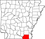
North Crossett is a census-designated place (CDP) in Ashley County, Arkansas, United States. Per the 2020 census, the population was 2,756.

<span class="mw-page-title-main">Prairie Creek, Arkansas</span> CDP in Arkansas, United States

Prairie Creek is a census-designated place (CDP) in Benton County, Arkansas, United States. Per the 2020 census, the population was 2,217. It is a lakefront community adjacent to Beaver Lake and Rogers within the Northwest Arkansas region.

<span class="mw-page-title-main">Hensley, Arkansas</span> Census-designated place in Arkansas, United States

Hensley is a census-designated place (CDP) in Pulaski County, Arkansas, United States. The population was 139 at the 2010 census. It is part of the Little Rock–North Little Rock–Conway Metropolitan Statistical Area.

<span class="mw-page-title-main">Landmark, Arkansas</span> CDP in Arkansas, United States

Landmark is a census-designated place (CDP) in Pulaski County, Arkansas, United States. Per the 2020 census, the population was 3,585. It is part of the Little Rock–North Little Rock–Conway Metropolitan Statistical Area.

<span class="mw-page-title-main">Salem, Saline County, Arkansas</span> CDP in Arkansas, United States

Salem is a census-designated place (CDP) in Saline County, Arkansas, United States. Per the 2020 census, the population was 2,544. It is part of the Little Rock–North Little Rock–Conway Metropolitan Statistical Area.
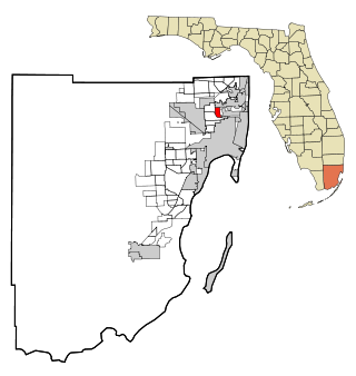
<span class="mw-page-title-main">Palm Springs North, Florida</span> Census-designated place in Florida

Palm Springs North is an unincorporated community and census-designated place (CDP) in Miami-Dade County, Florida, United States. It is part of the Miami metropolitan area of South Florida. The population was 5,030 at the 2020 census.

<span class="mw-page-title-main">Three Lakes, Florida</span> Census-designated place in Florida

Three Lakes is a census-designated place (CDP) and planned community in Miami-Dade County, Florida, United States. It is part of the Miami metropolitan area of South Florida. The population was 16,540 at the 2020 census, up from 15,047 in 2010.

<span class="mw-page-title-main">Westwood Lakes, Florida</span> Census-designated place in Florida

Westwood Lakes is a census-designated place and unincorporated community of Miami-Dade County, Florida, United States. It is part of the Miami metropolitan area of South Florida. The population was 11,373 at the 2020 census.

<span class="mw-page-title-main">Fort Pierce North, Florida</span> CDP in Florida, United States

Fort Pierce North is a census-designated place (CDP) in St. Lucie County, Florida, United States. Per the 2020 census, the population was 6,904. It is part of the Port St. Lucie Metropolitan Statistical Area.

Fox Lake Hills is an unincorporated community and census-designated place (CDP) in Lake Villa Township, Lake County, Illinois, United States. Per the 2020 census, the population was 2,684.

Long Lake is an unincorporated community and census-designated place (CDP) in Lake County, Illinois, United States. Per the 2020 census, the population was 3,663.

<span class="mw-page-title-main">Preston Heights, Illinois</span> Census-designated place in Illinois, United States

Preston Heights is a census-designated place (CDP) in Will County, Illinois, United States. As of the 2020 census, the CDP population was 2,898.

North Vacherie is a census-designated place (CDP) in St. James Parish, Louisiana, United States. The population was 2,411 at the 2000 census. Vacherie was noted in the 2000 census as being the town with the least mobility of all in the United States.

<span class="mw-page-title-main">Brooklyn Park, Maryland</span> Census-designated place in Maryland, United States

Brooklyn Park is a census-designated place (CDP) in Anne Arundel County, Maryland, United States. The population was 14,373 at the 2010 census.

<span class="mw-page-title-main">East Riverdale, Maryland</span> Census-designated place in Maryland, United States

East Riverdale is an unincorporated area and census-designated place (CDP) in Prince George's County, Maryland, United States. The population was 18,459 at the 2020 census.

<span class="mw-page-title-main">Springdale, Maryland</span> Census-designated place in Maryland

Springdale is an unincorporated area and census-designated place (CDP) in Prince George's County, Maryland, United States. Per the 2020 census, the population was 5,301.

<span class="mw-page-title-main">West Laurel, Maryland</span> Census-designated place in Maryland

West Laurel is an unincorporated area and census-designated place (CDP) in Prince George's County, Maryland, United States. Per the 2020 census, the population was 4,428.

<span class="mw-page-title-main">Montrose, Virginia</span> Census-designated place in Virginia

Montrose is a census-designated place (CDP) in Henrico County, Virginia, United States. The population was 7,909 at the 2020 census.

<span class="mw-page-title-main">Laurel Park, Virginia</span> CDP in Virginia, United States

Laurel Park is a census-designated place (CDP) in Henry County, Virginia, United States. The population was 675 at the 2010 census. It is part of the Martinsville Micropolitan Statistical Area.

References

  1. "2020 U.S. Gazetteer Files". United States Census Bureau. Retrieved October 29, 2021.
  2. "West Crossett CDP, Arkansas". United States Census Bureau . Retrieved April 15, 2022.
  3. "US Gazetteer files: 2010, 2000, and 1990". United States Census Bureau. February 12, 2011. Retrieved April 23, 2011.
  4. "Decennial Census of Population and Housing by Decades". US Census Bureau.
  5. 1 2 "P2 HISPANIC OR LATINO, AND NOT HISPANIC OR LATINO BY RACE – 2010: DEC Redistricting Data (PL 94-171) – West Crossett CDP, Arkansas". United States Census Bureau .
  6. 1 2 "P2 HISPANIC OR LATINO, AND NOT HISPANIC OR LATINO BY RACE – 2020: DEC Redistricting Data (PL 94-171) – West Crossett CDP, Arkansas". United States Census Bureau .
  7. "U.S. Census website". United States Census Bureau . Retrieved January 31, 2008.
  8. "SCHOOL DISTRICT REFERENCE MAP (2010 CENSUS): Ashley County, AR." U.S. Census Bureau. Retrieved on June 17, 2018.