North Crossett, Arkansas

Last updated

North Crossett, Arkansas
CDP
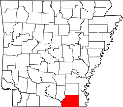
Ashley County Arkansas Incorporated and Unincorporated areas North Crossett Highlighted.svg
Location in Ashley County and the state of Arkansas
Coordinates: 33°10′3″N91°56′34″W / 33.16750°N 91.94278°W / 33.16750; -91.94278
Country United States
State Arkansas
County Ashley
Area
[1]
  Total10.46 sq mi (27.09 km2)
  Land10.43 sq mi (27.02 km2)
  Water0.03 sq mi (0.07 km2)
Elevation
151 ft (46 m)
Population
 (2020)
  Total2,756
  Density264.16/sq mi (101.99/km2)
Time zone UTC-6 (Central (CST))
  Summer (DST) UTC-5 (CDT)
ZIP code
71635 [2]
Area code 870
FIPS code 05-50240
GNIS feature ID0058274

North Crossett is a census-designated place (CDP) in Ashley County, Arkansas, United States. Per the 2020 census, the population was 2,756. [3]

Contents

Geography

North Crossett is located at 33°10′3″N91°56′34″W / 33.16750°N 91.94278°W / 33.16750; -91.94278 (33.167512, -91.942671). [4]

According to the United States Census Bureau, the CDP has a total area of 10.3 square miles (27 km2), of which 10.3 square miles (27 km2) is land and 0.04 square miles (0.10 km2) (0.29%) is water.

Demographics

Historical population
CensusPop.Note
2010 3,119
2020 2,756−11.6%
U.S. Decennial Census [5]
2010 [6] 2020 [7]

2020 census

North Crossett CDP, Arkansas – Demographic Profile
(NH = Non-Hispanic)
Note: the US Census treats Hispanic/Latino as an ethnic category. This table excludes Latinos from the racial categories and assigns them to a separate category. Hispanics/Latinos may be of any race.
Race / EthnicityPop 2010 [6] Pop 2020 [7] % 2010% 2020
White alone (NH)2,6022,11883.42%79.39%
Black or African American alone (NH)40540612.98%14.73%
Native American or Alaska Native alone (NH)1000.32%0.00%
Asian alone (NH)840.26%0.15%
Pacific Islander alone (NH)100.03%0.00%
Some Other Race alone (NH)030.00%0.11%
Mixed Race/Multi-Racial (NH)28900.90%3.27%
Hispanic or Latino (any race)65652.08%2.36%
Total3,1192,756100.00%100.00%

2000 Census

As of the census [8] of 2000, there were 3,581 people, 1,422 households, and 1,045 families residing in the CDP. The population density was 348.4 inhabitants per square mile (134.5/km2). There were 1,554 housing units at an average density of 151.2 per square mile (58.4/km2). The racial makeup of the CDP was 87.69% White, 10.42% Black or African American, 0.25% Native American, 0.20% Asian, 0.14% Pacific Islander, 0.73% from other races, and 0.59% from two or more races. 2.04% of the population were Hispanic or Latino of any race.

There were 1,422 households, out of which 35.2% had children under the age of 18 living with them, 57.4% were married couples living together, 12.2% had a female householder with no husband present, and 26.5% were non-families. 23.5% of all households were made up of individuals, and 8.9% had someone living alone who was 65 years of age or older. The average household size was 2.52 and the average family size was 2.96.

In the CDP, the population was spread out, with 27.6% under the age of 18, 8.8% from 18 to 24, 29.6% from 25 to 44, 23.1% from 45 to 64, and 11.0% who were 65 years of age or older. The median age was 33 years. For every 100 females, there were 93.8 males. For every 100 females age 18 and over, there were 88.5 males.

The median income for a household in the CDP was $29,734, and the median income for a family was $35,682. Males had a median income of $34,146 versus $17,927 for females. The per capita income for the CDP was $14,945. About 14.1% of families and 18.6% of the population were below the poverty line, including 31.9% of those under age 18 and 21.0% of those age 65 or over.

Education

Most of the North Crossett CDP is in the Crossett School District which operates Crossett High School. A portion is in the Hamburg School District, which operates Hamburg High School. [9]

Related Research Articles

<span class="mw-page-title-main">Rock Creek, Alabama</span> CDP in Alabama, United States

Rock Creek is a census-designated place in Jefferson County, Alabama, United States. Its location is northwest of Hueytown. At the 2020 census, the population was 1,471. This area was damaged by an F5 tornado on April 8, 1998. An EF2 tornado struck northwest from here on January 23, 2012.

<span class="mw-page-title-main">West Crossett, Arkansas</span> CDP in Arkansas, United States

West Crossett is a census-designated place (CDP) in Ashley County, Arkansas, United States. Per the 2020 census, the population was 1,144.

<span class="mw-page-title-main">Hermitage, Arkansas</span> City in Arkansas, United States

Hermitage is a city in Bradley County, Arkansas, United States. The United States Census Bureau estimated the population to be 830 as of the 2010 census.

<span class="mw-page-title-main">Jerome, Arkansas</span> Census designated place in Arkansas, United States

Jerome is an unincorporated community and former town in Drew County, Arkansas, United States. On October 14, 2021, the Jerome City Council elected to surrender the town's charter and officially declared Jerome no longer in existence as an incorporated entity. It is now listed as a census designated place.

<span class="mw-page-title-main">Hensley, Arkansas</span> Census-designated place in Arkansas, United States

Hensley is a census-designated place (CDP) in Pulaski County, Arkansas, United States. The population was 139 at the 2010 census. It is part of the Little Rock–North Little Rock–Conway Metropolitan Statistical Area.

<span class="mw-page-title-main">Landmark, Arkansas</span> CDP in Arkansas, United States

Landmark is a census-designated place (CDP) in Pulaski County, Arkansas, United States. Per the 2020 census, the population was 3,585. It is part of the Little Rock–North Little Rock–Conway Metropolitan Statistical Area.

<span class="mw-page-title-main">Salem, Saline County, Arkansas</span> CDP in Arkansas, United States

Salem is a census-designated place (CDP) in Saline County, Arkansas, United States. Per the 2020 census, the population was 2,544. It is part of the Little Rock–North Little Rock–Conway Metropolitan Statistical Area.

<span class="mw-page-title-main">Camp Pendleton Mainside, California</span> Census-designated place in California, United States

Camp Pendleton Mainside is a census-designated place (CDP) in San Diego County, California, located at the southeast corner of the Marine Corps Base Camp Pendleton. Per the 2020 census, the population was 9,683. It was formerly known as Camp Pendleton North, but its name was changed for the 2020 Census. Along with Camp Pendleton South, it is one of two CDPs located on the base.

<span class="mw-page-title-main">North Fort Myers, Florida</span> Census-designated place in Florida, United States

North Fort Myers is an unincorporated area and census-designated place (CDP) in Lee County, Florida, United States. It is part of the Cape Coral-Fort Myers, Florida Metropolitan Statistical Area. The population was 42,719 at the 2020 census.

<span class="mw-page-title-main">Palm Springs North, Florida</span> Census-designated place in Florida

Palm Springs North is an unincorporated community and census-designated place (CDP) in Miami-Dade County, Florida, United States. It is part of the Miami metropolitan area of South Florida. The population was 5,030 at the 2020 census.

<span class="mw-page-title-main">Palmetto Estates, Florida</span> Census-designated place in Florida

Palmetto Estates is an unincorporated area and census-designated place (CDP) in Miami-Dade County, Florida, United States. It is part of the Miami metropolitan area of South Florida. The population was 13,498 at the 2020 census.

<span class="mw-page-title-main">Pinewood, Florida</span> Census-designated place in Florida

Pinewood is an unincorporated community and census-designated place (CDP) in Miami-Dade County, Florida, United States. It is part of the Miami metropolitan area of South Florida. The population was 17,246 at the 2020 census.

Long Lake is an unincorporated community and census-designated place (CDP) in Lake County, Illinois, United States. Per the 2020 census, the population was 3,663.

<span class="mw-page-title-main">Regina, New Mexico</span> CDP in New Mexico, United States

Regina is a census-designated place (CDP)) in Sandoval County, New Mexico, United States. The population was 99 at the 2000 census. It is part of the Albuquerque Metropolitan Statistical Area. It was named for Regina, Saskatchewan.

St. Bonaventure is a hamlet and census-designated place (CDP) in the town of Allegany in Cattaraugus County, New York, United States. The population was 1,963 at the 2020 census.

<span class="mw-page-title-main">Clearwater, South Carolina</span> Census-designated place in South Carolina, United States of America

Clearwater is a census-designated place (CDP) in Aiken County, South Carolina. It lies near North Augusta, South Carolina, and is part of the Augusta, Georgia metropolitan area. Clearwater is located in historic Horse Creek Valley. The population was 4,370 at the time of the 2010 census.

<span class="mw-page-title-main">Liberty City, Texas</span> Census-designated place in Texas, United States

Liberty City is a census-designated place (CDP) in Gregg County, Texas, United States. The population was 2,721 at the 2020 census, an increase over the figure of 2,351 tabulated in 2010.

<span class="mw-page-title-main">Falman-County Acres, Texas</span> Former CDP in Texas, United States

Falman-County Acres is a census-designated place (CDP) in San Patricio County, Texas, United States. The population was 289 at the 2000 census.

<span class="mw-page-title-main">Cienegas Terrace, Texas</span> CDP in Texas, United States

Cienegas Terrace is a census-designated place (CDP) in Val Verde County, Texas, United States. The population was 3,424 at the 2010 census.

<span class="mw-page-title-main">Peaceful Valley, Washington</span> CDP in Washington, United States

Peaceful Valley is a census-designated place (CDP) in Whatcom County, Washington, United States, near Kendall. The population was 3,324 at the 2010 census.

References

  1. "2020 U.S. Gazetteer Files". United States Census Bureau. Retrieved October 29, 2021.
  2. "North Crossett AR ZIP Code". zipdatamaps.com. 2023. Retrieved January 26, 2023.
  3. "North Crossett CDP, Arkansas". United States Census Bureau . Retrieved April 15, 2022.
  4. "US Gazetteer files: 2010, 2000, and 1990". United States Census Bureau. February 12, 2011. Retrieved April 23, 2011.
  5. "Decennial Census of Population and Housing by Decades". US Census Bureau.
  6. 1 2 "P2 HISPANIC OR LATINO, AND NOT HISPANIC OR LATINO BY RACE – 2010: DEC Redistricting Data (PL 94-171) – North Crossett CDP, Arkansas". United States Census Bureau .
  7. 1 2 "P2 HISPANIC OR LATINO, AND NOT HISPANIC OR LATINO BY RACE – 2020: DEC Redistricting Data (PL 94-171) – North Crossett CDP, Arkansas". United States Census Bureau .
  8. "U.S. Census website". United States Census Bureau . Retrieved January 31, 2008.
  9. "SCHOOL DISTRICT REFERENCE MAP (2010 CENSUS): Ashley County, AR." U.S. Census Bureau. Retrieved on June 17, 2018.