2020 census
As of the 2020 census, the county had a population of 7,225. The median age was 51.6 years. 18.0% of residents were under the age of 18 and 28.8% of residents were 65 years of age or older. For every 100 females there were 101.2 males, and for every 100 females age 18 and over there were 101.0 males age 18 and over. [13] [14]
The racial makeup of the county was 92.6% White, 0.1% Black or African American, 1.0% American Indian and Alaska Native, 0.3% Asian, <0.1% Native Hawaiian and Pacific Islander, 0.4% from some other race, and 5.6% from two or more races. Hispanic or Latino residents of any race comprised 1.1% of the population. [14]
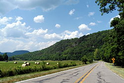
<0.1% of residents lived in urban areas, while 100.0% lived in rural areas. [15]
There were 3,169 households in the county, of which 23.1% had children under the age of 18 living in them. Of all households, 51.2% were married-couple households, 21.0% were households with a male householder and no spouse or partner present, and 23.5% were households with a female householder and no spouse or partner present. About 32.2% of all households were made up of individuals and 18.1% had someone living alone who was 65 years of age or older. [13]
There were 4,086 housing units, of which 22.4% were vacant. Among occupied housing units, 82.4% were owner-occupied and 17.6% were renter-occupied. The homeowner vacancy rate was 2.4% and the rental vacancy rate was 8.0%. [13]
2000 census
As of the 2000 census, [16] there were 8,608 people, 3,500 households, and 2,495 families residing in the county. The population density was 4/km2 (10/sq mi), one of the most sparse among county populations in Arkansas. There were 4,316 housing units at an average density of 5 per square mile (1.9/km2). The racial makeup of the county was 99.29% White, 0.00% Black or African American, 0.56% Native American, 0.06% Asian, 0.00% Pacific Islander, 0.09% from other races, and 0.00% from two or more races. 0.00% of the population were Hispanic or Latino of any race.
There were 3,500 households, out of which 32.20% had children under the age of 18 living with them, 60.00% were married couples living together, 7.70% had a female householder with no husband present, and 28.70% were non-families. 26.00% of all households were made up of individuals, and 10.90% had someone living alone who was 65 years of age or older. The average household size was 2.44 and the average family size was 2.94.
In the county, the population was spread out, with 24.90% under the age of 18, 7.60% from 18 to 24, 25.00% from 25 to 44, 27.60% from 45 to 64, and 14.80% who were 65 years of age or older. The median age was 40 years. For every 100 females, there were 102.30 males. For every 100 females age 18 and over, there were 98.60 males.
The median income for a household in the county was $24,756, and the median income for a family was $30,134. Males had a median income of $22,406 versus $17,654 for females. The per capita income for the county was $13,788. About 15.70% of families and 20.40% of the population were below the poverty line, including 27.80% of those under age 18 and 16.90% of those age 65 or over.
Native residents of Newton County were interviewed in 1970 for research being done by a doctoral student at the University of Arkansas in Fayetteville. A Ph.D. degree was awarded to Bethany K. Dumas in May 1971 after she completed "A Study of the Dialect of Newton County, Arkansas." Results are discussed in two of her published articles/chapters: "The Morphology of Newton County, Arkansas: An Exercise in Studying Ozark Dialect," Mid–South Folklore 3 (1975), 115–125, and "Southern Mountain English" Chapter 5 of The Workings of Language, ed. R. S. Wheeler, Westport, CT, and London: Praeger, 1999, 67–79.