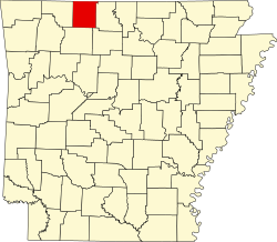
Harrison, Arkansas

Last updated

Harrison
City
Harrison AR downtown.jpg
Harrison Arkansas Seal.png
Motto: 
"Adventure Awaits You" [1]
Boone County Arkansas Incorporated and Unincorporated areas Harrison Highlighted 0530460.svg
Location of Harrison in Boone County, Arkansas.
Coordinates: 36°14′38″N93°07′11″W / 36.24389°N 93.11972°W / 36.24389; -93.11972
CountryUnited States
State Arkansas
County Boone
Platted1869
IncorporatedMarch 1, 1876
Government
  TypeCouncil government
  MayorJerry Jackson [ citation needed ] (R)
Area
[2]
  Total11.23 sq mi (29.09 km2)
  Land11.21 sq mi (29.02 km2)
  Water0.03 sq mi (0.07 km2)
Elevation
1,247 ft ( [3]  m)
Population
 (2020)
  Total13,069
  Estimate 
(June 30, 2023)
13,100
  Density1,166.35/sq mi (450.35/km2)
Time zone UTC−6 (Central (CST))
  Summer (DST) UTC−5 (CDT)
ZIP codes
72601-72602
Area code 870
FIPS code 05-30460
GNIS feature ID2403805 [3]
Website www.cityofharrison.com

The city of Harrison is the county seat of Boone County, Arkansas, United States. It is named after Marcus LaRue Harrison, a surveyor who laid out the city along Crooked Creek at Stifler Springs. [4] According to 2019 Census Bureau estimates, the population of the city was 13,069, [5] up from 12,943 at the 2010 census and it is the 30th largest city in Arkansas based on official 2019 estimates from the U.S. Census Bureau. [6] Harrison is the principal city of the Harrison Micropolitan Statistical Area, which includes all of Boone and Newton counties.

Contents

The community has a history of racism: there were two race riots in the early 20th century and an influx of white supremacist organizations during the late 20th and early 21st centuries. [7] Because of this, a number of sources have called it "the most racist town in the United States". [8] [9] [10] [11] [12]

History

Harrison Courthouse Square, listed in the National Register of Historic Places Downtown Harrison, AR Courthouse Square.jpg
Harrison Courthouse Square, listed in the National Register of Historic Places

Precolonial history

Native Americans were the earliest inhabitants of the area, probably beginning with cliff dwellers who lived in caves in the bluffs along the rivers. In later times, the Osage, a branch of the Sioux, was the main tribe in the Ozarks, and one of their larger villages is thought to have been to the east of the present site of Harrison. The Shawnee, Quapaw, and Caddo people were also familiar to the area.

The Cherokee arrived around 1816 and did not get along with the Osage. This hostility erupted into a full-scale war in the Ozark Mountains. By the 1830s, both tribes were removed to Indian Territory.

It is possible that the first Europeans to visit the area were some forty followers of Hernando de Soto and that they camped at a Native village on the White River at the mouth of Bear Creek. It is more likely that the discoverers were French hunters or trappers who followed the course of the White River. [13]

19th century

In early 1857, the Baker–Fancher wagon train assembled at Beller's Stand, south of Harrison. On September 11, 1857, approximately 120 members of this wagon train were murdered near Mountain Meadows, Utah Territory, by a local Mormon militia and members of the Paiute Indian tribe. In 1955, a monument to memorialize the victims of the massacre was placed on the Harrison town square. [14]

Boone County was organized in 1869, during Reconstruction after the Civil War. Harrison was platted and made the county seat. It is named after Marcus LaRue Harrison, a Union officer who surveyed and platted the town. The town of Harrison was incorporated on March 1, 1876. [15]

20th century

In 1905 and 1909, white race riots occurred in Harrison, which drove away black residents and established the community as one of hundreds of sundown towns in the country. [16] [17]

The bank robber and convicted murderer Henry Starr was in Harrison on February 18, 1921, when Starr and three companions entered the People's State Bank and robbed it of $6,000.00. During the robbery, Starr was shot by the former president of the bank, William J. Myers. Starr was carried to the town jail, where he died the next morning. [18]

On May 7, 1961, heavy rain caused Crooked Creek, immediately south of the downtown business district, to flood the town square and much of the southwestern part of the city. Water levels inside buildings reached eight feet (2.5 m). Many small buildings and automobiles were swept away. According to the American Red Cross, four people died, 80 percent of the town's business district was destroyed, and over 300 buildings were damaged or destroyed in losses exceeding $5.4 million. [19] In 1962, Sam Walton opened his second Walmart store in Harrison. [20]

In 1982, Kingdom Identity Ministries, an anti-gay Christian Identity outreach ministry identified as a hate group by the Southern Poverty Law Center, was founded in Harrison. [21] [22]

21st century

Peace March in Harrison in 2017 Peace March Harrison AR.jpg
Peace March in Harrison in 2017

Harrison's Community Task Force on Race Relations [7] was established in 2003 to "promote diversity and respond to racial-bias accusations against the city". [23] City officials have made efforts to counteract organized racist activity with educational forums and billboards promoting tolerance. [24] They also attempted to downplay the city's racist reputation and improve its image by editing the town's Wikipedia article. [23]

In 2014, a peace march and vigil celebrating the life and legacy of Martin Luther King Jr. was held in downtown Harrison, hosted by the Arkansas Martin Luther King Jr. Commission. [25] [26] In December of the same year, a dedication was held for a Confederate monument in Harrison. [27]

In 2017, Mayor Dan Sherrell and Boone County Judge Robert Hathaway signed proclamations recognizing June as Confederate Heritage and History Month. [28]

Kevin Cheri, who became the first African-American employed in the area in 1978, received death threats shortly after his arrival, which prompted him to leave the area. He returned in 2007, and in 2019 was recognized by mayor Jerry Jackson when Harrison issued its first-ever Black History Month proclamation. [29]

In June 2020, a group of around 300 gathered in Harrison to protest police brutality in the murder of George Floyd while 15 people armed with rifles and displaying Confederate and American flags looked on. [30]

As of October 2023, the Southern Poverty Law Center has said that Kingdom Identity Ministries (founded in Harrison) has a location in the city. [31]

Geography

U.S. Routes 62, 65, and 412 pass through Harrison. U.S. 65 leads north 33 miles (53 km) to Branson, Missouri, and south 108 miles (174 km) to Conway, Arkansas. U.S. 62 leads west 43 miles (69 km) to Eureka Springs and beyond to Rogers and Bentonville. U.S. 412 leads west 73 miles (117 km) to Springdale. U.S. 62 and 412 combined lead east 48 miles (77 km) to Mountain Home.

According to the United States Census Bureau, the city has a total area of 11.1 square miles (28.8 km2), of which 11.1 square miles (28.7 km2) is land and 0.04 square miles (0.1 km2), or 0.26%, is water. [6]

Climate

The climate in this area is characterized by hot, humid summers and generally mild to cool winters. According to the Köppen Climate Classification system, Harrison has a humid subtropical climate, abbreviated "Cfa" on climate maps. [32]

Climate data for Harrison, Arkansas (1991–2020 normals, extremes 1891–present)
MonthJanFebMarAprMayJunJulAugSepOctNovDecYear
Record high °F (°C)81
(27)
87
(31)
98
(37)
99
(37)
99
(37)
105
(41)
112
(44)
112
(44)
106
(41)
96
(36)
86
(30)
82
(28)
112
(44)
Mean daily maximum °F (°C)46.8
(8.2)
51.6
(10.9)
60.0
(15.6)
69.2
(20.7)
76.9
(24.9)
85.0
(29.4)
89.4
(31.9)
89.5
(31.9)
81.8
(27.7)
71.3
(21.8)
59.3
(15.2)
49.1
(9.5)
69.2
(20.7)
Daily mean °F (°C)37.5
(3.1)
40.8
(4.9)
49.4
(9.7)
58.3
(14.6)
66.9
(19.4)
74.9
(23.8)
78.9
(26.1)
78.3
(25.7)
70.7
(21.5)
59.9
(15.5)
48.5
(9.2)
39.9
(4.4)
58.7
(14.8)
Mean daily minimum °F (°C)28.1
(−2.2)
30.0
(−1.1)
38.8
(3.8)
47.3
(8.5)
56.8
(13.8)
64.8
(18.2)
68.3
(20.2)
67.0
(19.4)
59.5
(15.3)
48.5
(9.2)
37.7
(3.2)
30.7
(−0.7)
48.1
(8.9)
Record low °F (°C)−18
(−28)
−20
(−29)
−10
(−23)
20
(−7)
26
(−3)
40
(4)
41
(5)
41
(5)
30
(−1)
16
(−9)
5
(−15)
−6
(−21)
−20
(−29)
Average precipitation inches (mm)2.96
(75)
2.80
(71)
4.20
(107)
5.17
(131)
5.54
(141)
4.17
(106)
3.74
(95)
3.36
(85)
4.40
(112)
4.02
(102)
3.88
(99)
3.22
(82)
47.46
(1,205)
Average snowfall inches (cm)2.2
(5.6)
3.4
(8.6)
2.2
(5.6)
0.0
(0.0)
0.0
(0.0)
0.0
(0.0)
0.0
(0.0)
0.0
(0.0)
0.0
(0.0)
0.0
(0.0)
0.2
(0.51)
1.5
(3.8)
9.5
(24)
Average precipitation days (≥ 0.01 in)7.17.210.810.511.28.49.18.87.68.28.08.9105.8
Average snowy days (≥ 0.1 in)1.52.11.00.10.10.00.00.00.00.00.21.16.1
Source: NOAA [33] [34]
Climate data for Harrison, Arkansas (Boone County Airport) (1991–2020 normals, extremes 1948–present)
MonthJanFebMarAprMayJunJulAugSepOctNovDecYear
Record high °F (°C)79
(26)
87
(31)
91
(33)
92
(33)
94
(34)
107
(42)
107
(42)
112
(44)
103
(39)
92
(33)
84
(29)
78
(26)
112
(44)
Mean daily maximum °F (°C)46.9
(8.3)
51.2
(10.7)
60.3
(15.7)
69.6
(20.9)
76.6
(24.8)
84.9
(29.4)
89.1
(31.7)
88.7
(31.5)
81.4
(27.4)
70.8
(21.6)
59.0
(15.0)
49.2
(9.6)
69.0
(20.6)
Daily mean °F (°C)37.0
(2.8)
40.9
(4.9)
49.2
(9.6)
58.3
(14.6)
66.2
(19.0)
74.4
(23.6)
78.5
(25.8)
77.6
(25.3)
69.9
(21.1)
59.4
(15.2)
48.5
(9.2)
39.7
(4.3)
58.3
(14.6)
Mean daily minimum °F (°C)27.2
(−2.7)
30.6
(−0.8)
38.1
(3.4)
47.0
(8.3)
55.8
(13.2)
63.9
(17.7)
67.9
(19.9)
66.5
(19.2)
58.5
(14.7)
48.0
(8.9)
38.0
(3.3)
30.2
(−1.0)
47.6
(8.7)
Record low °F (°C)−13
(−25)
−9
(−23)
−9
(−23)
22
(−6)
32
(0)
46
(8)
50
(10)
48
(9)
33
(1)
21
(−6)
8
(−13)
−11
(−24)
−13
(−25)
Average precipitation inches (mm)2.67
(68)
2.42
(61)
3.91
(99)
4.98
(126)
4.81
(122)
3.85
(98)
3.67
(93)
3.42
(87)
4.06
(103)
3.81
(97)
3.96
(101)
2.94
(75)
44.50
(1,130)
Average precipitation days (≥ 0.01 in)8.27.710.49.911.89.29.38.18.09.18.48.1108.2
Source: NOAA [33] [35]

Demographics

Historical population
CensusPop.Note
1880 582
1890 1,438147.1%
1900 1,5517.9%
1910 1,6023.3%
1920 3,477117.0%
1930 3,6264.3%
1940 4,23816.9%
1950 5,54230.8%
1960 6,58018.7%
1970 7,23910.0%
1980 9,56732.2%
1990 9,9223.7%
2000 12,15222.5%
2010 12,9436.5%
2020 13,0691.0%
U.S. Decennial Census [36]

2020 census

Harrison racial composition [37]
RaceNumberPercentage
White (non-Hispanic)11,50188.0%
Black or African American (non-Hispanic)530.41%
Native American 850.65%
Asian 1481.13%
Pacific Islander 140.11%
Other/Mixed 7665.86%
Hispanic or Latino 5023.84%

As of the 2020 United States census, there were 13,069 people, 5,578 households, and 3,198 families residing in the city.

2010 census

As of the census [38] of 2010, there were 12,943 people and 6,043 housing units in the city. The racial makeup of the city was 96.2% White, 0.3% Black or African American, 0.6% American Indian and Alaska Native, 0.7% Asian, 0.0% Pacific Islander, and 1.6% from two or more races. 2.2% of the population were Hispanic or Latino of any race.

23.2% of the population was under the age of 18, and 19.0% were 65 years of age or older. Females made up 53.1% of the population, and males made up 46.9% of the population.

The median income for the period 2007–11 for a household in the city was $33,244, and the number of people living below the poverty level was 15.1%. The median value of owner-occupied housing units was $108,700. [39]

Economy

Harrison is home of the general office of FedEx Freight, a leading Less-Than-Load (LTL) freight carrier. Arkansas Freightways, later renamed to American Freightways, was combined with Viking Freight to become FedEx Freight in February 2001. [40]

Major employers

Architecture

Lake Harrison Park and downtown Harrison viewed from a hot air balloon during the Balloon Festival Downtown Harrison, Arkansas aerial view from hot air balloon.jpg
Lake Harrison Park and downtown Harrison viewed from a hot air balloon during the Balloon Festival

The Boone County Courthouse, built in 1909, and the Boone County Jail, built in 1914, were both designed by architect Charles L. Thompson and are listed on the U.S. National Register of Historic Places. [42]

Arts and culture

Annual cultural events

Hot air balloons from across the United States attend this annual two-day event Balloon Festival Harrison, Arkansas.png
Hot air balloons from across the United States attend this annual two-day event
Crawdad Days (2008) at Crooked Creek, an annual festival Crawdad Days Festival Harrison, Arkansas.jpg
Crawdad Days (2008) at Crooked Creek, an annual festival

Harrison hosts the annual Arkansas Hot Air Balloon races each September, Crawdad Days Music Festival each May, a Harvest Homecoming festival each October, and Christmas celebration in December.[ citation needed ]

Museums and other points of interest

Spanish Revival (Mission) styled historic hotel (opened in 1929) in downtown Harrison, Arkansas. Hotel Seville Harrison Arkansas.jpg
Spanish Revival (Mission) styled historic hotel (opened in 1929) in downtown Harrison, Arkansas.

The National Trust for Historic Preservation has recognized the Harrison Courthouse Square Historic District. It contains a large number of the city's original commercial and governmental structures, including the still-used courthouse in the center of the square, the recently refurbished Lyric Theater, and the 1929 Hotel Seville, which underwent a complete restoration in 2008.[ citation needed ]

The Lyric Theatre in downtown Harrison hosts plays, concerts and films. Historic Lyric Theatre Harrison, Arkansas.jpg
The Lyric Theatre in downtown Harrison hosts plays, concerts and films.

Ozark Arts Council

The Ozarks Arts Council is a 501(c)3 non-profit organization established in 1996 with the mission "To enrich lives by promoting the arts in Harrison and North Arkansas through exhibitions, performances, and education." [43] It provides administrative support and distributes financial and in-kind donations to its member organizations:

The historic Lyric Theatre is managed by the Ozark Arts Council. Originally opened as a movie theater in 1929, it is now used for plays, community events, old movies and other gatherings. [44]

Parks and recreation

Harrison serves as the National Park Service's Buffalo National River headquarters. The park was established in the 1970s, and was the nation's first national river. [45] The river flows for 135 miles (217 km), and there are over 59 different species of fish in it.[ citation needed ]

Anstaff Bank Soccer Complex Anstaff Bank Soccer Complex Aerial View Harrison, Arkansas.jpg
Anstaff Bank Soccer Complex
Equity Bank Sports Complex Equity Bank Sports Complex Field View Harrison, Arkansas.jpg
Equity Bank Sports Complex
Brandon Burlsworth Youth Center hosts basketball and volleyball for youth and high school teams. Brandon Burlsworth Youth Center Harrison, Arkansas.jpg
Brandon Burlsworth Youth Center hosts basketball and volleyball for youth and high school teams.

Crooked Creek, a nationally recognized "Blue Ribbon" smallmouth bass fishery, flows through Harrison. [46]

Hemmed-In-Hollow Falls, at 209 feet (64 m) the tallest waterfall between the Rocky Mountains and the Appalachians, is located 25 miles (40 km) southwest of Harrison near Compton. [47] On the same bluff line is Diamond Falls, at 148 feet (45 m) the second tallest in the state. [48]

Education

Northark College Northark 001.jpg
Northark College

Residents are served by the Harrison School District. The Harrison High School mascot is the Golden Goblin. Harrison is also home to North Arkansas College (Northark). The Harrison School District had been a member of the North Central Association of Colleges and Schools since 1936 until its dissolution in 2014. It is now a member of the AdvancED commission.

Media

Print

Harrison and Boone County have been served by the local newspaper The Harrison Daily Times [49] since 1876. [50]

Radio

Radio stations broadcasting from Harrison [51] include:

Television

Harrison has two stations of its own, including KXMP-LD and K26GS-D (both in Harrison proper). Harrison KTKO-TV 8.1, also known as TKO 8, provides coverage for local events including Goblin Sports, Harrison City Council meetings, and Boone County Quorum Court meetings. [52] It is an affiliate of the Me-TV Network showing a wide range of classic television programming. [53] K26GS is a This TV affiliate and also provides local programming to Harrison. KWBM, a Daystar affiliate, is also licensed to Harrison, however its offices are in Springfield, while its transmitter is located in Taney County, Missouri. KWBM leases part of its signal to Springfield Fox affiliate KRBK, in order to relay reliable Fox TV coverage to Harrison and the southern portions of the Springfield TV market.

Harrison is part of the Springfield, Missouri, television market, and receives stations from Springfield, including: KYTV (NBC), KOLR (CBS), KSPR (ABC), KOZL (MyNetworkTV), and KRBK (Fox).

It was also featured in a BBC TV show in the UK named Miriam's Big American Adventure, hosted by Miriam Margolyes.

Infrastructure

Transportation

A segment of the route between Seligman, Missouri and Harrison, Arkansas was operated as the Arkansas & Ozarks Railroad from 1948 to 1960. [54]

Harrison is served by Boone County Regional Airport. Scheduled flights from Harrison to Memphis, Tennessee, and Dallas/Fort Worth, Texas, are offered by Southern Airways Express. The closest airport with service from a carrier aside from Southern Airways Express is Branson Airport (served only by Frontier Airlines), and the closest airport served by multiple airlines or a legacy carrier is Northwest Arkansas National Airport.[ citation needed ]

Highways in the area include:

Health care

North Arkansas Regional Medical Center North Arkansas Regional Medical Center 001.jpg
North Arkansas Regional Medical Center

The North Arkansas Regional Medical Center is in Harrison. [55]

Notable people

In 2020, the video Holding a Black Lives Matter Sign in America's Most Racist Town was filmed in Harrison. [12] [58] [59] [60]

Related Research Articles

<span class="mw-page-title-main">Washington County, Arkansas</span> County in Arkansas, United States

Washington County is a regional economic, educational, and cultural hub in the Northwest Arkansas region. Created as Arkansas's 17th county on November 30, 1848, Washington County has 13 incorporated municipalities, including Fayetteville, the county seat, and Springdale. The county is also the site of small towns, bedroom communities, and unincorporated places. The county is named for George Washington, the first President of the United States.

<span class="mw-page-title-main">Stone County, Arkansas</span> County in Arkansas, United States

Stone County is located in the Ozark Mountains in the U.S. state of Arkansas. The county is named for rugged, rocky area terrain of the Ozarks. Created as Arkansas's 74th county on April 21, 1873, Stone County has two incorporated cities: Mountain View, the county seat and most populous city, and Fifty-Six. The county is also the site of numerous unincorporated communities and ghost towns.

<span class="mw-page-title-main">Newton County, Arkansas</span> County in Arkansas, United States

Newton County is a county in the U.S. state of Arkansas. As of the 2020 census, the population was 7,225. The county seat is Jasper. Newton County is Arkansas's 46th county, formed on December 14, 1842, and named for Thomas W. Newton, an Arkansas Congressman. It is an alcohol prohibition or dry county.

<span class="mw-page-title-main">Marion County, Arkansas</span> County in Arkansas, United States

Marion County is located in the Ozark Mountains in the U.S. state of Arkansas. The county is named for Francis Marion, the famous "Swamp Fox" of the Revolutionary War. Created as Arkansas's 35th county in 1836, Marion County is home to one incorporated town and four incorporated cities, including Yellville, the county seat. The county is also the site of numerous unincorporated communities and ghost towns. The county included part of what is now Searcy County, Arkansas, with many opposing to dividing them, which helped fueled the bloody Tutt-Everett War between 1844 and 1850.

<span class="mw-page-title-main">Boone County, Arkansas</span> County in Arkansas, United States

Boone County is located in the U.S. state of Arkansas, along the Missouri border. As of the 2020 census, the population was 37,373. The county seat is Harrison. It is Arkansas's 62nd county, formed on April 9, 1869.

<span class="mw-page-title-main">Baxter County, Arkansas</span> County in Arkansas, United States

Baxter County is a county in the U.S. state of Arkansas. As of the 2020 census, the county's population was 41,627. The county seat is Mountain Home. It is Arkansas's 66th county, formed on March 24, 1873, and named for Elisha Baxter, the tenth governor of Arkansas.

<span class="mw-page-title-main">Gravette, Arkansas</span> City in Arkansas, United States

Gravette is a city in Benton County, Arkansas, United States. The population was 3,547 as of the 2020 census. It is part of the Northwest Arkansas region.

<span class="mw-page-title-main">Springdale, Arkansas</span> City in Arkansas, United States

Springdale is the fourth-most populous city in Arkansas, United States. It is located in both Washington and Benton counties in Northwest Arkansas. Located on the Springfield Plateau deep in the Ozark Mountains, Springdale has long been an important industrial city for the region. In addition to several trucking companies, the city is home to the world headquarters of Tyson Foods, the world's largest meat producing company. Originally named Shiloh, the city changed its name to Springdale when applying for a post office in 1872. It is included in the four-county Northwest Arkansas Metropolitan Statistical Area, which is ranked 102nd in terms of population in the United States with 546,725 in 2020 according to the United States Census Bureau. The city had a population of 84,161 at the 2020 Census.

<span class="mw-page-title-main">Alpena, Arkansas</span> Town in Arkansas, United States

Alpena is a town in Boone and Carroll counties in the U.S. state of Arkansas. The population was 374 at the 2020 census.

<span class="mw-page-title-main">Diamond City, Arkansas</span> City in Arkansas, United States

Diamond City is a city in northeast Boone County, Arkansas, United States. The population was 782 at the 2010 census. It is part of the Harrison Micropolitan Statistical Area.

<span class="mw-page-title-main">Everton, Arkansas</span> Town in Arkansas, United States

Everton is a town in Boone County, Arkansas, United States. The population was 133 at the 2010 census. It is part of the Harrison Micropolitan Statistical Area.

<span class="mw-page-title-main">Lead Hill, Arkansas</span> Town in Arkansas, United States

Lead Hill is a town in Boone County, Arkansas, United States. The population was 271 at the 2010 census. It is part of the Harrison Micropolitan Statistical Area.

<span class="mw-page-title-main">Zinc, Arkansas</span> Town in Arkansas, United States

Zinc is a town near the east-central edge of Boone County, Arkansas, United States. The population was 92 at the 2020 census. It is part of the Harrison Micropolitan Statistical Area. A chapter of the Ku Klux Klan operates in Zinc.

<span class="mw-page-title-main">Ozark, Arkansas</span> City in Arkansas, United States

Ozark is a city in Franklin County, Arkansas, United States and one of the county's two seats of government. The community is located along the Arkansas River in the Arkansas River Valley on the southern edge of the Ozark Mountains. As of the 2010 census it had a population of 3,684.

<span class="mw-page-title-main">Batesville, Arkansas</span> City in Arkansas, United States

Batesville is the county seat and largest city of Independence County, Arkansas, United States, 80 miles (183 km) northeast of Little Rock, the state capital. According to the 2010 Census, the population of the city was 10,268. The city serves as a regional manufacturing and distribution hub for the Ozark Mountain region and Northeast Arkansas.

<span class="mw-page-title-main">Yellville, Arkansas</span> City in Arkansas, United States

Yellville is a city in and county seat of Marion County, Arkansas, United States. Yellville is located in the Ozark Mountains along the banks of Crooked Creek, and neighbors the small town of Summit to the north. The population was 1,178 at the 2020 census. The town's original name is preserved in the Shawnee Town Branch, a local creek. The town holds an annual Turkey Trot Festival.

<span class="mw-page-title-main">Greenland, Arkansas</span> City in Arkansas, United States

Greenland is a city in Washington County, Arkansas, United States. The population is 1,213 as of the 2020 census. The community is located in the Boston Mountains, within the Ozark Mountains.

<span class="mw-page-title-main">Arkansas Highway 206</span> State highway in Arkansas, United States

Highway 206 is a designation for three east–west state highways in the Ozark Mountains. Each segment was created during periods of state highway systemwide expansions ordered by the Arkansas General Assembly to add system mileage in every county, first in 1957, and again in 1973. All are low-traffic highways providing connectivity between rural communities and major highways in the area. All are maintained by the Arkansas Department of Transportation (ArDOT).

<span class="mw-page-title-main">Special routes of U.S. Route 65</span>

A total of eight special routes of U.S. Route 65 exist, divided between the U.S. states of Arkansas and Missouri. Currently, they are all business loops, although a spur route in Pine Bluff, Arkansas and bypass routes in Baton Rouge, Louisiana and Springfield, Missouri both existed in the past.

Batavia Township is one of 20 current townships in Boone County, Arkansas, USA. As of the 2010 census, its total population was 911. Batavia, Arkansas was settled in 1881 by Roswell Emerson Underwood, who spent four years as a Genesee County, New York, surveyor for the Holland Land Company. He was impressed by the beauty of this site which is located in the foothills of the Ozark Mountains. He was the first postmaster, and named the town for Batavia, New York, his former residence.

References

    1. "City of Harrison Arkansas". City of Harrison Arkansas. Retrieved September 12, 2012.
    2. "2020 U.S. Gazetteer Files". United States Census Bureau. Retrieved October 29, 2021.
    3. 1 2 U.S. Geological Survey Geographic Names Information System: Harrison, Arkansas
    4. "History and Facts of Harrison – City of Harrison, Arkansas" . Retrieved March 10, 2020.
    5. "Harrison (City) QuickFacts from the US Census Bureau". Archived from the original on September 20, 2013. Retrieved September 25, 2013.
    6. 1 2 "Geographic Identifiers: 2010 Demographic Profile Data (G001): Harrison city, Arkansas". U.S. Census Bureau, American Factfinder. Archived from the original on February 12, 2020. Retrieved September 25, 2013.
    7. 1 2 Morris, Frank (May 12, 2014). "Tale Of Two Billboards: An Ozark Town's Struggle To Unseat Hate". NPR . Retrieved September 7, 2019.
    8. Bucktin, Christopher (November 24, 2016). "The most racist town in US where "diversity is a code word for white genocide"". mirror. Retrieved July 29, 2020.
    9. Brantley, Max (November 25, 2016). "Most racist town in America". Arkansas Times. Retrieved July 29, 2020.
    10. Rowles, Dustin (January 2, 2015). "Harrison, Arkansas Continues To Be One Of The Most Racist Towns In America". UPROXX. Retrieved July 29, 2020.
    11. Chojar, Faith (April 17, 2019). "The Most Racist Town in America?". Papers, Posters, and Recordings.
    12. 1 2 "Man holding Black Lives Matter sign in Harrison faces racist language". thv11.com. Archived from the original on July 29, 2020. Retrieved July 29, 2020.
    13. "Native Americans of Carroll County, AR – Arkansas Guide to Eureka Springs, Berryville, Green Forest, and more!" . Retrieved May 1, 2017.
    14. Mountain Meadows Massacre, Mountain Meadows Massacre.com, retrieved January 16, 2011
    15. Harrison, AR, citydata.com, retrieved January 16, 2011
    16. Lancaster, Guy (August 13, 2014). "Harrison Race Riots of 1905 and 1909". Encyclopedia of Arkansas. Central Arkansas Library System.
    17. Loewen, James (2005). Sundown Towns: A Hidden Dimension of American Racism. New York: The New Press. pp. 36–37. ISBN   9781595586742.
    18. Henry Starr – The Cherokee Bad Boy, Legends of America, retrieved December 26, 2010
    19. "1961 Harrison Flood". Boone County Historical & Railroad Society. Archived from the original on June 30, 2007. Retrieved August 31, 2019.
    20. Vance H. Trimble, Sam Walton: The Inside Story of America's Richest Man, pp.46–64 (Dutton, 1990)
    21. Hilliard, Robert L.; Keith, Michael C. (1999). Waves of Rancor: Tuning in the Radical Right. M.E. Sharpe. p. 158. ISBN   9780765601315.
    22. "Kingdom Identity Ministries". Southern Poverty Law Center . Retrieved August 22, 2017.
    23. 1 2 Bowden, Bill (August 11, 2019). "Wikipedia entries won't let Harrison shed unsavory past". Arkansas Online. Retrieved August 31, 2019.
    24. Rugh, Peter (March 11, 2014). "The KKK Embraces Diversity in Harrison, Arkansas". Vice. Retrieved February 20, 2018.
    25. "Nonviolence Youth Summit Part 10 – Education Alliance". March 7, 2014. Retrieved May 1, 2017.
    26. MrcleanMinistries (April 5, 2014). "Mrclean at 2nd Part of Non Violence Youth Summit March Harrison, AR". Archived from the original on November 17, 2021. Retrieved May 1, 2017 via YouTube.
    27. "Monument dedication honors Arkansas Civil War soldiers". Harrison Daily Times. December 2, 2014. Archived from the original on January 11, 2015.
    28. "June proclaimed Confederate History and Heritage Month". May 25, 2017. Archived from the original on January 30, 2018. Retrieved September 11, 2019.
    29. Sinett, Caitlin (February 16, 2019). "Harrison Mayor Signs Black History Month Proclamation". KNWA . Retrieved August 22, 2019.
    30. "Hundreds of George Floyd Protesters Come Out in Arkansas". U.S. News. June 5, 2020. Retrieved July 30, 2020.
    31. "Hate Map". Southern Poverty Law Center. Retrieved August 7, 2021.
    32. "Harrison, Arkansas Köppen Climate Classification (Weatherbase)" . Retrieved May 1, 2017.
    33. 1 2 "NowData – NOAA Online Weather Data". National Oceanic and Atmospheric Administration. Retrieved June 19, 2021.
    34. "Station: Harrison, AR". U.S. Climate Normals 2020: U.S. Monthly Climate Normals (1991–2020). National Oceanic and Atmospheric Administration. Retrieved June 19, 2021.
    35. "Station: Harrison Boone CO AP, AR". U.S. Climate Normals 2020: U.S. Monthly Climate Normals (1991–2020). National Oceanic and Atmospheric Administration. Retrieved June 19, 2021.
    36. "Census of Population and Housing". Census.gov. Retrieved June 4, 2015.
    37. "Explore Census Data". data.census.gov. Retrieved January 1, 2022.
    38. "U.S. Census website". United States Census Bureau . Retrieved January 31, 2008.
    39. "State & County QuickFacts: Harrison (city), Arkansas". U.S. Census Bureau. Archived from the original on September 20, 2013. Retrieved September 25, 2013.
    40. "History – About FedEx". Archived from the original on June 2, 2016. Retrieved June 1, 2016.
    41. "Top Employers | HRCC". Harrison Regional Chamber of Commerce. Retrieved February 8, 2021.
    42. "ARKANSAS – Boone County" . Retrieved January 31, 2019.
    43. "Ozark Arts Council in Harrison, AR – About the OAC". Archived from the original on September 28, 2013. Retrieved June 28, 2013.
    44. The Lyric Theatre, Ozarks Arts Council, archived from the original on July 19, 2011, retrieved January 19, 2011
    45. Buffalo River – Frequently Asked Questions, National Park Service, retrieved December 26, 2010
    46. Crooked Creek, Arkansas – The Natural State, archived from the original on May 1, 2011, retrieved January 19, 2011
    47. How to get to Hemmed in Hollow Waterfalls in the Arkansas Ozarks, Arkansas' Ozark Mountains Region, retrieved January 19, 2011
    48. Arkansas Waterfalls Guidebook – Tallest Waterfalls in Arkansas, Cloudland, retrieved January 19, 2011
    49. "HarrisonDaily.com" . Retrieved May 1, 2017.
    50. Newspaper-Harrison Daily Times, Community Publishers, Inc., archived from the original on December 27, 2010, retrieved December 26, 2010
    51. "Radio Stations in Harrison AR". On The Radio.Net. Retrieved June 28, 2013.
    52. "TKO 8 Local Television Serving You" . Retrieved June 28, 2013.
    53. "Me-TV Network | About Me-TV". Archived from the original on June 28, 2013. Retrieved June 28, 2013.
    54. "The Missouri and North Arkansas Railroad: Joplin, MO to Helena, AR". abandonedrails.com. Archived from the original on August 3, 2014.
    55. Welcome to North Arkansas Regional Medical Center, NARMC, retrieved January 19, 2011
    56. Brantley, Max (February 26, 2012). "Meet Republican leader John Burris". Arkansas Times. Retrieved August 12, 2019.
    57. Cathy Kunzinger Urwin, Agenda for Reform: Winthrop Rockefeller As Governor of Arkansas, 1967–71, p. 37. Fayetteville, Arkansas: University of Arkansas Press. 1991. ISBN   9781557282002 . Retrieved August 19, 2012.
    58. Peiser, Jaclyn (July 30, 2020). "He held a BLM sign in what he called 'America's most racist town.' The result? A viral video of abuse". Washington Post. Retrieved July 30, 2020.
    59. Rowles, Dustin (July 28, 2020). "Harrison, Arkansas Really Is the Most Racist Town in America". Pajiba.
    60. Culver, Jordan. "A man held a Black Lives Matter sign in Harrison, Arkansas. He posted the racist responses to YouTube". USA TODAY. Retrieved September 15, 2021.

    Further reading