North Harrison Township, Boone County, Arkansas

Last updated

North Harrison Township
USA Arkansas location map.svg
Red pog.svg
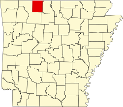
North Harrison Township
Location in Arkansas
Coordinates: 36°15′1.16″N93°6′8.34″W / 36.2503222°N 93.1023167°W / 36.2503222; -93.1023167
Country Flag of the United States.svg  United States
State Flag of Arkansas.svg  Arkansas
County Boone
Area
  Total16.988 sq mi (44.00 km2)
  Land16.933 sq mi (43.86 km2)
  Water0.055 sq mi (0.14 km2)
Population
 (2010)
  Total8,057
  Density475.82/sq mi (183.72/km2)
Time zone UTC-6 (CST)
  Summer (DST) UTC-5 (CDT)
Zip Code
72601 (Harrison)
Area code 870

North Harrison Township is one of twenty current townships in Boone County, Arkansas, USA. [1] As of the 2010 census, its total population was 8,057.

Contents

Although the township includes a significant portion of the city of Harrison, it also encompasses rural areas. Prior to 1950, this township, along with South Harrison Township, were part of a single Harrison Township. Boundary lines may have been different between the former single Harrison Township and the two modern day townships.

Geography

According to the United States Census Bureau, North Harrison Township covers an area of 16.988 square miles (44.00 km2); 16.933 square miles (43.86 km2) of land and 0.055 square miles (0.14 km2) of water.

Cities, towns, and villages

Population history

The population history includes the population of that portion of the city of Harrison which is included within the boundaries of this township.

Historical population
CensusPop.Note
1950 4,179
1960 4,71612.8%
1970 5,47116.0%
1980 7,11730.1%
1990 6,393−10.2%
2000 7,74821.2%
2010 8,0574.0%

Related Research Articles

<span class="mw-page-title-main">Union County, Arkansas</span> County in Arkansas, United States

Union County is a county located on the central southern border of the U.S. state of Arkansas. As of the 2020 census, the population was 39,054. The county seat is El Dorado. The county was formed on November 2, 1829, and named in recognition of the citizens' petition for a new county, which said that they were petitioning "in the spirit of Union and Unity." The county is directly adjacent to the south to Union Parish in the state of Louisiana.

<span class="mw-page-title-main">Marion County, Arkansas</span> County in Arkansas, United States

Marion County is located in the Ozark Mountains in the U.S. state of Arkansas. The county is named for Francis Marion, the famous "Swamp Fox" of the Revolutionary War. Created as Arkansas's 35th county in 1836, Marion County is home to one incorporated town and four incorporated cities, including Yellville, the county seat. The county is also the site of numerous unincorporated communities and ghost towns. The county included part of what is now Searcy County, Arkansas, with many opposing to dividing them, which helped fueled the bloody Tutt-Everett War between 1844 and 1850.

<span class="mw-page-title-main">Lonoke County, Arkansas</span> County in Arkansas, United States

Lonoke County is located in the Central Arkansas region of the U.S. state of Arkansas. As of the 2020 census, the population was 74,015, making it the 10th-most populous of Arkansas's 75 counties. The county seat is Lonoke and largest city is Cabot. Lonoke County was formed on April 16, 1873, from Pulaski County and Prairie County, and was named as a corruption of "lone oak", after a large red oak in the area that had been used by a surveyor to lay out the Memphis and Little Rock Railroad.

<span class="mw-page-title-main">Independence County, Arkansas</span> County in Arkansas, United States

Independence County is a county located in the U.S. state of Arkansas. As of the 2020 census, the population was 37,938. The county seat is Batesville. Independence County is Arkansas's ninth county, formed on October 20, 1820, from a portion of Lawrence County and named in commemoration of the Declaration of Independence. It is an alcohol prohibition or dry county.

<span class="mw-page-title-main">Carroll County, Arkansas</span> County in Arkansas, United States

Carroll County is a county located in the U.S. state of Arkansas. As of the 2020 census, the population was 28,260. The county has two county seats, Berryville and Eureka Springs. Carroll County is Arkansas's 26th county, formed on November 1, 1833, and named after Charles Carroll, the last surviving signer of the United States Declaration of Independence.

<span class="mw-page-title-main">Boone County, Arkansas</span> County in Arkansas, United States

Boone County is located in the U.S. state of Arkansas, along the Missouri border. As of the 2020 census, the population was 37,373. The county seat is Harrison. It is Arkansas's 62nd county, formed on April 9, 1869.

<span class="mw-page-title-main">Wayne Township, Fulton County, Indiana</span> Township in Indiana, United States

Wayne Township is one of eight townships in Fulton County, Indiana. As of the 2010 census, its population was 569 and it contained 253 housing units.

<span class="mw-page-title-main">Ohio Township, Crawford County, Indiana</span> Township in Indiana, United States

Ohio Township is one of nine townships in Crawford County, Indiana. As of the 2010 census, its population was 742 and it contained 354 housing units.

Elixir Township is one of twenty current townships in Boone County, Arkansas, USA. As of the 2010 census, its total population was 2,802.

Batavia Township is one of 20 current townships in Boone County, Arkansas, USA. As of the 2010 census, its total population was 911. Batavia, Arkansas was settled in 1881 by Roswell Emerson Underwood, who spent four years as a Genesee County, New York, surveyor for the Holland Land Company. He was impressed by the beauty of this site which is located in the foothills of the Ozark Mountains. He was the first postmaster, and named the town for Batavia, New York, his former residence.

Bellefonte Township is one of 20 current townships in Boone County, Arkansas, USA. As of the 2010 census, its total population was 2,380.

Blythe Township is one of twenty current townships in Boone County, Arkansas, USA. As of the 2010 census, its total population was 245.

Bryan Township is one of twenty current townships in Boone County, Arkansas, USA. As of the 2010 census, its total population was 1,018.

Carrollton Township is one of twenty current townships in Boone County, Arkansas, USA. As of the 2010 census, its total population was 843.

Sugar Loaf Township is one of twenty current townships in Boone County, Arkansas, USA. As of the 2010 census, its total population was 2,320.

South Harrison Township is one of twenty current townships in Boone County, Arkansas, USA. As of the 2010 census, its total population was 7,590.

Zinc Township is one of twenty current townships in Boone County, Arkansas, USA. As of the 2010 census, its total population was 585.

Jackson Township is one of twenty current townships in Boone County, Arkansas, USA. As of the 2010 census, its total population was 1,340.

Jefferson Township is one of twenty current townships in Boone County, Arkansas, USA. As of the 2010 census, its total population was 1,202.

Gaither Township is one of twenty current townships in Boone County, Arkansas, USA. As of the 2010 census, its total population was 676.

References

  1. "North Harrison Township, Boone County, Arkansas." U.S. Census Bureau. Breakdown. Retrieved June 2, 2012.